Five minutes with … the BGS Hazard and Resilience Modelling team
Meet the team behind our geohazard products and datasets.
22/04/2021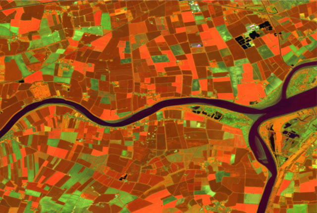
With an increasing awareness of the issues around climate change and changes in pattern and severity of hazards such as flooding, coastal erosion and subsidence, it is more important than ever that we continue to update data products with the latest research and data analyses. BGS makes information available for users to help model, plan, mitigate for and adapt to geohazards across Great Britain, being prepared both for today and for the future.
The UK government recently released its 10 point plan for a green industrial revolution to tackle the climate emergency, but more needs to be done to ensure geohazards are included, especially within planning and development.
In November 2021, the UK hosts the 26th UN Climate Change Conference of the Parties (COP26). This is an important opportunity to engage and encourage governments around the world to collaborate in tackling the major challenges in the climate crisis. BGS will be sharing updates throughout the year about how our research is supporting the major themes of COP26, helping achieve net zero emissions by 2030 and mitigating other challenges presented by climate change.
In this blog, we’re introducing you to our product development team for BGS Hazard and Resilience Modelling. We’ll share a little about their individual roles and experience and what drives them to create and continue to improve BGS’s data products.
If you would like to find out more about our latest data product release GeoClimate UKCP18, be sure to sign up to our launch webinar on May 20.
So, grab a cuppa and meet …
Clive Cartwright | Rowan Vernon | Emma Bee | Anna Harrison | Chris Williams | Severine Cornillion | Katy Lee | Jenny Richardson
Clive Cartwright
A GIS expert, data innovator, python scripter, leader of LandFIT and frustrated archaeologist, Clive has a background in cartography and works alongside scientists to create and deliver innovative products. Clive finds inspiration from all sorts of sources and often when he’s least expecting it. Clive could be listening to BBC Radio 4 or perhaps Gardeners’ Question Time and the discussions and topics raised often flag up ideas of where geology could be applied.
Natural flood management is a good example that he heard during a recent farming debate. ‘Creating surface ponding or diverting water could be strongly influenced by the type of underlying geology; unstable ground could be made worse, and sinkholes could develop.’ This fed into Clive’s work, and led to developing a prototype dataset.

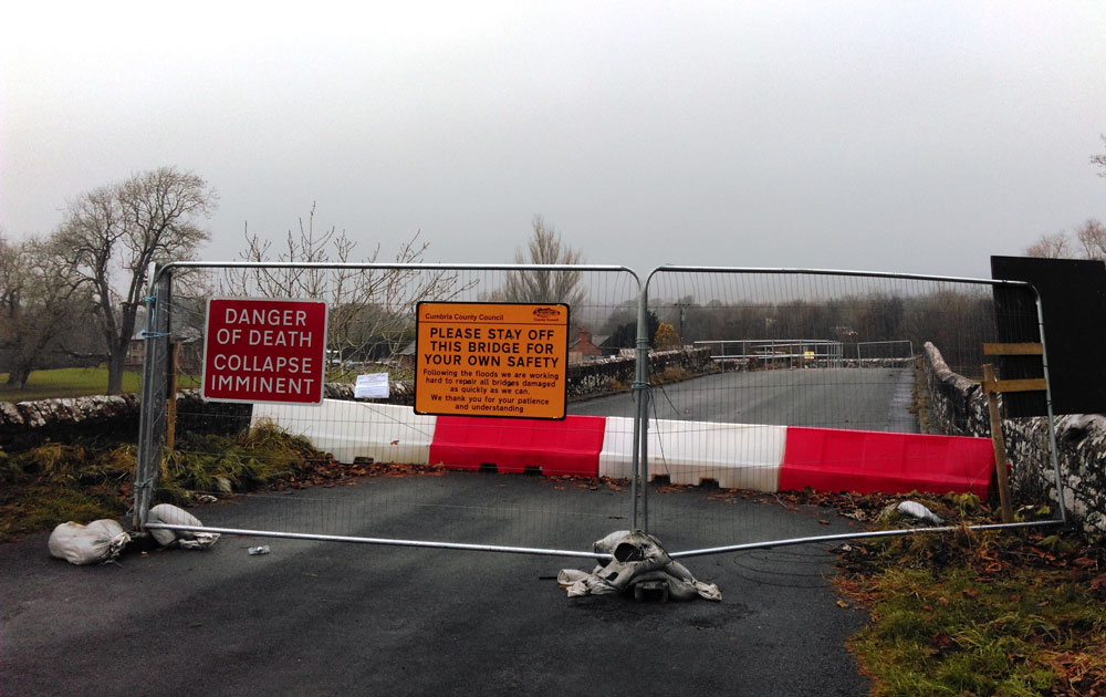
Flooding impacting connectivity in rural locations. BGS © UKRI
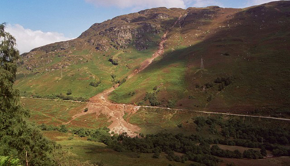
The variety and scope of tasks Clive works on can vary hugely from IT work, scripting computer processes in a software called Python, to being out in the field, examining river processes in the Lake District National Park. Clive recalls the last as one of his favourite projects; learning through fieldwork and gaining a greater understanding of physical process is invaluable and led to the creation of a data product GeoScour and GeoScour Open, all about identifying key areas at risk of river erosion during storm floods.

‘My background in archaeology means that I have a key perspective of how the two subjects interrelate and my job allows me to indulge in my interests both at work and in leisure time; I can often be found looking out for lynchets or ridge and furrow features, much to the boredom of my kids!’
Clive Cartwright, BGS Geospatial Data Analyst.
Clive’s cartographic background also plays a role in his work. He explains that creating the BGS GeoSure hex grids as national coverage open datasets used both skillsets: scripting the technical data analysis and processing needs in Python as well as using cartographic skills to ensure the outputs were suitable visualisations for a range of uses.
As a GIS analyst and data innovator, Clive’s next tasks will be looking into natural capital and incorporating a better understanding of how the huge importance of geology can be communicated and valued on a national scale.
To find out more about Clive’s data and outputs, please visit:
- product Development webpages
- sustainable drainage systems
- mining hazard hex grid data
- superficial thickness hex grid
- suitability and viability of green infrastructure data prototype
Clive Cartwright
Geospatial data analyst
Rowan Vernon
A geologist with a background in geological mapping, 3D structural modelling and coastal processes, Rowan leads the development of coastal domains as part of GeoCoast. Rowan is a keen climber, campervan renovator and DIY enthusiast.
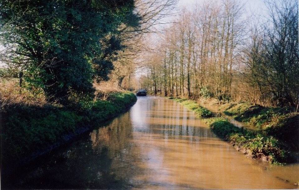
GeoCoast represents the natural geological coastline as if no coastal defences or made ground are present. This is of particular value in areas where coastal defences are no longer maintained. Source: Benjamin Thomas / Pixabay
Geology became a fascination for Rowan from an early age, particularly mountains, having regularly visited the Scottish Highlands on childhood holidays. This was further strengthened when her aunt and uncle embarked on a trekking trip in the Himalayas and Rowan finally got to realise her dream when, as part of her PhD research, she worked on the Tibetan Plateau, studying mountain uplift and tectonic evolution.
Since joining BGS, she has continued her work in structural geology, frequently applying it to a UK setting such as the GeoCoast project. Rowan explains that understanding coastal processes, particularly the structure of rocks, is important to understand how the coast will behave and how the rocks will affect that. Climate change processes are important too; through these, we can expect changes in the way the coast erodes and how different hazards occur.
‘My work on developing coastal domains has been bringing together multiple different datasets to identify areas of similar characteristics. The UK has an incredibly varied coastline, one of the most varied in the world based on its size. Being able to understand how the coastline behaves and the impacts of changes such as sea-level rise will be critical for ensuing our coastal communities and infrastructure are resilient and adaptive for the future.’
Rowan Vernon, BGS Geologist.
Being a geologist definitely helps you understand the natural environment and landscape, and Rowan has enjoyed many projects that help to make that knowledge and data relevant to society. She has also learnt a lot from working collaboratively and applying that geological knowledge to different areas and topics. Recent work with the Environment Agency and water companies is helping improve water management and contamination issues.
Rowan’s longer-term ambition is to bring together all of BGS’s multiple datasets on structure into one easy-to-access database. This will allow easier analysis of coastal zone erosion, understanding groundwater flow and siting of key infrastructure.
To find out more about Rowan’s data and projects, you can visit: GeoCoast project.
Emma Bee
A geospatial analyst with a background in GIS development and social media analyses, Emma enjoys collaboration and knowledge exchange.
Debris flow landslides, A85, Glen Ogle. BGS © UKRI
Emma is a chartered geographer and very much enjoys the ‘people’ and ‘place’ elements of her job. She utilises her geography skills on a daily basis to ensure that both the human and physical aspects are considered in her work, which primarily focuses on geohazards. ‘I love networking and listening to different people’s perspectives to help solve multidisciplinary problems,’ says Emma, who uses her skills to analyse spatial data to answer real world problems. One aspect of Emma’s work is analysing landslide data, both in the UK and overseas.
Being a geospatial analyst means bringing together multiple types of data with a spatial dimension to help understand or solve a societal problem, so analysing data relating to a specific location can offer valuable insights. One such project she is working on is all about developing an early warning system (EWS) for rainfall-induced landslides in India. Key to its success are both the data about the locality and the social, political and cultural dimensions to developing a system and ensuring forecast information is appropriately communicated and interpreted. Emma explains that social media data can also provide valuable information for scientists.
‘Social media can provide useful information about what the situation on the ground is like directly following a hazard event and can help scientists become aware of events, sooner than they might otherwise have done. It is a useful tool to understand.’
Emma Bee, BGS Senior Geospatial Analyst.
Emma’s love of networking and bringing people together was highlighted in her secondment with the Met Office. This opportunity was invaluable to understand how other organisations operate and how they conduct their data analytics and operations. This time allowed strong relationships with colleagues to form and has since resulted in multiple collaborations, new projects and research bringing together weather, climate and geohazard data.
In her downtime, Emma loves nothing more than a walk in the hills; one of her favourite places is Ingleborough in Yorkshire. Over the last year, during lockdown, she has enjoyed discovering many local footpaths too.
To find out more about Emma’s work, you can visit:
Bee Emma
Head of the National Geoscience Data Centre
Anna Harrison
An applied Quaternary scientist and lead of the climate CHANGE project, Anna is involved in analysing climate change data at BGS and enjoys developing science information for stakeholder needs. She has run a number of focus groups and enjoys collaborating with colleagues both across BGS and externally. Anna’s main role in product development is managing the GeoClimate team, which typically includes planning work tasks, keeping in touch with stakeholders, and ensuring everyone is abreast of the latest research and government agendas around climate change related to geohazards.

Cracking of clay-rich soils due to loss of moisture. This movement can impact property foundations and asset resilience. BGS © UKRI
Anna always finds inspiration working with her BGS colleagues and knows that collaboration is key to success. While that collaboration has had to be via Zoom during lockdown, she likes the fact that Zoom allows everyone an equal platform. Anna explains that, although we have a diverse stakeholder community, it is important to ensure our outputs are tailored towards their needs.
‘I really enjoy the diversity of my role I can be carrying out science research one week and attending a stakeholder meeting or conference the next. Our stakeholders are from a large range of sectors from critical infrastructure providers to home buyers. We have made data freely available for public use as GeoClimate Open, so that people can gain knowledge and understanding of how subsidence hazards might impact in the future.’
Anna Harrison, BGS Applied Quaternary Scientist.
Climate change is an ever-increasing challenge and, as awareness grows, so does the need for research and data interpretation. Anna describes a recent project she has led interpreting data for part of the Bank of England’s stress test to assess climate risk and financial stability. ‘These sorts of analyses are key for moving forward and ensuring that geohazards, particularly shrink–swell subsidence, are properly considered and mitigated for,’ she says.
Her next tasks are to contribute to COP26, the major climate change conference in Glasgow this year, and to bring together research in groundwater flooding with climate data. In between balancing all these activities, Anna loves to spend time with her young family and walking the family cockapoo, Coco.
To find out more about Anna’s data and projects, you can visit GeoClimate: UKCP09 & UKCP18.
Anna Harrison
Applied Quaternary scientist
Chris Williams
A geospatial analyst with a background in geomorphology and terrain analysis, Chris’s role at BGS is to lead the development of data analytics for assessing geohazards. Working with both data analysts and geologists, Chris looks to combine a complex range of data and interpretations with knowledge of natural processes. One example is developing data tailored for the emergency services. Most recently, climate change and temporal data are a focus, looking to inform and support adaptation and resilience for the future. As a keen surfer, Chris has an interest in all things coastal and is also a keen climber and budding grow-your-own enthusiast.
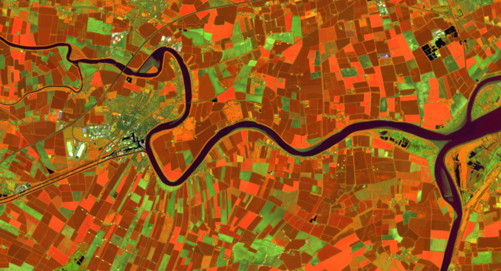
Terrain analysis created from Sentinel image. Source: BGS © UKRI
Chris is passionate about using different data types, such as temperature, terrain and hazards, to innovate and find new solutions to ‘real-life’ issues. One such example of this is his work with the emergency services, where geodata is inherently important but geology detail is not needed. Chris explains ‘What is crucial is the interpretation and ability of users to understand consequences of, for example, a landslide. An emergency response team is not interested in the type of geology but does need to know how different areas and situations react and what the consequences could be. Another aspect of my work is the innovation of technical know-how. This ranges from ensuring that we are up to date with current geo-environmental academic research as well as using that we are using the most effective and suitable technologies to create our products and carry out our analyses.’
‘A geospatial analyst is someone who interrogates and manipulates any type of spatial data. The role can be incredibly diverse but essentially it’s all about gaining insights into data and finding opportunities to interpret and use it.’
Chris Williams, BGS Geospatial Analysis Lead.
Chris’s recent work is using climate change data. The key factor here is where environmental processes become important and the impacts that then occur. Annual, or even seasonal, changes can have a detrimental impact on geohazards, which then impact on the way we live, the way we build and how we can manage and adapt to coastal erosion, groundwater flooding, or subsidence. Chris says ‘The aims of the research and analytics are to provide information to help people to be prepared and able to deal with different or changing issues in the future. ‘
Chris finds much of his inspiration and motivation from being outdoors in the natural environment. It is intrinsically linked to his job but experiencing it for real not only helps his understanding, it also puts things into context. Especially, Chris says, a few days spent surfing at the coast are not only a great escape but also motivate him to continue to find sustainable solutions to geoenvironmental issues.
To find out more about Chris’s data and projects, you can visit:

Dr Christopher Williams
Head of BGS Digital Mapping
Séverine Cornillon
With a background in geology, Séverine works alongside a range of scientists to evaluate and analyse a broad range of geoscientific issues, from brownfield cost calculators to historic river networks and their present-day influence on geohazards. Séverine has a keen interest in natural hazards, urban water management and delivering data solutions to stakeholders.
Major river scour damage as a result of Storm Desmond in 2015, River Greta, near Keswick. Source: BGS © UKRI
Séverine loves problem solving: piecing together different information to understand the bigger picture. This is why she first got involved in geospatial analysis and, having a background in geology, she is able to understand the environmental processes and 3D conceptualisation needed in her job. ‘Having both geology and geospatial skills allows me to identify the technical workflows necessary as well as to collaborate effectively with other geologists and data experts,’ she explains.
A recent project that she is involved in, Camellia, is about bringing together stakeholders from multiple organisations from commercial to academic, water companies and local authorities. The aim is to provide a platform for data as well as communication for understanding urban water management. ‘I really enjoy this aspect of my work where I can see that what I do makes a difference!’ says Séverine.
Another project she has contributed to is the Brownfield Ground Risk Calculator, a tool for local authorities to assess potential risks and costs of redeveloping brownfield sites. Most recently, Séverine is leading the development of the GeoScour data product, which identifies stretches of rivers susceptible to erosion during storm events.
‘The climate is changing and flooding is an increasing issue, already costing the economy millions of pounds through winter storm damage. It is important that we input our knowledge and provide data that will help catchment managers, infrastructure managers and provide the best scientific understanding and data possible to enable better decision making.’
Séverine Cornillon, BGS Geospatial Data Analyst.
Séverine is inspired by enabling others to learn and accomplish goals. ‘I love supporting colleagues in technical methods and engaging with external stakeholders to tailor solutions for their needs. As a student, I travelled to Burkina Faso and Senegal in west Africa and was able to use my GIS skills in a number of international humanitarian projects.’
In her spare time, Séverine is a keen tennis player, a sport she has enjoyed since her teens and recently took up again a few years ago. Once lockdown has been lifted and life is returning to normal, she looks forward to once again picking up her racquet and winning a few games!
To find out more about Séverine’s data and projects, you can visit:
Cornillon Severine
Geospatial data analyst
Katy Lee
A geologist with a background in geological mapping and engineering geology, Katy is the team leader of BGS Hazard and Resilience Modelling. She has an interest in the historic environment and how hazards are mitigated, utilising data to help protect and adapt to climate changes. She recently completed a placement with Historic England, appreciates good project management and enjoys getting out and about with her dog.
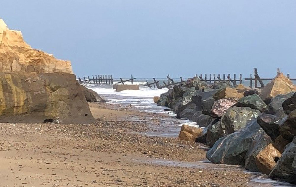
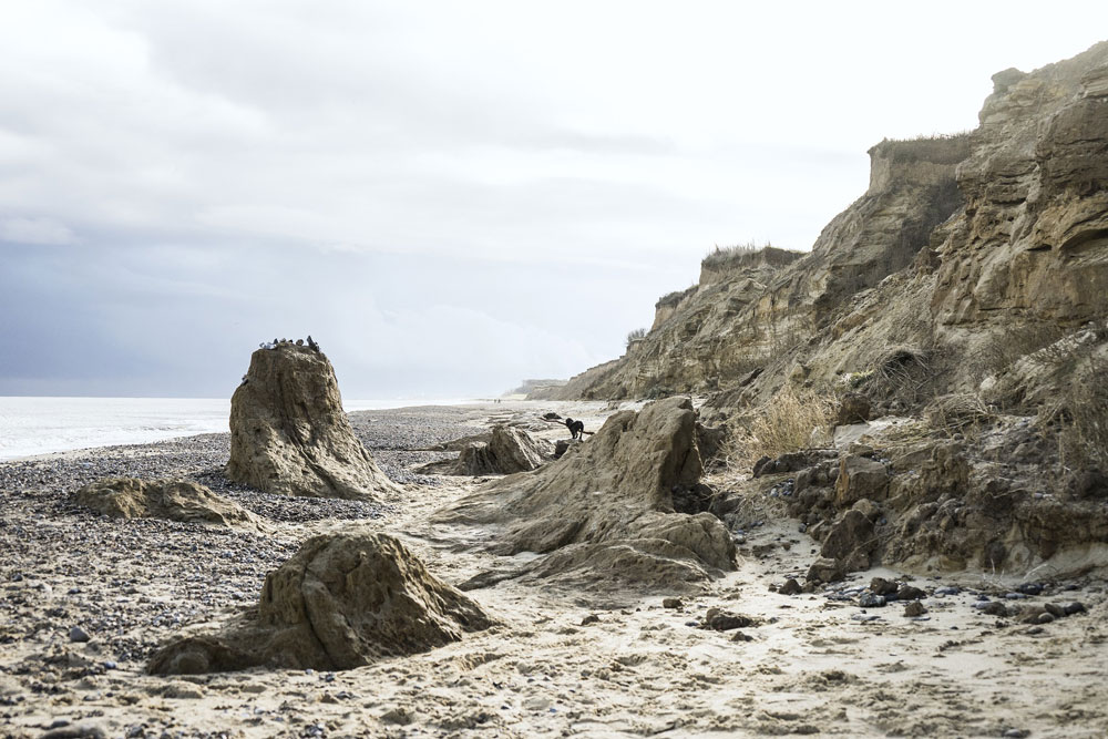
Coastal defences vary in type, form and effectiveness. BGS © UKRI.
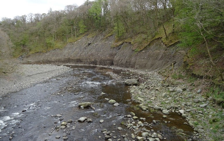
Structural bridge damage caused by river scour, Cumbria. BGS © UKRI.
‘I find inspiration from all sort of places,’ says Katy, ‘but probably mostly from the natural environment and the processes happening within it, such as the shifting shores of coastal areas, the changing seasons and the ever-changing flow of rivers and streams.’
‘I can be analysing digital data in a GIS, or compiling a GeoReport for a customer in the morning, then meeting with stakeholders to discuss data needs and climate change issues in the afternoon. The part I think I enjoy most about my job is making data useful for everyone and interpreting science in a way that allows an understanding of hazards and how they might impact you, your home, your way of life is incredibly important, and it’s essential to ensure that people understand how they can be resilient to natural processes.’
Katy Lee, BGS Team Leader of Hazard and Resilience Modelling.
Katy joined BGS over 20 years ago as a mapping geologist. A key motivator for her is being outdoors, being able to observe and interpret the 3D landscape beneath your feet and to understand how the rock originated because understanding past environments is the key to understanding the future. After many years of creating geological maps with new, detailed understanding and data, including borehole logging and 3D modelling, Katy decided to move into product development. ‘It was a natural step,” she says. ‘I enjoyed providing solutions and data that others could use, so by making products I’ve found a really positive way to make a difference.’
Although we don’t have volcanoes or big earthquakes in the UK, it’s important to recognise other hazards that can cause significant problems if not properly assessed and engineered for. For example, the team looks at subsidence, mining hazards, solution hollows and much more. Recently, Katy has led developments on river erosion and coastal change. ‘We are led by our stakeholders and their needs, whether engineering, insurance, climate change, planning, etc. and provide impartial data and advice. Our next steps are to look at providing more temporal environmental data and incorporating other hazards into our climate change assessments.’
In her spare time, Katy enjoys getting out into the countryside, especially when walking with her energetic Labrador! Being outside, witnessing change in the natural world is the best tonic that one can find.
To find out more about Katy’s data and projects, you can visit hazard and resilience modelling.
Kathryn Lee
Geologist and BGS Informatics product portfolio manager
Jenny Richardson
An expert GIS programmer and analyst, Jenny has worked on a range of geohazard projects and is a key process scripter within the team, using technologies including Python and Java. She has recently been working with daily data streams of weather data from the Met Office and developing detailed models to ingest and analyse landslide potential across Great Britain. Jenny enjoys crafting and is a keen baker and DIYer.
Degraded coastal defences. BGS © UKRI.
Jenny first became interested in earth sciences through her love of skiing in the mountains. ‘Being on alpine slopes, surrounded by mountains, glaciers and contorted rock formations, is both awe inspiring and humbling,’ she says. This love of the natural environment led her to study physical geography as a degree and this in turn led her to investigate methods of visualising spatial data in GIS. Originally self-taught in ARC GIS, she completed a GIS MSc before joining BGS, where she continued to develop her skills as a software developer and now regularly uses Python in her work. As one of the team’s key developers, Jenny spends blocks of time focusing on individual projects; some weeks she can be working on coastal data analyses, identifying the amount of coastline that is susceptible to erosion, whilst another week she could be analysing data for commercial research for clients such as Network Rail.
Jenny explains that she loves the problem-solving aspect of her job where she can take a series of analytics, break down into steps, script, test and tweak until an accurate solution is created. ‘Scripting is all about being able to automate a workflow,’ explains Jenny, ‘and make tasks reproducible.’ This is of enormous benefit in BGS’s product development as it streamlines and creates accessible pipelines (a set of automated processes) for often complex geospatial analytical processes.
A role she has recently enjoyed was the challenge of picking up legacy codebase and deciphering and updating it to create suitable outputs that will feed into a client’s asset-management programme. Jenny has also worked on the GeoCoast project and has developed a series of data stats for local authorities and shoreline management plan areas. ‘These are critical in visualising and communicating potential threats around the coastline of Great Britain,’ says Jenny.
Jenny is passionate about her work, emphasising that geology underpins everything from housing development, through industry and resource to leisure. It’s really important to understand the potential impacts we are already beginning to see related to climate change and Jenny is already involved in a project that is all about assessing resilience to climate change and ensuring that planning for the future is sustainable.
As well as having a successful career, she is a proud mum of two and baking, especially triple chocolate cookies or brownies, is a favourite. She is also a dab hand at carpet fitting, having renovated much of their family house over the last few years!
Find out more about projects that Jenny is involved in:

Jennifer Richardson
GIS programmer and analyst
Please get in touch if you’d like more information or have suggestions about future blogs and let us know what you would like to see or hear about. Do you have a story about how climate change is affecting you? Let us know
If you would like to find out more about our latest data product release GeoClimate UKCP18 then be sure to sign up to our launch webinar on May 20.
Relative topics
Latest blogs

Collecting beach pebbles: fun hobby but is it legal?
14/07/2026
The UK coastline will be inundated with keen holidaymakers this summer, many of whom will take a memento of their trip home in the shape of a pebble or two — but is it legal?

Strengthening capacity through partnership: a critical minerals perspective
28/04/2026
BGS has been working in partnership with the Geological Survey Department of Zambia (GSD) to build national capacity, improve data accessibility and support long-term, sustainable development.

PhD adventures in Copenhagen, Denmark: revealing past recovery processes of tropical forest systems through ancient environmental DNA
12/03/2026
PhD student Chris Bengt visited the University of Copenhagen to carry out very delicate extraction of aeDNA from lake-sediment cores, in the hopes of unlocking the secrets of past volcanic eruptions.

MARC Conference 2025: highlighting the importance of conferences to PhD students
16/02/2026
BGS and University of Nottingham PhD student Paulina Baranowska shares her experience presenting her research on nuclear forensics at her first international conference.

Hole-y c*@p! How bat excrement is sculpting Borneo’s hidden caves
23/12/2025
BGS researchers have delved into Borneo’s underworld to learn more about how guano deposited by bats and cave-dwelling birds is shaping the subsurface.

How the geology on our doorstep can help inform offshore infrastructure design
19/11/2025
BGS is part of a new collaboration using onshore field work to contextualise offshore data and update baseline geological models which can inform the sustainable use of marine resources.

Fieldwork on Volcán de Fuego
13/10/2025
Understanding how one of the world’s most active volcanoes builds up material, and how they collapse to feed hot flows
Esthwaite Water: applying novel approaches to understand lake-water nutrient pollution
19/09/2025
Andi Smith (BGS) and Savannah Worne (Loughborough University) embarked on fieldwork in the Lake District, applying a novel stable isotope method for tracing phosphorus sources.

Opening up the geosciences: making work experience more accessible
19/09/2025
BGS has been working with partners to make the geosciences more accessible to young people, including those from under-represented backgrounds.
PhD adventures in the Philippines: coring around Lake Bulusan
05/09/2025
Chris Bengt recounts his two-week field trip to Bulusan Volcano Natural Park in the Philippines to collect lake sediment cores, fresh soil and water samples.
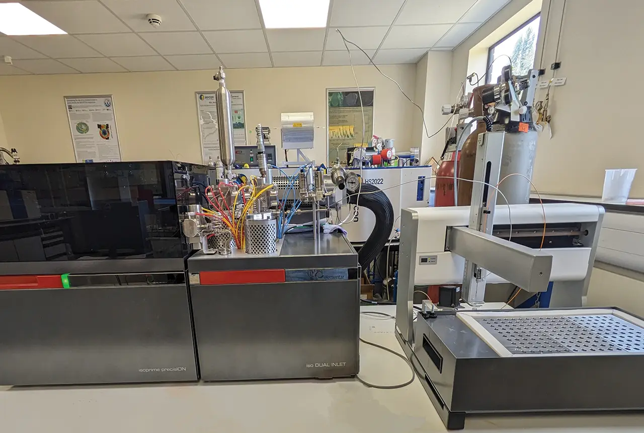
Gemini: a new stable isotope tool
21/08/2025
BGS’s Stable Isotope Facility has new mass spectrometer equipment for analysing carbon and oxygen isotopes from carbonates and water.
BGS hosts India for ‘deep dive’ on carbon capture and storage
30/07/2025
Some of India’s top scientists visited BGS to explore the UK’s carbon dioxide storage research potential.