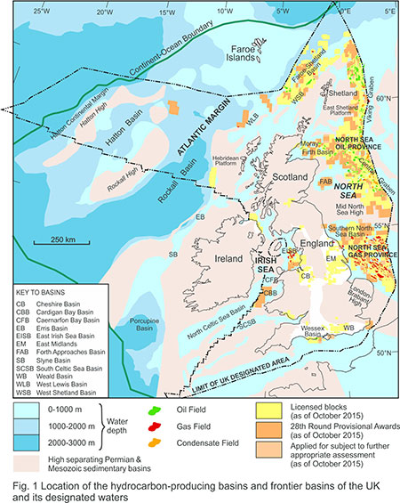
Hydrocarbon systems
BGS Research

The BGS works with UK and overseas governments, the World Bank, other national geoscience organisations, oil company consortia and the North Sea Transition Authority (NSTA, formerly the Oil & Gas Authority) to provide geological advice and services in support of exploration and development activity.

Our aim is to use and develop our expertise and experience in subsurface geology, basin analysis and hydrocarbon systems in the following ways:
- understanding the petroleum potential of the UK and its offshore regions, so that we may advise the North Sea Transition Authority on the UK’s hydrocarbon reserves
- evaluating and documenting the remaining prospectivity of the UK, to help our industry collaborators identify hydrocarbon resources as part of a roadmap for low-carbon energy resources
- understanding the geological evolution of the UK Continental Shelf (UKCS) in its wider North Atlantic setting, in collaboration with other national geological survey organisations, to fully evaluate the geological context of our collective offshore resources
- evaluating the petroleum potential of other countries so their governments might facilitate inward investment, leading to sustainable energy roadmaps for a region
Our expertise covers a wide range of aspects of the exploration business, from regional geological studies through to prospect generation, field development studies, licensing and marketing and promotion of opportunities. We also have considerable experience of negotiating and managing the exploration programmes that governments require oil companies to deliver as part of their licence agreements.
Collaborations
We have worked (sometimes in in partnerships with specialist economic and engineering consultancies) to deliver integrated geological, prospectivity, economic and development analyses for clients including:
- Falkland Islands Government
- governments and national oil companies in Africa, the Caribbean, Europe, Latin America and the former Soviet Union
- UK Government
- World Bank
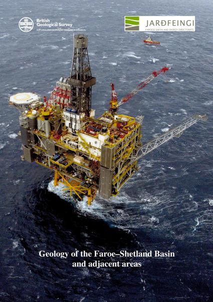
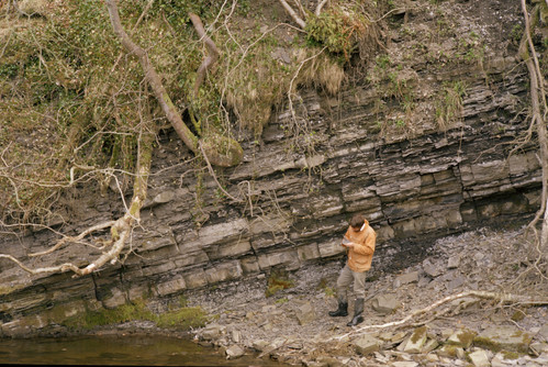
Geology of the Faroe–Shetland Basin and adjacent areas. BGS © UKRI.
We have also worked with several different oil company consortia, including:
- Rockall Consortium
- Passive Margins Modelling Project Consortium
- Faroe–Shetland Consortium (FSC; now in its third three-year phase)
In addition to the eight oil company sponsors, the FSC is conducted in partnership with Faroese Earth and Energy Directorate, Jarðfeingi, and the Northeast Atlantic Geoscience Tectonostratigraphic Atlas Consortium (NAG-TEC), whose partners comprise the ‘NAG group’ of north European geological surveys, led by the Geological Survey of Denmark and Greenland (GEUS) and sponsored by a number of oil companies.
The BGS team also played a role in the production of the Southern Permian Basin Atlas and the Millennium Atlas.
Selected research
The team has substantial research interests and jointly supervises PhD and Masters students at Keele University undertaking a range of cutting-edge research into subsurface fluid flow in complexly faulted, dry land depositional systems in both the UK and the USA. We also have research links with the University of Adelaide in Australia and Heriot-Watt University in the UK.
The petroleum geoscience team has worked with the Falkland Islands Government since 1992 and provides advice on the exploration setting and potential of all the offshore basins. Summaries of the geology of the region and of its petroleum potential are available at the Falklands Islands Government Department of Mineral Resources.
The petroleum geoscience team coordinates a consortium-based research approach to understanding the tectonostratigraphic evolution of the north west Atlantic margin.
The Faroe–Shetland Consortium (FSC) was established by the BGS, Jarðfeingi and sponsoring oil companies, with the aim of investigating the tectono-stratigraphic development of the Faroe–Shetland region. It grew from foundations established during an earlier collaborative joint industry project that delivered the BGS/Jarðfeingi Faroe–Shetland Basin regional report. A number of advantages resulted from this collaborative approach, including a joined-up overview of the entire region (not just national sectors) and cost sharing to support an ambitious programme of work. The BGS and Jarðfeingi aim to benefit from the co-funded research through publication of results for national-good purposes, once the period of sponsorship confidentiality has lapsed.
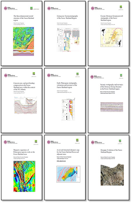
The FSC has completed two three-year phases of work, resulting in a suite of reports and GIS databases describing the structure and stratigraphy of the Faroe–Shetland region. These are based on an analysis of commercial seismic, released wells, BGS shallow boreholes, potential field data, third party (Ichron Limited) biostratigraphic data and the published literature.
Phases one and two of the project highlighted key areas of uncertainty, which will be addressed in phase three of the project. The major subprojects of phase three will include:
- interpretation of the facies and depositional setting of Upper Jurassic coarse clastic rocks, to evaluate the evolution of the proto-north-east Atlantic margin and its consequent tectonic setting
- generation of new biostratigraphic and radiometric age dating of the Paleocene–earliest Eocene breakup succession, to provide a new stratigraphic framework
- fully integrated interpretation of the structure of the area south-east of the Faroe Islands using reprocessed seismic data
These tasks were agreed by existing project sponsors at a kick-off meeting of sponsors in August 2015.
The BGS and Jarðfeingi welcome the participation of additional sponsors into the consortium.
If you want to discover more then please contact BGS Enquiries.
The petroleum geoscience team works closely with the North Sea Transition Authority (NSTA), formerly the Oil & Gas Authority, to provide advice on the remaining oil and gas prospectivity of the UK and its offshore regions. The results of this work are used by the UK Government to quantify the country’s unfound resources and to identify areas and prospects that can be promoted to the oil industry. Although much of this work is confidential to the NSTA, we have published a number of regional reviews, including those for the shale gas potential of three onshore areas of the UK: the Midland Valley of Scotland, the Weald Basin and the Bowland Shale of northern England.
The petroleum geoscience team has worked with theNrth Sea Transition Authority (NSTA), Oil & Gas UK (OGUK) and a consortium of over 45 oil companies to evaluate the remaining petroleum potential of previously overlooked or ‘unfashionable’ areas of the UK Continental Shelf (UKCS).
The 21st Century Exploration Roadmap (21CXRM): Palaeozoic Project is part of the UK Government’s endeavour to maximise the economic recovery of hydrocarbons on the UKCS in response to the Wood Review.
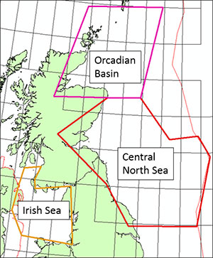
A study of the Palaeozoic of the UKCS was one of the first projects to be implemented as part of 21CXRM. Multidisciplinary studies further defined the Carboniferous and Devonian petroleum systems focused over and around the Mid-North Sea High and northwards to the Orcadian Basin/East Shetland Platform. In the wider Irish Sea area, the focus was the Carboniferous play.
Coinciding with the release by the NSTA of seismics across and around the Mid-North Sea High frontier area, project results have been delivered digitally to project sponsors. They include seismic, well and gravity interpretations along with burial/uplift/maturity modelling, source-rock geochemistry studies and palaeographic reconstructions to inform the location of prospective Carboniferous and Devonian plays. Onshore data and knowledge have also been incorporated.
The results were published under the Open Government License in March 2017 and are loaded to the BGS Offshore GeoIndex.
Users should note that:
- these outputs are at a regional scale, created for project-specific purposes and so should be used appropriately
- they are not BGS corporate products, but peer-reviewed project outputs
Data downloads
| All project files (816 MB .zip) | The complete set of reports and digital products metadata |
| Mid-North Sea High/Central North Sea files (230 MB .zip) | Reports and digital products for the Mid-North Sea High/Central North Sea; metadata |
| Orcadian study area files (159 MB .zip) | Reports and digital products for the Orcadian study area; metadata |
| Irish Sea files (91 MB .zip) | Reports and digital products for the Irish Sea area; metadata |
| Overview products files (336 MB .zip) | Overview reports, presentations and posters and paleogeographic/structural digital products; metadata |
Terms of use
Available under the Open Government Licence subject to the following acknowledgement accompanying the reproduced BGS materials: ‘Contains British Geological Survey materials © UKRI [year].’
Contact
If you want to discover more then please contact Alison Monaghan.
Related news
A new open dataset to benefit onshore geoscience research
15/06/2023
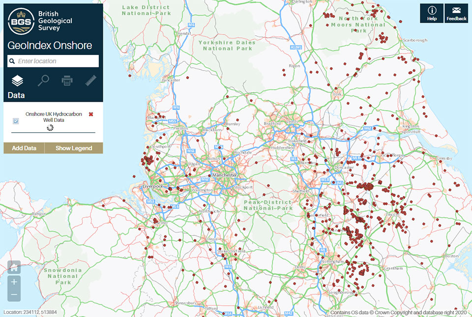
Data from deep onshore hydrocarbon wells is being released on an open access basis to help meet the UK’s net zero targets.
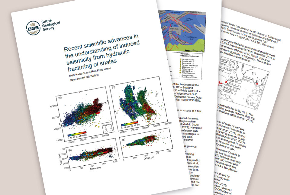
Scientific report published
22/09/2022
BGS was requested by the UK Government to address six questions related to recent scientific research on the hazard and risk from induced seismicity during hydraulic fracturing of shale rocks.
Making recommendations for the management of carbon dioxide storage and unconventional hydrocarbon extraction sites
04/10/2021
The safe operation of geoenergy and subsurface storage sites is required to help meet net zero carbon ambitions.
Scientists test a new model to understand and forecast seismicity induced by hydraulic fracturing operations
02/07/2021
Encouraging new research could bring scientists a step closer to being able to forecast earthquakes induced by human activity.
Methane release from UK shale gas site equivalent to 142 trans-Atlantic flights
28/10/2020
Operations at the Preston New Road shale gas site led to an atmospheric venting of 4.2 tonnes of methane gas that was detected at a nearby station installed by researchers from the University of Manchester as part of a project led by the British Geological Survey (BGS).
BGS shale gas research
We provide independent, expert and impartial geological and environmental advice with continued monitoring and publication of the latest data.
Shale gas in the UK
The UK has a number of sites that have been explored for shale gas deposits.
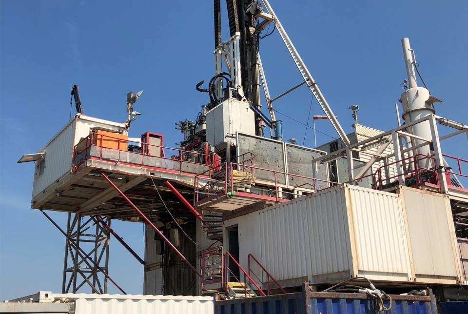
Shale gas extraction
Shale gas is extracted from microscopic pores in impermeable shale rock through a process called hydraulic fracturing.

Total organic carbon
Total organic carbon is a measure of the weight per cent of organic carbon within hydrocarbon source rocks. This dataset is derived from borehole analysis.