Scientific report published
BGS was requested by the UK Government to address six questions related to recent scientific research on the hazard and risk from induced seismicity during hydraulic fracturing of shale rocks.
22/09/2022 By BGS Press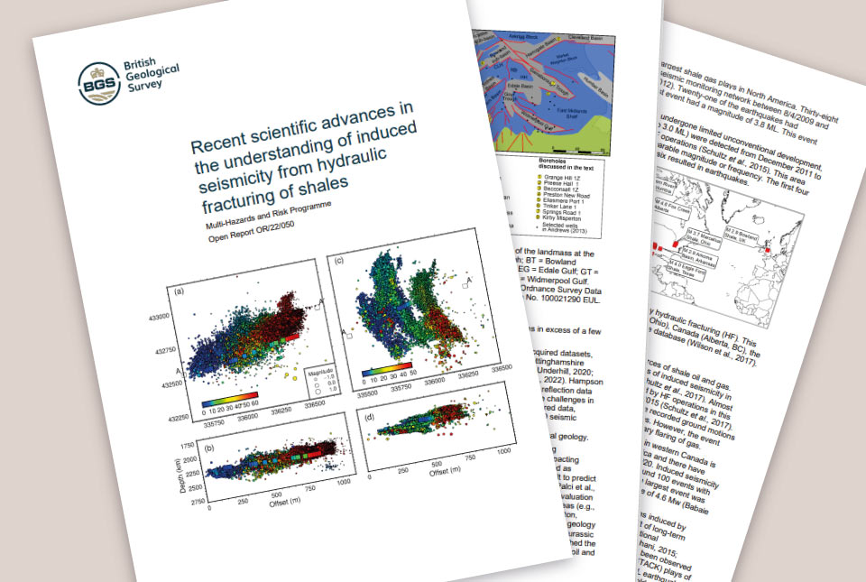

BGS submitted the report ‘Recent scientific advances in the understanding of induced seismicity from hydraulic fracturing in shales’ to the UK Government on 5 July 2022. This was in response to a Government request for a review of new scientific evidence focusing on the period from November 2019 until the present.
The report has been externally peer-reviewed by independent experts both within and outside the UK. The report draws on existing peer-reviewed data and research from academic journals, as well as on information from relevant technical reports from regulators and public bodies.
The UK Government requested BGS address six questions related to recent scientific research on the hazard and risk from induced seismicity during hydraulic fracturing of shale rocks. For more information about these questions, please refer to the letter from the Secretary of State.
This report concludes that forecasting the occurrence of large earthquakes and their expected magnitude is complex and remains a scientific challenge. As a result, our ability to evaluate and mitigate risks from hydraulic fracturing-induced seismicity and predict the occurrence of larger earthquakes during hydraulic fracturing operations is also a challenge.
This report also concludes there are new seismic data analysis methods that could help to manage the risk of seismic activity from hydraulic fracturing in shales. Further work is needed to develop these methods and incorporate them in risk assessments.
If you have any enquiries on the findings of the scientific report, please email our Press Office.
If you have any other queries then please contact the BEIS press office.
Further information about our research is also available on our website:
Frequently asked questions
BGS submitted the report ‘Recent scientific advances in the understanding of induced seismicity from hydraulic fracturing in shales to the Department of Business, Energy & Industrial Strategy on 5 July 2022. The report was prompted by a Government request for BGS to conduct a review of science about seismic activity associated with hydraulic fracturing of shales to extract hydrocarbons, focusing on work published between November 2019 and the present.
BGS was requested by the UK Government to address six questions related to recent scientific research on the hazard and risk from induced seismicity* during the hydraulic fracturing of shale rocks. More information about these questions can be found in a published letter from the Secretary of State of the Department of Business, Energy & Industrial Strategy.
*induced seismicity: earthquakes that are caused by human activity, such as hydraulic fracturing and mining.
In order to answer the questions set out by the Secretary of State of the Department of Business, Energy & Industrial Strategy, the report draws on existing data and peer-reviewed research from academic journals and information from relevant technical reports from regulators and public bodies. This includes:
- published examples of induced seismicity related to hydraulic fracturing
- analytical and numerical modelling studies
- geological investigations
- hazard and risk assessments
- our wider understanding of earthquakes in general
No drilling of any further test wells or seismic monitoring took place.
This report has been externally peer-reviewed by independent experts within and outside the UK. The peer-review process was required to independently assess the quality and validity of the work.
The report set out to answer the questions set out by the Secretary of State for the Department of Business, Energy &Industrial Strategy. The report also sets out recommendations where further study is needed.
This report concludes that forecasting large magnitude earthquakes and understanding the mechanisms behind earthquake occurrence remain a scientific challenge. This is the case for tectonic, natural and induced earthquakes.
This report also concludes that methods have been developed that use geological and geophysical data, including real-time analysis of operational data. These methods may help evaluate the potential for induced seismicity and therefore better manage risks both before and during hydraulic fracturing operations. More work is needed to develop these methods and incorporate them into risk assessments. Further research to bring new insights that may reduce uncertainties and improve the mitigation of risks is also required.
A full summary and further information about the scientific content of the review is included within the report.
The report submitted to the Department for Business, Energy & Industrial Strategy answers six specific questions from the terms of reference related to recent scientific research on the hazard and risk from induced seismicity during hydraulic fracturing of shale rocks. While this may help inform any decision about the lifting of the moratorium, our report does not make any conclusions about whether the moratorium should be lifted.
The report concludes that more measurements from boreholes in areas of shale gas potential will improve assessment of risks prior to, and during any hydraulic fracturing operations. For example, recent research demonstrates the importance of geomechanical modelling to identify the faults that are most likely to rupture during operations. These models require accurate mapping of subsurface faults, robust estimates of stress state and formation pore pressures, and knowledge of the mechanical properties of subsurface rocks.
Relative topics
Related news

New NERC-funded project empowers young people to engage with environmental science
23/07/2026
BGS is part of a new, collaborative project, funded through NERC’s ‘Opening up the environment’ programme, helping the environmental research community become more accessible.

Delving deep into mountains for future water security
16/07/2026
A BGS-led project is using new water-tracing investigation methods, geophysics and modelling to understand how water moves from mountains to the lowlands, helping to improve water security for billions of people.

Updated national 3D model will determine the depth to the solid bedrock beneath our feet
13/07/2026
The BGS Superficial Deposit Thickness Model now includes an elevation model of geological rockhead for the first time, providing important data for civil engineers, geoscientists and environmental scientists.

UK’s world-class research organisations launch new collective
10/07/2026
The launch of the National Research Organisations Group brings together more than 100 science leaders to provide an authorativive voice on science, research policy and long-term investment.

Cheshire Geoenergy Observatory releases key geological datasets for UK thermal energy storage scheme design
09/07/2026
A new report and data packs from BGS will provide a unique resource for scientists working on the geology and hydrogeology of the Sherwood Sandstone Formation, an important aquifer and reservoir rock.

New geological mapping underway to help manage flooding along the River Tweed
08/07/2026
Scientists are surveying the Tweed catchment for the first time in over 100 years to enhance understanding of localised groundwater and improve flood forecasting.

Geological research in North Sea helping to safeguard subsea cables
06/07/2026
Subsea power and telecommunications cables are critical to the UK’s energy infrastructure and global connectivity, yet they remain vulnerable to damage from ship anchors, fishing activity and natural hazards.

UK Critical Minerals Intelligence Centre makes recommendations for the next UK criticality assessment
01/07/2026
CMIC has outlined the enhancements made to the next assessment update to ensure it is better tailored to the structure of the UK economy.

From archive to discovery: historical mineral reports support gold exploration in Scotland
25/06/2026
Digitised geological records show potential to unlock untapped mineral resources in Ardlochan, Argyllshire.

UK and Philippines scientists investigate natural hydrogen generation processes at atomic scale
22/06/2026
BGS researchers were granted access to use the Diamond Light Source facility in order to study hydrogen in light brighter than the sun.

Shortage of end-of-life materials presents challenge to UK critical minerals security
17/06/2026
A new report by the UK Critical Minerals Intelligence Centre reveals insufficient end-of-life material stocks present a supply risk over the coming decade, but offer significant long-term potential to meet critical mineral demand through recycling.

UK geothermal catalogue receives update
16/06/2026
BGS releases the second digital version of the UK geothermal catalogue of subsurface temperature and rock thermal conductivity measurements and heat flow calculations.