Product development: properties and resources
BGS Research
The properties and resources team publishes a broad range of geological data and information for all stakeholders. Our portfolio includes all digital mapping relating to the description of the main lithological, geochemical and geophysical characteristics of UK geology, as well as covering aspects of engineering behaviour and resource potential.
Our product development centres on updating the extensive, supporting databases relating to geotechnical, geochemical and geophysical properties of rocks and soils. This includes looking at novel spatial modelling techniques, as well as the development of work flows to improve data ingestion and publishing.
Product development is focused on meeting the needs of stakeholders. We do this by working collaboratively with users across industry, government and academia to develop answers to their specific problems. Examples of these can be seen in our case studies pages for the utilities sector.
The team are also working to upgrade our systems and methods, to enable more data to be gathered from a wider number of sources, collated with more automation and released in a wider range of outputs.
Case studies
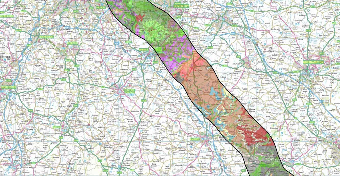
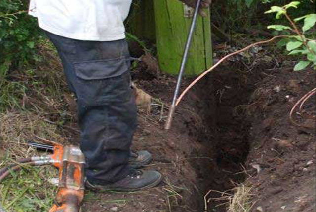
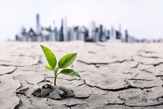
The team has worked with numerous clients in the utilities and transport sectors to assess the impact of geological environment on buried or on-surface infrastructure assets. Much of the research has focused on determining if assets are being unduly compromised by their environment or are in need of specific maintenance to mitigate local environmental conditions. Many of the projects also included an assessment of likely changes arising from climate variability.
All geological materials change through time. Units that are youngest, or closest to the ground surface, are subject to constant changes in moisture, stability (subsidence; heave; weathering; erosion) and solar gain. These factors are compounded by the fact that the assets themselves may influence their environment by introducing changes to local drainage, heat-profiles, stray currents and ground stability (loading; voids).
These studies have used a range of geostatistical methods to model spatio-temporal correlations and uncertainty.
Systems and methods
The properties and resources team use a wide range of GIS systems (e.g. ESRI; QGIS; MapInfo) and bespoke tools (including R and in-house Python scripting) to build and maintain the main products. We have a small number of additional projects that consider novel techniques for spatial analysis to either develop new mapping outputs or assess spatial correlation of geological features with other datasets.
Find out more about our research
Mapping with machine learning
Recently there has been a trend towards the collection of ever-more quantitative data, as exemplified by the Tellus projects.
Our projects
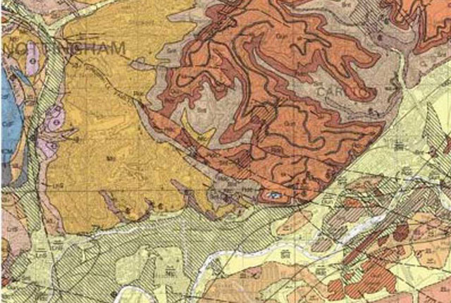
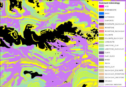
BGS Geology
The BGS Geology datasets are digital geological maps of Great Britain based on the different series of published BGS geological maps.
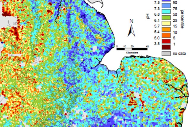
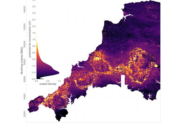
G-BASE: regional geochemistry
Systematic geochemical sampling and analysis of rural stream sediment, stream water and soil samples was carried out across the UK by the BGS and GSNI.
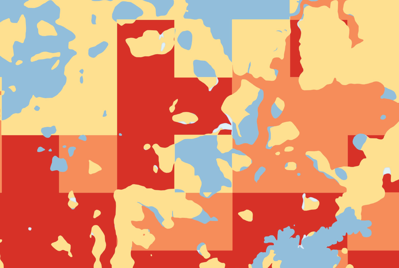
BGS Civils
National maps of engineering properties based on geological data and BGS Geology 50K.
Soil Parent Material Model
The Soil Parent Material Model details the distribution of properties of the weathered and unweathered soil parent materials of Great Britain.
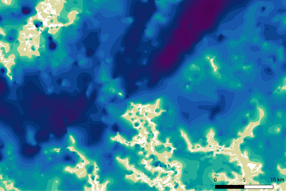
Superficial deposit thickness model
The superficial deposit thickness model shows the depth of the bedrock surface below unconsolidated deposits
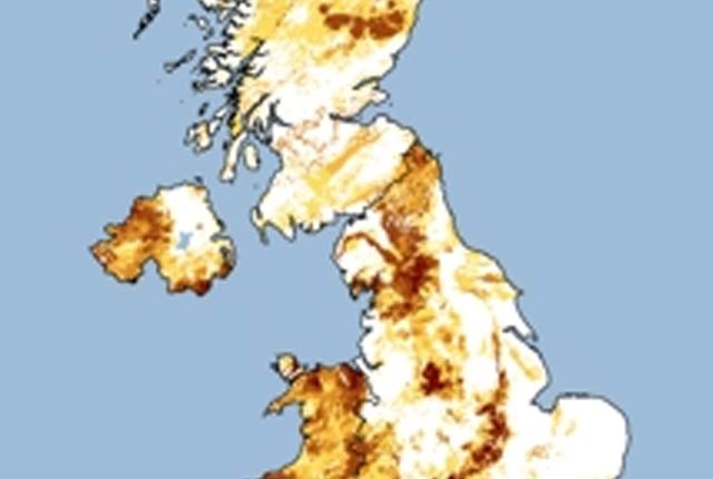
Indicative atlas of radon in Great Britain WMS
Public Health England and the BGS have published a map showing where high levels of radon are more likely, which is provided as a web map service (WMS).
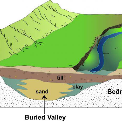
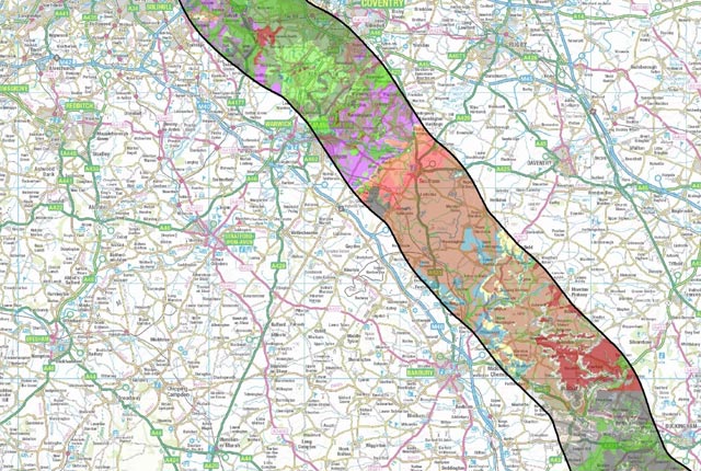
Buried valleys
Buried valleys are ancient river or subglacial (beneath a glacier) drainage networks that are now abandoned and have become either partly or completely buried by more recent sediment.
Case studies
Power networks
BGS worked with National Grid to undertake a screening exercise to identify potential geological and flooding hazards that might impact their network.
Water networks
Water companies manage extensive networks of pipes for water supply and sewerage and over time, these pipes can fail, resulting in leakage to the surrounding soils.
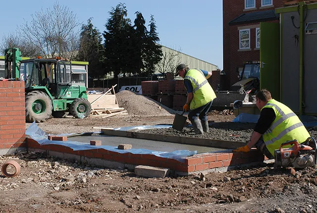
Transport networks
Major transport projects create and utilise excavated materials to create underpinning infrastructure (in the form of tunnels, cuttings and embankments).
Related news

Updated national 3D model will determine the depth to the solid bedrock beneath our feet
13/07/2026
The BGS Superficial Deposit Thickness Model now includes an elevation model of geological rockhead for the first time, providing important data for civil engineers, geoscientists and environmental scientists.

From archive to discovery: historical mineral reports support gold exploration in Scotland
25/06/2026
Digitised geological records show potential to unlock untapped mineral resources in Ardlochan, Argyllshire.

Ukraine and the UK strengthen their commitment to geological cooperation
10/06/2026
A new Memorandum of Understanding reaffirms the UK’s support of Ukraine’s ambitions to develop its critical mineral resources, paving the way for collaboration through capacity-building programmes.

New geological maps of Berwick-upon-Tweed to help future-proof natural water supply
20/05/2026
Scientists have mapped the geology under the town to better understand the groundwater system to inform decisions around abstraction.
BGS GeoClimate – dataset launch webinar
Event on 02/06/2026
The virtual launch of our new BGS GeoClimate dataset – helping mitigate the economic risk from shrink-swell subsidence. Event recording now available

Map of BGS BritPits showing the distribution of worked mineral commodities across the country
18/02/2026
BGS’s data scientists have generated a summary map of the most commonly extracted mineral commodities by local authority area, demonstrating the diverse nature of British mineral resources.

Funding secured to help mitigate ground risk in UK construction sector
05/02/2026
The BGS Common Ground project has been awarded new funding to help unlock the value of ground investigation data.

New geological maps of the Yorkshire Wolds to better inform groundwater management and policy decisions
17/12/2025
The new mapping provides crucial data on localised geological issues that may assist in protecting water supplies.

New 3D model to help mitigate groundwater flooding
08/12/2025
BGS has released a 3D geological model of Gateshead to enhance understanding of groundwater and improve the response to flooding.

Latest BGS Geology 50K mapping data launched
06/11/2025
Some of our most widely used maps have received a major update, including the 1:50 000-scale map series that now includes enhanced coverage of Great Britain.

World Cities Day: the geological story of our cities
31/10/2025
Understanding the rocks that underlie our towns and cities, the risks they can present and how they influence urban planning and redevelopment.

New BGS GeoIndex viewer released for user testing
24/09/2025
The premium map-viewing application has been given a major upgrade and made available as a beta release.
You may also be interested in
Hazard and resilience modelling
Developing new and innovative data products that deliver geoscientific information to a range of users in an accessible form.
