Geodesy and Earth observation
BGS Research
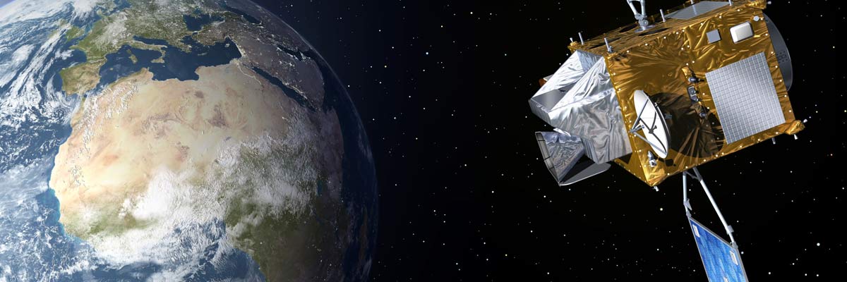
BGS Geodesy and Earth Observation is a world-class capability comprising scientists and instrumentation that lead the way in UK and international research.
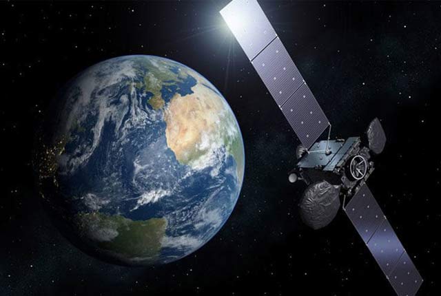
Our team of specialists develop and use a wide range of innovative Earth observation (EO) techniques to characterise and monitor Earth processes that impact lives and livelihoods in the UK and globally. Our EO sensors are located on the ground, in the air and on satellites, helping us to collect and interpret data from crowded cities to the remotest places on Earth. We lead applied research projects and work in partnerships in the UK and globally.
Our research includes the following themes:
- Multi-hazards and resilience
- landslides
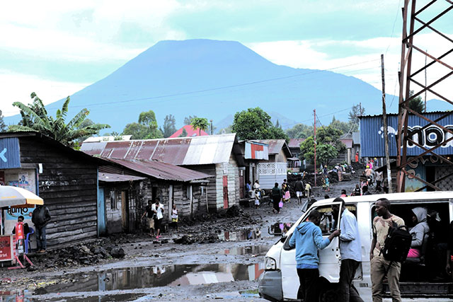
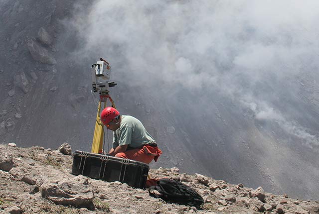
- volcanology
- International Charter project management
- Environmental change, adaptation and resilience
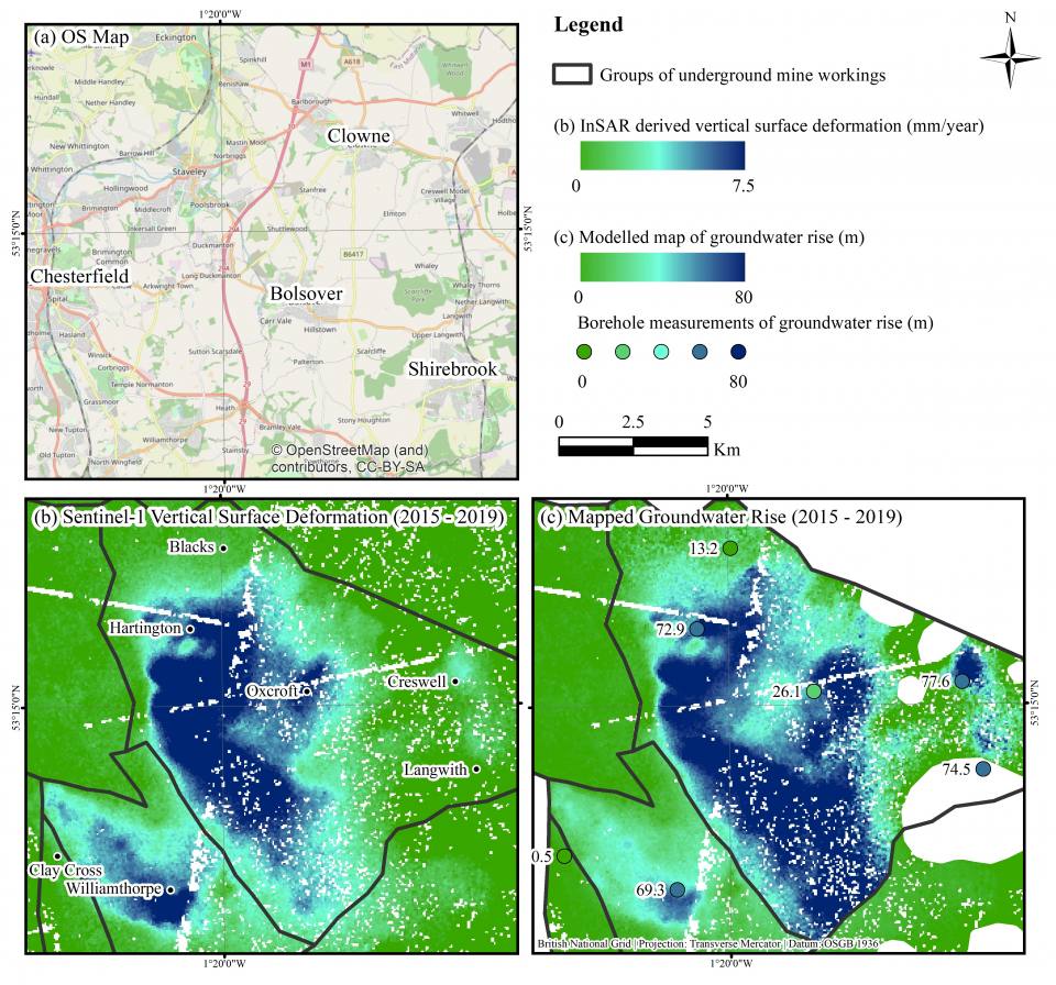
- mine-waste mapping
- subsidence monitoring
- potential impacts of shale gas operations
- coastal studies
- Decarbonisation and resource management
- CO2 storage monitoring
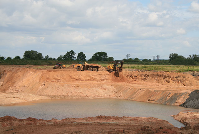
- mineral exploration
- mineral mapping
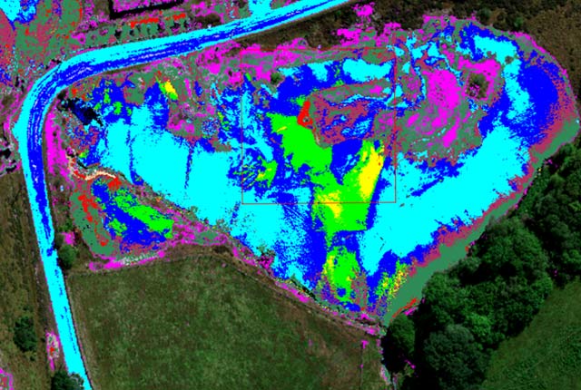
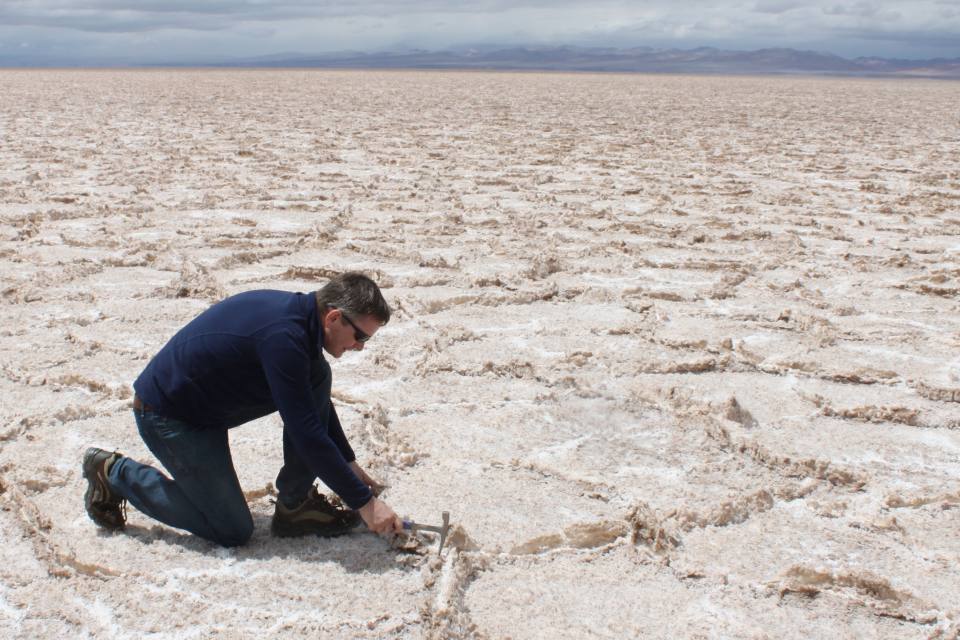
- Geological and geophysical surveying
- geological mapping
- ground truthing
- Official Development Assistance
We are a member of the European Association of Remote Sensing Laboratories (EARSeL). We have world-class facilities with state-of-the-art processing systems and expertise including:
- interferometic synthetic aperture radar (GAMMA, ISCE, Mintpy, StaMPS and SNAP)
- digital photogrammetry (ERDAS LPS, BAE Socet and GXP)
- structure from motion (Agisoft Metashape and Pix4D)
- image processing (ENVI, ERDAS, Spectral Mapper)
- GIS (ESRI ArcGIS and QGIS)
- 3D visualisation (Geovisionary)
- rotary and fixed-wing drones with fully qualified pilots
BGS has a long history of developing EO systems that help us to understand the Earth and other planets: we have had a dedicated remote sensing group since 1949. Since 2014, the BGS and the UK Centre for the Observation and Modelling of Earthquakes, Volcanoes and Tectonics (COMET) jointly deliver the NERC National Capability in Earth Observation for understanding volcanic and tectonic processes and hazards. BGS also operates the Space Geodesy Facility at Herstmonceux, making a range of satellite laser ranging, GNSS and absolute gravity observations and manages the British Isles continuous GNSS Facility (BIGF), which is hosted at the University of Nottingham.
FInd out more about our research
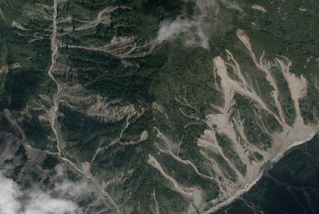
Disaster response
BGS Geodesy and Earth Observation provides satellite imagery and expertise that is used to determine the effects of disaster events.
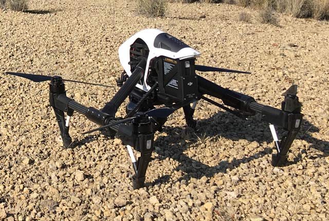
Drone research
BGS use drones to gain a perspective of the Earth that is simply not possible with instruments that are based on the ground.
Hyperspectral research
The BGS has extensive experience acquiring and processing hyperspectral data for a range of geological applications.
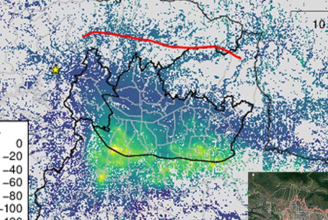
InSAR research
BGS Geodesy and Earth Observation scientists have a long history of working with InSAR data.
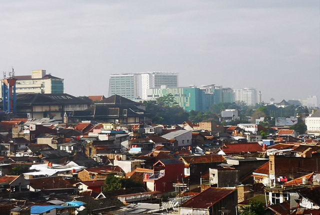
Seismic cities
Identifying communities that are particularly vulnerable to future earthquake hazards.
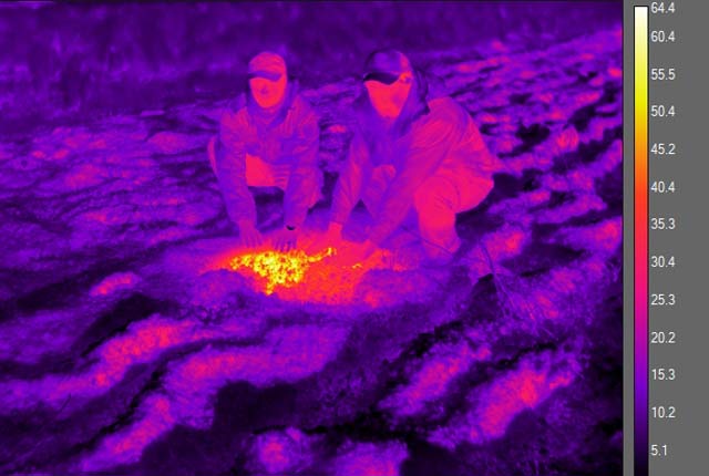
Thermal research
Remote sensing of land surface temperature is a useful method of extracting information about the surface for geoenvironmental studies.
Related news
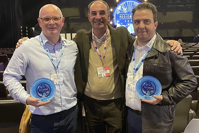
GSNI project wins multiple awards at RegioStars event
17/10/2025
The AGEO project enjoyed a double success at the RegioStars awards, hosted at the European Commission in Brussels.
AI and Earth observation: BGS visits the European Space Agency
02/07/2025
The newest artificial intelligence for earth science: how ESA and NASA are using AI to understand our planet.
UK’s geomagnetic blind spots tackled with new observatories
28/07/2022
Three new geomagnetic observatories have been installed across the UK to fill in the country’s ‘blind spots’ and tackle the risk posed by space weather.
Using satellite imagery for emergency disaster response
06/07/2021
BGS has a long history of assisting relief efforts by providing satellite maps, data and interpretation to those affected by disasters, helping to identify hazardous areas to avoid.
Spaceborne data: an expanding role in disaster response
23/06/2021
Alessandro Novellino explains the importance of Earth observation to help facilitate successful emergency responses after natural hazard occurrences.
Virtual fieldwork during a global pandemic
03/03/2021
Virtual field reconnaissance can help maintain research momentum during the COVID-19 pandemic.
BGS data supports new tool to track geological changes in abandoned coal mines
20/11/2020
BGS data supports new tool to track geological changes in abandoned coal mines.
Joint project aims to support sustainable development in Kenya
12/10/2020
BGS is part of a joint UK-Kenyan international project that aims to blend data and information with local stakeholder input to explore the sustainable supply of sand and aggregates in Kenya.
Geodesy and Earth observation
Developing and using innovative Earth observation techniques to characterise and monitor Earth processes that affect lives and livelihoods.
Ground-based and near-Earth geomatic surveys
BGS has pioneered the use of ground-based (terrestrial) techniques for a variety of geoscientific applications since 1999.
You may also be interested in
Disaster response
BGS Geodesy and Earth Observation provides satellite imagery and expertise that is used to determine the effects of disaster events.
Ground-based and near-Earth geomatic surveys
BGS has pioneered the use of ground-based (terrestrial) techniques for a variety of geoscientific applications since 1999.