Joint project aims to support sustainable development in Kenya
BGS is part of a joint UK-Kenyan international project that aims to blend data and information with local stakeholder input to explore the sustainable supply of sand and aggregates in Kenya.
12/10/2020 By BGS Press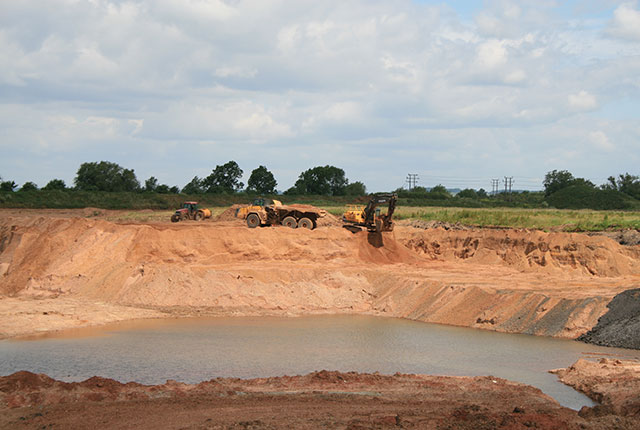

The project, called Earth Observation for Sustainable Aggregate Supply (EO4SAS), is one of ten recently announced projects being grant-funded through the UK Space Agency’s International Partnership Programme (IPP), part of the Department for Business, Energy & Industrial Strategy’s (BEIS) Global Challenges Research Fund (GCRF).
Sand used as aggregate forms an essential but finite resource. Growing demand for construction – buildings and infrastructure, creating land through reclamation, and coastal protection from climate change – has resulted in supply pressures on traditional sources. Unmanaged extraction is an emerging and locally significant problem around the world.
The issue has been highlighted by the United Nations and has the potential to cause wide-ranging social, economic and environmental impacts. These impacts can include pollution, land erosion, changing water flows, reduction of biodiversity, damage to infrastructure, degradation of habits and impacts on vulnerable communities.
Pixalytics Ltd, a UK-based earth-observation company, is leading the project and will be working with the Government of Kenya alongside Kenyan partners Nairobi Design Institute and NIRAS Africa, and UK partners Satellite Applications Catapult, Chatham House and the University of Plymouth to deliver the work. The project is being supported by the minerals team from BGS.
The team will be working with local stakeholders alongside satellite data, machine-learning technology and in-country knowledge to bring together a better understanding of the current extraction sites, scale, transportation routes and environmental impacts for sand, helping the Government of Kenya identify better strategies for the sustainable management of this resource.
This is a short-term discovery project, running until March 2021, to look at how such a system could be implemented. It is hoped the proposed solution will go on to receive further funding and so improve the monitoring and regulation of aggregate mining, supporting sustainability in the aggregate supply chain and progress towards the United Nations’ Sustainable Development Goals.

Sand is a vital raw material for construction, essential for houses and infrastructure in rapidly developing counties like Kenya. However, high demand can lead to shortages, lack of effective environmental controls and even illegal mining. Through this project we are excited to be involved in developing more effective resource management systems using innovative technologies to mitigate some of the harmful effects of sand extraction.
Tom Bide, BGS Minerals Geologist.
With an increasing global demand for sand, we are excited to be working with Government of Kenya, local stakeholders and communities to see how we can all work together to develop a more sustainable system for the management of this vital resource.
Dr Samantha Lavender, Managing Director at Pixalytics.
The compelling results of previous IPP projects cement the case for investment in space for sustainable development. IPP is not only demonstrating the value of satellite solutions and improving the lives of people on the ground in developing countries, but also facilitating effective alliances between the United Kingdom and international organisations. It’s a ‘win-win’ and an exciting moment in the programme.
Liz Cox, IPP Head of International Relations at the UK Space Agency.
For further information please contact our press office:
Call: +44 (0)7790 607 010.
(Please do not text this number. We accept calls or email only.)
Email: bgspress@bgs.ac.uk
About the UK Space Agency’s International Partnership Programme:
The UK Space Agency’s International Partnership Programme (IPP) is a five-year, £30 million per year initiative designed to utilise the UK space sector’s research and innovation strengths to deliver sustainable economic, societal and/or environmental benefits to developing countries. Projects within IPP span a range of themes including: building climate/disaster resilience; improving agriculture; reducing deforestation; preventing and reducing maritime pollution and illegal fishing; optimising renewable energy production; and improving access to appropriate and affordable financial services.
IPP is funded from the Department for Business, Energy and Industrial Strategy’s (BEIS) Global Challenges Research Fund (GCRF). This £1.5 billion Official Development Assistance (ODA) fund supports cutting-edge research and innovation on global issues affecting developing countries. ODA-funded activity focuses on outcomes that promote long-term sustainable development and growth in countries on the OECD Development Assistance Committee (DAC) list. IPP is ODA compliant, being delivered in alignment with UK Aid Strategy and the United Nations’ (UN) Sustainable Development Goals (SDGs).
About the British Geological Survey
The British Geological Survey (BGS) is a world leading applied geoscience research centre that is part of UK Research and Innovation (UKRI) and affiliated to the Natural Environment Research Council (NERC). BGS core science provides objective and authoritative geoscientific data, information and knowledge to inform UK Government on the opportunities and challenges of the subsurface. It undertakes national and public good research to understand earth and environmental processes in the UK and globally. The BGS annual budget of approximately £60 million pa is funded directly by UKRI, as well as research grants, government commissions and private sector contracts. Its 650 staff work across the UK with two main sites, the head office in Nottingham and Lyell Centre, a joint collaboration with Heriot Watt University in Edinburgh. BGS works with more than 150 private sector organisations, has close links to 40 universities and sponsors about 100 PhD students each year. Please see www.bgs.ac.uk.
Related news

New NERC-funded project empowers young people to engage with environmental science
23/07/2026
BGS is part of a new, collaborative project, funded through NERC’s ‘Opening up the environment’ programme, helping the environmental research community become more accessible.

Delving deep into mountains for future water security
16/07/2026
A BGS-led project is using new water-tracing investigation methods, geophysics and modelling to understand how water moves from mountains to the lowlands, helping to improve water security for billions of people.

Updated national 3D model will determine the depth to the solid bedrock beneath our feet
13/07/2026
The BGS Superficial Deposit Thickness Model now includes an elevation model of geological rockhead for the first time, providing important data for civil engineers, geoscientists and environmental scientists.

UK’s world-class research organisations launch new collective
10/07/2026
The launch of the National Research Organisations Group brings together more than 100 science leaders to provide an authorativive voice on science, research policy and long-term investment.

Cheshire Geoenergy Observatory releases key geological datasets for UK thermal energy storage scheme design
09/07/2026
A new report and data packs from BGS will provide a unique resource for scientists working on the geology and hydrogeology of the Sherwood Sandstone Formation, an important aquifer and reservoir rock.

New geological mapping underway to help manage flooding along the River Tweed
08/07/2026
Scientists are surveying the Tweed catchment for the first time in over 100 years to enhance understanding of localised groundwater and improve flood forecasting.

Geological research in North Sea helping to safeguard subsea cables
06/07/2026
Subsea power and telecommunications cables are critical to the UK’s energy infrastructure and global connectivity, yet they remain vulnerable to damage from ship anchors, fishing activity and natural hazards.

UK Critical Minerals Intelligence Centre makes recommendations for the next UK criticality assessment
01/07/2026
CMIC has outlined the enhancements made to the next assessment update to ensure it is better tailored to the structure of the UK economy.

From archive to discovery: historical mineral reports support gold exploration in Scotland
25/06/2026
Digitised geological records show potential to unlock untapped mineral resources in Ardlochan, Argyllshire.

UK and Philippines scientists investigate natural hydrogen generation processes at atomic scale
22/06/2026
BGS researchers were granted access to use the Diamond Light Source facility in order to study hydrogen in light brighter than the sun.

Shortage of end-of-life materials presents challenge to UK critical minerals security
17/06/2026
A new report by the UK Critical Minerals Intelligence Centre reveals insufficient end-of-life material stocks present a supply risk over the coming decade, but offer significant long-term potential to meet critical mineral demand through recycling.

UK geothermal catalogue receives update
16/06/2026
BGS releases the second digital version of the UK geothermal catalogue of subsurface temperature and rock thermal conductivity measurements and heat flow calculations.