Coasts and estuaries geohazards
BGS Research
BGS Coasts and Estuaries provides independent and expert geoscientific tools and advice for collaborative decision making to assess different adaptation options for coastal flooding and erosion.
This research area aims to make our coasts and estuaries more resilient to coastal geohazards, help the transition from grey to green engineering, ensure that the built environment is adaptable to today’s and tomorrow’s climate and to minimise the impacts due to the legacy of anthropic activities on the coastal zone.
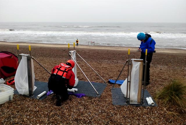

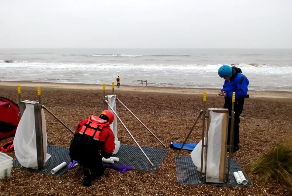
Team members setting up the portable streamer trap devices used to measure sediment transport on mixed sand and gravel beaches at Minsmere, eastern England, UK. BGS © UKRI.
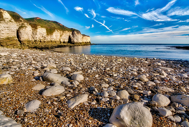
Globally, most people live within a few hours’ travel of a coast or an estuary. Because of their access to marine resources and opportunities for transport, trade and recreation, coasts and estuaries are major concentrations of population and investment and are the greatest concentration of assets anywhere on the planet. They provide enormous resources, not only in relation to minerals, energy, habitats and food, but also as a recreational amenity.
Such resources and societal assets are threatened by a range of hazards, including marine flooding (the greatest flood risk in the UK), erosion and contamination. Long-term environmental changes, including societal pressures and climate change, are threatening the processes and functions of the coast upon which we depend.
Climate change will also have an enormous impact on coastal stability. Associated changes in the ocean climate are changing the frequency and scale of storm surges in the short term and, in the longer term, increases in sea level pose major threats to coastal areas.
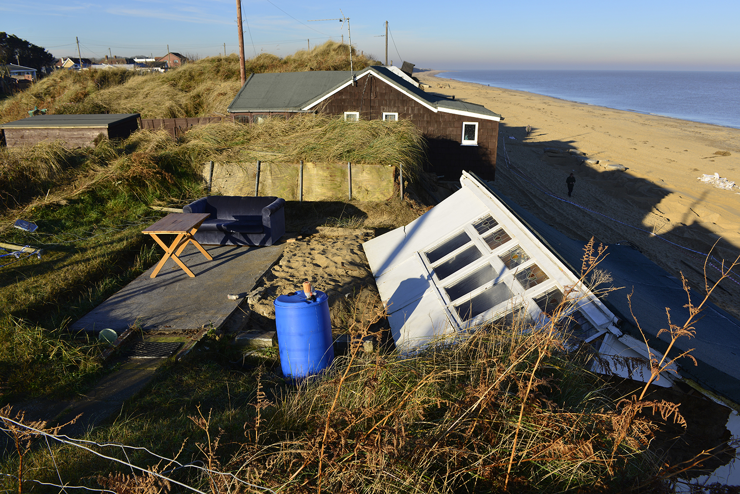
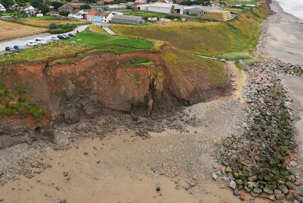
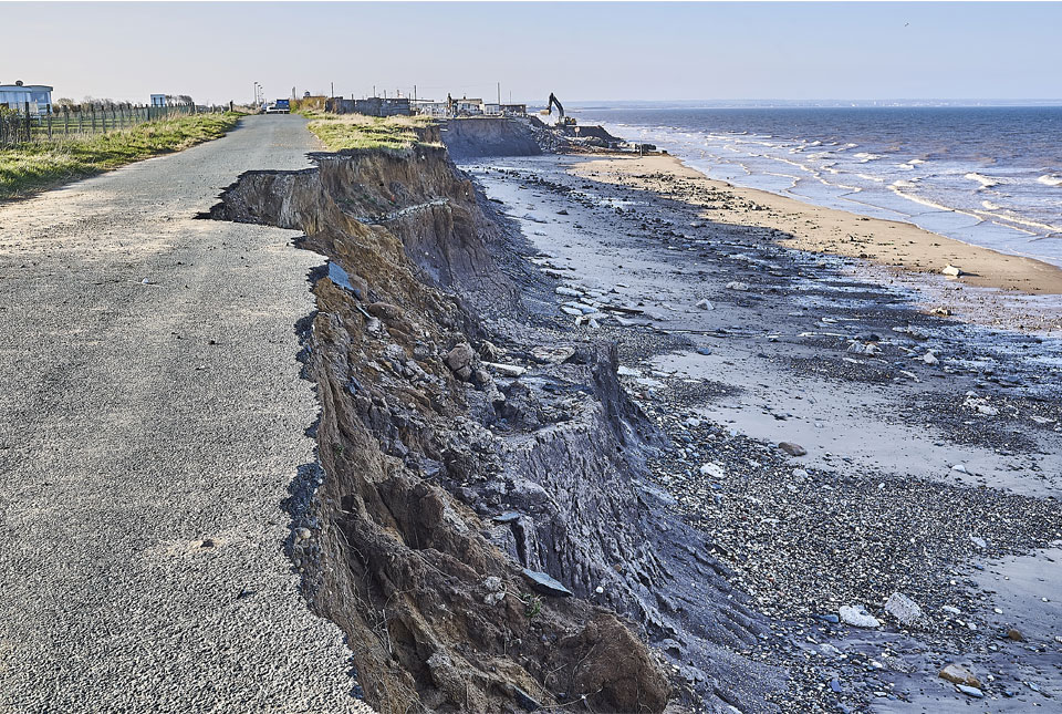
Damage due to coastal erosion after the storm surge of 5 December 2013. Hemsby, Norfolk. BGS © UKRI.
The characterisation of geological processes, resources and hazards on the coast is essential in understanding how coasts are likely to change under future environmental and management scenarios. The knowledge and data we acquire will serve business, government and wider society to make better-informed decisions about coastal risks and opportunities. The BGS Coasts and Estuaries research programme is therefore targeting the increasing need for impartial, authoritative geoscientific advice on coasts nationally and internationally.
Coastal response to environmental change
BGS Coasts and Estuaries will combine the use of innovative 4D simulation models and cost-effective monitoring approaches (from space and using non-intrusive survey methods) to quantitatively assess the effects of different adaptation options against coastal flooding and coastal erosion (for example non-active intervention, managed realignment, hold the line, advance the line) with an emphasis on the transition from traditional grey engineering (such as hold the line with hard defences) to more green engineering (a combination of sand-scaping and giving space to coastal processes).
Find out more about our research
UKGravelBarriers
Increasing our understanding and modeling capabilities of gravel beach and barrier dynamics.
Monitoring coastal change from space
BGS is helping to develop applications that detect and track coastal erosion and accretion from space to inform coastal management plans.
Related news

Collecting beach pebbles: fun hobby but is it legal?
14/07/2026
The UK coastline will be inundated with keen holidaymakers this summer, many of whom will take a memento of their trip home in the shape of a pebble or two — but is it legal?
What does the next generation of coastal environmental models look like?
15/04/2025
A new tool is now available that has been designed to help coastal engineers and practitioners better manage the compound risk of coastal erosion and flooding.
Spotlight on BGS coastal erosion data
18/07/2024
BGS GeoCoast data can support researchers and practitioners facing coastal erosion adaptation challenges along our coastline.
BGS to lead new research project on barrier systems to support more sustainable coastal management
06/12/2023
Scientists at BGS will lead a new four-year project that will enhance our understanding of gravel barrier systems across the coastlines of the UK.
The art of boreholes: Essex artists visit the BGS to be inspired by our library of geological core
02/11/2023
Two UK-based artists visitors aim to turn art and earth science into a collaborative experience that facilitates discussion on land usage.

Island groundwater management in the Philippines: part one — Boracay
19/04/2023
BGS’s Andy Barkwith and Andy McKenzie travelled to the Philippines to undertake collaborative research and outreach with Filipino partners for a national hydrological modelling project. In this first blog, they discuss the first week of work on small islands.
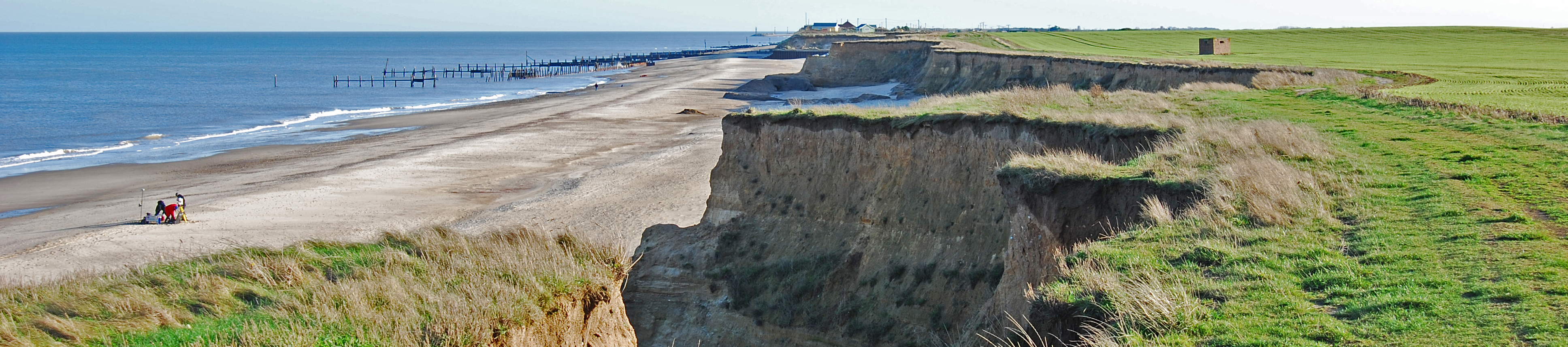
Hemsby coastal erosion: the scale of the transformational challenge around the coastlines of England and Wales
24/03/2023
The recent closure of Hemsby beach in Norfolk provides key information on the transformational challenge of coasts around England and evidence of historical change along the coastlines of England and Wales.
Introducing GeoCoast: new coastal datasets from BGS
20/04/2022
GeoCoast is an integrated GIS package of datasets designed to inform and support coastal management and adaptation.
Six changing coastlines and how climate change could affect them
12/04/2022
We explore how parts of the British coastline are changing and what important factors we should consider in terms of natural hazards, adaptation and resilience.
Sea level rise and coastal erosion: what’s the real impact?
05/04/2022
How much of an issue are coastal vulnerabilities and what do we need to consider to increase our resilience to future events?

New BGS datasets for coastal management, planning and adaptation in the face of climate change
29/03/2022
BGS GeoCoast is a package of geospatial datasets designed to provide information on the geological conditions and constraints around the coastline of Britain.

GeoCoast dataset launch event
Event on 28/04/2022
BGS invites you to discover more about our new data product to underpin coastal decision making, resilience and adaptation.
You may also be interested in

Sea floor: marine geoscience
Providing independent and expert geological advice, research and data acquisition to anyone working in the marine environment.