Rock Volume Characterisation Laboratory Cluster
BGS Science Facilities
The Rock Volume Characterisation Cluster studies the structural and compositional characterisation of rocks and their constituent parts, from micron to kilometre scale.

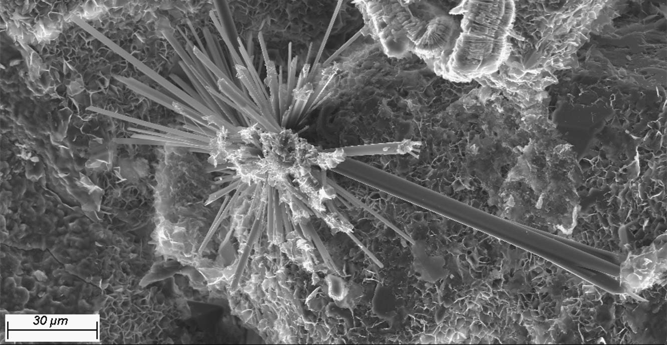
Ribbons and wisps of illite and illite–smecite hosted on the platy and blocky forms of a kaolinite booklet. Helsby Sandstone Formation core from a borehole at GeoEnergy Test Bed, Leicestershire. Secondary electron scanning electron microscope image from BGS’s Zeiss Sigma 300 VP-FEG, using its in-lens detector. SSK108242. BGS © UKRI.
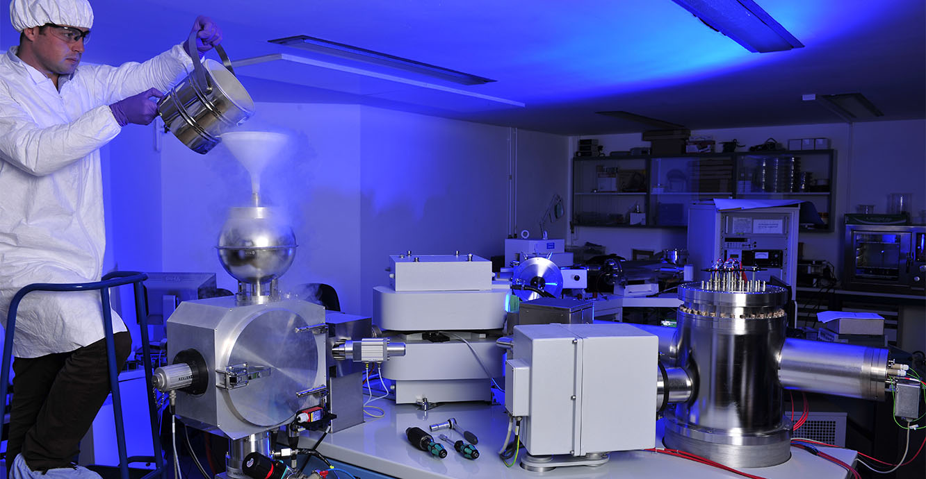
Loading the cold trap of the mass spectrometer with liquid nitrogen to reduce the pressure in the sample chamber before analysis begins. BGS © UKRI.
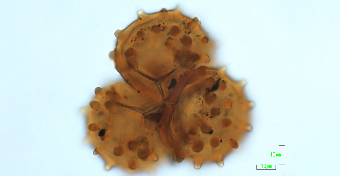
Tetrad of Raistrickia nigra (× 1000), a Carboniferous (359–299 million years old) miospore. This specimen (#8729) is part of the Bernard Owens Collection, one of the most complete single grain mount collections in the world for the Carboniferous, housed at BGS. BGS © UKRI.
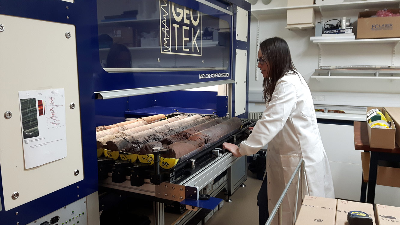
Core from the UK Geoenergy Observatory at Glasgow ready to be scanned within the Geotek Core Workstation (MSCL-XYZ) for high-resolution optical images, which are publicly available. BGS © UKRI.

Dissolved samples ready for chemical purification and isotope ratio mass spectrometry. These samples were used in the study of Hiess et al (2011) 238U/235U systematics in terrestrial U-bearing minerals. BGS © UKRI.
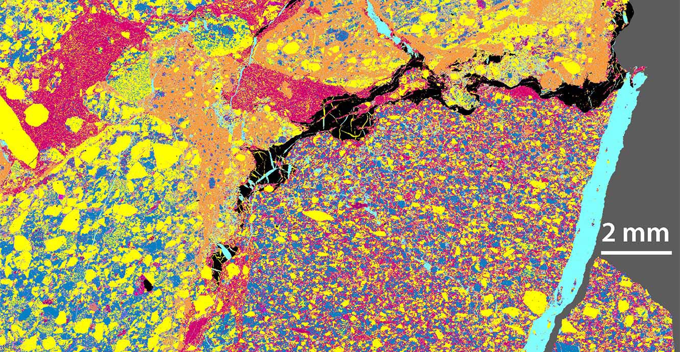
Phase map of a palaeo-weathered, fractured breccia of sedimentary rock types. Pale blue highlights calcite fracture fill. Clasts are defined by variable textures and mineralogies (yellow – quartz; dark blue -feldspar; red – Fe-rich mudstone/clay matrix; orange – clay matrix; black – bituminous organic material). Note the microfractures in the bituminous organics are cemented by quartz and calcite. Map generated using Mineralogic on BGS’s Zeiss Sigma 300 VP-FEG. SSK76495. BGS © UKRI.
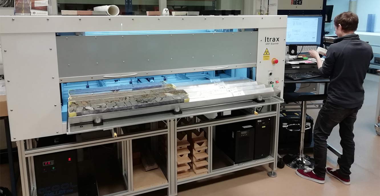
The Itrax XRF Scanner Multi Core (MC) being used to continuously scan slabbed rock or split sediment core for elemental abundances (Na to U). Additional optical and UV imaging capabilities provide records of downcore textual/compositional variation. BGS © UKRI.
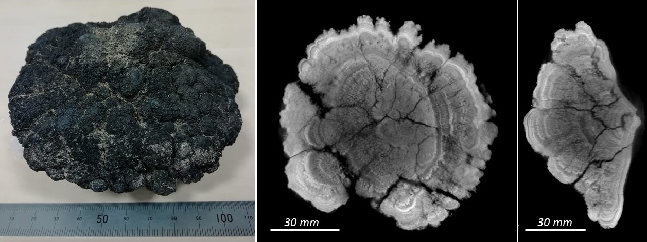
3D CT scan of a deep-oceanic ferromanganese nodule from the Clarion–Clipperton Fracture Zone in the Pacific Ocean, using the Geotek rotating X-ray CT (RXCT) core scanner and image visualisation software PerGeos. Internal structures of the specimen such as growth layers and fracture network can be observed. BGS © UKRI.
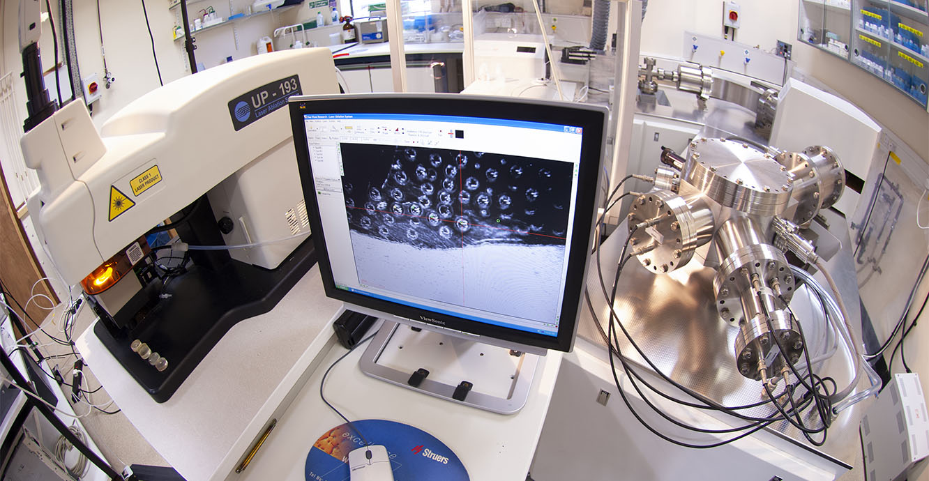
The laser ablation system coupled to a multi-collector inductively coupled plasma mass spectrometer being used to date the mineral zircon at a spatial scale of tens of microns. BGS © UKRI.
The cluster comprises a set of leading analytical capabilities and expertise, outlined below, that focus on the characterisation of materials at a range of scales and target different attributes (mineralogy, geochemistry, structure etc). Current activities in the cluster are focused on the integration of the individual capabilities in order to offer a more complete, coherent characterisation for a range of geological applications.
Capabilities
The Core Scanning Facility (CSF) was initially established in 2018 as part of the BEIS-funded UK Geoenergy Observatories project. The facility is centred on a suite of core scanners, including two multi-core X-ray fluorescence (XRF) core scanners (Itrax multicore scanner and Geotek MSCL-XYZ), an X-ray computed tomography (CT) core scanner (Geotek RXCT) and multi-sensor core logger (Geotek MSCL-S).
These analytical techniques are non-destructive and are used to characterise the chemical and physical properties of rock core, sediment core and rock samples from around a hundred microns up to kilometre scale, providing data to underpin a breadth of science applications.
Capabilities of the scanning facility are:
-
- gamma density
-
- magnetic susceptibility
-
- P-wave velocity
-
- non-contact electrical resistivity
-
- natural gamma activity
-
- rotating x-ray computed tomography (2D and 3D)
-
- near infra-red imaging
-
- high-resolution line scan imaging (50-micron resolution)
-
- X-ray fluorescence (XRF)
For more detailed information about our capabilities, please go to UKGEOS Core Scanning Facility.
In addition to characterising core from the UKGEOS observatory, the scanning facility works on projects from academic partners, commercial clients and governmental agencies. Projects can be large and small, from hundreds of meters of core to 10s of centimetres.
For any enquiries about the facility please contact enquiries@bgs.ac.uk. For access to the facility, please navigate to the access tab of the UK Geoenergy Observatory site.
The Geochronology and Tracers Facility (GTF) is part of the NERC-funded National Environmental Isotope Facility (NEIF), in addition to being a BGS facility. This group specialises in using a range of isotopic analyses of rocks and minerals for the dating of rocks and minerals and as ‘tracers’ for a breadth of geological and environmental processes, using a combination of approaches using both spatial resolution and high-precision techniques. The chronology capabilities are applied to a range of materials, from traditional uranium-bearing minerals to less commonly utilised phases such as carbonate, allowing for a wider range of applications. The same analytical capabilities are used for the application of tracer isotopes (e.g., Si, Sr, Nd, Pb) to a range of geological, environmental and archaeological science topics.
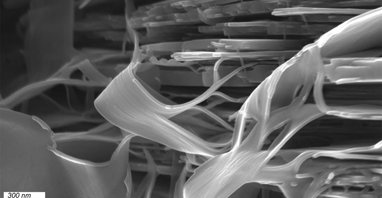
Mineralogy and petrology is an established set of capabilities at BGS, from bespoke thin-section preparation though optical microscopy, scanning electron microscopy and X-ray diffraction to thermal analysis and allied techniques. These methods allow for the identification and quantification of the mineralogy and petrology of rocks, soils and particulates. This information is used to underpin a wide range of materials characterisation and research, including diagenesis, mineralisation and fluid/rock interaction.
The BGS Palaeontology Laboratories are part of a broader capability in palaeontology in BGS, which also includes extensive collections of macrofossils and microfossils. Our palaeontology laboratories constitute essential sample preparation facilities in palynology and micropalaeontology for a range of stratigraphical uses. The data is combined with other stratigraphical data types (for example, chemistry and physical properties) to help characterise ‘stratigraphical volumes’ that are targets for use in understanding the properties of such volumes at the scales from microns to kilometres.
Need more information?
You may also be interested in
Transport Properties and Fracture Physics Research Laboratories
Research in these laboratories focuses on understanding fluid (water, gas and solutes) movement and rock deformation in the subsurface.
Engineering and Geotechnical Capability
Leading the development and application of field and laboratory infrastructure and long-term management of geophysical and geotechnical property data.