Sea floor: marine geoscience
BGS Research
The marine geoscientists at BGS provide independent and expert geological advice, research and data acquisition to anyone working in the marine environment.
We do this for the benefit of governments, industry, cultural heritage organisations and the marine scientific community, enabling them to make informed decisions regarding the sustainable development, management and protection of the seabed. Our scientists, engineers and technical experts are highly skilled in geological research and scientific exploration in the world’s seas and oceans.


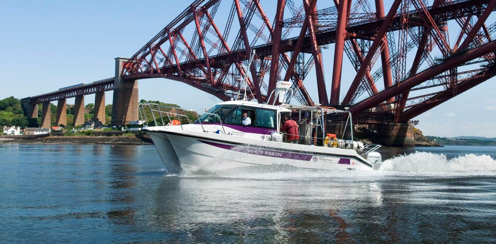
We use the research vessel White Ribbon to collect scientific information on seabed and inland marine environments, information of value to marine conservation, fisheries, oil and gas and renewable energy research projects and collaborations.
New marine technologies are opening opportunities for scientific exploration and new economic activity (the ‘blue economy’) while, at the same time, the marine environment is under threat from climate change, pollution and overuse. The geological knowledge we provide is crucial to fully understanding the nature of the seabed, its potential resources, what lives and grows there and how it can change through natural processes and human activities.

“The BGS models allow our projects to better foresee hazards, refine foundation design and optimise windfarm layout; all of which contribute to reducing the cost of offshore wind farm development”
SSE Renewables
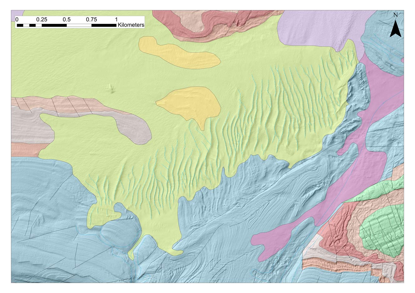
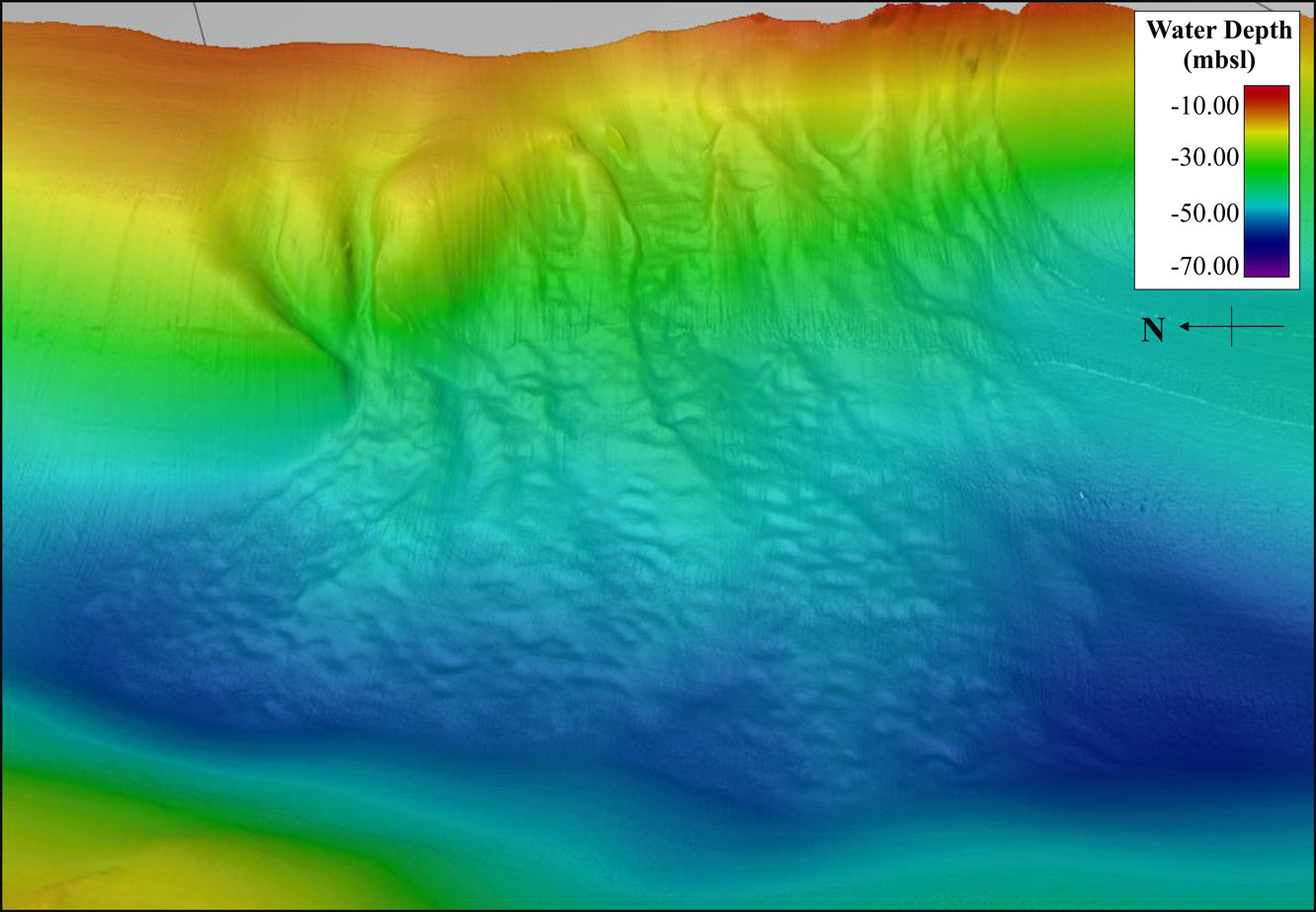
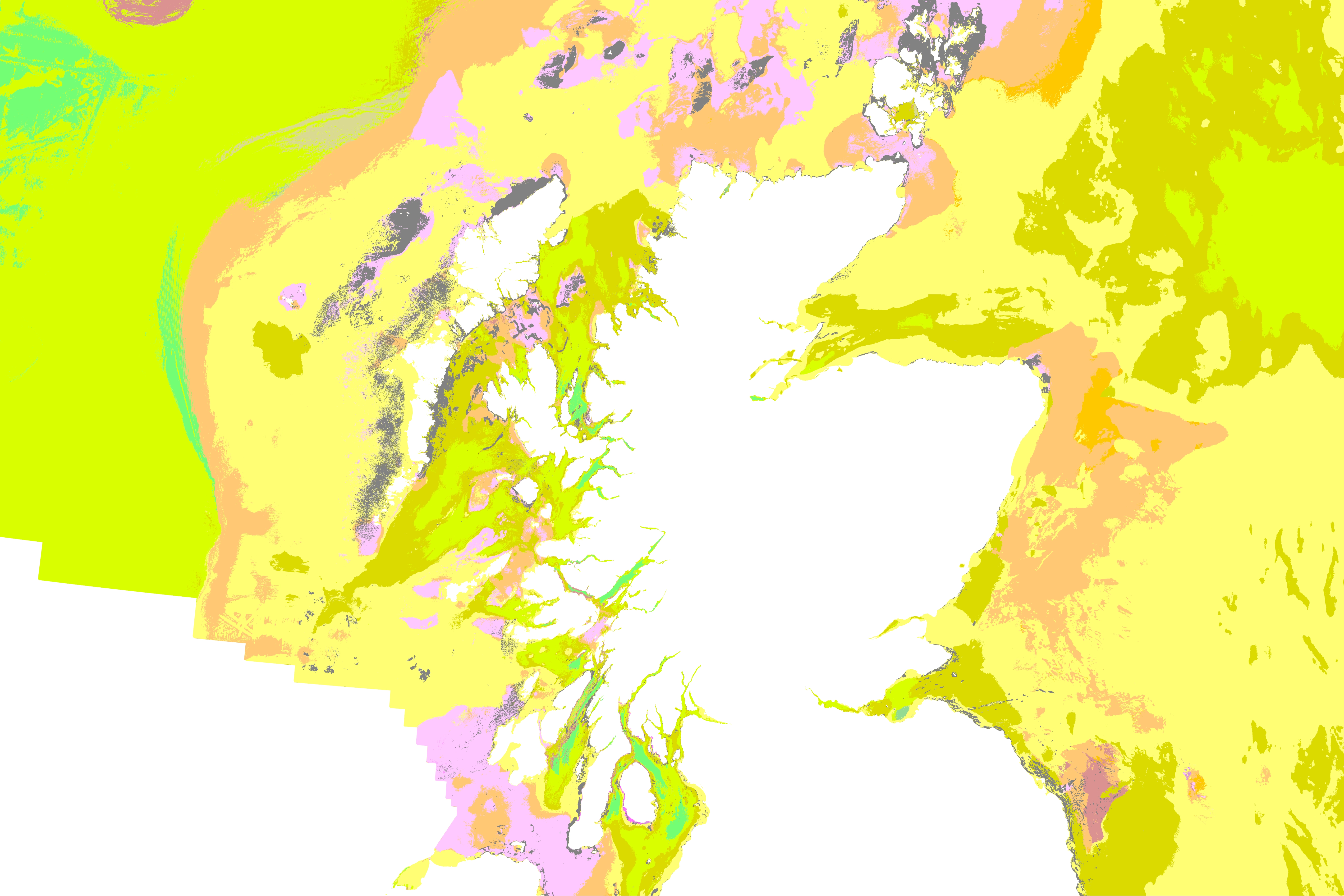
Seafloor geology mapped at 1:10,000 scale, revealing exposed bedrock, seabed sediments, and seabed geomorphology (sandwave field). Source: BGS © UKRI
Debris flows along the submarine slopes of Loch Eriboll, NW Scotland. Source: BGS © UKRI
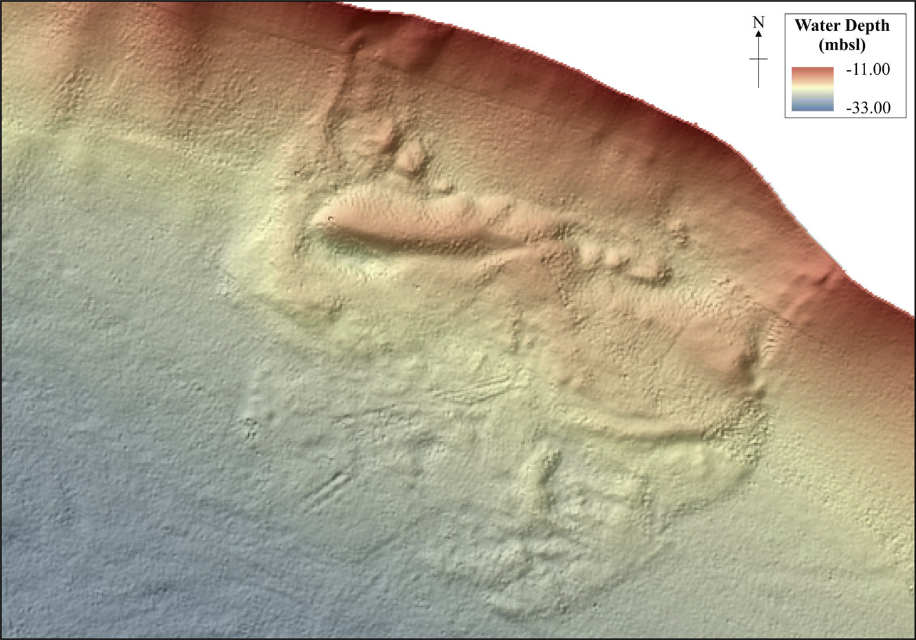
Shallow submarine landslide located in the Holy Loch, Firth of Clyde. Source: BGS © UKRI
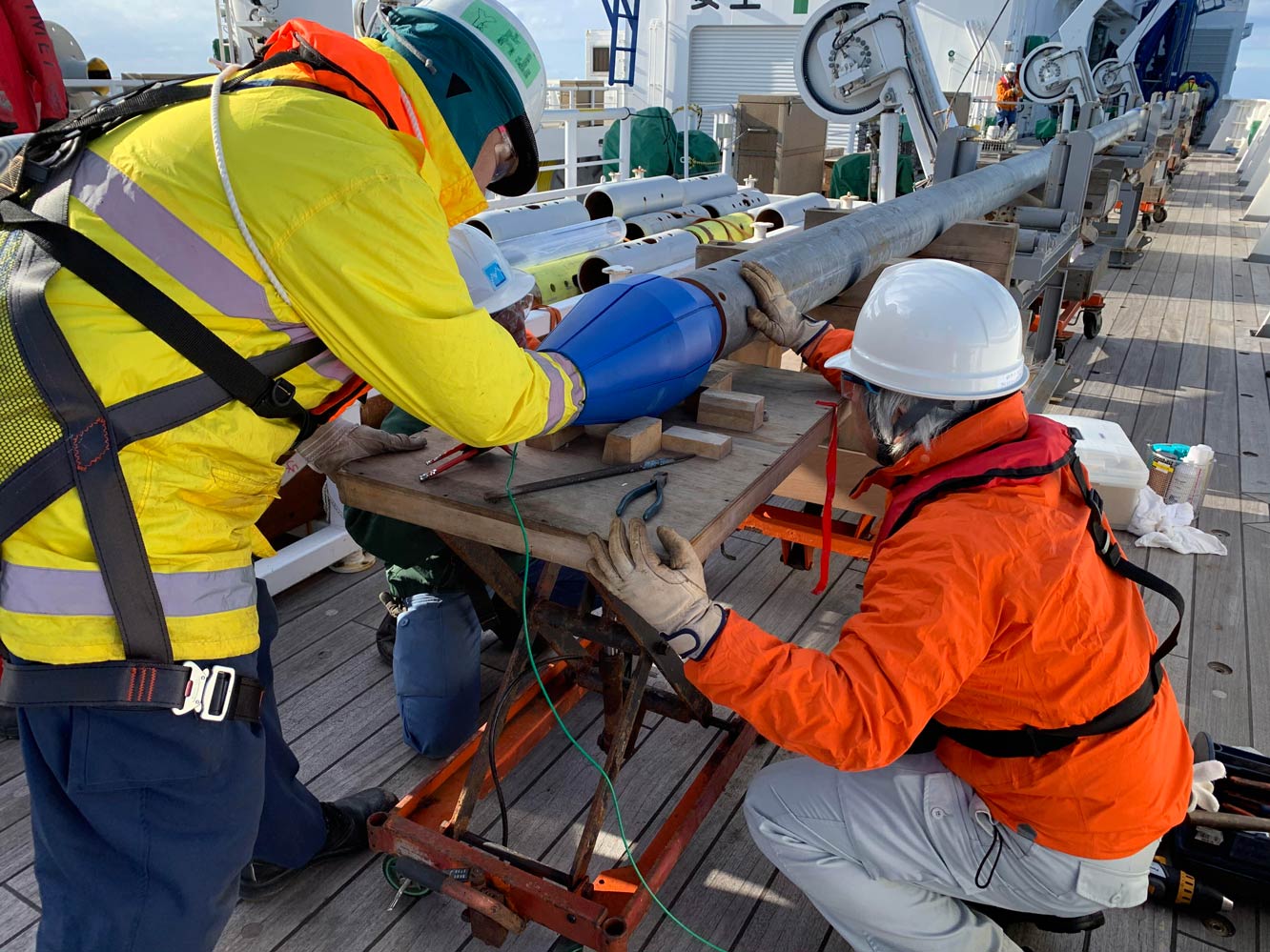
Giant piston core on R/V Kaimei trial cruise in preparation for IODP Expedition 386 Japan Trench Paleoseismology. Source: BGS © UKRI
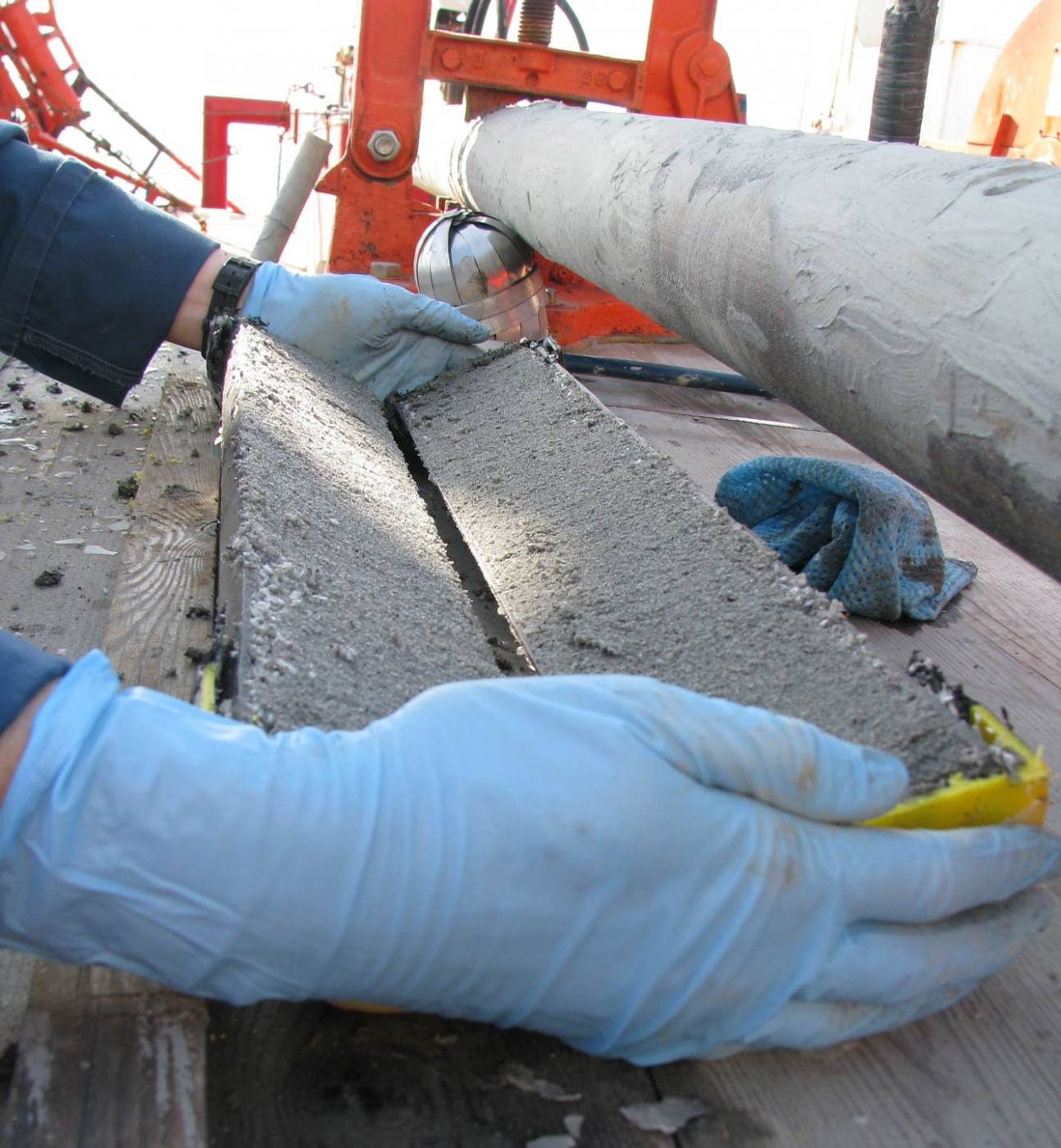
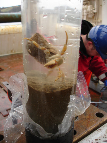
A split core from the BGS vibrocore. Source: BGS © UKRI
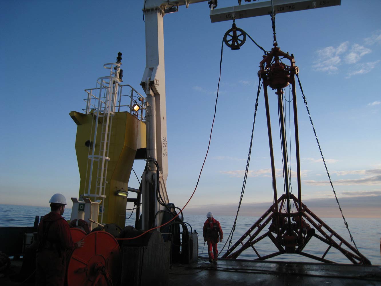
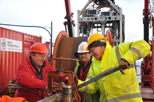
Recovering the BGS vibrocore in the North Sea. Source: BGS © UKRI
Our research and marine scientific exploration capabilities
Our ocean geoscience team provides the scientific and technical capability for deep-sea geoscientific research. Their knowledge and analytical expertise, coupled with our unique expertise in seabed drilling, allow us to provide geological knowledge that will support a range of deep-seabed commercial or academic research activities.
The team also provides logistical and technical support for the International Ocean Discovery Programme (IODP) helping teams of international research scientists to investigate ancient meteorite impact craters, sedimentary records of past climate change and volcanic processes occurring at the oceanic spreading ridges as the continents slowly drift apart.
If you want to discover more then please contact David McInroy.
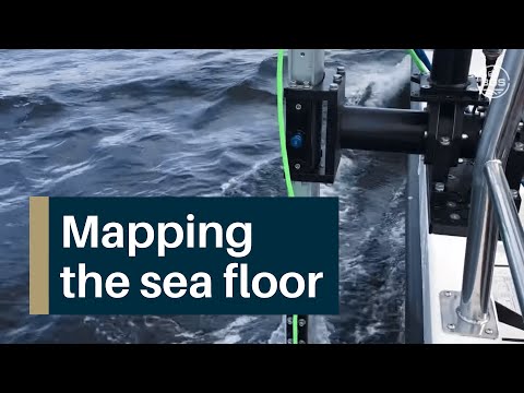
Our team of scientists, hydrographers and technical experts are undertaking a programme of geological mapping of the seabed and sub-seabed of the continental shelf surrounding the UK (UKCS). We use high-resolution multibeam and sub-seabed geophysical datasets, as well as boreholes and sediment ‘grab’ samples, to understand the nature of the geology offshore. Our maps of the properties and type of sediment and/or bedrock exposed on the seabed, as well as the detailed geological and geomorphological models we provide, can be used to responsibly develop, manage or protect areas of the sea floor.
The nature of the seabed, whether it is soft marine sediment or hard bedrock, can have a profound effect on the type and range of marine life that lives and grows there. Our seabed substrate and habitat maps can provide marine biologists, environmental scientists and government agencies with the information they need to help protect and manage sensitive areas of the seabed.
As well as our traditional maps, we offer bespoke surveys that can supply marine scientists and developers with detailed information for key areas of the seabed and the near subsurface. The resulting high-resolution 3D and 4D geological models can be used to investigate and monitor changes in the distribution of mobile sediments in estuaries, as well as the movement of sand waves and gravel bars that may damage offshore infrastructure, such as cables and pipelines.
If you want to discover more then please contact Andrew Finlayson.
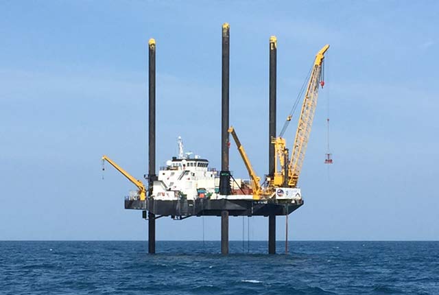
Our marine geoscientists are providing the renewables industry with the detailed geological information they require to build the offshore wind farms that the UK needs to meet its future energy needs.
It is not widely known that, during the last ice age, much of the seabed surrounding the UK and Ireland was in fact land that was covered by major ice sheets. This has left behind a complex pattern of ancient glacial and river landscapes that were submerged as the sea level rose at the end of the ice age. Our expertise is in understanding how this cold, glacial climate affected the nature of the sediments beneath the seabed.
This knowledge is critical because the complex suite of sediments left behind as the ice sheets melted provides the foundations into which the large, offshore wind turbines are being emplaced. Our scientists are helping the renewables industry build the UK’s future green energy supply.
If you want to discover more then please contact Gareth Carter.
Our marine engineering geologists provide the scientific and technical expertise needed to understand the factors that control the location and triggering of marine geohazards such as submarine landslides, shallow gas, mobile sand waves and gravel bars or scouring by currents.
Using high-resolution, multibeam and shallow seismic data, our experts are able to create detailed maps of the distribution of these hazards. Our shallow-seabed mapping capabilities (multibeam, shallow sub-seabed geophysics and towed benthic imager) are able to provide the repeat surveys needed to investigate and monitor any changes in the distribution of marine geohazards in critical areas of the UK continental shelf.
The high-resolution 3D and 4D geological models our scientists produce, backed up by their expert knowledge, is helping offshore developers to avoid the potential risks of damage to sea-floor cables and pipelines.
If you would like to discover more then please contact Gareth Carter.
Publications
Narloch, W, Phillips, E.R., Piotrowski, J.A., Ćwiek, M. 2020. Patterns of deformation within a subglacial shear zone: Implications for palaeo-ice stream bed evolution. Sedimentary Geology 397. https://doi.org/10.1016/j.sedgeo.2019.105569.
Iacono, C. L., Guillén, J., Guerrero, Q., Durán, R., Wardell, C., Hall, R. A., Aslam, T., Carter, G. D., Gales, J. A., & Huvenne, V. A. (2020). Bidirectional bedform fields at the head of a submarine canyon (NE Atlantic). Earth and Planetary Science Letters, 542, 116321. https://doi.org/10.1016/j.epsl.2020.116321
STEWART, H A, BRADWELL, T, CARTER, G D O, DOVE, D, GAFEIRA, J. 2020. Chapter 6: Geomorphology of the Offshore Continental Shelf. In World Geomorphological Landscapes: Landscapes and Landforms of Scotland (J Gordon and C Ballantyne Editors). (London Springer).
Jamieson, A.J., Stewart, H.A., Paul-Henry Nargeolet P-H. 2020. Exploration of the Puerto Rico Trench in the mid-twentieth century: Today’s significance and relevance. Endevour https://doi.org/10.1016/j.endeavour.2020.100719
Vallius, H., Kotilainen, A., Asch, K., Fiorentino, A., Judge, M., Stewart, H.A., Pjetursson, B. 2020. Discover Europe’s seabed geology. The EMODnet concept of uniform collection and harmonization of marine data. Geological Society, London, Special Publications. http://sp.lyellcollection.org/
Jamieson, A.J., Linley, T.D., Stewart, H.A., Nargeolet, P-H., Vescovod, V. 2020. Revisiting the 1964 Archimède bathyscaphe dive to 7300 m in the Puerto Rico trench, abundance of an elasipodid holothurian Peniagone sp. and a resolution to the identity of the ‘Puerto Rican snailfish’. Deep-Sea Research Part I. https://doi.org/10.1016/j.dsr.2020.103336.
Emery, A. R., Hodgson, D. M., Barlow, N. L. M., Carrivick, J. L., Cotterill, C. J., Richardson, J., Ivanovic, R. and Mellett, C. 2020. Ice sheet and paleaclimate controls on drainage network evolution: an example from Dogger Bank, North Sea. Earth Surface Dynamics. https://doi.org/10.5194/esurf-2020-41
Fielding, J. J., Croudace, I. W., Kemp, A. E. S., Pearce, R., Cotterill, C. J., Langdon, P. and Avery, R. 2020. Tracing lake pollution, eutrophication and partial recovery from the sediments of Windermere, UK, using geochemistry and sediment microfacies. Science of the Total Environment. 722. https://doi.org/10.1016/j.scitotenv.2020.137745
Dove, D., Weijerman, M., Grüss, A., Acoba, T., Smith, J. R. 2020. Substrate mapping to inform ecosystem science and marine spatial planning arounf the main Hawaiian Islands. 619-640 in: Harris, P.T, Baker, E.K (Editors). Seafloor geomorphology as benthic habitat: GeoHab Atlas of seafloor geomorphic features and benthic habitats (Second Edition). Elsevier Insights series. (Elsevier, London, UK).
Jamieson, A J, Stewart, H A, Rowden, A A, Clark, M R. (2020) Geomorphology and benthic habitats of the Kermadec Trench, SW Pacific Ocean. 949-966 in: Harris, P.T, Baker, E.K (Editors). Seafloor geomorphology as benthic habitat: GeoHab Atlas of seafloor geomorphic features and benthic habitats (Second Edition). Elsevier Insights series. (Elsevier, London, UK).
Stewart, H A, Kirkbride, M, 2019. Special issue for Early Career Researchers: editorial. Scottish Journal of Geology, 55(2), 73
Abdel-Mageed, W, Lehri, B, Jarmusch, S A, Miranda, K, Al-Wahaibi, L H, Stewart, H A, Jamieson A J, Jaspars, M, Karlyshev, A V. 2020. Whole genome sequencing of four bacterial strains from South Shetland Trench revealing biosynthetic and environmental adaptation gene clusters. Marine Genomics, 100782 https://doi.org/10.1016/j.margen.2020.100782
Carter, G.D.O., Cooper, R., Gafeira, J., John A. Howe, J.A., David Long, D. 2020. Morphology of small-scale submarine massmovement events across the northwest United Kingdom. Geomorphology 365. https://doi.org/10.1016/j.geomorph.2020.107282
Carter, G., Everest, J. 2019. Day 1: Monitoring an active rock slope failure in Corrie Brandy. In Mitchell, W.A., Guild, A. 2019. The Quaternary of Glen Clova and Strathmore: Field Guide. Quaternary Research association, London. ISBN 0 907 780 997
Phillips, E. 2019. Chapter 3: Bedrock Geology. In Mitchell, W.A., Guild, A. 2019. The Quaternary of Glen Clova and Strathmore: Field Guide. Quaternary Research association, London. ISBN 0 907 780 997
Brumme, J., Hüneke, H., and Phillips, E. 2019. Micromorphology and clast microfabrics of subglacial traction tills at the sea cliff Dwasieden: evidence of polyphase syn- and post-depositional deformation, DEUQUA Spec. Pub., 2, 51–60, https://doi.org/10.5194/deuquasp-2-51-2019.
Gehrmann, A., Hüneke, H., Meschede, M., and Phillips, E. 2019. Sea cliff at Wissower Bach (Pleistocene stripe 5) – microstructural evidence of large-scale glacitectonism and glacier kinematics, DEUQUA Spec. Pub., 2, 29–33, https://doi.org/10.5194/deuquasp-2-29-2019
Sigfusdottir, T., Phillips, E., Benediktsson, I. O. 2019. The role of pressurised water in large-scale glaciotectonic thrusting: Evidence from submarine, ice-marginal thrust-block moraines in Melasveit, W-Iceland. Quaternary Research.
Mellett, C.L., Phillips, E., Lee, J.R., Cotterill, C.J., Tjelta, T.I., James, L., Duffy, C. 2019. Elsterian ice sheet retreat in the southern North Sea: antecedent controls on large-scale glacitectonics and subglacial bed conditions. Boreas.
Dell, R. Carr, R., Phillips, E., Russell, A.J. 2019. Response of glacier flow and structure to proglacial lake development and climate at Fjallsjökull, south-east Iceland. Journal of Glaciology (2019), doi: 10.1017/jog.2019.18
Emery AR, Hodgson DM, Barlow NLM, Carrivick JL, Cotterill CJ and Phillips E (2019) Left High and Dry: Deglaciation of Dogger Bank, North Sea, Recorded in Proglacial Lake Evolution. Front. Earth Sci. 7:234. doi: 10.3389/feart.2019.00234
Avery, R., S., Kemp, A., Bull, J. M., Pearce, R. B., Vardy, M., Fielding, J. J. and Cotterill, C. 2019. A new varve sequence from Windermere, UK, records rapid ice retreat prior to the onset of the Lateglacial Interstadial (GI-1). Quaternary Science Reviews.
Neat, F C, Jamieson, A J, Stewart, H A, Narayanaswamy, B E, Collie, N, Stewart, M, Linley, T D. (2019). Visual evidence of reduced seafloor conditions and indications of a cold-seep ecosystem from the Hatton–Rockall basin (NE Atlantic). Journal of the Marine Biological Association of the United Kingdom, v. 99, 271-277. doi.org/10.1017/S0025315418000115.
Bradwell, T., Small, D., Fabel, D., Clark, C. D., Chiverrell, Saher, M. H., Dove, D., Callard, S. L., Burke, M., Moreton, S. G., Medialdea, A., Bateman, M. D., Roberts, D. H., Golledge, N. R., Finlayson, A., Morgan, S., O Cofaigh, C. 2019. Pattern, style and timing of British-Irish Ice Sheet retreat: Shetland and northern North Sea sector. Journal of Quaternary Science. https://doi.org/10.1002/jqs.3163
Weijerman, M., Grüss, A., Dove, D., Asher, J., Williams, I. D., Kelley, C., Drazen, J. C. 2019. Shining a light on the composition and distribution patterns of mesophotic and subphotic fish communities in Hawa’i. Marine Ecology Progress Series, 630, 161-182. https://doi.org/10.3354/meps13135
Bradwell, T., Small, D., Fabel, D., Smedley, R. K., Clark, C. D., Saher, M. H., Callard, S. L., Chiverrell, R. C., Dove, D., Moreton, S. G., Roberts, D. H., Duller. G. A. T., Ó Cofaigh, C. 2019. Ice-stream demise dynamically conditioned by trough shape and bed strength. Science Advances, v. 5(4), eaau1380. DOI: 10.1126/sciadv.aau1380
Jordan, S. F., O’Reilly, S. S., Praeg, D., Dove, D., Facchin, L., Romeo, R., Szpak, M., Monteys, X., Murphy, B. T., Scott, G., McCarron, S. S., Kelleher, B. P. 2019. Geophysical and geochemical analysis of shallow gas and an associated pockmark field in Bantry Bay, Co. Cork, Ireland. Estuarine, Coastal and Shelf Science, 225, 106232. https://doi.org/10.1016/j.ecss.2019.05.014
Roelofse, C., Alves, T.M., Gafeira, J., 2019. Structural controls on shallow fluid flow and associated pockmark fields in the East Breaks area, northern Gulf of Mexico, Marine and Petroleum Geology (2019), doi: https://doi.org/10.1016/j.marpetgeo.2019.104074.
Emery, A.R., Hodgson, D.M., Barlow, N.L.M., Carrivick, J.L., Cotterill, C.J., Mellett, C.L., Booth, A.D. 2019. Topographic and hydrodynamic controls on barrier retreat and preservation: An example from Dogger Bank, North Sea. Marine Geology 416. https://doi.org/10.1016/j.margeo.2019.105981
Stewart, H.A., Jamieson, A.J. 2019. The five deeps: The location and depth of the deepest place in each of the world’s oceans. Earth Science Reviews 197, https://doi.org/10.1016/j.earscirev.2019.102896
Purser, A, Dorschel, B, Dreutter, S, Hehemann, L, Herr, H, Jamieson, A J, Linley, T, Stewart, H A, and Wenzhöfer, F. 2019. Depression chains in seafloor of contrasting morphology, Atacama Trench margin. A comment on Marsh et al. (2018). Royal Society Open Science. V. 6, issue 3. https://doi.org/10.1098/rsos.182053
Le Heron, D.P., Hogan, K.A., Phillips, E.R., Huuse, M., Busfield, M.E., Graham, A.G.C. 2019. An introduction to glaciated margins: the sedimentary and geophysical archive. In Glaciated margins: the sedimentary and geophysical archive” Geological Society, London, Special Publications. Vol. 475, 2019. Edited by: D. P. Le Heron, K. A. Hogan, E. R. Phillips, M. Huuse, M. E. Busfield and A. G. C. Graham.
Glaciated margins: the sedimentary and geophysical archive” Geological Society, London, Special Publications. Vol. 475, 2019. Edited by: D. P. Le Heron, K. A. Hogan, E. R. Phillips, M. Huuse, M. E. Busfield and A. G. C. Graham.
McNeill, L.C., Shillington, D.J., Carter, G.D.O., Everest, J.D., … & Green, S. (2019). High-resolution record reveals climate-driven environmental and sedimentary changes in an active rift. Nature Scientific Reports, 9, 3116. https://doi.org/10.1038/s41598-019-40022-w
Jamieson, A J, Linley, T, Stewart, H, Gerringer M. (2019) Camera Lander (Section 7.5.4). 23-24 in Wenzhöfer, F. (Editor) The Expedition SO261 of the Research Vessel SONNE to the Atacama Trench in the Pacific Ocean in 2018. Reports on polar and marine research, Bremerhaven, Alfred Wegener Institute for Polar and Marine Research, v. 729, 111 pp. doi: 10.2312/BzPM_0729_2019
Stewart, H A, Glud, R N, Hehemann, L. (2019) Sediment and geological characterisation (Section 7.21). 70-75 in Wenzhöfer, F. (Editor) The Expedition SO261 of the Research Vessel SONNE to the Atacama Trench in the Pacific Ocean in 2018. Reports on polar and marine research, Bremerhaven, Alfred Wegener Institute for Polar and Marine Research, v. 729, 111 pp. doi:10.2312/BzPM_0729_2019
Jones, D.G., Vane, C.H., Lass-Evans, S., Chenery, S., Lister, B., Cave, M., Gafeira, J., Jenkins, G., Leslie, A., Breward, N., Freeborough, K. 2019. Geochemistry and related studies of Clyde Estuary sediments. Earth and Environmental Science Transactions of the Royal Society of Edinburgh, 108(2-3), 269-288.
Roelofse, C., Alves, T.M., Gafeira, J., Kamal’deen, O.O. 2019. An integrated geological and GIS-based method to assess caprock risk in mature basins proposed for carbon capture and storage. International Journal of Greenhouse Gas Control, 80, 103-122.
Grant, H.L.J., Mark D. Hannington, M.D., Petersen, S., Frische M., Fuchs, S.H. 2019. Constraints on the behaviour of trace elements in the actively-forming TAG deposit, Mid-Atlantic Ridge, based on LA-ICP-MS analyses of pyrite. Chemical Geology 498. 45-71.
Farrant, A., Terrington, R., Carter, G., Free, M., Porovic, E., Manning, J., Fourniadis, Y., Lagesse, R., Ting, C., & Omar, T. (2019). Engineering Geological, Geotechnical and Geohazard Modelling for Offshore Abu Dhabi, UAE. In IAEG/AEG Annual Meeting Proceedings, San Francisco, California, 2018—Volume 6 (pp. 237-243). Springer, Cham. https://doi.org/10.1007/978-3-319-93142-5_33
O Dochartaigh, Brighid E.; MacDonald, Alan M.; Black, Andrew R.; Everest, Jez; Wilson, Paul; Darling, W. George; Jones, Lee; Raines, Mike. 2019 Groundwater - meltwater interaction in proglacial aquifers. Hydrology and Earth System Sciences, 23. 4527-4539. https://doi.org/10.5194/hess-23-4527-2019
Mackay, Jonathan D.; Barrand, Nicholas E.; Hannah, David M.; Krause, Stefan; Jackson, Christopher R.; Everest, Jez; Aðalgeirsdóttir, Guðfinna; Black, Andrew R.. 2019 Future evolution and uncertainty of river flow regime change in a deglaciating river basin. Hydrology and Earth System Sciences, 23 (4). 1833-1865. https://doi.org/10.5194/hess-23-1833-2019
McNeill, L.C., Shillington, D.J., Carter, G.D.O., and the Expedition 381 Participants. 2019. Corinth Active Rift Development. Proceedings of the International Ocean Discovery Program, 381: College Station, TX (International Ocean Discovery Program). https://doi.org/10.14379/iodp.proc.381.101.2019
Strasser, M., Ikehara, K., and Cotterill, C., 2019. Expedition 386 Scientific Prospectus: Japan Trench Paleoseismology. International Ocean Discovery Program. https://doi.org/10.14379/iodp.sp.386.2019
McNeill, L., Shillington, D., Carter, G., Everest, J., Green, S., and Expedition 381 Scientists, 2018. Preliminary results from IODP Expedition 381: development of the active Corinth Rift, Greece. Geophysical Research Abstracts, 20:EGU2018-9231-1. https://meetingorganizer.copernicus.org/EGU2018/EGU2018-9231-1.pdf
Roberts, D.H., Grimoldi, E., Callard, L., Evans, D.J.A., Clark, C.D., Stewart, H.A., Dove, D., Saher, M., Ó Cofaigh, C., Chiverrell, R.C., Bateman, M.D., Moreton, S.G., Bradwell, T., Derek Fabel, D., Medialdea, A. 2019. The mixed-bed glacial landform imprint of the North Sea Lobe in the western North Sea. Earth Surface Processes and Landforms. DOI: 10.1002/esp.4569
2018
Finlayson, A., Phillips, E., Benediktsson, Í. Ö., Zoet, L.K., Iverson, N.R., Everest, J. 2018. Subglacial drumlins and englacial fractures at the surge-type glacier, Múlajökull, Iceland. Earth Surface Processes and Landforms.
Guild, A., Phillips, E.R., Evans, D.J.A. 2018. Structural glaciology of the Svínafellsjökull snout: implications for ice dynamics and debris transfer. In Evans, D.J.A. (ed.) Glacial Landsystems of southeast Iceland – Quaternary applications. Quaternary Research Association. ISBN: 0 9077 80288.
Everest, J., Bradwell, T. 2018. Glacial landsystem development at Svínafellsjökull. In Evans, D.J.A. (ed.) Glacial Landsystems of southeast Iceland – Quaternary applications. Quaternary Research Association. ISBN: 0 9077 80288.
Phillips, E., Evans, D.J.A., Ewertowski, M., Finlayson, A., Guild, A., Everest, J. 2018. Structural glaciology and ice dynamics: implications for landsystem development at Kvíárjökull. In Evans, D.J.A. (ed.) Glacial Landsystems of southeast Iceland – Quaternary applications. Quaternary Research Association. ISBN: 0 9077 80288.
Phillips, E., Spagnolo, M., Alasdair C.J. Pilmer, A.C.J., Rea, B.R., Piotrowski, J.A., Ely, J.C., Carr, S., 2018. Progressive ductile shearing during till accretion within the deforming bed of a palaeo-ice stream. Quaternary Science Reviews 193, 1-23.
Phillips, E., Finlayson, A., Everest, J., Jones, L., Bradwell, T. 2018. Changes in the structure and dynamics of Falljökull during the ongoing phase of rapid retreat. In Evans, D.J.A. (ed.) Glacial Landsystems of southeast Iceland – Quaternary applications. Quaternary Research Association. ISBN: 0 9077 80288.
Phillips, E., Cotterill, C., Johnson, K., Crombie, K., James, L., Carr, S., Ruiter, A. 2018. Large-scale glacitectonic deformation in response to active ice sheet retreat across Dogger Bank (southern central North Sea) during the Last Glacial Maximum. Quaternary Science Reviews 179, 24-47.
Payo, Andres. 2018. Dynamic systems: Modelling the coastal environment. Earth & Environment. www.researchfeatures.com.
Carter, G.D.O., Huvenne, V.A.I., Gales, J.A., Lo Iacono, C., Marsh, L., Audrey Ougier-Simonin, A., Robert, K., Wynn, R.B. 2018. Ongoing evolution of submarine canyon rockwalls; examples from the Whittard Canyon, Celtic Margin (NE Atlantic). Progress in Oceanography. https://doi.org/10.1016/j.pocean.2018.02.001
Christenson, G.l., Mellet, C., Green, S., and others. 2018. Extraordinary rocks from the peak ring of the Chicxulub impact crater: P-wave velocity, density, and porosity measurements from IODP/ICDP Expedition 363. Earth and Planetary Science Letters, 495. 1-11.
Fielding, J.J., Kemp, A.E.S., Bull, J.M., Cotterill, C.J., Pearce, R.B., Avery, R.S., Langdon, P.G., Croudace, I.W. 2018. Palaeoseismology from microfabric and geochemical analysis of lacustrine sediment, Windermere, UK. Journal of the Geological Society.
Gafeira, J., Dolan, M.F.J., Monteys, X. 2018. Geomorphometric Characterization of Pockmarks by Using a GIS-Based Semi-Automated Toolbox. Geosciences 8, 154; doi:10.3390/geosciences8050154
Robert, K., Huvenne V.A.I., Georgiopoulou, A., Jones, D.O.B., Marsh, L., Carter, G.D.O., Chaumillon, L. 2018. New approaches to high-resolution mapping of marine vertical structures. Scientific Reports 7: 9005. DOI:10.1038/s41598-017-09382-z
Lofi, J., Smith, D., and others. 2018. Drilling-induced and logging-related features illustrated from IODP–ICDP Expedition 364 downhole logs and borehole imaging tools. Scientific Drilling, 24, 1–13. https://doi.org/10.5194/sd-24-1-2018
Lowery, C.M., Green, S., and others. 2018. Rapid Recoveryt of life at ground zero of the end-Cretaceous mass extinction. Nature. htts://doi.org/10.1038/s41586-018-0163-6
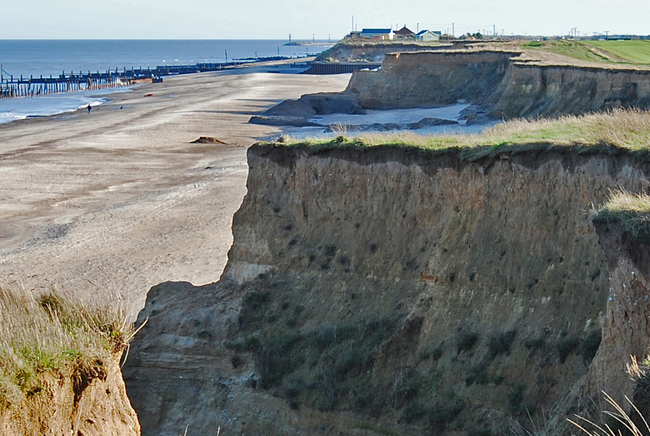
Payo, A., Walkde, M., Ellis, M.A. , Barkwith, A., Favis-Mortlock, D., Kessler, H., Wood, B., Burke, H., Lee, J.R. 2018. A Quantitative Assessment of the Annual Contribution of Platform Downwearing to Beach Sediment Budget: Happisburgh, England, UK. Journal of Marine Science and Engineering. 6, 113; doi:10.3390/jmse6040113.
Nicholls RJ, Hutton CW, Lázár AN, Adger WN, Allan A, Whitehead PG, Wolf J, Rahman MM, Salehin M, Hanson SE, Payo A. An Integrated Approach Providing Scientific and Policy-Relevant Insights for South-West Bangladesh. InEcosystem Services for Well-Being in Deltas 2018 (pp. 49-69). Palgrave Macmillan, Cham.
Lázár AN, Payo A, Adams H, Ahmed A, Allan A, Akanda AR, Johnson FA, Barbour EJ, Biswas SK, Caesar J, Chapman A. Integrative analysis applying the Delta Dynamic Integrated Emulator Model in south-west coastal Bangladesh. In Ecosystem Services for Well-Being in Deltas 2018 (pp. 525-574). Palgrave Macmillan, Cham.
Mukhopadhyay A, Payo A, Chanda A, Ghosh T, Chowdhury SM, Hazra S. Dynamics of the Sundarbans Mangroves in Bangladesh Under Climate Change. In Ecosystem Services for Well-Being in Deltas 2018 (pp. 489-503). Palgrave Macmillan, Cham.
Payo Garcia A, Jigena Antelo B, Hurst M, Palaseanu-Lovejoy M, Williams C, Jenkins G, Lee K, Favis-Mortlock D, Barkwith A, Ellis MA. Development of an automatic delineation of cliff top and toe on very irregular planform coastlines (Cliff Metrics v1. 0). Geoscientific Model Development. 2018; 11(10):4317-37.
Roberts DH, Evans DJA, Callard SL, Dove D, Bateman MD, Medialdea A, Saher M, Ó Cofaigh C, Chiverrell RC, Moreton SG, Cotterill CJ, Clark CD. 2018. The MIS II limit of the British-Irish Ice Sheet in the Southern North Sea. Quaternary Science Reviews 198: 181–207.
Sawaryn, S J, Bustin, P, Cain, M G, Crawford, I A, Lim, S, Linossier, A and Smith, D. 2018. Lunar Drilling – Challenges and Opportunities. Society of Petroleum Engineers, SPE Annual Technical Conference and Exhibition, 24-26 September, Dallas, Texas, USA.
Kaskela, A.M., Kotilainen, A.T., Alanen, U., Cooper R., Green, S., Guinan J., van Heteren, S., Kihlman, S., Van Lancker, V., Stevenson, A., and others. 2019. Picking Up the Pieces—Harmonising and Collating Seabed Substrate Data for European Maritime Areas. Geosciences, 9, 84; doi:10.3390/geosciences9020084
Free, M., Porovic, E., Manning, J., Fourniadis, Y., Lagesse, R., Ting, C., Campbell, G., Koskosidi, A., Farrant, A., Terrington, R., Carter, G., & Tarek, O. (2018). Offshore Geological, Geotechnical and Geohazard Modelling and Design for Abu Dhabi. In Offshore Technology Conference. Offshore Technology Conference. Houston, Texas. https://doi.org/10.4043/29047-MS
Arosio, R., Dove, D., Cofaigh, C.Ó. and Howe, J.A., 2018. Submarine deglacial sediment and geomorphological record of southwestern Scotland after the Last Glacial Maximum. Marine Geology, 403, pp.62-79.
Fairchild, I.J., Spencer, A.M., Ali, D.O., Anderson, R.P., Anderton, R., Boomer, I., Dove, D., Evans, J.D., Hambrey, M.J., Howe, J. and Sawaki, Y., 2018. Tonian-Cryogenian boundary sections of Argyll, Scotland. Precambrian Research, 319, pp.37-64.
Ali, D.O., Spencer, A.M., Fairchild, I.J., Chew, K.J., Anderton, R., Levell, B.K., Hambrey, M.J., Dove, D. and Le Heron, D.P., 2018. Indicators of relative completeness of the glacial record of the Port Askaig Formation, Garvellach Islands, Scotland. Precambrian Research, 319, pp.65-78.
David H Roberts, David JA Evans, S Louise Callard, Chris D Clark, Mark D Bateman, Alicia Medialdea, Dayton Dove, Carol J Cotterill, Margot Saher, Colm Ó Cofaigh, Richard C Chiverrell, Steven G Moreton, Derek Fabel, Tom Bradwell. 2018. Ice marginal dynamics of the last British-Irish Ice Sheet in the southern North Sea: ice limits, timing and the influence of the Dogger Bank. Quaternary Science Reviews, v. 198, 181-207. https://doi.org/10.1016/j.quascirev.2018.08.010
Thorsnes, T., Bjarnadóttir, L.R., Jarna, A., Baeten, N., Scott, G., Guinan, J., Monteys, X., Dove, D., Green, S., Gafeira, J. and Stevenson, A., 2018. National Programmes: Geomorphological Mapping at Multiple Scales for Multiple Purposes. In Submarine Geomorphology, 535-552. Springer.
Picard, K., Radke, L., Williams, D., Nicholas, W., Siwabessy, P., Howard, F., Gafeira, J., Przeslawski, R., Huang, Z., Nichol, S. (2018). Origin of high density seabed pockmark fields and their use in inferring bottom currents. Geosciences, 8(6), 195
Mackay, Jonathan D.; Barrand, Nicholas E.; Hannah, David M.; Krause, Stefan; Jackson, Christopher R.; Everest, Jez; Aðalgeirsdóttir, Guðfinna. 2018 Glacio-hydrological melt and run-off modelling: application of a limits of acceptability framework for model comparison and selection. The Cryosphere, 12 (7). 2175-2210. https://doi.org/10.5194/tc-12-2175-2018.
Stewart, H A and Jamieson, A J. 2018. Habitat heterogeneity of hadal trenches: considerations and implications for future studies. Progress in Oceanography, Vol. 161, 47-65. https://doi.org/10.1016/j.pocean.2018.01.007
Collart, T, Verreydt, W, Hernàndez-Molina, F J, Llave, E, Léon, R, Gomes-Ballesteros, M, Pons-Branchu, E, Stewart, H, and Van Rooij, D. 2018. Sedimentary processes and cold-water coral mini-mounds at the Ferrol canyon head, NW Iberian margin. Progress in Oceanography. https://doi.org/10.1016/j.pocean.2018.02.027
Neat , F C, Jamieson, A J, Stewart, H A, Narayanaswamy, B E, Collie, N, Stewart, M, and Linley, T D. 2018. Visual evidence of reduced seafloor conditions and indications of a cold-seep ecosystem from the Hatton–Rockall basin (NE Atlantic). Journal of the Marine Biological Association of the United Kingdom https://doi.org/10.1017/S0025315418000115
Früh-Green, Gretchen L.; Orcutt, Beth N.; Rouméjon, Stéphane; Lilley, Marvin D.; Morono, Yuki; Cotterill, Carol; Green, Sophie; and others. 2018. Magmatism, serpentinization and life: insights through drilling the Atlantis Massif (IODP Expedition 357). Lithos, 323. 137-155.
Jamieson, A J, Stewart, H A, Rowden, A A, and Clark, M R. 2019. Geomorphology and benthic habitats of the Kermadec Trench, SW Pacific Ocean. In: Harris, P.T, Baker, E.K (Editors). Seafloor geomorphology as benthic habitat: GeoHab Atlas of seafloor geomorphic features and benthic habitats (Second Edition). Elsevier Insights series. (Elsevier, London, UK).
Find out more about our research
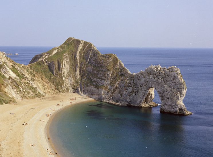
Seamless bedrock map of the Jurassic Coast
A new, seamless, onshore–offshore digital geological map for part of one of the most famous coastlines in the world — the Jurassic Coast in Dorset, a UNESCO World Heritage Site.
Our projects
MEDIN Data Archive Centre
The BGS is the accredited Marine Environment Data and Information Network data archive centre for geology, geophysics and backscatter data.
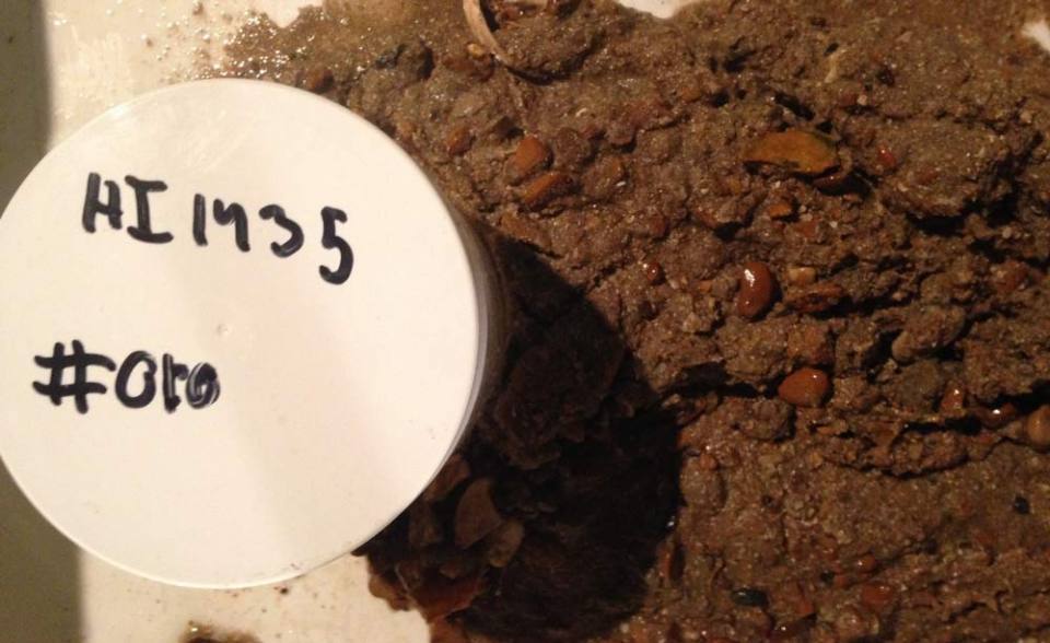
Maritime and Coastguard Agency Civil Hydrography Programme sediment samples
The National Geological Repository at BGS stores material from samples which are routinely collected from the seabed during Civil Hydrography Programme (CHP) Hydrographic Instruction (HI) surveys.
Related news

Geological research in North Sea helping to safeguard subsea cables
06/07/2026
Subsea power and telecommunications cables are critical to the UK’s energy infrastructure and global connectivity, yet they remain vulnerable to damage from ship anchors, fishing activity and natural hazards.

UK scientists unite for seabed mapping survey of the UK’s south-west coastline
15/04/2026
BGS geologists join research voyage, gathering crucial geological data to support offshore energy and infrastructure projects.

Updated geological assessment of the Southern North Sea set to underpin future offshore infrastructure development
25/03/2026
The first regional assessment for 30 years will support offshore marine and subsurface planning for the UK’s low-carbon energy infrastructure, including the 2030 target of 45 to 50 GW generated through offshore wind.

Extensive freshened water confirmed beneath the ocean floor off the coast of New England for the first time
09/02/2026
BGS is part of the international team that has discovered the first detailed evidence of long-suspected, hidden, freshwater aquifers.

Quaternary UK offshore data digitised for the first time
21/01/2026
The offshore wind industry will be boosted by the digitisation of a dataset showing the Quaternary geology at the seabed and the UK’s shallow subsurface.

Offshore Quaternary 250K
The 1:250 000-scale offshore geological map for quaternary geology (BGS Geology: marine quaternary 250k) is available digitally.

How the geology on our doorstep can help inform offshore infrastructure design
19/11/2025
BGS is part of a new collaboration using onshore field work to contextualise offshore data and update baseline geological models which can inform the sustainable use of marine resources.

Extended seabed geology map of the Bristol Channel published
07/10/2025
BGS has released significantly extended high-resolution maps that will support offshore green-energy initiatives in the area.

New seabed sediment maps reveal what lies beneath the waves
03/09/2025
Marine ecosystem science and offshore infrastructure will be boosted by a new dataset showing sediment composition across the UK continental shelf.

Seabed sediments 250K
This offshore Quaternary geology dataset shows the distribution of interpreted lithostratigraphical units within the shallow subsurface. The dataset represents the Quaternary geology immediately beneath the active seabed sediment layer.

Offshore bedrock 250K
The BGS Offshore Bedrock 250k dataset depicts the distribution of the different types of bedrock on the UK Continental Shelf.
BGS Predictive Seabed Sediments (UK)
The BGS Predictive Seabed_Sediments (UK) data provide digital maps of seabed sediment (SBS) composition across the UK Continental Shelf (UKCS).
You may also be interested in
Sea floor: scientific ocean drilling
Implementing several high profile expeditions for the European Consortium for Ocean Research Drilling (ECORD).
Coasts and estuaries geohazards
Providing independent and expert geoscientific tools and advice to assess different adaptation options to coastal flooding and erosion.