New seabed geology maps to enable long term conservation around Ascension Island
BGS deliver the first marine geology and habitat maps for one of the world’s largest marine protected areas.
01/04/2025 By BGS Press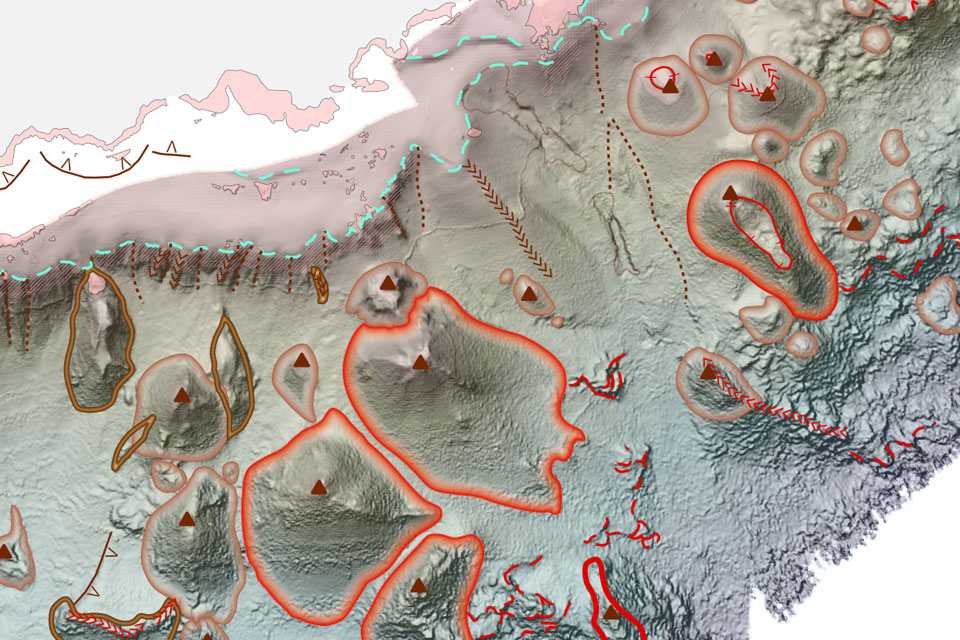

The Ascension Island Marine Protected Area (MPA) is one of the largest areas of protected ocean in the world and safeguards a unique ecosystem in the South Atlantic Ocean. It supports many species that are found nowhere else on earth, a mixture of deep sea and open ocean habitats that remain largely untouched and unexplored, whilst the island itself is home to thousands of nesting turtles and seabirds.
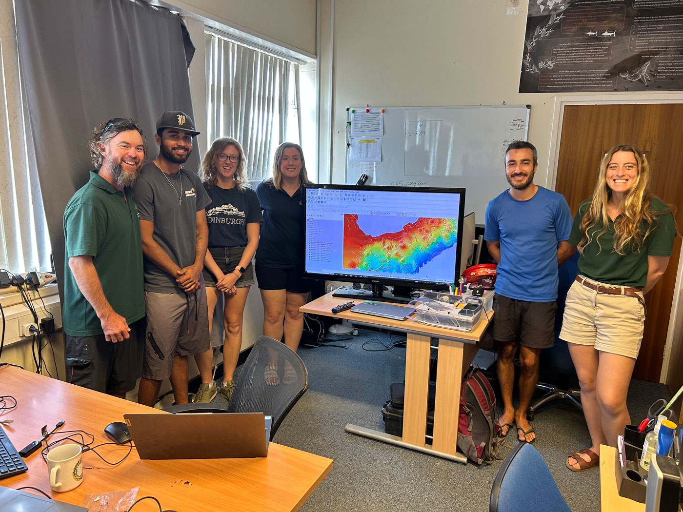
BGS Marine Geoscientist, Catriona MacDonald delivering a lesson in geomorphology to the Ascension Island Government Conservation Team. Source: BGS © UKRI
The British Geological Survey (BGS) recently completed a programme of high-resolution bathymetry surveys and drop-camera sampling within the nearshore areas of the Island. The survey team even managed to collect data where no other survey had ever been undertaken, which in addition to supporting conservation efforts, will also enable safer navigation in future.
The project was funded by the UK Government and utilised both BGS and Royal Navy bathymetry (depth), backscatter (seabed composition), ground-truth sampling (underwater video footage) and many other derived data layers to create the suite of bespoke geological outputs.
The maps, which include seabed geology (substrate and geomorphology) and habitat, are the first to be created for the Island and determine the character, distribution and extent of the nearshore habitats of the MPA.
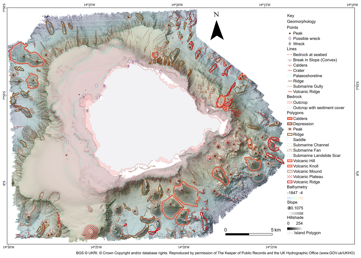
BGS 1:50 000 Geomorphology map of the seabed around Ascension Island. BGS © UKRI. © Crown Copyright and/or database rights. Reproduced by permission of The Keeper of Public Records and the UK Hydrographic Office (www.GOV.uk/UKHO)
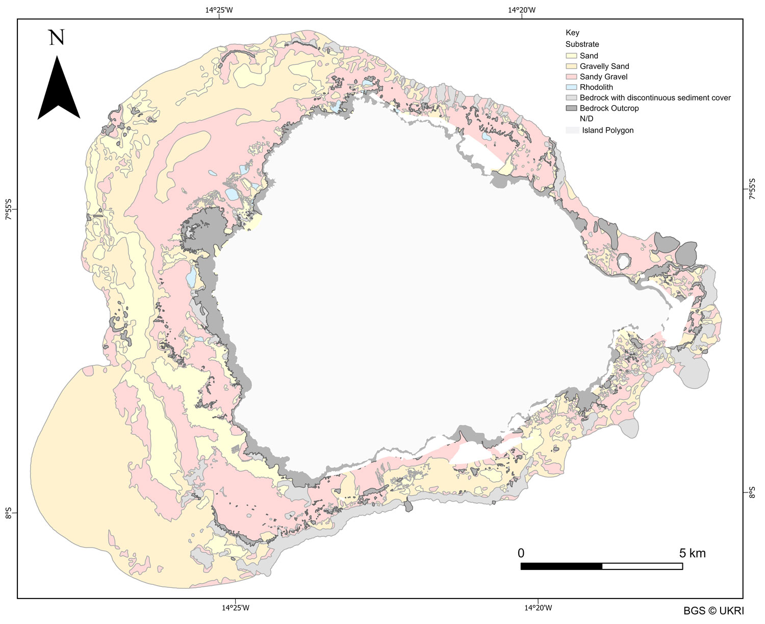
BGS substrate map around Ascension Island, which one of the essential input layers to derive habitat management zones. BGS © UKRI
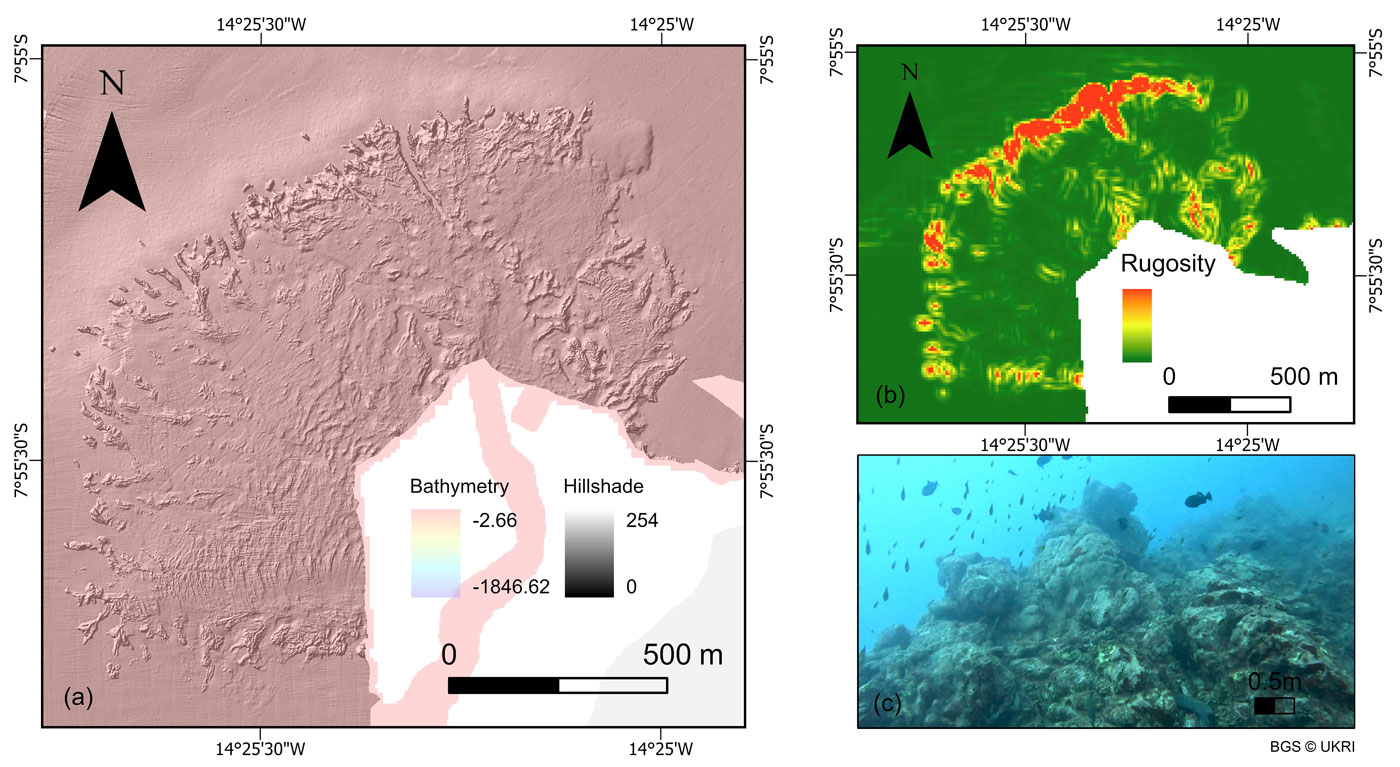
Example bathymetry data and a derived layer (slope) and ground truth footage used to create seabed maps. BGS © UKRI
The geomorphological map revealed a collection of previously unmapped volcanic, erosion-depositional and coastal features including seamounts, submerged lava flows, ridges, submarine landslides and channels. Whilst the substrate map focused on the nearshore areas, composed of sandy sediments and rocky outcrops which are fundamental habitats for the marine communities. Both maps have enhanced the understanding of seabed processes and geological processes occurring around Ascension Island and enabled the creation of seabed habitat maps which provide unprecedented insight into the diverse ecosystems present in the surrounding waters.
As part of the project, the BGS Marine team provided training to the Ascension Island Government (AIG) in how to effectively use GIS software to view, edit, query and manipulate the data. The intention is for AIG to modify these maps as new data and knowledge becomes available and the management requirements of the protected area changes. Although the region is rich in biodiversity it is one of the habitats most at risk from anthropogenic development and climate change. The maps and data will be a vital resource for the AIG Conservation team as they continue to manage and safeguard the region.

“Collecting data in such a remote and exposed location was a challenge, but an absolute privilege and pleasure. BGS had to adapt existing technology to work with the available survey platform within the limits of Ascension’s wonderfully varied and unpredictable operating environment.”
Rhys Cooper, BGS Project Manager and Senior Surveyor
“The collection of new high-resolution datasets around Ascension Island allowed us to map the seafloor geology in unprecedented detail, uncovering critical geological features and habitats that support a rich diversity of marine life, and marks a significant milestone in our understanding of Ascension Island’s marine environment.”
Catriona Macdonald, BGS Marine Geoscientist
“AIG are excited to have access to such high-quality bathymetry and habitat maps. They will be transformative in our nearshore research and monitoring and allow for much more evidence based conservation management.”
Tiffany Simpson, Director of Conservation and Fisheries, Ascension Island Government
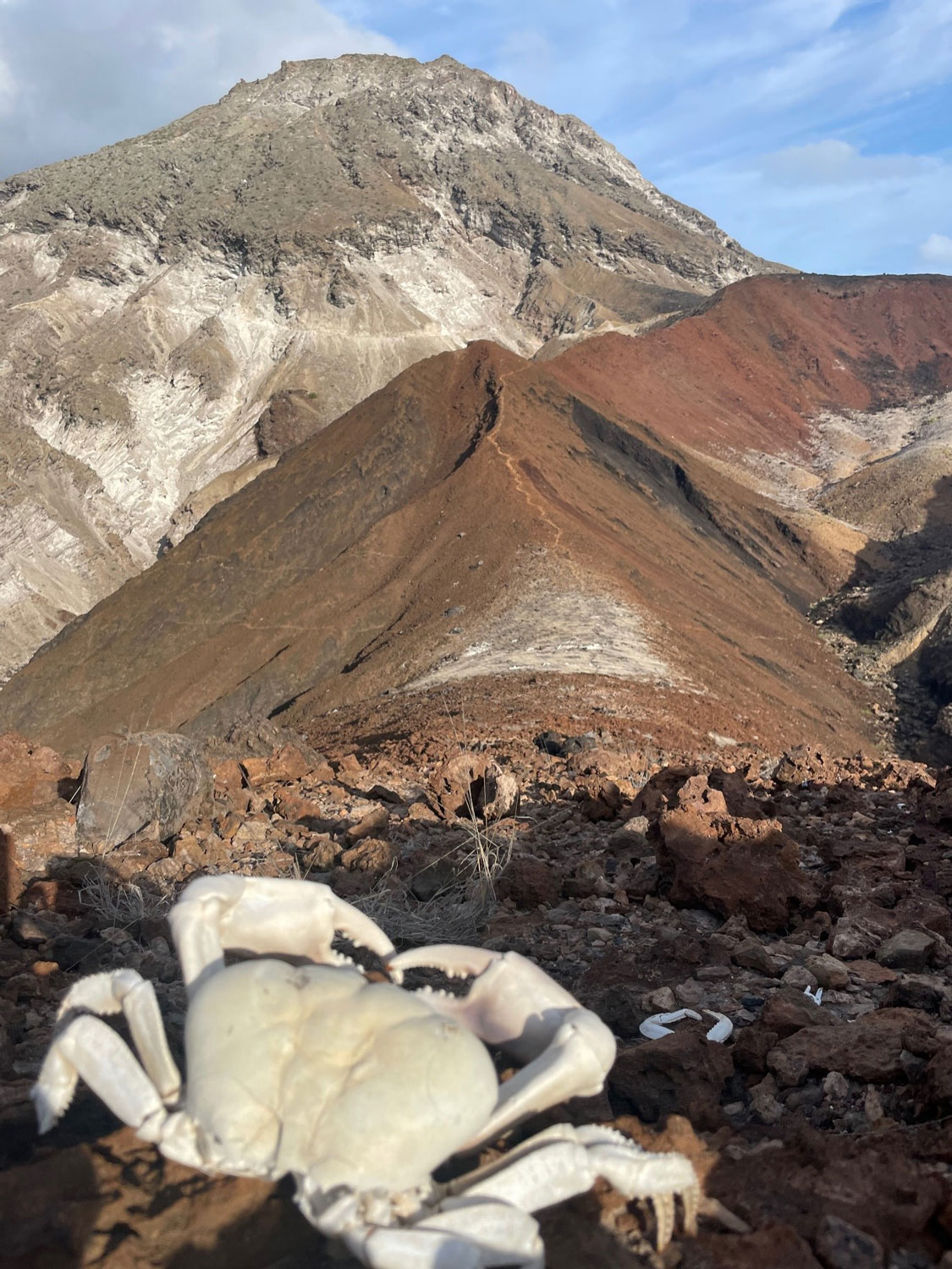
Land crabs (Johngarthia lagostoma) on the approach to White Hill, Ascension Island. BGS © UKRI
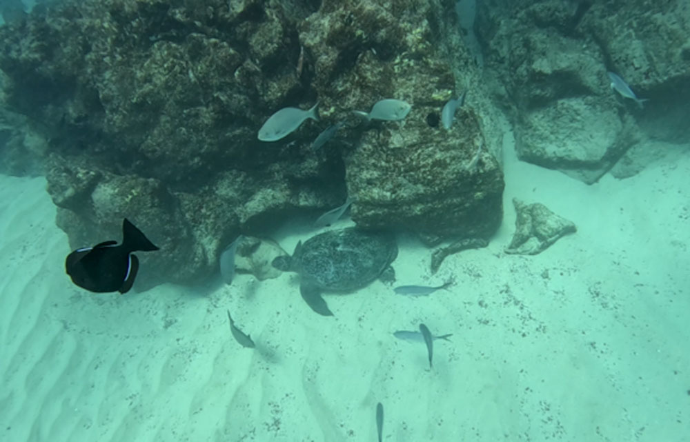
Marine life filmed as part of the video transect work around the coast of Ascension Island. BGS © UKRI
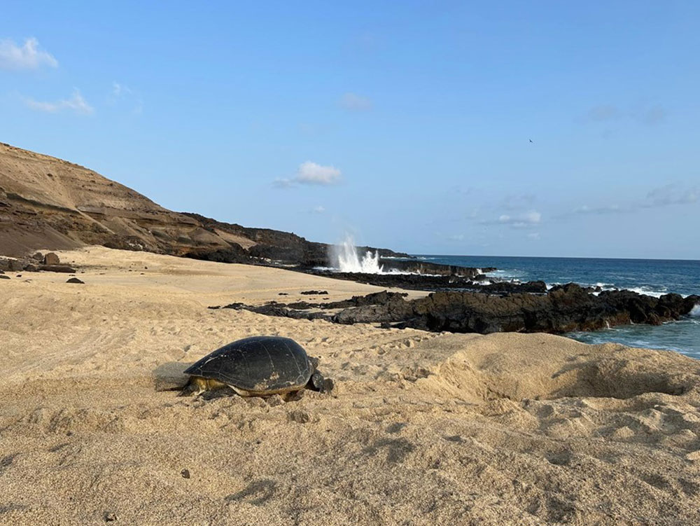
A green turtle (Chelonia mydas) returning to the sea after nesting on North East Beach, Ascension Island. BGS © UKRI
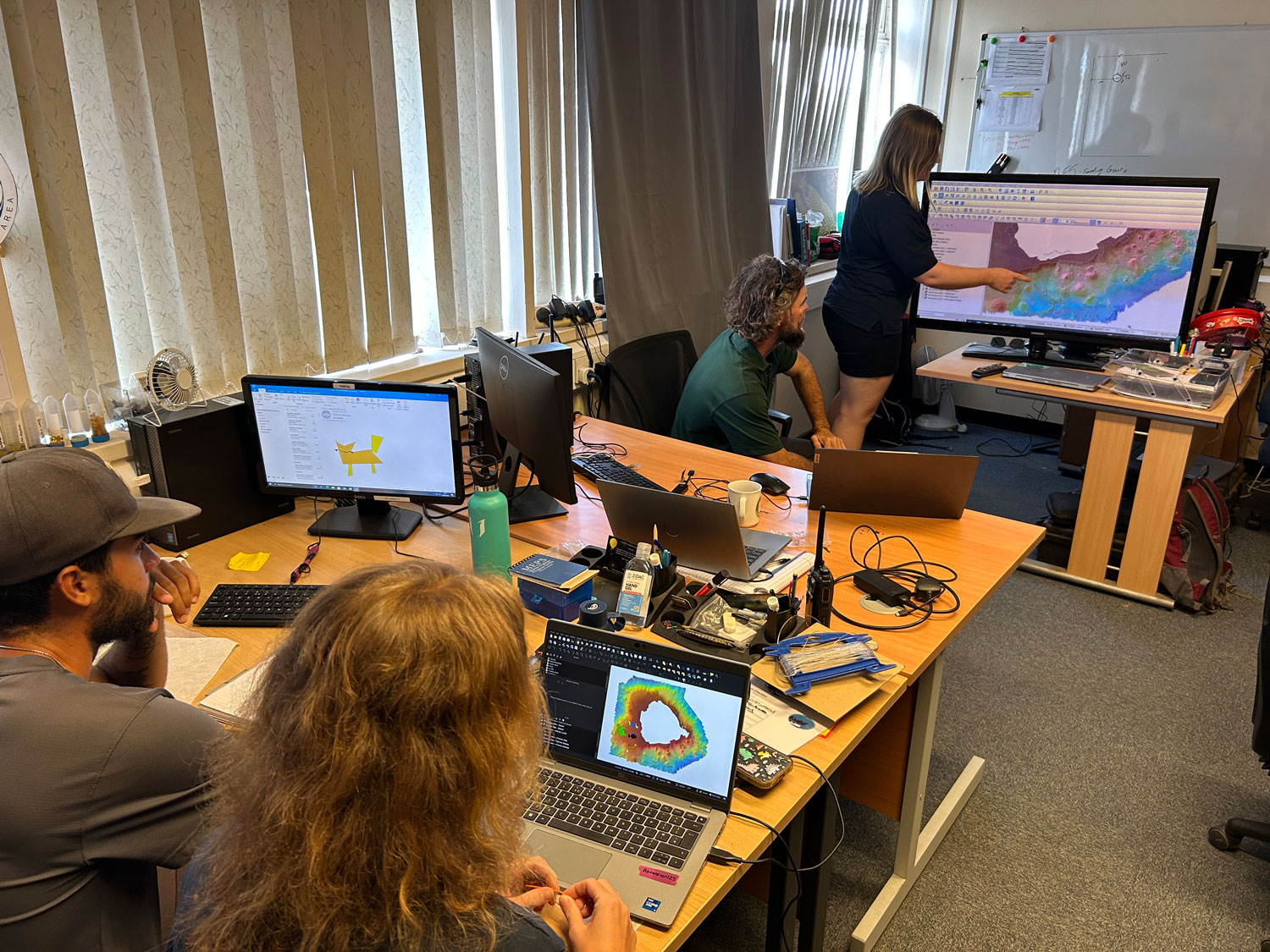
In depth training in QGIS and how to interpret the maps with the Ascension Island Government Conservation Team. BGS © UKRI
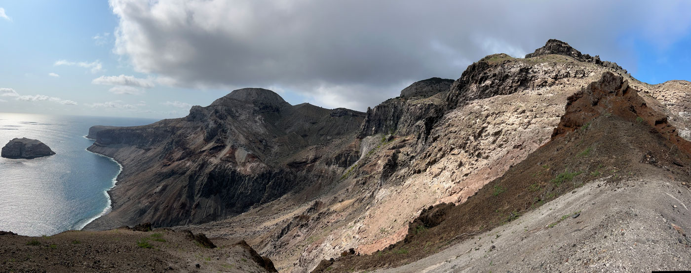
View down to Spire Beach from one of the world-famous letterbox walks. BGS © UKRI
The final maps were delivered by BGS to the Ascension Island Government’s Department of Conservation in February 2025 and will be used by the team to manage the marine environment for future generations.
Further information
Ascension Island Marine Protected Area Website
BGS completes first mapping expedition to Ascension Island
In photos: Marine surveying a remote volcanic island
Report of survey : Ascension Island multibeam & video transects
This project is funded by the UK Government through Darwin Plus.

Relative topics
Related news

New NERC-funded project empowers young people to engage with environmental science
23/07/2026
BGS is part of a new, collaborative project, funded through NERC’s ‘Opening up the environment’ programme, helping the environmental research community become more accessible.

Delving deep into mountains for future water security
16/07/2026
A BGS-led project is using new water-tracing investigation methods, geophysics and modelling to understand how water moves from mountains to the lowlands, helping to improve water security for billions of people.

Updated national 3D model will determine the depth to the solid bedrock beneath our feet
13/07/2026
The BGS Superficial Deposit Thickness Model now includes an elevation model of geological rockhead for the first time, providing important data for civil engineers, geoscientists and environmental scientists.

UK’s world-class research organisations launch new collective
10/07/2026
The launch of the National Research Organisations Group brings together more than 100 science leaders to provide an authorativive voice on science, research policy and long-term investment.

Cheshire Geoenergy Observatory releases key geological datasets for UK thermal energy storage scheme design
09/07/2026
A new report and data packs from BGS will provide a unique resource for scientists working on the geology and hydrogeology of the Sherwood Sandstone Formation, an important aquifer and reservoir rock.

New geological mapping underway to help manage flooding along the River Tweed
08/07/2026
Scientists are surveying the Tweed catchment for the first time in over 100 years to enhance understanding of localised groundwater and improve flood forecasting.

Geological research in North Sea helping to safeguard subsea cables
06/07/2026
Subsea power and telecommunications cables are critical to the UK’s energy infrastructure and global connectivity, yet they remain vulnerable to damage from ship anchors, fishing activity and natural hazards.

UK Critical Minerals Intelligence Centre makes recommendations for the next UK criticality assessment
01/07/2026
CMIC has outlined the enhancements made to the next assessment update to ensure it is better tailored to the structure of the UK economy.

From archive to discovery: historical mineral reports support gold exploration in Scotland
25/06/2026
Digitised geological records show potential to unlock untapped mineral resources in Ardlochan, Argyllshire.

UK and Philippines scientists investigate natural hydrogen generation processes at atomic scale
22/06/2026
BGS researchers were granted access to use the Diamond Light Source facility in order to study hydrogen in light brighter than the sun.

Shortage of end-of-life materials presents challenge to UK critical minerals security
17/06/2026
A new report by the UK Critical Minerals Intelligence Centre reveals insufficient end-of-life material stocks present a supply risk over the coming decade, but offer significant long-term potential to meet critical mineral demand through recycling.

UK geothermal catalogue receives update
16/06/2026
BGS releases the second digital version of the UK geothermal catalogue of subsurface temperature and rock thermal conductivity measurements and heat flow calculations.