

Updated national 3D model will determine the depth to the solid bedrock beneath our feet
The BGS Superficial Deposit Thickness Model now includes an elevation model of geological rockhead for the first time, providing important data for civil engineers, geoscientists and environmental scientists.
13/07/2026 By BGS Press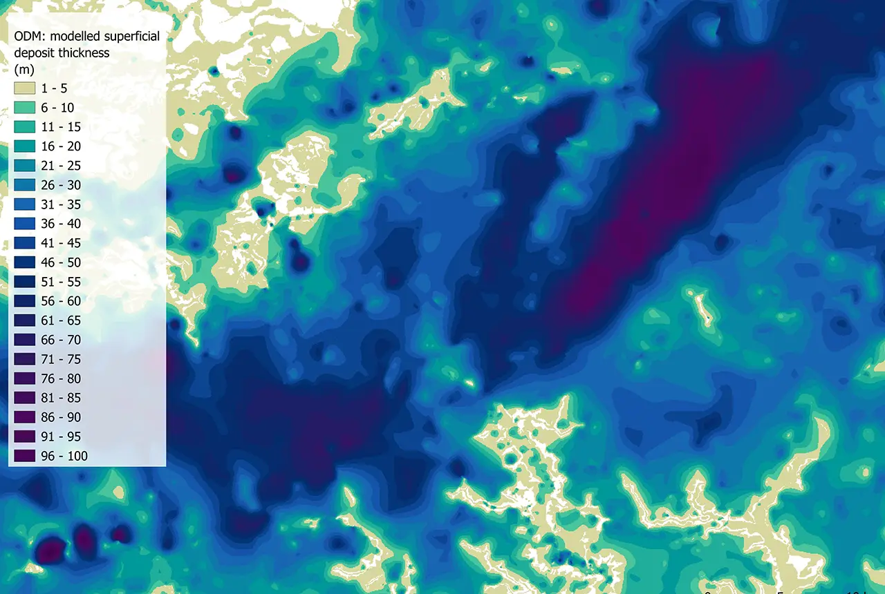

The BGS Superficial Deposit Thickness Model (SDTM) dataset presents the modelled regional variation in thickness of superficial and unconsolidated deposits across Great Britain. These include sediments of fluvial, glacial, marine or anthropogenic origin that were generally formed during the Quaternary (the past 2.6 million years up to today). The thickness of these deposits signifies the depth down to the top of the bedrock, known as geological rockhead.
The distribution of these deposits is not uniform: sometimes they are thin veneers, sometimes they form large, irregular masses, and sometimes they infill entire valleys. The latest SDTM release, the first for over 15 years, includes a raster model of the elevation of rockhead for the first time, providing important data for a variety of different sectors.
The transition between superficial sediments and geological rockhead (and associated bedrock units) is an important zone for geologists, civil engineers, hydrogeologists and environmental scientists because it is where most physical and chemical properties of the deposits significantly change. Properties such as strength, lithology, conductivity, porosity and permeability can be strongly affected by this transition, so an understanding of the depth of the transition zone beneath the ground surface is vital.
The SDTM models have been created using digital mathematical interpolation techniques, combining observations of superficial thickness from borehole logs held in our archives with mapped superficial and artificial geology extents from the 1:50 000-scale digital geological map of Britain.
Version 8 of the SDTM includes the new layer, the rockhead elevation model (RHEM). This is a raster model of the elevation of rockhead relative to Ordnance Datum, the standard vertical reference system used in Great Britain to measure land elevation. This model provides users with an integer value of modelled depth to bedrock in metres and will be of particular use for creating 3D ground models and understanding the geological structure across a site.
The updated SDTM product also contains the observation driven model (ODM), the terrain adjusted model (TAM) and data distance (DataDist).
Observation driven model
The ODM is a raster model of sediment thickness that interpolates thickness values between boreholes within the mapped superficial extents, giving users an integer value of modelled superficial thickness in metres.
Terrain adjusted model
The TAM is a raster model of sediment thickness derived using a method that combines borehole records, the mapped superficial deposit extents and surface elevation data. This differs from the ODM by considering the ground surface elevation, derived from the Ordnance Survey Terrain® 50 model, and gives users an integer value of modelled superficial thickness in metres.
Data distance
DataDist is a raster surface defining the distance of any location relative to the nearest source of thickness information; either the location of a borehole or the mapped boundary of a superficial deposit. This is provided as a pseudo-uncertainty surface relative to the ODM, TAM and RHEM components of the SDTM. The further a location is from a source of thickness data, the more uncertain any values provided by ODM, TAM and RHEM models are likely to be.
New naming conventions
SDTM Version 8 has introduced new naming conventions for the ODM and TAM datasets. These name changes better describe the characteristics of the two datasets and removes confusion or implications relating to the terms ‘basic’ and ‘advanced’ that might imply one model is superior. Both model outputs provide valid options and should be considered in tandem rather than in isolation to understand the models’ constraints.
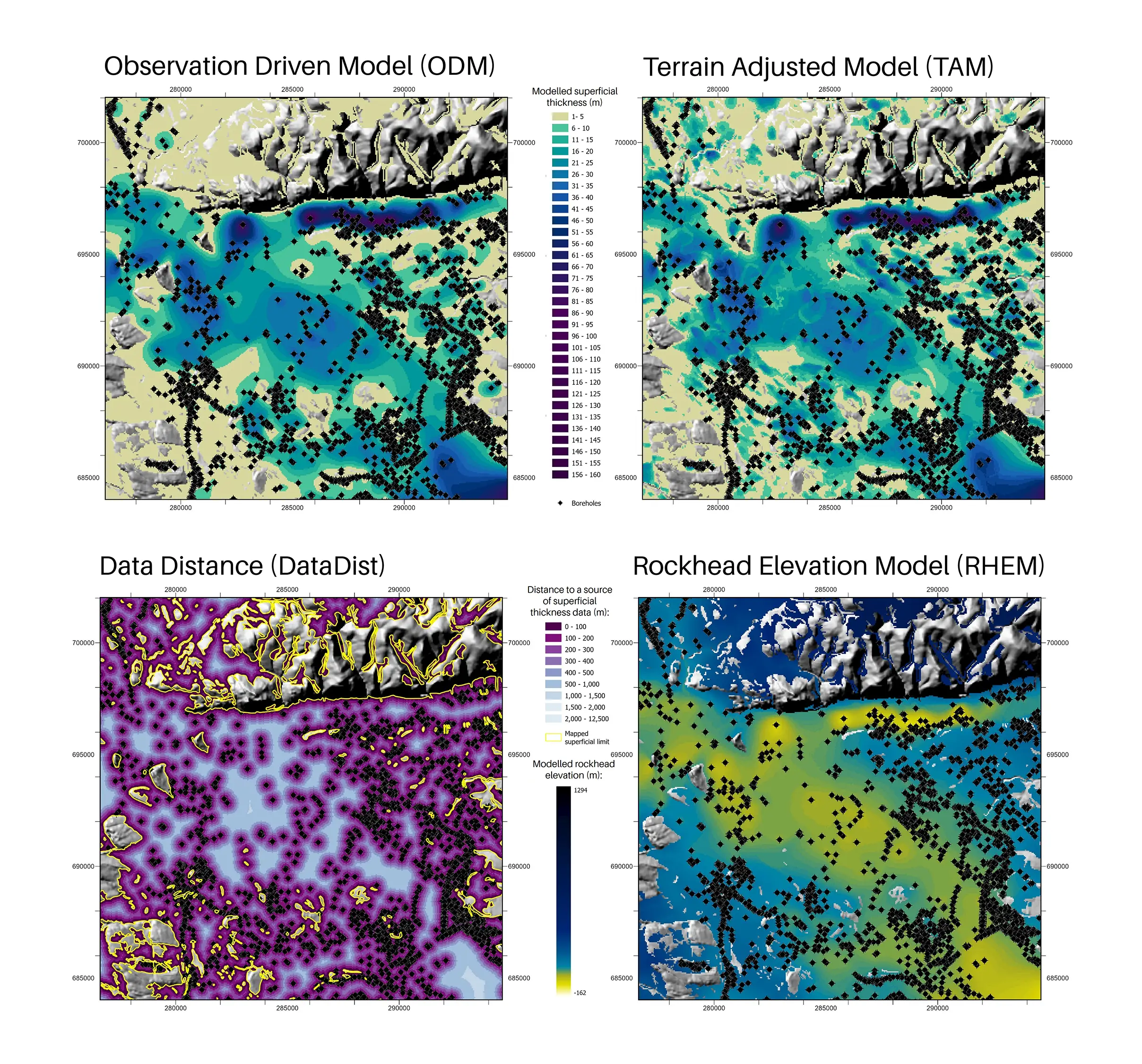
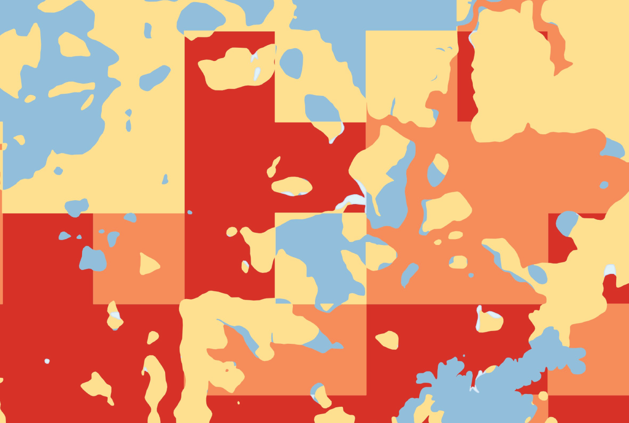
Map extracts from the ODM, TAM, RHEM and DataDist. The background greyscale digital terrain model (DTM) is an extract from the OS Terrain® 50 DTM product. Contains OS Terrain® 50 DTM data © Crown copyright and database rights 2026.

This dataset release marks an important development for the BGS SDTM and is its first update since 2010. Improved borehole selection criteria have been implemented, allowing the models to benefit from the latest interpretations of BGS-held borehole logs as well as identifying and excluding low-confidence, inappropriate and conflicting boreholes that may have been included in previous versions. As such, the borehole selection underpinning SDTM V8 is considered to be more robust, resulting in a higher confidence model.
Rob Shaw, geospatial analyst and SDTM product developer, BGS.
The intended scale of use of this dataset is 1:100 000, with an average vertical accuracy of +/-5 m elevation. The dataset is intended for use at national, regional and city scales, but not site scales where specific ground-investigation works should be undertaken to determine precise superficial thickness and rockhead elevation.
We are continuing our scientific research on to how to improve the prediction of superficial thickness and will build that into any future update of the SDTM.
For more information on the SDTM datasets, including how to access the data, please visit the STDM product webpage, download the product user guide or get in touch with BGS Digital Data (digitaldata@bgs.ac.uk).
Relative topics
Related news

New project mapping UK Continental Shelf provides boost to offshore infrastructure and development
22/10/2026
BGS is leading a three-year project funded by The Crown Estate to develop a new suite of seabed geology datasets and reports, providing crucial information for offshore developers about the seabed around the UK.
Updated national 3D model will determine the depth to the solid bedrock beneath our feet
13/07/2026
The BGS Superficial Deposit Thickness Model now includes an elevation model of geological rockhead for the first time, providing important data for civil engineers, geoscientists and environmental scientists.
New geological mapping underway to help manage flooding along the River Tweed
08/07/2026
Scientists are surveying the Tweed catchment for the first time in over 100 years to enhance understanding of localised groundwater and improve flood forecasting.
Geological research in North Sea helping to safeguard subsea cables
06/07/2026
Subsea power and telecommunications cables are critical to the UK’s energy infrastructure and global connectivity, yet they remain vulnerable to damage from ship anchors, fishing activity and natural hazards.
From archive to discovery: historical mineral reports support gold exploration in Scotland
25/06/2026
Digitised geological records show potential to unlock untapped mineral resources in Ardlochan, Argyllshire.
Ukraine and the UK strengthen their commitment to geological cooperation
10/06/2026
A new Memorandum of Understanding reaffirms the UK’s support of Ukraine’s ambitions to develop its critical mineral resources, paving the way for collaboration through capacity-building programmes.
GeoClimate Shrink–Swell
GeoClimate clay shrink-swell provides information on the projected future change in susceptibility of clay shrink–swell across Great Britain due to climate change.
New geological maps of Berwick-upon-Tweed to help future-proof natural water supply
20/05/2026
Scientists have mapped the geology under the town to better understand the groundwater system to inform decisions around abstraction.
BGS GeoClimate – dataset launch webinar
Event on 02/06/2026
The virtual launch of our new BGS GeoClimate dataset – helping mitigate the economic risk from shrink-swell subsidence. Event recording now available
Isotopes and science: my student placement at BGS
08/04/2026
Industrial placements at BGS for undergraduate students give real-life experience of working in laboratories and learning different analytical techniques.
Updated geological assessment of the Southern North Sea set to underpin future offshore infrastructure development
25/03/2026
The first regional assessment for 30 years will support offshore marine and subsurface planning for the UK’s low-carbon energy infrastructure, including the 2030 target of 45 to 50 GW generated through offshore wind.
PhD adventures in Copenhagen, Denmark: revealing past recovery processes of tropical forest systems through ancient environmental DNA
12/03/2026
PhD student Chris Bengt visited the University of Copenhagen to carry out very delicate extraction of aeDNA from lake-sediment cores, in the hopes of unlocking the secrets of past volcanic eruptions.