Volcanology
BGS Research
Our scientists draw on a broad range of expertise across the BGS and from collaborative research worldwide to improve understanding of volcanic processes, hazards and risks.
By nature, volcanic research is multidisciplinary, covering a broad area of physical sciences including atmospheric, earth and marine sciences; remote sensing; numerical and experimental modelling, and data science. We embrace interdisciplinary research and routinely use social science methods in our research. Our scientists lead research projects and work in partnerships both in the UK and internationally.
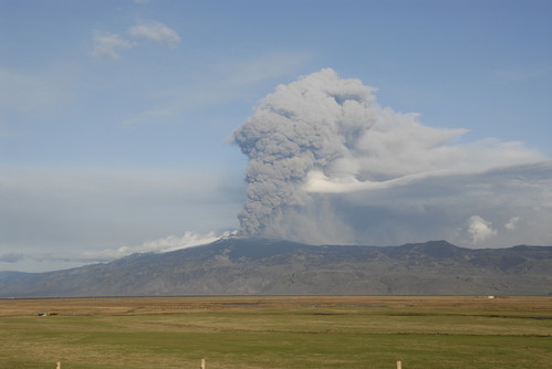

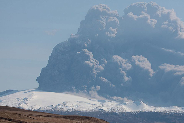
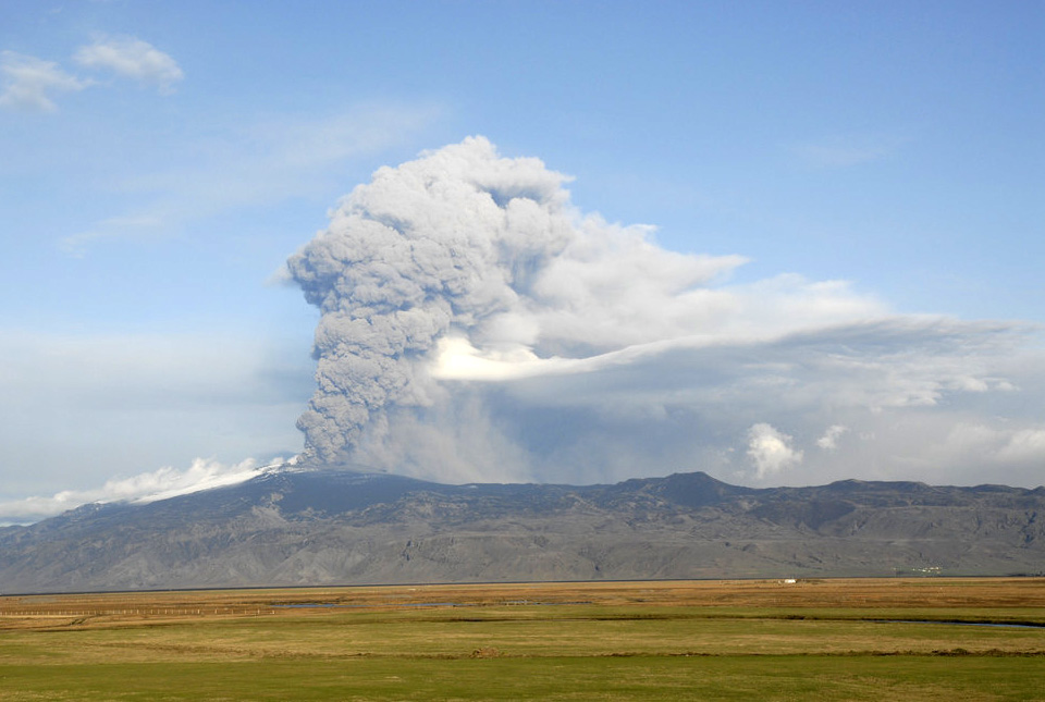
Eyjafjallajökull volcanic eruption, Iceland, May 2010. BGS © UKRI.
Our research relies on our strong in-country partnerships. Through engagement with national to local civil protection agencies, government departments, research institutions, civil society groups, non-governmental organisations (NGOs), the private sector and communities both in the UK and overseas, we are contributing to strategies for disaster risk reduction. We work with national and international government agencies on innovative research and to provide support and scientific advice not only during volcanic unrest, but also in preparation for potential future unrest and eruptions.
BGS Volcanology researchers are improving knowledge and understanding of eruption processes through research and the development of novel computational tools. Our research involves:
- field mapping and deposit-characteristic analysis
- geochronological, petrological and geochemical analyses
- laboratory- to large-scale experiments
- numerical and experimental modelling
Volcanoes are multi-hazard environments with eruptions rarely resulting in just a single hazard. Hazards can occur simultaneously or can be cascading. Our research on volcanic hazard analysis and assessment involves both quantitative and qualitative approaches:
- deterministic and probabilistic numerical modelling of volcanic ash fall and dispersal; gas dispersal; pyroclastic density currents; lahars, and vent opening
- probabilistic event trees and statistical emulators
- development of eruption scenarios, expert elicitation and use of global databases
- understanding of uncertainties and their implications
Our research aims to provide evidence to support both disaster risk reduction and development, so communities worldwide can live with and benefit from volcanoes.
We work collaboratively across the BGS and with international partners on a range of projects, including:
- exposure, vulnerability and impact analyses for a range of volcanic hazards
- effective risk communication through story telling and collaborative film making
- global reporting of volcanic activity, including providing scientific advice to the UK government and the European Union Civil Protection Mechanism (specifically the Emergency Response Coordination Centre) on volcanic eruptions and their impacts
- citizen science and its contribution to disaster risk reduction, both in the UK and overseas
In the past, the UK has been affected by volcanic eruptions in Iceland, the most notable being the 2010 Eyjafjallajökull and 2011 Grímsvötn eruptions, which resulted in disruption of air traffic in the North Atlantic and Europe.
BGS scientists respond to volcanic eruptions and contribute to the Scientific Advisory Group in Emergencies (SAGE). We are part of a Memorandum of Understanding with the Icelandic Meteorological Office, the UK Met Office and the National Centre for Atmospheric Science in order to enhance scientific collaboration before during and after eruptions.
Our scientists also respond to eruptions worldwide as appropriate, providing advice or a collaborative scientific response.
Find out more about our research
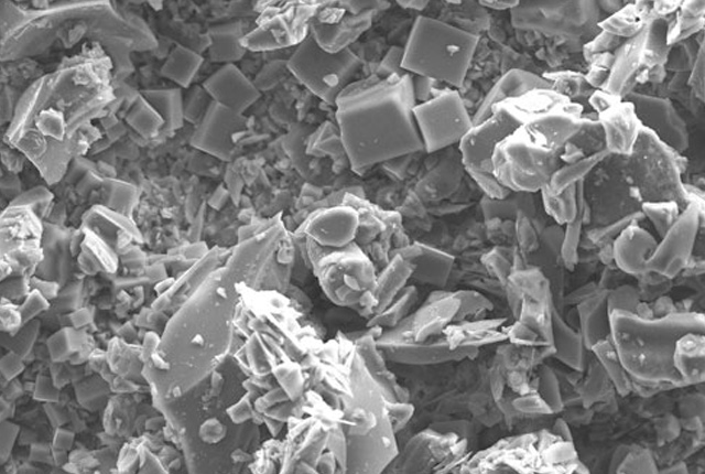
Ash collection
In the event of an eruption in Iceland volcanic emissions may affect the UK. If they do, we need you to collect observations and samples to help us learn about the nature of the eruption.
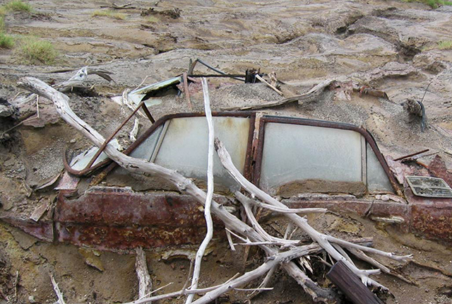
Volcanic debris flows
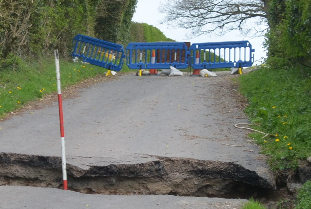
Debris flows, also known as lahars when they involve volcanic material, are mixtures of sediments and water that flow down the slopes in response to gravity.
Eruption source parameters
Eruption source parameters (ESPs) are those parameters that describe the initiation condition for numerical models. Different models require different input parameters; the quality of model outputs is dependent on the quality of model inputs.
Pyroclastic density currents
Pyroclastic density currents (PDCs) are perhaps the most hazardous events to local areas during explosive volcanic eruptions.
Modelling of volcanic ash
Volcanic ash in the atmosphere is a hazard particularly for civil aviation. Atmospheric dispersion models are used to predict volcanic ash transport.
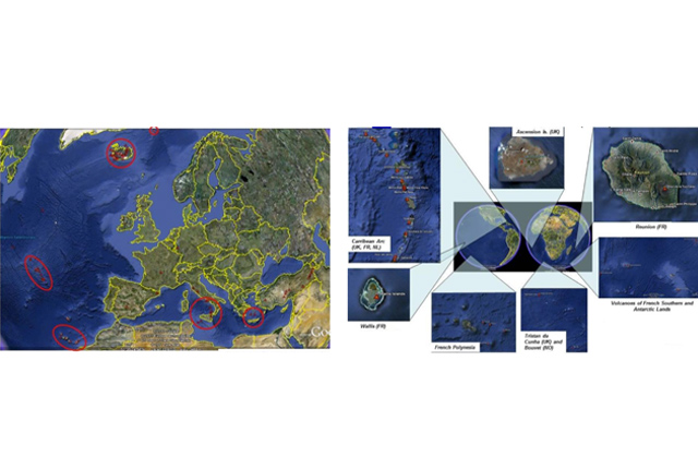
Geoscience in the Overseas Territories
The UK’s 14 Overseas Territories (UKOTs) are highly diverse islands, geographically dispersed around the world in different climate zones. Most are small islands that are particularly vulnerable to natural hazards and climate change.
Our projects
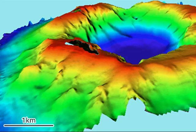
Understanding eruptive activity and related hazards at Krakatau volcano
The BGS is involved in research to understand eruptive processes and implications for tsunami initiation at Krakatau.
ARISTOTLE-ENHSP
The ARISTOTLE-ENHSP project delivers multi-hazard advice capability to the Emergency Response Coordination Centre (ERCC).
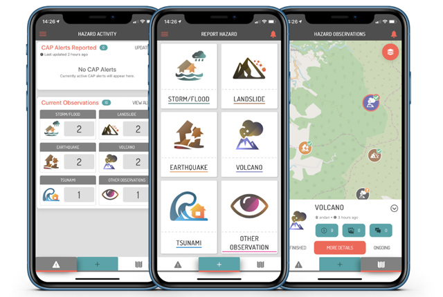
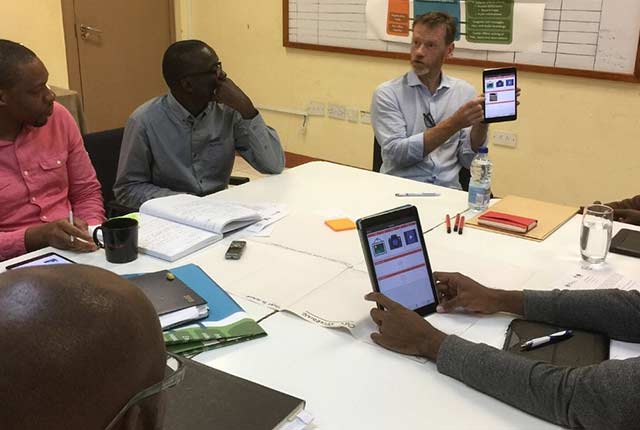
Citizen science for multi-hazards and disaster risk reduction
We are using citizen science for people to develop a shared understanding of hazardous phenomena and for communities to contribute to hazard forecasting and early warning.
Enhancing multi-hazard resilience through citizen science in the Caribbean
We are working with partners to develop a citizen science app for collecting and sharing observations of natural hazards and impacts in near real-time.
Related news

PhD adventures in Copenhagen, Denmark: revealing past recovery processes of tropical forest systems through ancient environmental DNA
12/03/2026
PhD student Chris Bengt visited the University of Copenhagen to carry out very delicate extraction of aeDNA from lake-sediment cores, in the hopes of unlocking the secrets of past volcanic eruptions.

Fieldwork on Volcán de Fuego
13/10/2025
Understanding how one of the world’s most active volcanoes builds up material, and how they collapse to feed hot flows
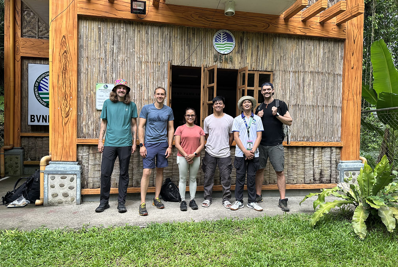
PhD adventures in the Philippines: coring around Lake Bulusan
05/09/2025
Chris Bengt recounts his two-week field trip to Bulusan Volcano Natural Park in the Philippines to collect lake sediment cores, fresh soil and water samples.
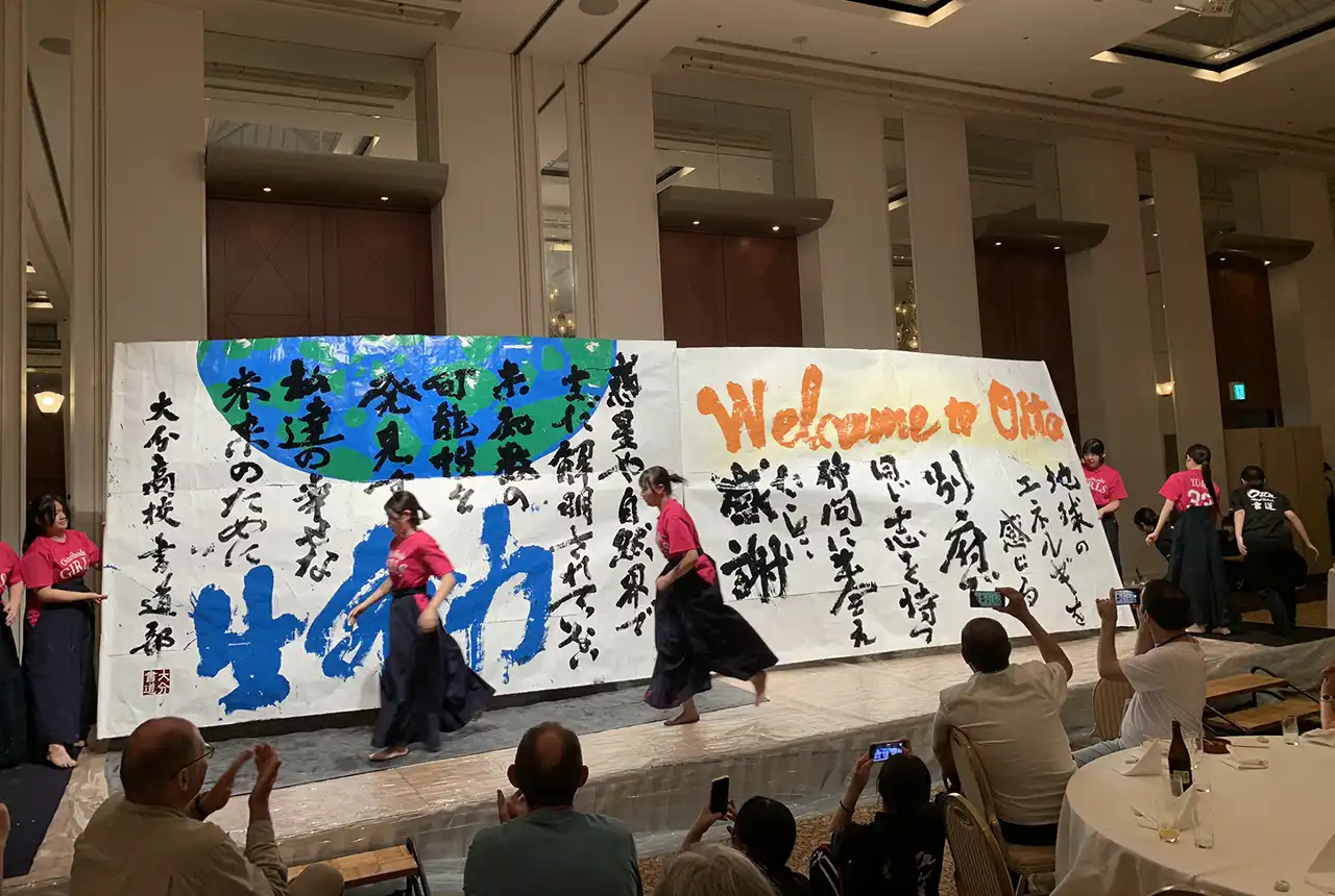
Electromagnetic geophysics in Japan: a conference experience
23/10/2024
Juliane Huebert took in the fascinating sights of Beppu, Japan, while at a geophysics conference that uses electromagnetic fields to look deep into the Earth and beyond.
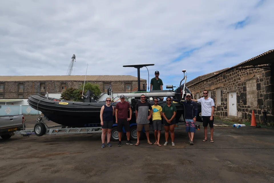
In photos: marine surveying a remote volcanic island
14/12/2023
A photo blog by members of the BGS Marine Survey team, who recently completed marine surveys around Ascension Island in the South Atlantic Ocean.
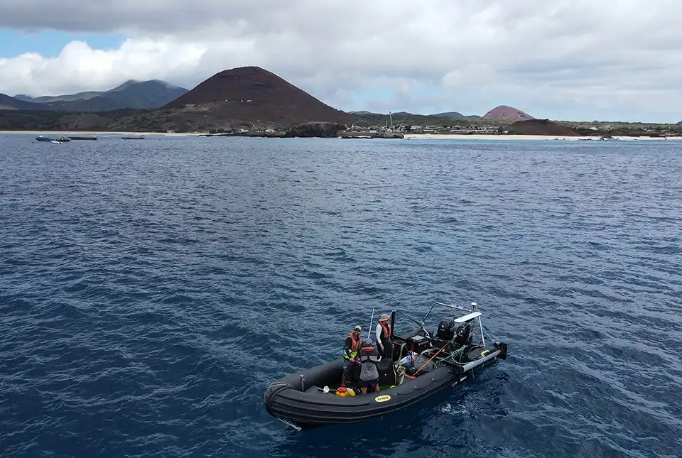
BGS completes first mapping expedition to Ascension Island
11/12/2023
BGS marine geoscientists travelled to Ascension Island to support its government with an ongoing, conservation-driven mapping programme.
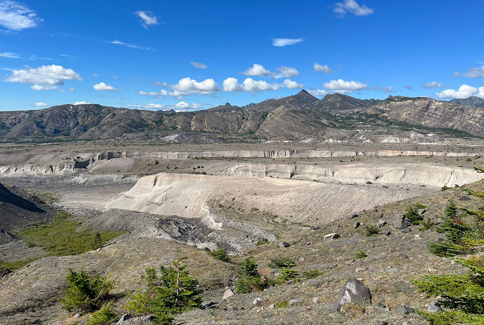
In photos: a volcanic field trip
31/08/2023
Volcanologist Samantha Engwell visited the Cascades in the United States to learn more about the 1980 Mount St Helens volcanic eruption.
One year on: reflections on the Hunga Tonga-Hunga Ha’apai volcanic eruption
18/01/2023
The eruption of the Hunga Tonga-Hunga Ha’apai Volcano in January 2022 has highlighted a global unpreparedness for the impacts from large-scale global events.
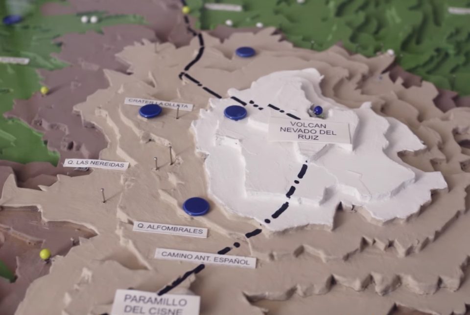
Film trilogy wins award and shares experiences of 1985 Nevado del Ruiz eruption
24/10/2022
A collaborative film trilogy co-directed by BGS Volcanologist, Dr Anna Hicks, has won the overall ‘Dynamic Earth’ Theme Award at the Earth Futures Festival 2022.
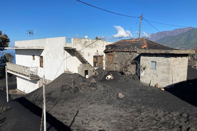
Building surveys in La Palma during the 2021 volcanic eruption
18/03/2022
In December 2021, BGS BUFI student Sara Osman visited La Palma in the Canary Islands to assess buildings damaged during the Cumbre Vieja volcanic eruption. In this blog, she talks about her experiences on the island.
Spaceborne data: an expanding role in disaster response
23/06/2021
Alessandro Novellino explains the importance of Earth observation to help facilitate successful emergency responses after natural hazard occurrences.
A new BGS platform to model volcanic ash in the atmosphere
16/12/2020
BGS has supported the creation of a new modelling platform to aid research workflows around ash dispersion simulation.
You may also be interested in
Shallow geohazards
Measuring, recording and analysing near-surface geological hazards including landslides, sinkholes and discontinuities.
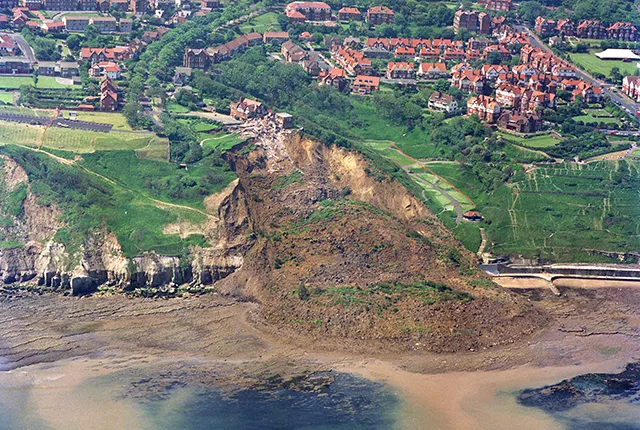
Landslides
Building resilience both in the UK and internationally to landslides and carrying out many aspects of landslide research.