Volcanic ash in the atmosphere is a dangerous hazard from volcanic eruptions, particularly for civil aviation. This is because volcanic ash can significantly damage aircraft and their turbines in particular. Mitigation actions for aviation safety are currently based on exclusion zones for air traffic, which can lead to airport closures and flight diversions or cancellations. The consequent travel disruption can potentially affect many countries for prolonged periods causing big economic losses, as dramatically demonstrated by the 2010 eruption of the Eyjafjallajökull volcano in Iceland.
Exclusion zones are defined through the numerical simulation of ash dispersion and these models are currently the object of extensive research in volcanology.
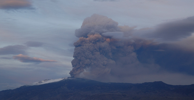

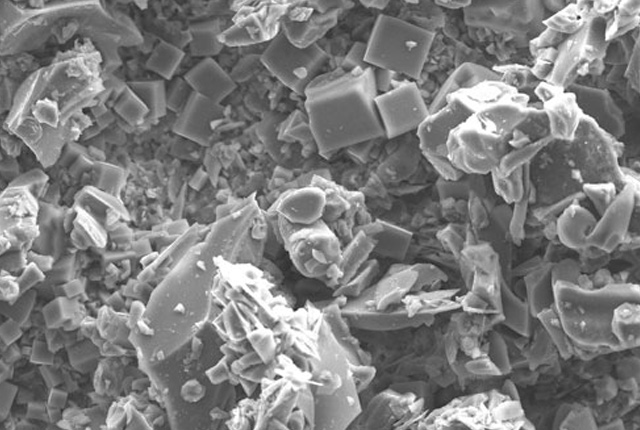
Eyjafjallajökull eruption, Iceland, May 2010. BGS © UKRI.
Predictions of volcanic ash transport are made using atmospheric dispersion models. Several models are available, often as free open-source codes. These models may differ in terms of the simulation approaches and the physical modelling of the processes with the dispersing volcanic plume. However, they are all designed to reproduce the following steps characterising the evolution of a volcanic ash cloud:
- the emission of volcanic particles and the generation of an ash cloud (volcanic source characterisation)
- the advection-diffusion of the ash cloud as the result of its interaction with the atmospheric wind field and turbulence
- the sedimentation and deposition of the particles from the ash cloud due to several processes, such as the gravitational settling and entrapment of the particles into rain and snow
We have designed and created a fully automated system to perform both scenario-based and user-requested simulations of ash dispersion. For a selected volcano, the system quantifies the eruption source parameters (e.g. the emission rate of volcanic particles) either based on observations (when available) from volcano monitoring networks or on most likely scenarios based on knowledge of the volcano. For the latter, the system uses data from the eruption source parameters database, hosted on BGS webpages. For the former, the system activates REFIR, which is a tool co-developed with partners from the University of Iceland and in collaboration with other partners in the framework of the FUTUREVOLC project, to process observational data to obtain source parameters.
Once the source is characterised, dispersion simulations are automatically performed using two open-source dispersion models: FALL3D and HYSPLIT. These models have been selected because they represent two examples of different modelling approaches (Eulerian versus Lagrangian), enabling us to explore the possible range of variability of modelling outcomes.
Dispersion simulations are carried out using meteorological data of the NOAA Global Forecast System (GFS) numerical weather prediction model. Output of volcanic ash concentration in the atmosphere and deposition on the ground are then processed with a set of Python plotting scripts developed by BGS Informatics and now publicly available on the BGS GitHub repository.
Scenario simulations are carried out automatically four times per day (at 00:00, 06:00, 12:00 and 18:00 UTC) at a selected volcano. Figures 1 and 2 show an example of a graphical output obtained for an eruption scenario at Reykjanes (Iceland).
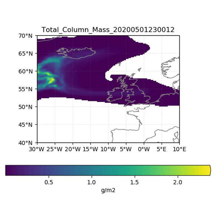
Figure 1: the plot shows the total mass of volcanic particles present in the atmosphere measured from the sea level to the top of the ash cloud. BGS © UKRI.
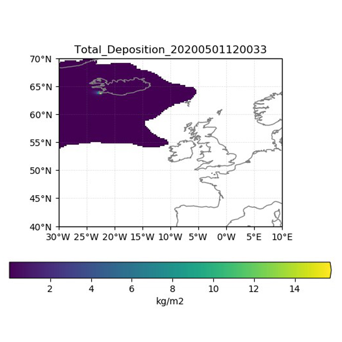
Figure 2: the plot shows the total mass of volcanic particles deposited on the ground at the same time from the beginning of the eruption. BGS © UKRI.
With this system we aim to simplify the process of ash dispersion simulations and investigate the influence of model selection and source parameter uncertainty on the ash cloud predictions.
Contact
If you want to discover more then please contact Fabio Dioguardi.
You may also be interested in
Volcanology
Our scientists lead research projects and work in partnerships around the world to improve our understanding of volcanic processes, hazards and risks.
Ash collection
In the event of an eruption in Iceland volcanic emissions may affect the UK. If they do, we need you to collect observations and samples to help us learn about the nature of the eruption.