How BGS can help your business
As a world-leading geoscience organisation, BGS holds extensive knowledge and expertise. Our vast collection of geoscience data, geological information, reports and datasets can support your business requirements. Furthermore, we design specific projects to address your challenges, from surveys and field mapping to models and expert advice, onshore, offshore in the UK and around the world. We value all of our stakeholders and will work with you to understand your requirements and build lasting partnerships.


BGS © UKRI.

BGS © UKRI.
BGS © UKRI.

BGS © UKRI.
The BGS is a data-rich organisation with over 400 datasets in our care. Many of these can be downloaded or viewed from our data pages. Others are available under licence for use within your own business or for you to use in the development of commercial application or product. Please see our dataset listing for more information of what’s available.
BGS GeoIndex is a map-based index showing a selection of BGS onshore and offshore data.
- The onshore data index includes boreholes, collections, geology, geochemistry, geophysics, flooding, ground stability, earthquakes and other datasets held by BGS.
- The offshore information index includes (but is not limited to) boreholes, seabed samples, geology and geophysics datasets, bathymetry and seabed and sediment data.
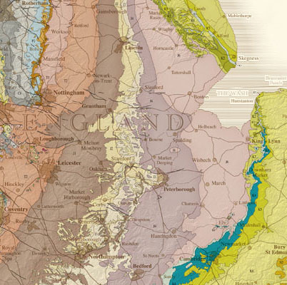
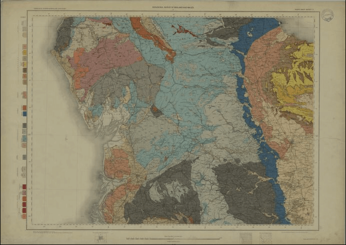
The BGS publishes specialist maps and reports on the geology, geophysics and resources of the UK and several other countries via its online shop. The shop also runs a service creating bespoke reports and maps specific to your area.
Many of our maps and publications are also available to view for free online via our publication viewer and map portal.
GeoReports provides cost-effective access to unique sources of published and unpublished geological data, combined with expert advice from BGS scientists.
If you are interested in ground conditions for drilling, investigation or house purchase or if you are concerned about subsidence or radon then GeoReports can help you.
With the use of extensive knowledge and expertise, we can provide services to support your organisation through projects designed to address your specific question or challenge. We use our full range of skills and services from geological mapping, 2D, 3D, and 4D modelling, evidence review and analysis, laboratory testing, real time monitoring, digital workflows and earth observation to work with you.
We deliver projects across the whole of the UK and have an extensive international profile, both on- and offshore.
We work with both the public and private sectors; our public task is delivered through our core funding and we are also commissioned to deliver specific programmes and projects for all levels of Government and public bodies.
Expert advice and information
- succinct to substantive reports
- peer review papers
- policy briefings
- spatial analysis such as GIS
- modelled outputs
Surveying and monitoring
- geological surveying
- seismological monitoring
- geophysical survey
- earth observation
Investigation and site assessments
- engineering investigation for new build/infrastructure and management of older assets
- geological site assessments for all types of installations (eg. wind farms, power stations and pipelines)
- regional scale surveys (e.g. utility company area, local authority) to national surveys
- resource (water, mineral and energy) assessments
- hazard/geohazard
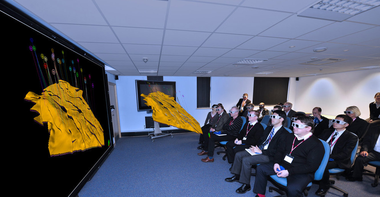
Cutting-edge geological modelling systems
We are developing a National Geological Model of the UK’s subsurface to give decision makers greater clarity in planning for the future. The model is supported by databases and graphical tools for the management, editing and visualisation of geological subsurface interpretation and models. We have invested heavily in techniques and expertise in 3D and 4D modelling and can provide solutions in these formats which can significantly reduce the need for expert interpretation.
Types of projects
- international development
- energy resource evaluation, including conventional, unconventional and renewable energy
- carbon capture, utilisation and storage (CCUS)
- energy storage
- water, particularly groundwater expertise in resource evaluation, monitoring and protection
- marine survey and interpretation, including drilling, and seabed survey for resource mapping to offshore wind siting
- environmental e.g. contamination of the ground or water, environmental impact assessments
- mineral expertise on mineral resources, mineral planning, policy and legislation, sustainable development, statistics and exploration at MineralsUK
- multi-hazards including earthquakes, volcanoes, landslides and tsunamis
- shallow geohazard assessments, including specialist advice for managing geotechnical and buried assets such as cabling and pipelines
- radioactive waste
- geoscience informatics
BGS capabilities are not limited to this list. Please contact us directly to see if we are able to support you.
We have a range of science facilities including geochemical, geotechnical, fluid processes and mineralogy, petrology, microanalysis and imaging laboratories. The laboratory facilities are available for research grants and commercial users.
We coordinate a range of customer groups and consortiums that focus on research questions that are relevant to multiple organisations, for example pre-competitive energy research, geomagnetism services and seismology monitoring.
We also operate the UK’s earthquake monitoring network, capable of detecting earthquakes as low as 2ML across the whole of the UK and considerably below that in some areas.
The BGS’s National Earthquake Information Service (NEIS) provides members with earthquake alerts by text and email, as well as direct access to our earthquake analysis team, including an out-of-hours service. This allows members to get immediate information on an earthquake that may have affected their assets.
Repairs to the seismic network are prioritised in areas that affect member assets. Members are able to influence the development of the seismic network and the areas of research and development our seismologists pursue.
Need more information?
Find out more about our work
Our data and services
The BGS offers a range of services and information for businesses, home-owners, policymakers and the general public.
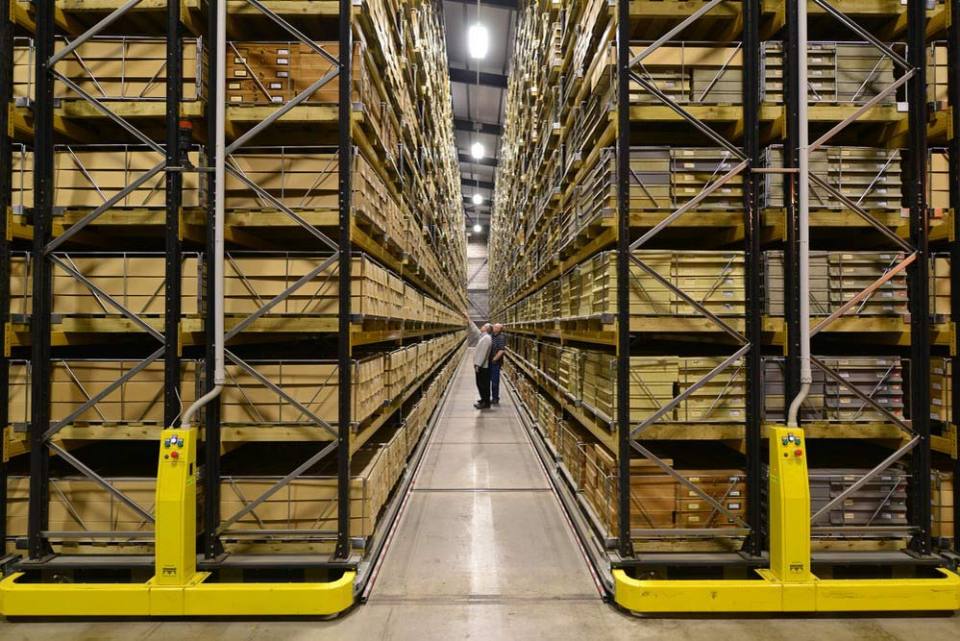
Data collections
Scans, photos and publications that are stored and managed by the BGS

Business development
BGS Business Development help identify and access funding, through commissioned research projects, partnerships, research grants, data licensing, and products royalties.
Related news

New NERC-funded project empowers young people to engage with environmental science
23/07/2026
BGS is part of a new, collaborative project, funded through NERC’s ‘Opening up the environment’ programme, helping the environmental research community become more accessible.

Geo-Explorers – after-school kids’ clubs
Event from 07/09/2026 to 07/12/2026
An after school club for junior geology enthusiasts

Building Europe’s geological future
20/07/2026
BGS scientists are contributing to a continent-wide initiative that is strengthening collaboration across borders to tackle shared subsurface challenges and unlock new opportunities.

Delving deep into mountains for future water security
16/07/2026
A BGS-led project is using new water-tracing investigation methods, geophysics and modelling to understand how water moves from mountains to the lowlands, helping to improve water security for billions of people.

Collecting beach pebbles: fun hobby but is it legal?
14/07/2026
The UK coastline will be inundated with keen holidaymakers this summer, many of whom will take a memento of their trip home in the shape of a pebble or two — but is it legal?

Updated national 3D model will determine the depth to the solid bedrock beneath our feet
13/07/2026
The BGS Superficial Deposit Thickness Model now includes an elevation model of geological rockhead for the first time, providing important data for civil engineers, geoscientists and environmental scientists.

UK’s world-class research organisations launch new collective
10/07/2026
The launch of the National Research Organisations Group brings together more than 100 science leaders to provide an authorativive voice on science, research policy and long-term investment.

Cheshire Geoenergy Observatory releases key geological datasets for UK thermal energy storage scheme design
09/07/2026
A new report and data packs from BGS will provide a unique resource for scientists working on the geology and hydrogeology of the Sherwood Sandstone Formation, an important aquifer and reservoir rock.

New geological mapping underway to help manage flooding along the River Tweed
08/07/2026
Scientists are surveying the Tweed catchment for the first time in over 100 years to enhance understanding of localised groundwater and improve flood forecasting.

Geological research in North Sea helping to safeguard subsea cables
06/07/2026
Subsea power and telecommunications cables are critical to the UK’s energy infrastructure and global connectivity, yet they remain vulnerable to damage from ship anchors, fishing activity and natural hazards.

UK Critical Minerals Intelligence Centre makes recommendations for the next UK criticality assessment
01/07/2026
CMIC has outlined the enhancements made to the next assessment update to ensure it is better tailored to the structure of the UK economy.

From archive to discovery: historical mineral reports support gold exploration in Scotland
25/06/2026
Digitised geological records show potential to unlock untapped mineral resources in Ardlochan, Argyllshire.