The BGS manages marine data, information and material as part of the National Geoscience Data Centre (NGDC), the Marine Environment Data and Information Network (MEDIN) geology data archive centre (DAC) and the National Geological Repository (NGR).
Geological, geophysical and environmental data on the seabed and sub-seabed is used to underpin the marine geoscience undertaken by the BGS and the wider user community in the UK and beyond. The data is used for a range of purposes, including the creation of BGS products such as the marine geoscience and seabed geology datasets.
Data is freely available online (where possible) under OpenGeoscience and the Open Government Licence. However, some data are not yet processed for online delivery and in these cases there may be a charge to cover data preparation. You can also deposit data with us.
Find out more about our work
GeoIndex (offshore)
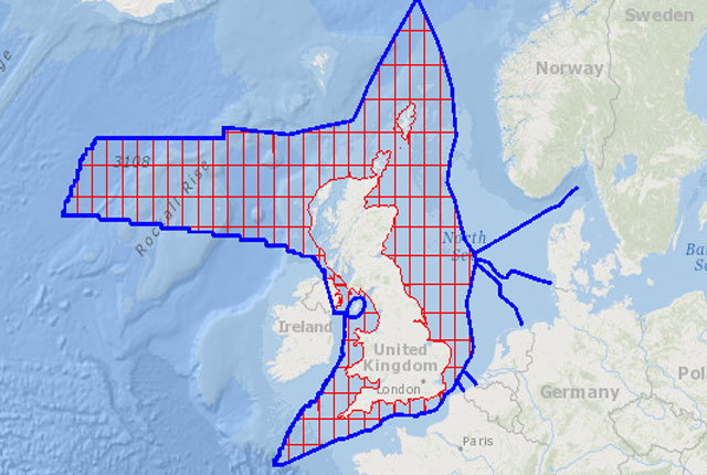
The offshore GeoIndex shows the range of marine geoscience data held by the BGS within the National Geoscience Data Centre (NGDC).
MEDIN Data Archive Centre
The BGS is the accredited Marine Environment Data and Information Network data archive centre for geology, geophysics and backscatter data.
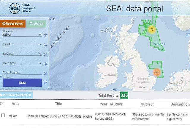
Strategic environmental assessment (SEA) data portal
Free access to available information and reports which have been produced through the Department for Business, Energy & Industrial Strategy (BEIS) SEA process.
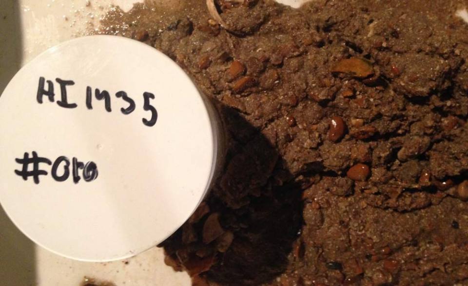
Maritime and Coastguard Agency Civil Hydrography Programme sediment samples
The National Geological Repository at BGS stores material from samples which are routinely collected from the seabed during Civil Hydrography Programme (CHP) Hydrographic Instruction (HI) surveys.

Sea floor: marine geoscience
Providing independent and expert geological advice, research and data acquisition to anyone working in the marine environment.
BGS marine products
Seabed sediments 250K

Offshore bedrock 250K
Further information
- The Marine Environmental Mapping Programme UK (MAREMAP) was a coordinated network of UK sea floor and shallow geological mapping. Maps are available to view via the offshore GeoIndex.
- The BGS is part of the European Marine Observation and Data Network (EMODnet), working with partner geological surveys (Euro-Geosurveys) and others to improve access to marine data, products and metadata. We are partners in:
- EMODnet Bathymetry high-resolution seabed mapping (HRSM) project
- EMODnet ingestion project, aiming to streamline the data ingestion process and connect marine data holders not yet connected to existing infrastructures. Deposit data via the EMODnet ingestion portal.
- EGDI is the EuroGeoSurveys’ European Geological Data Infrastructure. It provides access to pan-European and national geological datasets and services from the Geological Surveys of Europe.
- The BGS is the co-ordinator of the European Consortium for Ocean Research Drilling (ECORD) Science Operator (ESO) consortium that implements mission-specific platform (MSP) expeditions on behalf of the International Ocean Discovery Program (IODP). Access data from previous expeditions.
- Geo-Seas was an EU FP7 project to expand the SeaDataNet infrastructure to marine geological and geophysical data.
- OneGeology is an international initiative of the geological surveys of the world to ‘make web-accessible the best available geological map data worldwide at a scale of about 1: 1 million’. The results can be seen on the OneGeology portal.
- The National Hydrocarbons Data Archive (NHDA) is a long–term data archive of geoscientific legacy data resulting from UK offshore oil and gas exploration and production activity. The NHDA was operated by the BGS under agreement with Department of Energy and Climate Change (now BEIS).
Need more information?
You may also be interested in


National Geoscience Data Centre
Collecting and preserving geoscientific data, making it available to a wide range of users and communities.
MEDIN Data Archive Centre
The BGS is the accredited Marine Environment Data and Information Network data archive centre for geology, geophysics and backscatter data.