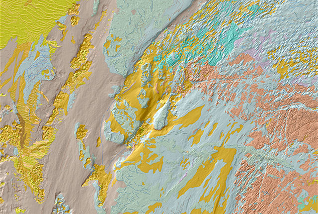

Section of the BGS Seabed Geology 10k Anglesey map, featuring combined bedrock, sediment and geomorphology interpretations. These resources provide valuable information to support policy and decision makers, as well as developers of offshore renewable energy. Contains data acquired by the MCA a 2.5 km nd by Defra © Crown Copyright 2022
BGS Seabed Geology
- 1:10 000 – 1:50 000
- Regional
- Open
The seabed geology map dataset covers regions on the UK’s continental shelf and details the substrate geology, structural geology and seabed geomorphology.
Supporting documents:
User guides are available via the links in the map series table in the page below.
Key information
- Scale:
- 1:10 000 – 1:50 000
- Coverage:
- Regional
- Availability:
- Open
- Format:
- Free to view via online map viewer
- Uses:
- Regional-level use
- Themes:
- Geology, Marine geoscience
BGS has initiated a programme of mapping the seabed geology of the UK’s continental shelf, the first effort to consistently characterise the geology of the seabed in over 20 years. These new, fine-scale maps provide detailed and accurate characterisation of the seabed geology, integrating substrate geology, structural geology and seabed geomorphology.
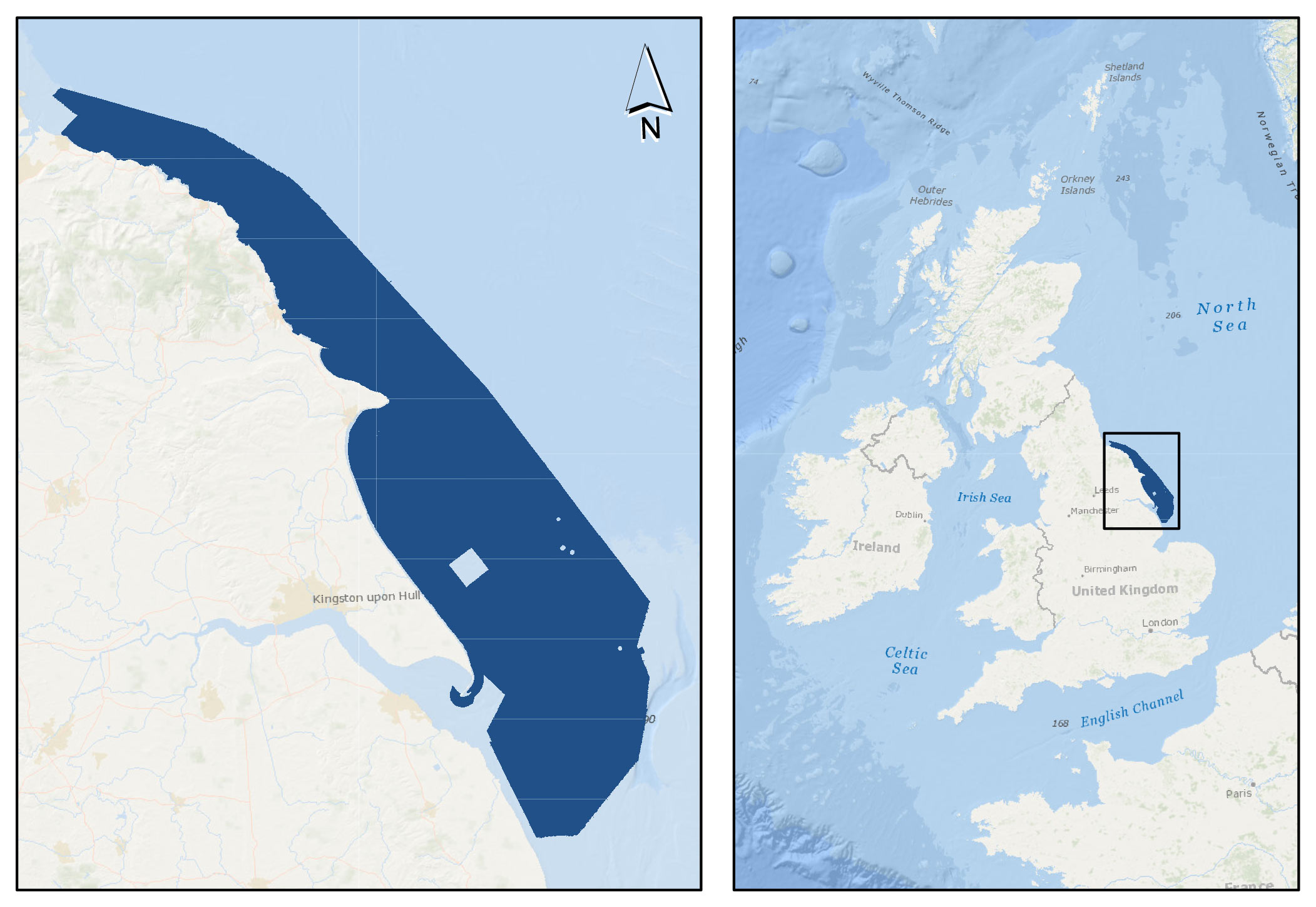
Dark blue area shows the coverage of the BGS Seabed Geology 10K: offshore Yorkshire map. Background image from World Ocean Base dataset compiled by Esri, Garmin, GEBCO, NOAA NGDC, and other contributors. Basemap created using ArcGIS. Copyright © Esri. All rights reserved. www.esri.com
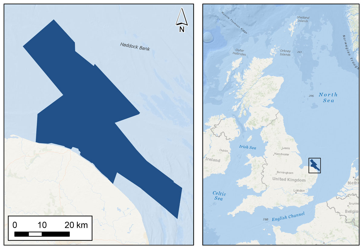
Dark blue area shows the coverage of the BGS Seabed Geology 10K: East Anglia. Background image from World Ocean Base dataset compiled by Esri, Garmin, GEBCO, NOAA NGDC, and other contributors. Basemap created using ArcGIS. Copyright © Esri. All rights reserved. www.esri.com
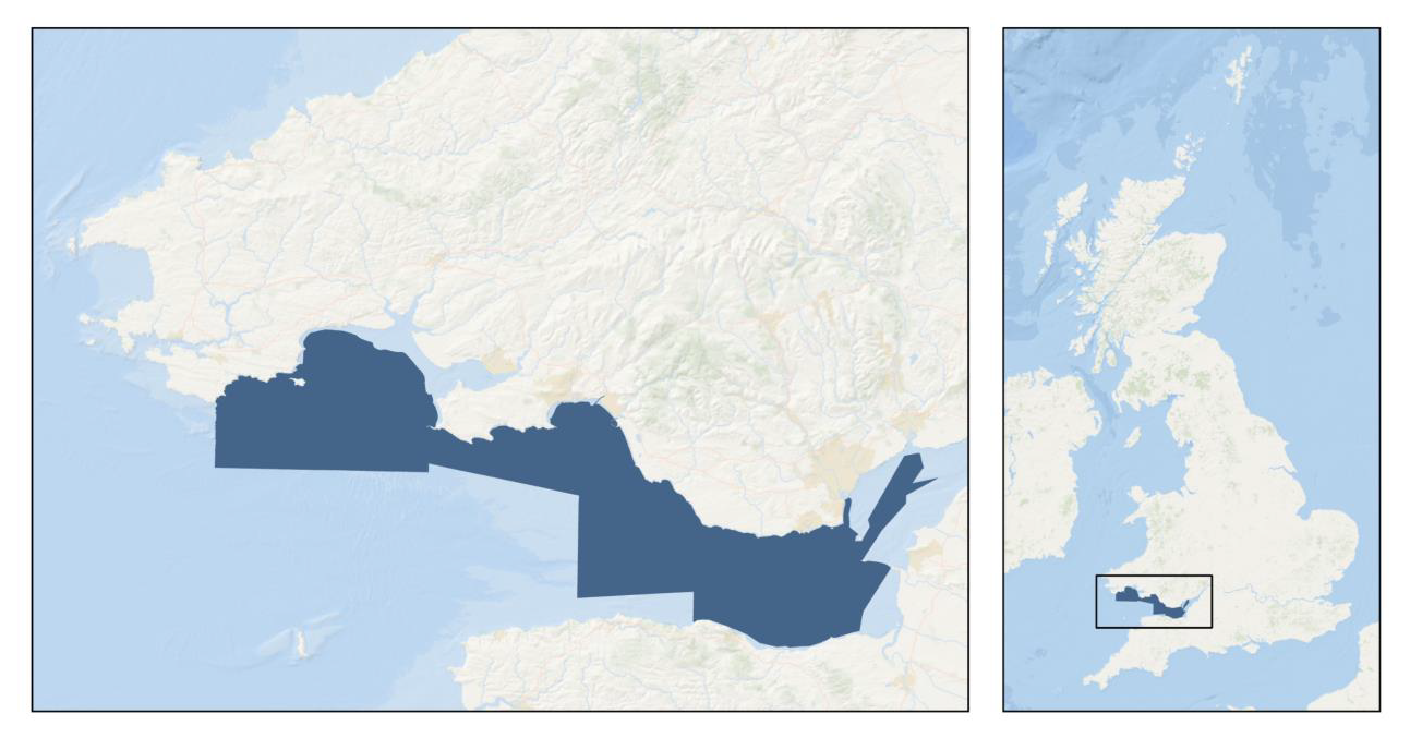
Dark blue area shows the coverage of the BGS Seabed Geology 10K: Anglesey map. Background image from World Ocean Base dataset compiled by Esri, Garmin, GEBCO, NOAA NGDC, and other contributors. Basemap created using ArcGIS. Copyright © Esri. All rights reserved. www.esri.com
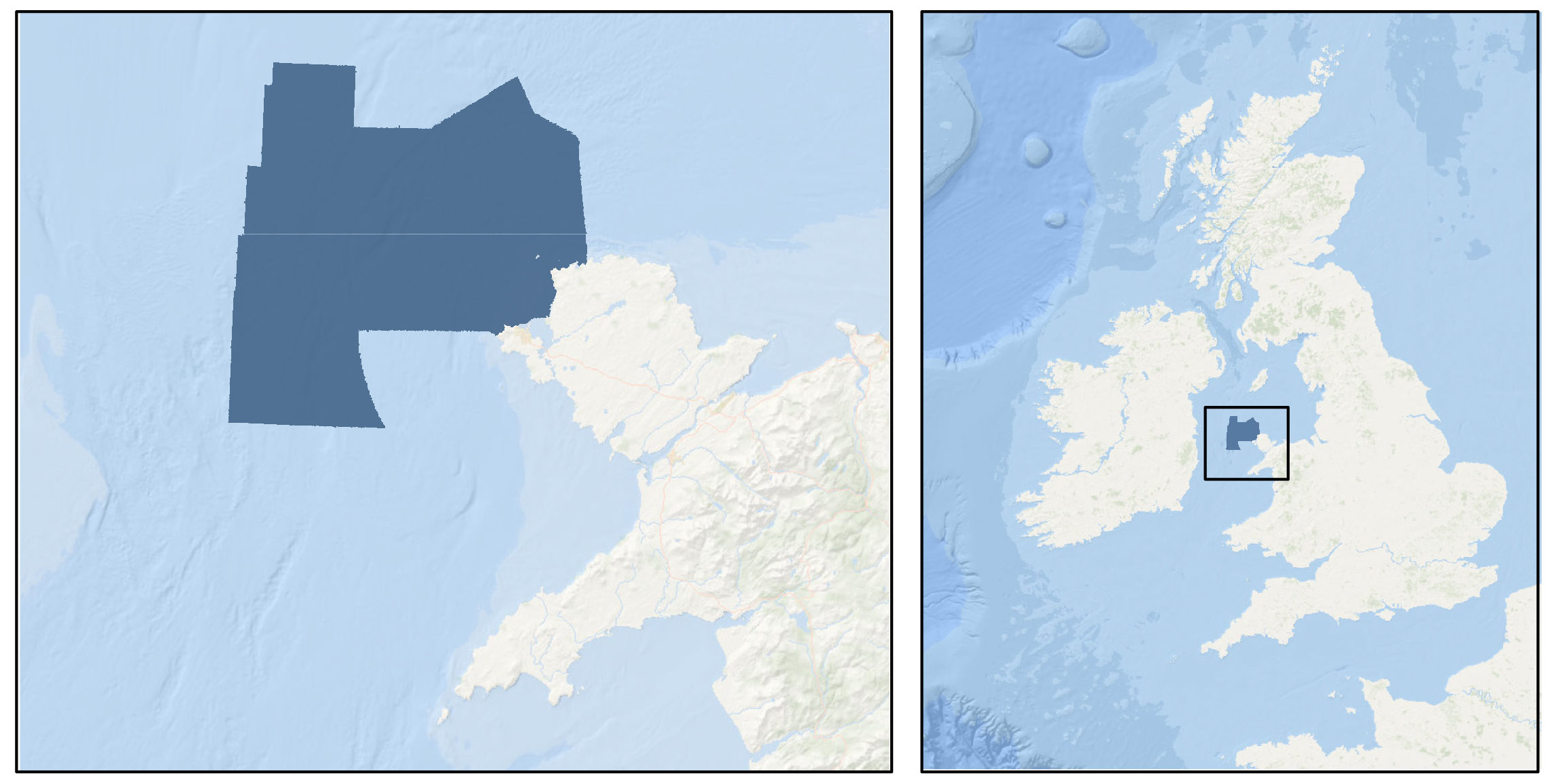
Dark blue area shows the coverage of the BGS Seabed Geology 10K: Bristol Channel map. Background image from World Ocean Base dataset compiled by Esri, Garmin, GEBCO, NOAA NGDC, and other contributors. Basemap created using ArcGIS. Copyright © Esri. All rights reserved. www.esri.com
The digital maps are intended as resources to support a diverse range of offshore activities and applications, including scientific research, offshore development, conservation initiatives and marine spatial planning and management.
The new mapping is based primarily on high-resolution bathymetry data produced by the UK Civil Hydrography Programme (CHP). Analysis and interpretation are further informed by secondary data and information resources, including:
- acoustic backscatter
- physical samples (for example grabs, cores and boreholes)
- seismic data
- academic and publicly accessible industry data and literature
- previous BGS mapping (onshore and offshore)
The CHP is administered by the Maritime and Coastguard Agency (MCA), with technical oversight, data validation and onward charting undertaken by the UK Hydrographic Office (UKHO).
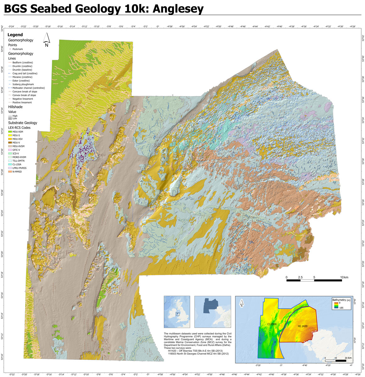
BGS Seabed Geology 10K: Anglesey map, showing geomorphology layers (lines and points), structural geology, substrate geology and hillshade. Contains OS data © Crown Copyright and database right 2020. The underlying hillshade image is derived from bathymetric data acquired by the MCA © Crown Copyright 2022, released under OGL.
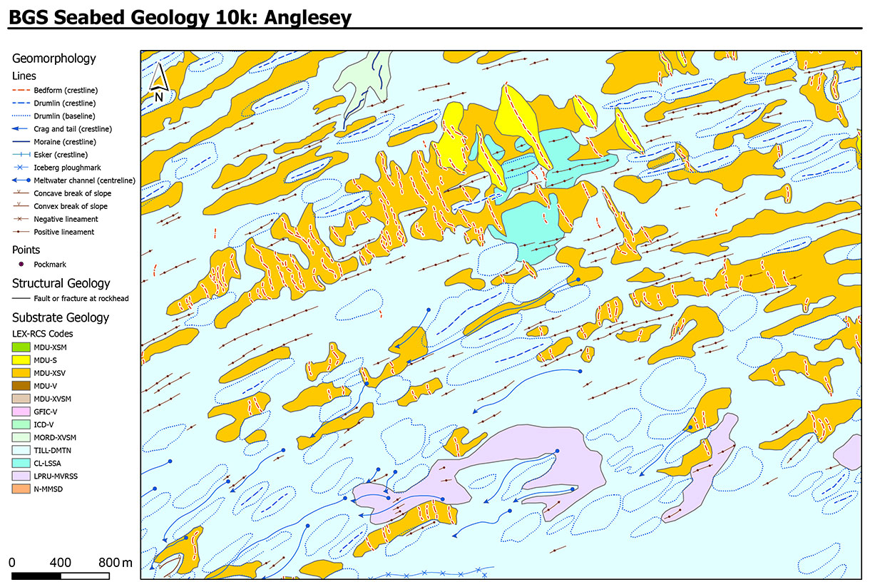
Section of the BGS Seabed Geology 10K: Anglesey map, showing geomorphology layers (lines and points), structural geology and substrate geology. Contains OS data © Crown Copyright and database right 2020.
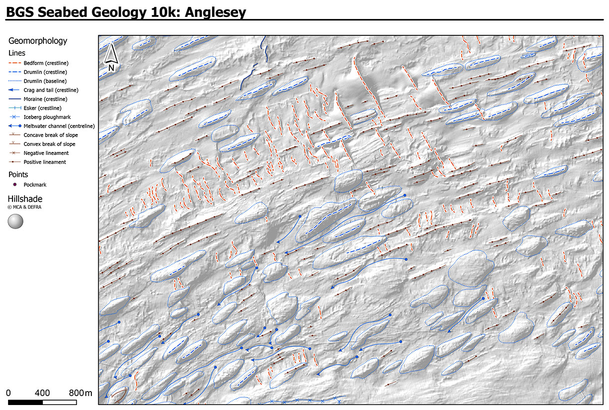
Section of the BGS Seabed Geology 10k: Anglesey map, showing geomorphology layers (lines and points) and hillshade. Contains OS data © Crown Copyright and database right 2020. The underlying hillshade image is derived from bathymetric data acquired by the MCA © Crown Copyright 2022, released under OGL.
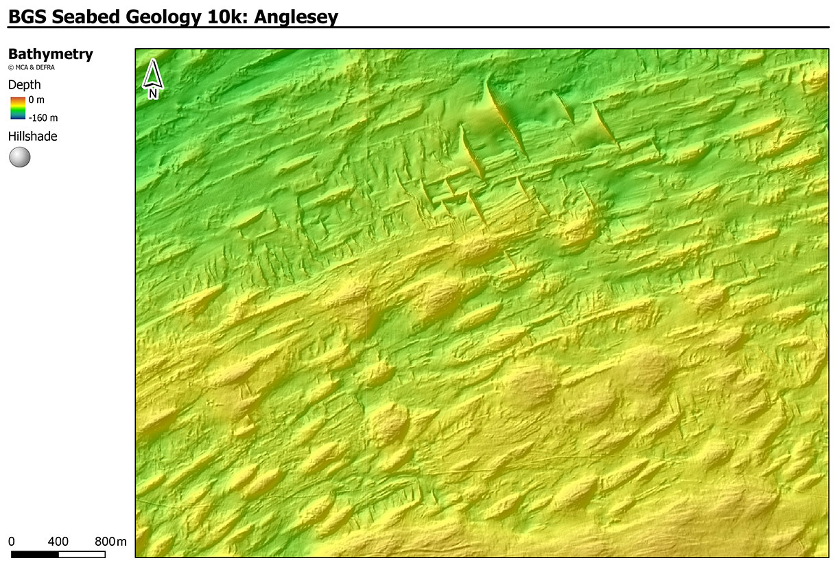
Section of the BGS Seabed Geology 10k: Anglesey map, showing bathymetry data (depth and hillshade). Contains OS data © Crown Copyright and database right 2020. The underlying hillshade image is derived from bathymetric data acquired by the MCA © Crown Copyright 2022, released under OGL.
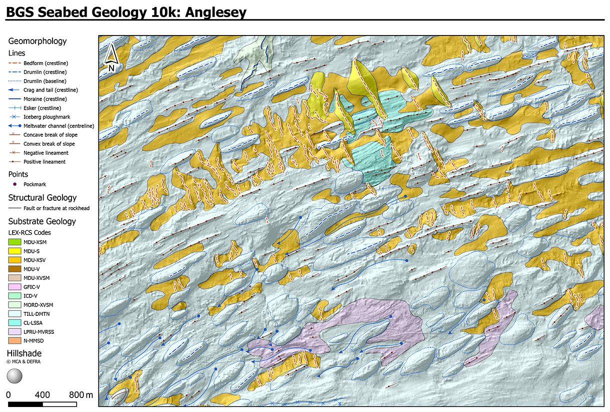
Section of the BGS Seabed Geology 10k: Anglesey map, showing geomorphology layers (lines and points), structural geology, substrate geology and hillshade. Contains OS data © Crown Copyright and database right 2020. The underlying hillshade image is derived from bathymetric data acquired by the MCA © Crown Copyright 2022, released under OGL.
Product summary
The fine-scale BGS Seabed Geology mapping comprise three complimentary components (or layers):
- substrate geology: distribution of bedrock and superficial geological units interpreted to be dominant within the top 1 m below seabed
- structural geology: principal structural features such as faults and folds observed at rockhead
- seabed geomorphology: physical morphology and interpreted geomorphic character of the seabed
Further detail on the mapping process and dataset characteristics are described within individual dataset user guides.

Available fine-scale maps
The BGS Seabed Geology maps can be viewed under the BGS fine-scale maps drop-down menu within the Offshore Geoindex. For information on licensing the downloadable GIS data (ESRI format), please contact digitaldata@bgs.ac.uk.
| Map | User guide | Further information |
|---|---|---|
| Anglesey | Available in NORA | Press release |
| Bristol Channel | Available in NORA | Press release Geology blog (from v1 mapping in 2022) |
| Dorset* | N/A | Research page |
| East Anglia | Available in NORA | Press release |
| Offshore Yorkshire | Available in NORA | Press release |
* Bedrock and structural geology only. The Dorset map was produced under the auspices of the Marine Environmental Mapping Programme (MAREMAP), in collaboration between BGS and the University of Southampton.
Relative topics
Related news

Geological research in North Sea helping to safeguard subsea cables
06/07/2026
Subsea power and telecommunications cables are critical to the UK’s energy infrastructure and global connectivity, yet they remain vulnerable to damage from ship anchors, fishing activity and natural hazards.

UK scientists unite for seabed mapping survey of the UK’s south-west coastline
15/04/2026
BGS geologists join research voyage, gathering crucial geological data to support offshore energy and infrastructure projects.

Updated geological assessment of the Southern North Sea set to underpin future offshore infrastructure development
25/03/2026
The first regional assessment for 30 years will support offshore marine and subsurface planning for the UK’s low-carbon energy infrastructure, including the 2030 target of 45 to 50 GW generated through offshore wind.

Extensive freshened water confirmed beneath the ocean floor off the coast of New England for the first time
09/02/2026
BGS is part of the international team that has discovered the first detailed evidence of long-suspected, hidden, freshwater aquifers.

Quaternary UK offshore data digitised for the first time
21/01/2026
The offshore wind industry will be boosted by the digitisation of a dataset showing the Quaternary geology at the seabed and the UK’s shallow subsurface.

Offshore Quaternary 250K
The 1:250 000-scale offshore geological map for quaternary geology (BGS Geology: marine quaternary 250k) is available digitally.

How the geology on our doorstep can help inform offshore infrastructure design
19/11/2025
BGS is part of a new collaboration using onshore field work to contextualise offshore data and update baseline geological models which can inform the sustainable use of marine resources.

Extended seabed geology map of the Bristol Channel published
07/10/2025
BGS has released significantly extended high-resolution maps that will support offshore green-energy initiatives in the area.

New seabed sediment maps reveal what lies beneath the waves
03/09/2025
Marine ecosystem science and offshore infrastructure will be boosted by a new dataset showing sediment composition across the UK continental shelf.

Seabed sediments 250K
This offshore Quaternary geology dataset shows the distribution of interpreted lithostratigraphical units within the shallow subsurface. The dataset represents the Quaternary geology immediately beneath the active seabed sediment layer.

Offshore bedrock 250K
The BGS Offshore Bedrock 250k dataset depicts the distribution of the different types of bedrock on the UK Continental Shelf.

IODP³-NSF Expedition 501: successful offshore operations launches onshore phase
06/08/2025
Scientists have managed to take water and sediment samples from beneath the ocean on the New England Shelf for the first time, with the intention of understanding this offshore aquifer system.
You may also be interested in:
BGS Predictive Seabed Sediments (UK)
The BGS Predictive Seabed_Sediments (UK) data provide digital maps of seabed sediment (SBS) composition across the UK Continental Shelf (UKCS).
Offshore bedrock 250K
The BGS Offshore Bedrock 250k dataset depicts the distribution of the different types of bedrock on the UK Continental Shelf.
Offshore Quaternary 250K
The 1:250 000-scale offshore geological map for quaternary geology (BGS Geology: marine quaternary 250k) is available digitally.
Seabed sediments 250K
This offshore Quaternary geology dataset shows the distribution of interpreted lithostratigraphical units within the shallow subsurface. The dataset represents the Quaternary geology immediately beneath the active seabed sediment layer.