Island groundwater management in the Philippines: part one — Boracay
BGS’s Andy Barkwith and Andy McKenzie travelled to the Philippines to undertake collaborative research and outreach with Filipino partners for a national hydrological modelling project. In this first blog, they discuss the first week of work on small islands.
19/04/2023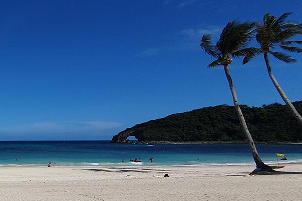

The hydrological modelling project is a partnership between BGS and governmental and academic institutions in the Philippines. It aims to improve the understanding of national water resources and identify the impact of future climate change and development on these resources.
After flying through multiple time zones and with far less than the recommended eight hours of sleep, we arrived bleary-eyed at Manila airport in the Philippines to meet our hosts from Ateneo de Manila University (ADMU). Our destination for the next few days was Boracay, billed as one of the most popular tourist hotspots in the Philippines. Thoughts of beaches, hammocks and mango ice cream filled our minds as we landed at Caticlan airport and were met by a live band at arrivals.
New Nabaoy river gauging station
We grabbed our suitcases and headed to our first stop, the Nabaoy river catchment Panay, to view a new river gauging station installed by ADMU and partners at the National Water Resources Board (NWRB). River gauging stations look at the flow and depth of the river, as well as some pollutants. There was a lot to discuss around groundwater residence times (the time water stays in the ground) and further development of sensors. With a light drizzle reminiscent of the UK we headed back into the bus to catch a boat to Boracay and, with the light fading, we made it to the hotel. The beaches would have to wait for tomorrow.
Rising early, the skies were blue and the breeze was warm and gentle. We met the ADMU and NWRB teams at breakfast to discuss the day’s work. Two hours later, we were back at the Nabaoy river, talking to the local mayor and various government departments about hydrogeology, modelling and climate before taking part in a ribbon-cutting ceremony. The river gauging station was officially open!
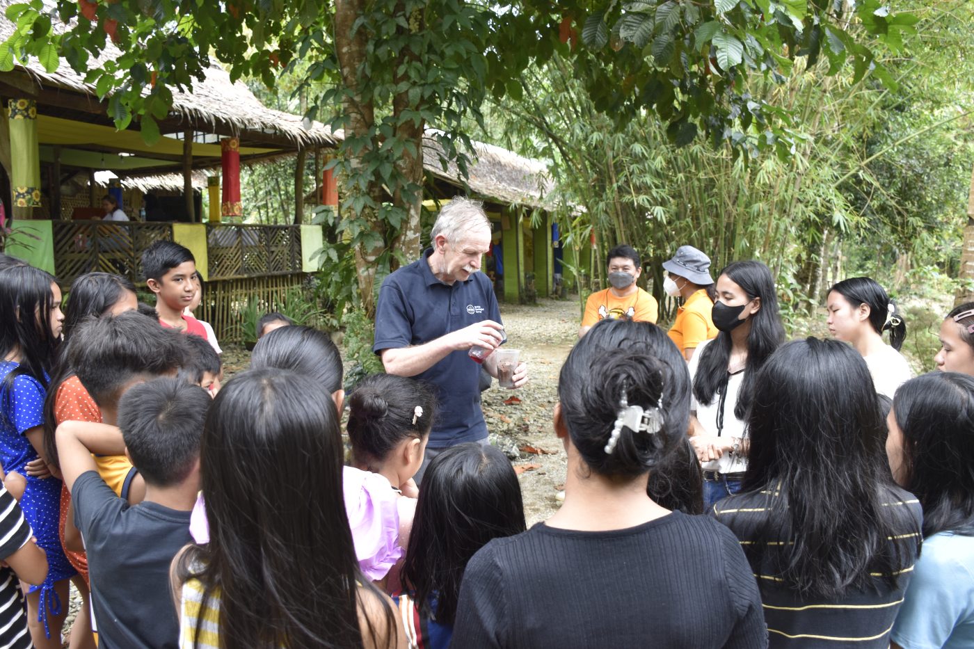
Andy McKenzie undertaking groundwater experiments with the local children in Boracay. BGS © UKRI.
We spent the remainder of the afternoon with the mayor and ran a series of groundwater experiments with local children, teaching them about water resources, pollution and hydrogeology. Once again, those world-famous beaches would have to wait…
Learning about Boracay
Wednesday began in a similar way to Tuesday, with a large breakfast and a discussion about the plan for the day. We boarded a bus and headed south, passing through the corridor of shops, cafes, homes and hotels that line Boracay’s western coastline. Again, we were greeted by local and regional government officials for a second ribbon-cutting ceremony at a new groundwater observation well. This time, Andy M was asked to wield the scissors.
An hour later, we were back at the hotel for a conference about the sustainability of water resources on the island. We learnt about the hydrology and ecology of Boracay and the Nabaoy watersheds, including some endemic, foot-long stick insects, and Andy B presented forecasts on the future of regional climate and hydrology up to the end of the century. This generated discussion around potential impacts on water resources and disaster recovery.
The next day we said our farewells to our project partners and headed to the beach for mango ice cream and to reflect on the last few days. The white sands and turquoise waters were the perfect way to unwind before ten days of delivering workshops, school sessions and training in Manila!
Vulnerability of small islands
The Intergovernmental Panel on Climate Change (IPCC) has identified small islands as high-risk settings facing adverse climate change impacts. They have limited, vulnerable resources and few freshwater sources. Small islands also have a high dependency on tourism in terms of exports and contribution to gross domestic product (GDP), however, tourism needs to be well managed to avoid deterioration of local water supplies.
Small islands present three key characteristics that make them particularly vulnerable to social, economic and environmental impacts:
- small size, which adds pressure on water resources and limits economic diversity
- isolation, which brings trading challenges, unique biodiversity and cultural richness
- maritime environment, leading to vulnerability to climate change
Understanding how climate change and differing tourism approaches impact hydrology provides a pathway to improved water security. Understanding and assessing impacts will require a unique approach integrating geosciences, social science and economics.
Funding
This fieldwork was undertaken as part of the International Geoscience Research and Development (IGRD) project ‘Geoscience to tackle global environmental challenges’. This is a £12 million project lasting until 2026, looking at challenges facing communities around the globe, including clean water availability, earth hazards and climate change impacts.
About the authors

Dr Andrew Barkwith
Associate Director of Operations
Relative topics

Building Europe’s geological future
20/07/2026
BGS scientists are contributing to a continent-wide initiative that is strengthening collaboration across borders to tackle shared subsurface challenges and unlock new opportunities.

Delving deep into mountains for future water security
16/07/2026
A BGS-led project is using new water-tracing investigation methods, geophysics and modelling to understand how water moves from mountains to the lowlands, helping to improve water security for billions of people.

Ukraine and the UK strengthen their commitment to geological cooperation
10/06/2026
A new Memorandum of Understanding reaffirms the UK’s support of Ukraine’s ambitions to develop its critical mineral resources, paving the way for collaboration through capacity-building programmes.

International science consortium to survey the health, economic value and social importance of Lake Victoria
22/05/2026
The project will replicate the 1927 survey to assess changes in the lake’s health, economic value and social importance.

New geological maps of Berwick-upon-Tweed to help future-proof natural water supply
20/05/2026
Scientists have mapped the geology under the town to better understand the groundwater system to inform decisions around abstraction.

BGS contributes to UN sand and sustainability report
19/05/2026
The new report highlights the impact of poor governance and unsustainable sand mining practices, calling on policymakers to take action.
BGS engineering geologist elected to CCOP
29/04/2026
Marcus Dobbs has been elected as vice-chair of the advisory group for the Coordinating Committee for Geoscience Programmes in East and Southeast Asia.

Strengthening capacity through partnership: a critical minerals perspective
28/04/2026
BGS has been working in partnership with the Geological Survey Department of Zambia (GSD) to build national capacity, improve data accessibility and support long-term, sustainable development.

New research could help provide a more reliable water supply for millions in rural Africa
24/03/2026
A new BGS-led study has revealed crucial insights into the longstanding challenges affecting the reliability and performance of rural water supply infrastructure in sub-Saharan Africa.

New UK/Chile partnership prioritises sustainable practices around critical raw materials
09/02/2026
BGS and Chile’s Servicio Nacional de Geología y Minería have signed a bilateral scientific partnership to support research into critical raw materials and sustainable practices.

Extensive freshened water confirmed beneath the ocean floor off the coast of New England for the first time
09/02/2026
BGS is part of the international team that has discovered the first detailed evidence of long-suspected, hidden, freshwater aquifers.

Hole-y c*@p! How bat excrement is sculpting Borneo’s hidden caves
23/12/2025
BGS researchers have delved into Borneo’s underworld to learn more about how guano deposited by bats and cave-dwelling birds is shaping the subsurface.