Pioneering tool expanding to analyse agricultural pollution and support water-quality interventions
An online tool that shows which roads are most likely to cause river pollution is being expanded to incorporate methods to assess pollution from agricultural areas.
06/02/2025 By BGS Press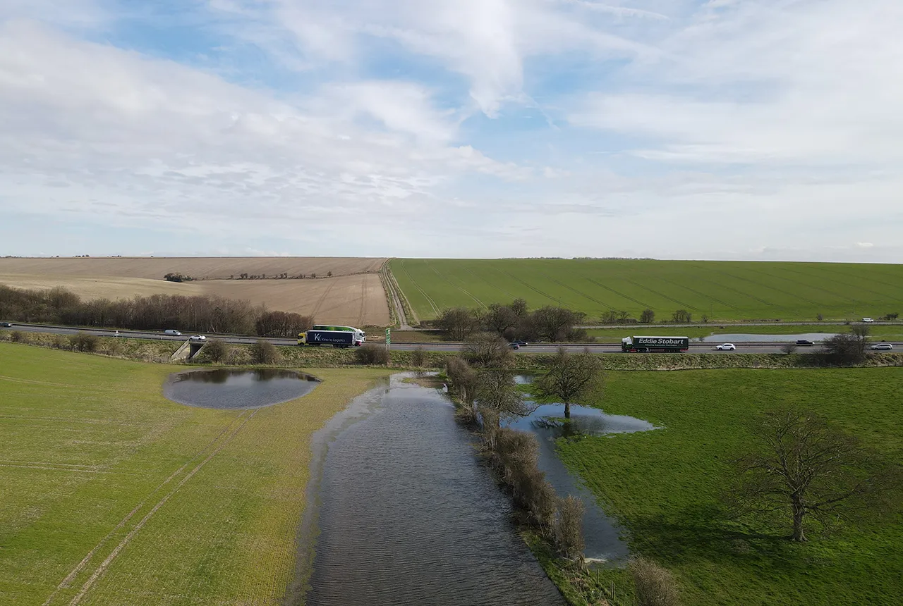

BGS’s first-of-its-kind online tool, Road Pollution Solutions, predicts which roads create the most run-off pollutants and how road pollution can be tackled with nature-based solutions. The tool helps local authorities to prioritise water-quality improvement interventions at roads where major road run-off pollution is occurring and in the greenspaces that lie between the roads and the rivers. It is now being extended to estimate the number of pollutants, including fertilisers and pesticides, that are transported into rivers in rural areas.
The first online map was launched in 2023 in London and was partly funded by the Mayor of London, Transport for London (TfL) and the Environment Agency. It now highlights more than 280 miles (450km) of the capital’s roads that have a higher risk of road run-off pollution. In total, the tool now covers roughly 3862.3 km (2400 miles or 10 per cent) of London’s major roads.
What causes the pollution?
Fertilisers, pesticides and animal waste in rural areas can run off into rivers, introducing chemicals and excess nutrients that can cause algal blooms, depleting oxygen and harming aquatic life. Similarly, run-off from roads can carry oil, heavy metals and other toxic substances into waterways, contaminating the water and affecting ecosystems. These pollutants not only harm wildlife but also threaten the quality of drinking water for communities.
How does the tool work?
The tool combines pollutant emission factors, local rainfall conditions, surface area and the make-up of traffic on particular routes, using official data to predict where pollution hotspots are likely to occur. Results are shown on an interactive map. The tool then suggests potential nature-based solutions, such as wetlands, ponds and rain gardens, alongside roads to manage pollution before the water discharges into streams or rivers.
The new, expanded tool
The expanded tool will be tested across the catchment of the upper River Thames, above Dorchester-on-Thames. This area is predominantly covered by arable crops and grassland, but it has varied geology and soils that affect the movement of water and pollutants through the landscape. It also includes urban areas and sections of the M4 and M40 motorways, which generate pollution in road run-off.
The project, which is funded by the Government Office for Technology Transfer, will last for 18 months.

The Road Pollution Solutions Tool, which was only launched just over a year ago, is already showing just how beneficial it is in highlighting which roads in London are at risk of road run-off pollution.
Expanding this tool further to include an integrated assessment of agricultural pollution risks means that we can assess these pollution sources and explore what can be done to reduce them.Chris Jackson, head of BGS Environmental Modelling.
Road Pollution Solutions is built on years of research by environmental charity Thames21 and its partner Middlesex University, as well as the South East Rivers Trust. The charity started its initial road runoff project identifying key polluting London roads in 2019, with funding help from the Greater London Authority, Transport for London and the Environment Agency.
Relative topics
Related news

Delving deep into mountains for future water security
16/07/2026
A BGS-led project is using new water-tracing investigation methods, geophysics and modelling to understand how water moves from mountains to the lowlands, helping to improve water security for billions of people.

Collecting beach pebbles: fun hobby but is it legal?
14/07/2026
The UK coastline will be inundated with keen holidaymakers this summer, many of whom will take a memento of their trip home in the shape of a pebble or two — but is it legal?

New geological maps of Berwick-upon-Tweed to help future-proof natural water supply
20/05/2026
Scientists have mapped the geology under the town to better understand the groundwater system to inform decisions around abstraction.

BGS contributes to UN sand and sustainability report
19/05/2026
The new report highlights the impact of poor governance and unsustainable sand mining practices, calling on policymakers to take action.

New research could help provide a more reliable water supply for millions in rural Africa
24/03/2026
A new BGS-led study has revealed crucial insights into the longstanding challenges affecting the reliability and performance of rural water supply infrastructure in sub-Saharan Africa.

PhD adventures in Copenhagen, Denmark: revealing past recovery processes of tropical forest systems through ancient environmental DNA
12/03/2026
PhD student Chris Bengt visited the University of Copenhagen to carry out very delicate extraction of aeDNA from lake-sediment cores, in the hopes of unlocking the secrets of past volcanic eruptions.

Extensive freshened water confirmed beneath the ocean floor off the coast of New England for the first time
09/02/2026
BGS is part of the international team that has discovered the first detailed evidence of long-suspected, hidden, freshwater aquifers.

Funding secured to help mitigate ground risk in UK construction sector
05/02/2026
The BGS Common Ground project has been awarded new funding to help unlock the value of ground investigation data.

Hole-y c*@p! How bat excrement is sculpting Borneo’s hidden caves
23/12/2025
BGS researchers have delved into Borneo’s underworld to learn more about how guano deposited by bats and cave-dwelling birds is shaping the subsurface.

New geological maps of the Yorkshire Wolds to better inform groundwater management and policy decisions
17/12/2025
The new mapping provides crucial data on localised geological issues that may assist in protecting water supplies.

New 3D model to help mitigate groundwater flooding
08/12/2025
BGS has released a 3D geological model of Gateshead to enhance understanding of groundwater and improve the response to flooding.

Latest BGS Geology 50K mapping data launched
06/11/2025
Some of our most widely used maps have received a major update, including the 1:50 000-scale map series that now includes enhanced coverage of Great Britain.