Virtual fieldwork during a global pandemic
Virtual field reconnaissance can help maintain research momentum during the COVID-19 pandemic.
03/03/2021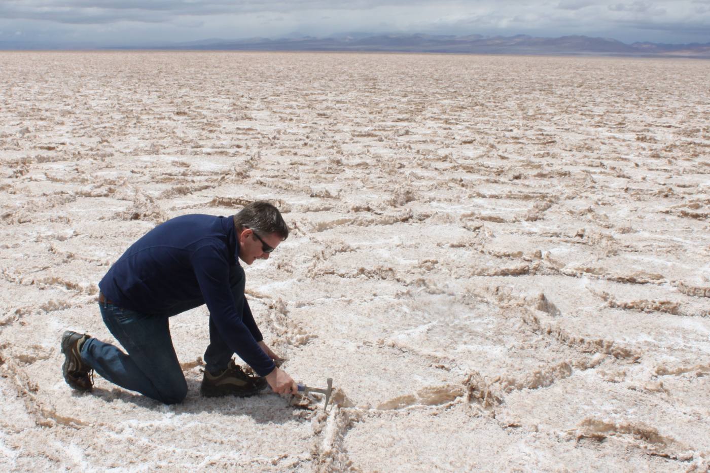

The demand for battery raw materials, such as lithium and cobalt, is increasing rapidly as we transition to a low-carbon economy and work towards net zero. The COVID-19 pandemic has disrupted normal working activities, including some of the ‘real-world’ geological fieldwork essential to the research that will help accelerate the shift towards zero-emission electric vehicles.
Geological research is a highly collaborative activity but, under current UK restrictions, fieldwork outside of the local area is very difficult to undertake. Focusing on lithium exploration, this article explains how virtual field reconnaissance can help maintain research momentum.
Virtual field reconnaissance
During the pandemic, BGS and Satellite Applications Catapult have been working in partnership with Yacimientos de Litio Bolivianos (YLB) on the Innovate UK-funded Use of innovative techniques to ensure lithium brine supply for the low-cost battery market project, which aims to better understand the lithium resource in the salt flats (salars) of South America. The research aim is not only to understand the sources of lithium in the volcanic rocks of the Andes Mountains, but also how it is liberated from these rocks and then transported, by surface water and underground water, to the salars.
Once the lithium is in the salar, we want to understand how it is deposited in the salt as the water evaporates. In addition, we seek to better understand how it can be moved around and concentrated by salt-rich brines. This research will lead to a better knowledge of lithium resource efficiency.

‘Resource efficiency means using the Earth’s limited resources in a sustainable manner while minimising impacts on the environment. It allows us to create more with less and to deliver greater value with less input.’
Geological mapping using satellite imagery
Remotely sensed satellite imagery and data play an important part in mapping the geology. Different rocks reflect different amount of sunlight in different regions of the electromagnetic spectrum; the satellites are able to record this information in infrared areas that the human eye cannot see. The imagery can therefore be processed to highlight reflections that characterise different rocks and minerals, meaning the geologist can see these subtle differences.
Understanding the geometric relationships between different geologies is crucial to understanding their ages and position in the succession. High-resolution terrain models, when combined with the processed satellite imagery in the GeoVisionary 3D environment, allow these relationships to be easily understood.
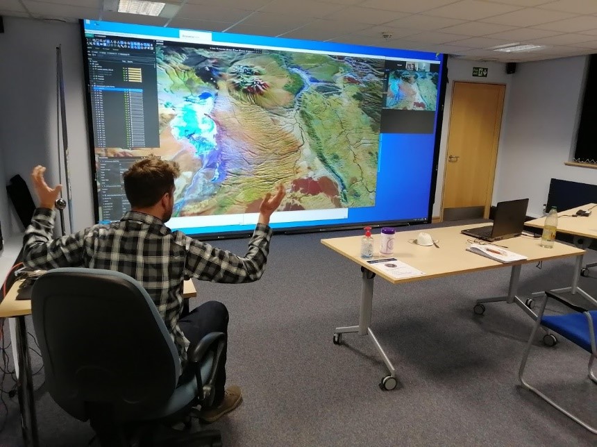
Collaborative working in the BGS 3D room using GeoVisionary and Zoom. Two BGS geologists were able to work, socially distanced, in front of the large screen whilst colleagues from the Satellite Applications Catapult joined the discussion and could see the 3D visualisation remotely. Landsat-8 image courtesy of the US Geological Survey. BGS © UKRI.
Some of the key questions in Bolivia concern where the lithium originates and also where it is most likely to be picked up by water to be transported to a salar. Geological processes and understanding tell us that it is the ignimbrites (deposits of ash, glass and rock particles following explosive pyroclastic flows), rather than the extrusive lavas, that will be richer in lithium. However, the majority of the lithium will reach the surface and groundwater from modern sediments (sands and gravels) that have eroded from the ignimbrites.
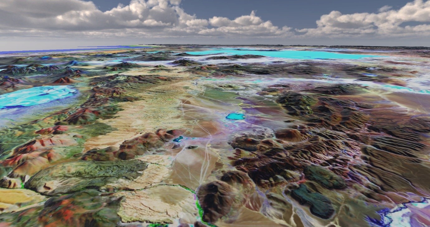
The GeoVisionary environment allows for effective virtual field work: here the extrusive lavas (the ridge to the left) are overlain by the ignimbrites (the yellow, ‘rilled’ area in the centre). In the centre are more recent sediments derived from the lavas and ignimbrites. Landsat-8 image courtesy of the US Geological Survey. BGS © UKRI.
GeoVisionary was already a proven environment for more effective and targeted fieldwork. In this case it proved to be an excellent means by which the entire project team could collaborate effectively and clearly, overlaying and analysing multiple datasets all within a single context-rich tool.
The outcomes of using GeoVisionary for virtual reconnaissance fieldwork have been to identify:
- geometrical relationships and hence relative ages of different rock types
- ignimbrites
- sediments derived from the ignimbrites
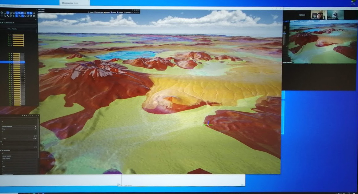
GeoVisionary’s ability to display the current geological map allows areas to be targeted. In this case, the yellow polygon indicates recent sediments where water has increased the opportunity to dissolve lithium. These sediments can be subdivided, based on their spectral signature, into those derived from lavas and those from ignimbrites. Note Satellite Applications Catapult colleagues on video conference call in corner of the screen. BGS © UKRI.
About the author
Luke Bateson
Acting head of shallow geohazards and Earth observation; head of geodesy and remote sensing (Keyworth)
More information
Find out more about virtual reconnaissance fieldwork and 3D visualisation systems or contact BGS Enquiries.