Summary
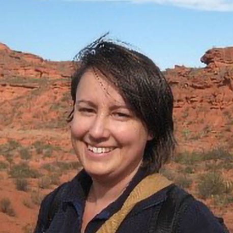
Kathryn leads the Products Development – Hazard & Resilience Modelling Team, incorporating a broad-range of licensed datasets as well as managing the Natural Hazards Project that provides the range of ‘GeoSure’ products for the BGS. After graduating with an MSc in Applied Environmental Geology from Cardiff University, Kathryn began her career gaining substantial experience in Cretaceous geology. This was followed by a 3 year secondment working within the Central Directorate of BGS, before focussing on geohazards research and data product development. She has a wealth of international experience in European consortiums and was the BGS hub manager of the global OneGeology Initiative for 7 years that brought together geological surveys around the world to make geological map data available via the web and advance the technical methodologies to do this. Her research focusses on geohazards, particularly slope stability (landslide) and shrink-swell clay, with particular reference to future climate change and the multiple effects of compound geohazards such as flooding and landslides.
Kathryn Lee’s Biography
- 2013 – ongoing : Team Leader Hazard & Resilience Modelling. Responsibile for a broad range of BGS’s derived licensed datasets, development and ongoing research.
- 2011 – ongoing : Manager DigMap-Plus project. A multidisciplinary project that creates value-added datasets aimed at a number of target customers including engineering, soil scientists and researchers.
- 2010 – ongoing : Manager of Natural Hazards Project. Current research activities are in the areas of shrink swell clays and landslide hazard potential. New mobile applications are being developed. New dataset for Insurers is being developed.
- 2008 – ongoing : Landslide geohazard survey and monitoring team. Field experiece in a number of areas in the UK including the Isle of Wight, Yorkshire and Derbyshire.
- 2008 – 2010 : Project leader Geological Indicators of Flooding: a BGS dataset highlighting areas of potential flooding as indicated by the geological deposits.
- 2007 – 2013 : Project coordinator OneGeology: manager of the OneGeology secretariat team, based at BGS. A multi-national initiative to make available geological map data for the world.
- 1997 – ongoing : Geologist, British Geological Survey
- 1997 – 2008 : Survey Geologist: Extensive experience of field surveying and mapping of geological deposits as well as 3D geological modelling and borehole interpretation. Work primarily within the Cretaceous, Jurassic and Tertiary strata of the Hampshire and Weald Basins, the South Downs, Wiltshire and Southern Midlands.
- 1996 – 1997 : MSc Applied Environmental & Engineering Geology, University of Cardiff
- 1992 – 1995 : BSc (Hons) Geology 2:1. Anglia Polytechnic University.
Research interests
- Engineering properties and the provision of relevant datasets fundamental to engineering projects across the UK.
- geohazards, particularly river scour, slope stability (landslide) and shrink-swell clay, with particular reference to future climate change and the multiple effects of compound geohazards such as flooding and landslides.
Current projects and collaborations
- BGS Civils: Engineering properties datasets
- Natural Geohazards (GeoSure) project manager
- 2016 – ongoing : 2016 – present: Scour project lead. A new initiative to develop geoproperty data as a 3-tier nested framework model to assess the risk of river scour. Kathryn has led the initiative and gained support and input from a range of stakeholders. Commissioned assessments are available.
Publications
- BOOTH, K A, D DIAZ DOCE, M HARRISON, GWILDMAN. 2010. User Guide for the British Geological Survey GeoSure dataset. British Geological Survey Internal Report, OR/10/066. 17pp
- BOOTH, K. WILDMAN, G (eds). BGS 2010. Geological Indicators of Flooding: User Guidance Notes. British Geological Survey Openfile Report,. OR/10/064. 16pp
- BOOTH, K.A.; HOPSON, P.M.; FARRANT, A.R.; NEWELL, A.J.; MARKS, R.J.; BATESON, L.B.; WOODS, M.A.; WILKINSON, I.P.; EVANS, D.J. 2010. Geology of the Devizes district: a brief explanation of the geological map Sheet 282 Devizes. Nottingham, UK, British Geological Survey, 32pp. (Explanation (England and Wales Sheet), 282).
- Booth, K.A.; Brayson, J. 2011 Geology, landscape and human interactions : examples from the Isle of Wight. Proceedings of the Geologists’ Association, 122 (5). 938-948. 10.1016/j.pgeola.2011.01.004
- Booth, Kathryn. 2011 Compound geohazards : planning for environmental change. [Poster] In: Cities, catchments and coasts: applied geoscience for decision-making in London and the Thames Basin, London, UK, 13 May 2011.
- Harrison, A M, Lee, K A, Holbrook, H W, Jones, L D., Freeborough, K A, Grebby, S. 2012b. Satellite derived soil moiture data and shrink swell research: Final report. British Geological Survey Internal Report OR/12/138.
- K A LEE, R LAWLEY, D ENTWISLE. 2012. User Guide DiGMapPlus+ Engineering Properties: Excavatability dataset (version 1). British Geological Survey Open Report, OR/12/044
- K A LEE, R LAWLEY, D ENTWISLE. 2012. User Guide DiGMapPlus+ Engineering Properties: Strength dataset (version 1). British Geological Survey Open Report, OR/12/043
- OneGeology: a global tool for geological data provision and outreach Kathryn A LEE, Joanna THOMPSON1, Gemma NASH1, Abigail K BURT. Abstract proceedings, International Geological Congress, Brisbane. 2012.
- PENNINGTON, C. V. L., BOOTH, K. AND FOSTER, C. 2010. Landslide Geohazard: the BGS approach to identification, documentation and data storage. Earthwise.
- Francesca Cigna, Deodato Tapetea, Kathryn Lee. 2017. Geological hazards in the UNESCO World Heritage sites of the UK: From the global to the local scale perspective. Earth Science Reviews.
- Entwisle, D C, Lee, K A, Lawley, R S. 2015. User Guide for ‘BGS Civils’ – a suite of engineering properties datasets. British Geological Survey Open Report, OR/15/065.
- LEE, K A, LAWLEY, R S. 2016. National-scale scour susceptibility assessment: a scoping study. British Geological Survey Internal Report, CR/16/175. 26pp.
Published outputs
Skills
- Cretaceous geology research
- Field geology and digital mapping
- Natural hazard geosciences research
- Project management


