Green infrastructure (GI), or ‘network of greenspaces’, can include parks, open spaces, playing fields, woodlands, street trees, allotments, private gardens, wetlands, road verges, and watercourses that create a physical connection for green habitats between grey, built-up areas.
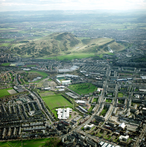

An aerial view across Edinburgh showing green infrastructure, Salisbury Crag and Arthur’s Seat. © NERC.
Project aim
This project explores the geological properties and ground conditions that can affect GI environments, with the aim of using geological data to analyse the suitability of an area of land for installation of new GI, or make existing GI more effective.
Measuring environmental suitability
Suitability of existing GI environments can be measured by factors such as the lithology and mineralogy of the superficial deposits, urban soil geochemistry, permeability, infiltration sustainable drainage and excavatability. Equally, geohazards such as flooding and ground instability may discourage land use for urban development, thereby opening opportunities for GI as a better, more viable investment. This helps to improve urban resilience against natural hazards, while creating spaces for recreation and biodiversity.
Demonstration SVGI map
A demonstration SVGI map is available at 1:50 000 scale to provide a case-study example of the data available. It offers a tool for urban councils and planners to inform the strategic planning of GI and their delivery based on geological information, which at the moment is largely under-represented in economic accounts of urban greenspace.
Contact
If you want to discover more then please contact Clive Cartwright.
You may also be interested in
Hazard and resilience modelling
Developing new and innovative data products that deliver geoscientific information to a range of users in an accessible form.