BGS collaborates with Icelandic colleagues to assess windfarm suitability
Iceland’s offshore geology, geomorphology and climate present all the elements required for renewable energy resources.
03/10/2024 By BGS Press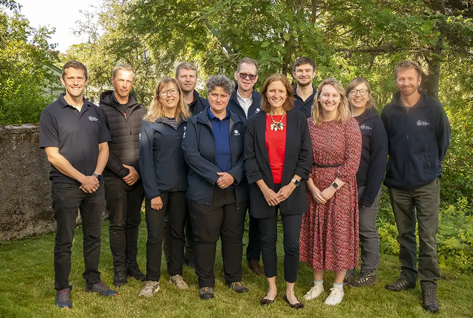

BGS and the Icelandic Geological Survey (ÍSOR) have been awarded an Arctic Office NERC grant to assess Iceland’s offshore geological and geomorphological landscapes for the suitability of windfarms. The grant enables BGS scientists to share their experience in offshore mapping, as well as working with wind developments.
Iceland fulfils its primary energy consumption with around 100 per cent renewable energy, via geothermal and hydro energy. Nowadays, there is a strong motivation to increase the country’s energy mix and energy security via wind power. Geology underpins the appropriate placement and foundation design for wind turbine structures. The NERC grant, which is supported by the Foreign, Commonwealth & Development Office, aims to facilitate knowledge sharing between BGS and ÍSOR about the geological classification of the seabed and subsurface, as well as the potential impacts on foundation design.
To help facilitate this partnership, Anett Blischke, a senior geoscientist at ÍSOR, led a week-long field trip in Iceland. Participants from BGS included Nicola Dakin, Andrew Finlayson, Dayton Dove and Duncan Stevens, who were joined by ISOR’s Árni Magnússon, Steinunn Hauksdóttir and Ögmundur Erlendsson, alongside Sigurður Friðleifsson from the National Energy Authority of Iceland (Orkustofnun).
Visiting Iceland presented a fantastic opportunity to see excellent analogue sites onshore that are often present in the UK’s offshore environment, such as glacial landforms and deposits. The field visits allowed us to discuss these sites, including the glacial moraine complex of Skeiðarársandur, how geoscience fits into the offshore wind development process in Iceland and its opportunities and challenges.
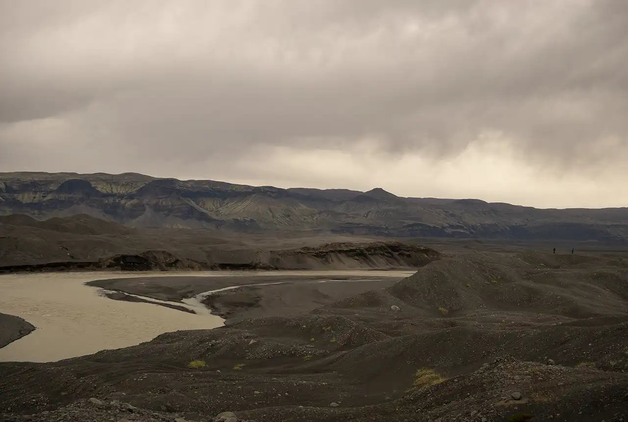
The moraine complex at Skeiðarársandur showing more than 50 m topography with boulders and coarse to fine sediments. At the right are BGS’s Dayton Dove and Duncan Steven, who are both about 1.83 m tall, for scale! Extensive sedimentary systems like Skeiðarársandur are sourced and shaped by the advance and retreat of glaciers over millennia. These processes have influenced the large volumes and types of sediment found where the land meets the sea and extends into the offshore environment. BGS © UKRI.
Visit to the British Embassy
The team was also invited to the British Embassy in Reykjavík to discuss the goals of the project. Embassy staff were eager to hear about the project goals and future collaborations around geology and renewables. During the visit and in her role as task lead of the Geological Service for Europe’s ‘Optimised windfarm siting’ work package, Nicola Dakin highlighted the benefits of the first deliverable to the European Commission: using the new ‘Geo-Assessment Matrix’, which will develop the first draft geological complexity maps offshore Iceland and European waters. Utilising existing datasets, such as EMODnet Geology, the maps aim to serve as a first-pass assessment showing areas that have low to high geological complexity. The maps will also highlight areas that require new data acquisition where the geology is unknown.
Fieldwork
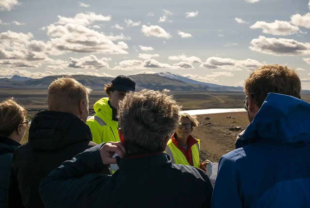
The team then travelled east to Landsvirkjun, the state-owned energy utility company, at Búrfell, which is an onshore wind turbine test site consisting of two turbines that have been in situ since 2012. Here, Landsvirkjun has been testing the development of onshore wind potential, using the powerful and persistent winds in the Icelandic highlands. Environmental impact assessments have been important to ensure that the effects on the area are minimised and a 200 MW windfarm has received development approval.
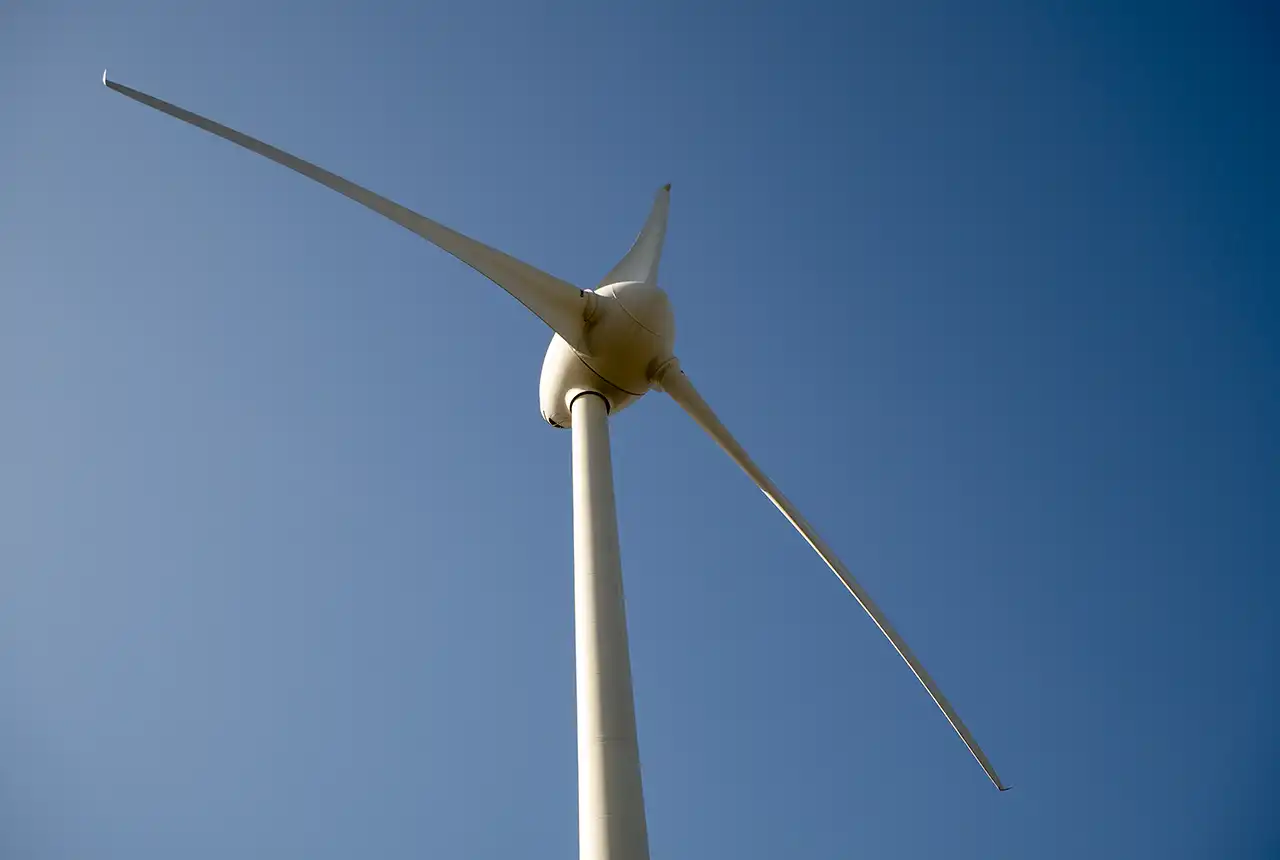
Búrfell wind farm, Búrfellslundur. BGS © UKRI.
View of Hekla stratovolcano, within 15 km south–west of the proposed onshore windfarm site. BGS © UKRI.
The field trip continued along south Iceland’s coastal ribbon, where the team observed active volcanic, tectonic, sedimentary and glacial processes, the effects of sea level changes, and geohazards. Such onshore analogues are critical to understanding the geological processes found in offshore environments. Starting in the west, at Stokkseyri, and travelling to Jökulsárlón (‘Diamond Beach’) in the east, the team visited a range of geological outcrops and sites highlighting the variety of tectonic, sedimentary and volcanic challenges.
South Iceland offers a variety of geological features that can be studied to better understand the offshore environment: variable topography, ancient lava flows and glacial landforms tens of metres high. Understanding depositional environments, such as those around Svínafellsjökull, is key to understanding their effects on sedimentology and any possible engineering implications in advance of foundation design and installation.
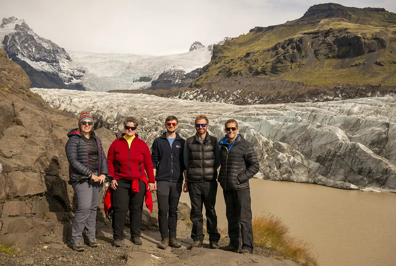
Svínafellsjökull. From left to right: Nicola Dakin (BGS); Anett Blischke (ÍSOR); Duncan Stevens (BGS); Dayton Dove (BGS); Andrew Finlayson (BGS). BGS © UKRI.
The final study location of Melasveit consists of an outcrop near Akranes, north-west of Reykjavík. The locality exposes ancient glaciotectonised sediments in a cliff section along the beach (Sigfúsdóttir et al., 2018). This cross-section is an excellent analogue to the lateral and vertical heterogeneity, and possible geotechnical impacts, of glaciotectonised sediments, which are also observed in windfarm sites the North Sea.
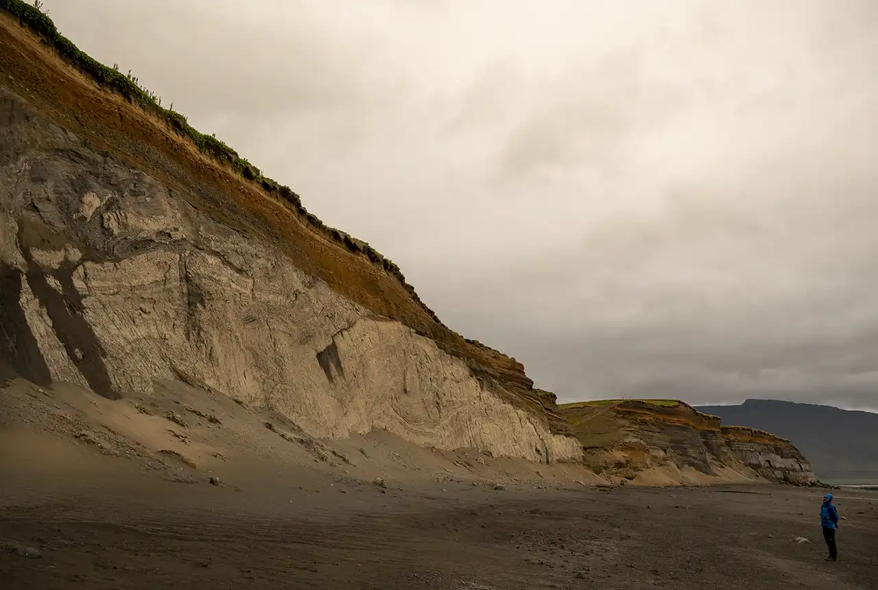
Melasveit, near Akranes. Glaciotectonised sediments in the beach cliff section. Right: Dayton Dove (BGS). BGS © UKRI.
The final, fortuitous and (naturally) most spectacular geological phenomenon was a visit to the fissure eruption that began during our visit on 22 August 2024 near the Blue Lagoon and the Svartsengi geothermal energy plant. Icelandic authorities closed the roads to protect people; however, the eruption and lava flows can be observed safely from the roadside.
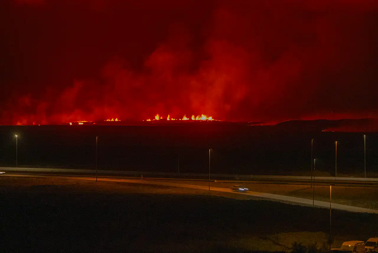
Fissure eruption near Akranes, which started 22 August 2024. BGS © UKRI.
Future collaboration
Iceland is a country full of opportunity regarding offshore wind potential. The geohazards and geological constraints in the offshore environment require a full assessment to better understand the influence on foundation types and design. BGS openly welcomes ÍSOR and Orkustofnun for further workshops and continuing our collaboration in the future.
More information
Field guide
A detailed field guide summarising the visited sites is available online.
References
Sigfúsdóttir, T, Benediktsson, Í Ö, and Phillips, E. 2018. Active retreat of a Late Weichselian marine‐terminating glacier: an example from Melasveit, western Iceland. Boreas, Vol. 47(3), 813–836. DOI: https://doi.org/10.1111/bor.12306;
Relative topics
Related news

Delving deep into mountains for future water security
16/07/2026
A BGS-led project is using new water-tracing investigation methods, geophysics and modelling to understand how water moves from mountains to the lowlands, helping to improve water security for billions of people.

Cheshire Geoenergy Observatory releases key geological datasets for UK thermal energy storage scheme design
09/07/2026
A new report and data packs from BGS will provide a unique resource for scientists working on the geology and hydrogeology of the Sherwood Sandstone Formation, an important aquifer and reservoir rock.

UK and Philippines scientists investigate natural hydrogen generation processes at atomic scale
22/06/2026
BGS researchers were granted access to use the Diamond Light Source facility in order to study hydrogen in light brighter than the sun.

Shortage of end-of-life materials presents challenge to UK critical minerals security
17/06/2026
A new report by the UK Critical Minerals Intelligence Centre reveals insufficient end-of-life material stocks present a supply risk over the coming decade, but offer significant long-term potential to meet critical mineral demand through recycling.

UK geothermal catalogue receives update
16/06/2026
BGS releases the second digital version of the UK geothermal catalogue of subsurface temperature and rock thermal conductivity measurements and heat flow calculations.

Ukraine and the UK strengthen their commitment to geological cooperation
10/06/2026
A new Memorandum of Understanding reaffirms the UK’s support of Ukraine’s ambitions to develop its critical mineral resources, paving the way for collaboration through capacity-building programmes.

International science consortium to survey the health, economic value and social importance of Lake Victoria
22/05/2026
The project will replicate the 1927 survey to assess changes in the lake’s health, economic value and social importance.

BGS contributes to UN sand and sustainability report
19/05/2026
The new report highlights the impact of poor governance and unsustainable sand mining practices, calling on policymakers to take action.
Natural hydrogen research
Understanding aspects of the natural hydrogen value chain on a national and international level.
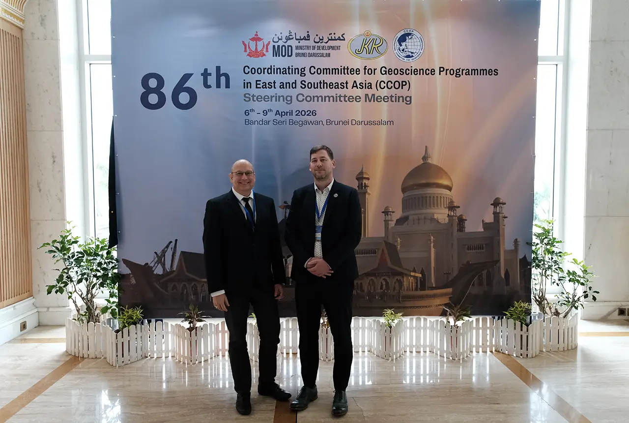
BGS engineering geologist elected to CCOP
29/04/2026
Marcus Dobbs has been elected as vice-chair of the advisory group for the Coordinating Committee for Geoscience Programmes in East and Southeast Asia.

Strengthening capacity through partnership: a critical minerals perspective
28/04/2026
BGS has been working in partnership with the Geological Survey Department of Zambia (GSD) to build national capacity, improve data accessibility and support long-term, sustainable development.

Updated geological assessment of the Southern North Sea set to underpin future offshore infrastructure development
25/03/2026
The first regional assessment for 30 years will support offshore marine and subsurface planning for the UK’s low-carbon energy infrastructure, including the 2030 target of 45 to 50 GW generated through offshore wind.