Great Britain has a long and diverse history of mining activity, resulting in the extraction of over 60 commodities. Materials raised range from metals, for example tin, lead and copper, to building stones, including the Northamptonshire ironstones (sandstone), slate and Portland limestone. Small-scale mining activities supporting local industries such as jet, graphite, ganister (silica-rich sandstone) and talc are also included.

Groverake fluorospar mine, Weardale. © NERC.
Hazards caused by old mine workings
Historic mining activity has resulted in a legacy of underground voids that, particularly where shallow, may lead to collapse, manifesting at surface from shallow depressions to sinkhole-like structures. This type of damage can lead to financial loss for anyone involved in the ownership or management of property in former mining areas, including householders, developers and local government.
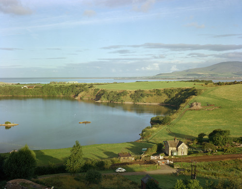
Park Sop, Dalton-in-Furness, Cumbria. These lakes formed in depressions caused by subsidence in haematite (iron ore) mines. Old mine shafts can be seen on the eastern bank (right). © NERC.
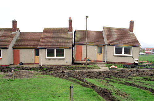
Houses affected by subsidence of old limestone mines in Ferniehill, Edinburgh. Mining stopped in 1829 but subsidence occurred in 2000. Many homes were lost; costs reached hundreds of thousands of pounds. © NERC.
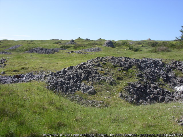
Old lead mine workings dot the landscape at Halkyn Mountain, North Wales. © John Harrison.
Costs resulting from the presence of old workings include increased insurance premiums, depressed house prices and, in some cases, engineering works to stabilise land or property. However, armed with knowledge about potential issues, preventative measures can be put in place to alleviate the impact to people and property.
The mining hazard dataset
The BGS mining hazard dataset combines geology, which constrains the distribution of workings, with records obtained through extensive literature searches to identify areas of past working. The result is a national dataset indicating the likelihood of the presence of past underground mining.
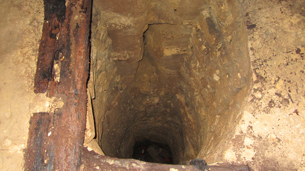
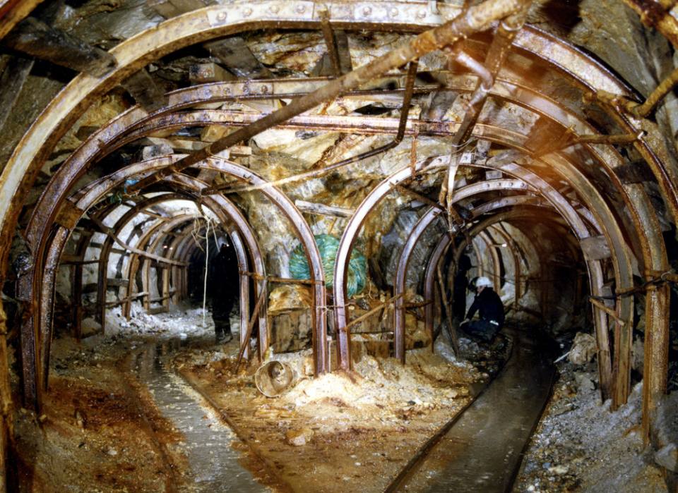
A shaft in the Box Ground underground quarry in Wiltshire. This shaft is inaccessible from the surface. © NERC.
The dataset was created by grouping the 60 commodities worked into seven broad categories:
- evaporites, e.g. gypsum; salt
- chalk
- vein minerals, e.g. tin; copper; lead
- bedded ores, e.g. ironstone
- building stones, e.g. sandstone; limestone; slate
- oil shale (for the extraction of hydrocarbons)
- other commodities including, but not limited to:
- talc
- pigments such as raddle or ochre
- ganister
- graphite
A second phase of processing collates the data into a single, comprehensive resource showing the location of known (non-coal) mining areas and describes the potential hazard associated with each site.
Zone of influence
Underground workings are surrounded by an area of ground that is affected by additional stresses due to its proximity to the working and may therefore be subject to subsidence. The extent of this area is controlled by multiple factors including depth, competence of overlying beds and extent of working. However, these may be partially mitigated by other aspects such as type and depth of working. This area is known as the ‘zone of influence’ (ZOI).
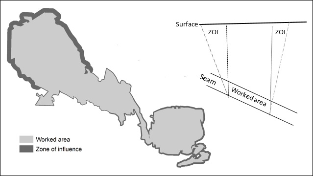
Left: the plan shows a variable width of the ZOI, which can result from a number of factors (depth to working; thickness of seam worked; dip of bed, etc.) © BGS/UKRI.
Right: the section shows the impact a dipping seam can have on the surface extent of the ZOI. © BGS/UKRI.
ZOIs have been extensively studied in relation to coal mining: we are currently conducting research to explore the calculation of ZOIs associated with other types of mining.
Current research will develop a methodology to calculate the potential surface expression of this subsidence area. Initially the study will focus on room-and-pillar mining to obtain an understanding of the mechanisms involved in determining the ZOI.
Case study
The Long Meg gypsum mine in Cumbria has been used to develop a case study with which to establish the methodology. Further testing will be carried out using other evaporite sites, oil shale workings and extended to other mining types.
Other research and development
- Development of a database of subsidence events including sinkholes and both natural and artificial mine collapse, particularly related to climate-induced occurrences.
- Continued development of the BGS mine plan collection to support 3D modelling and aid understanding of mining-related subsidence events.
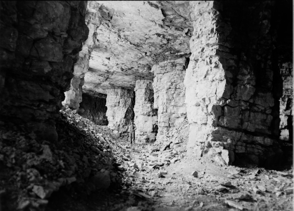
Middleton limestone mine, Midlothian, showing pillar-and-stall extraction (1945). © Crown copyright.
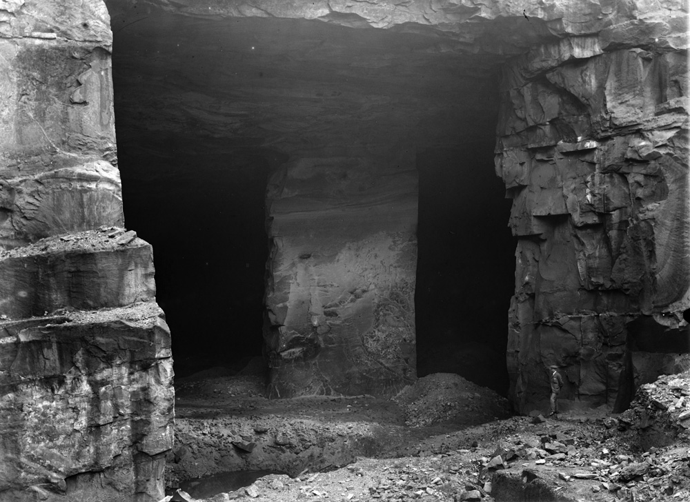
Huntershill quarry and mine, Glasgow. This was originally a quarry but then was mined by stoop-and-room (also called pillar-and-stall). Note the figure in the bottom right corner for scale. © Crown copyright.
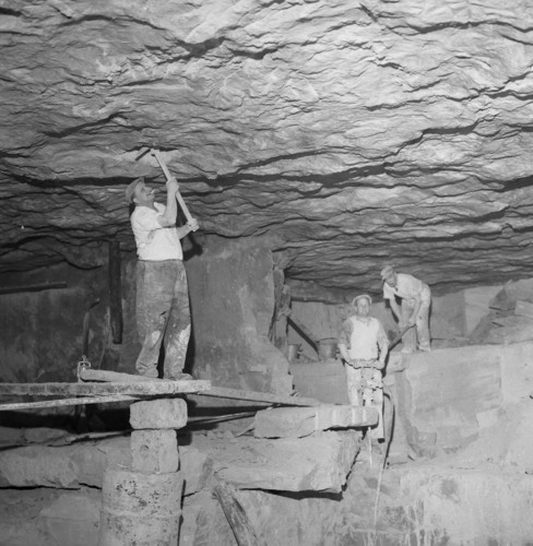
Miners working Bath Stone from Old Cleft Mine, Wiltshire. Smoking and balancing on bricks while using pickaxes are not recommended under current Health and Safety guidelines! Hugh O’Neill collection © NERC.
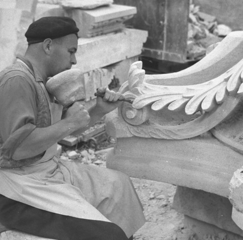
A stone mason carving a block of building stone at Bath & Portland Stone Firms Ltd. These blocks were used on college buildings at Oxford. Hugh O’Neill collection © NERC.
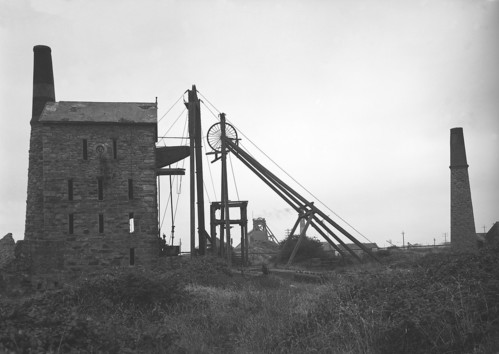
Agar Shaft engine, East Pool copper mine, Cornwall. This mine stopped production in 1945, but was taken over by the nearby South Crofty mine. Mine workings like this scatter the Cornish landscape. © Crown copyright.
Coal data
Mining of coal is specifically excluded from this dataset. Enquiries on past coal mining should be directed to the Coal Authority.
You may also be interested in

Hazard and resilience modelling
Developing new and innovative data products that deliver geoscientific information to a range of users in an accessible form.
Mining hazard (not including coal) coverage
The mining hazard dataset provides essential information for planners and developers building in areas of former shallow underground mine workings.
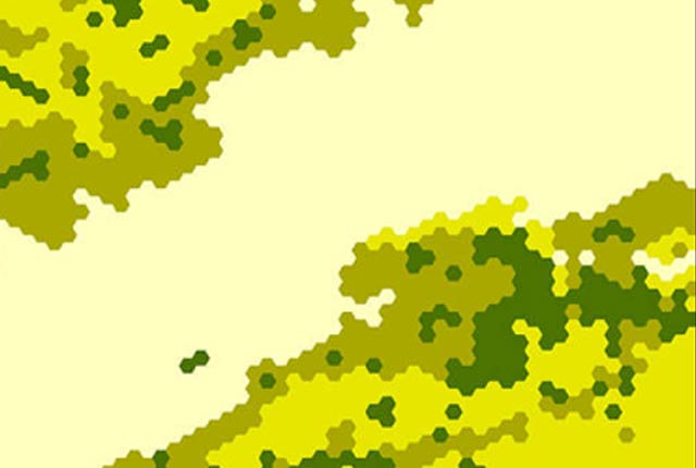
Mining hazard (not including coal) 1 km hex grid
This dataset provides a generalised overview of the likelihood for mining to have occurred.