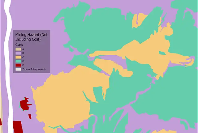

BGS mining hazard (not including coal) sample. BGS © UKRI.
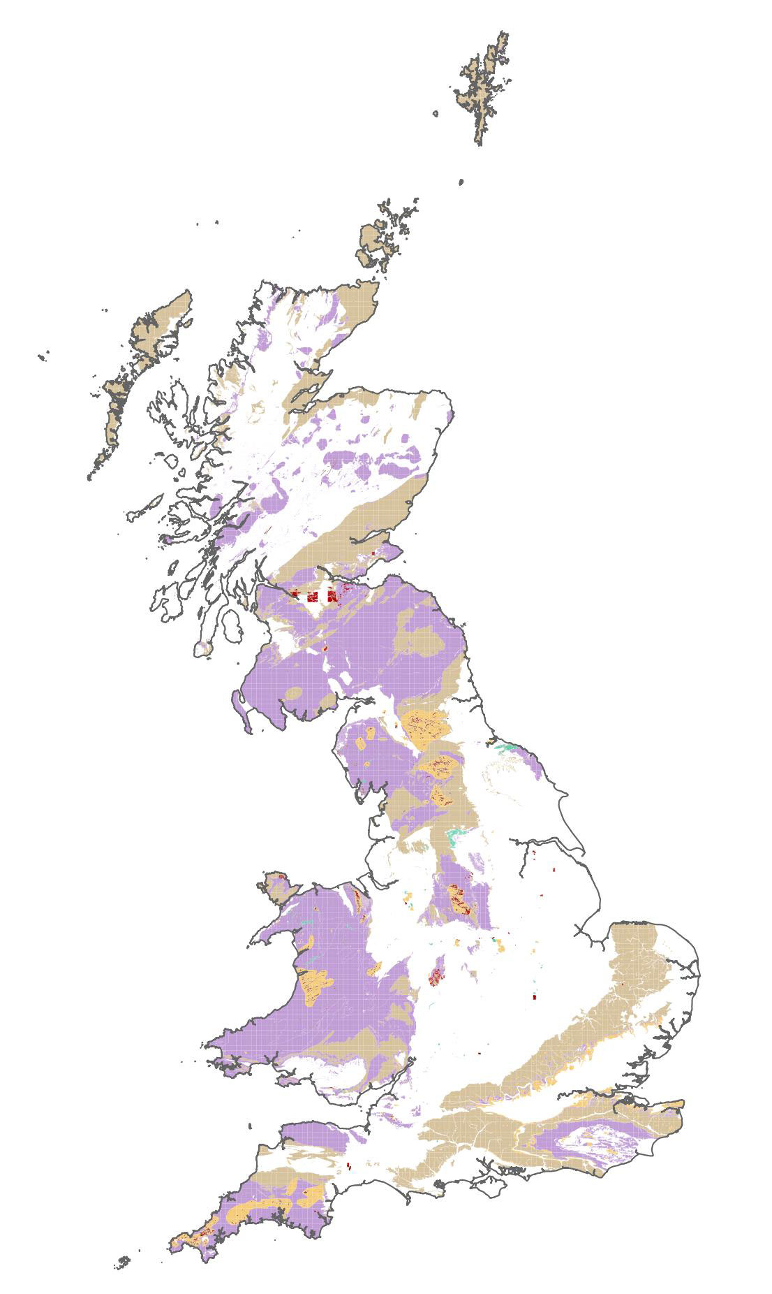
Mining hazard (not including coal) coverage
- 1:50 000
- Great Britain
- Premium
Former underground mine workings, particularly where shallow, may collapse and cause surface settlement. The mining hazard (not including coal) dataset indicates the potential for hazards due to the presence of underground (non-coal) mining.
Key information
- Scale:
- 1:50 000
- Coverage:
- Great Britain
- Availability:
- Premium
- Price:
£0.35 per km2. Subject to number of users, licence fee and data preparation fee.
- Format:
- GIS polygon data (ESRI, MapInfo, others available by request)
- Uses:
- Local-level to regional-level use
- Themes:
- Hazards, Mining and minerals
Underground extraction of rocks and minerals has taken place in Britain for more than 5000 years. A broad range of raw materials has been extracted using underground mining methods. These include ironstone, gypsum, lead, chalk and tin.
The voids resulting from past underground mining activity pose a possible hazard. Former underground workings, particularly where shallow, may collapse and cause surface settlement. The mining hazard (not including coal) dataset indicates the potential for hazards due to underground (non-coal) mining.
The mining hazard dataset draws together a diverse range of material derived from geology, which constrains distribution, supplemented by literature searches for historic locations and expert knowledge to assemble, interpret and organise the information.
The information has been compiled into a digital format using GIS to create a series of seven themes reflecting distinct categories of mining; each of these is the result of extensive research, specialist understanding and development and application of an appropriate method of data capture which are combined to deliver a single comprehensive mining hazard data layer.
The dataset identifies areas of known and recorded underground (non-coal) workings in Great Britain. Whilst this data in themselves are valuable, they only tell half the story. Any underground working will be surrounded by an area of ground, which is affected by additional stresses due to its close proximity to the working and subsequently may be subject to some degree of subsidence. The extent of this area is controlled by a number of factors including depth and extent of underground working but may be partially mitigated by other aspects such as type and size of working. This area is known as the zone of influence, which is now included in the dataset for known areas of working of evaporites, oil shales and building stones.
Mining of coal is specifically excluded from this dataset and enquiries on past coal mining should be directed to the Mining Remediation Authority.
This dataset provides essential information for planners and developers building in areas of former shallow underground mine workings that may collapse.
Mining hazards may lead to financial loss for anyone involved in the ownership or management of property, including developers, householders or local government. These costs could include increased insurance premiums, depressed house prices and, in some cases, engineering works to stabilise land or property.
BGS mining hazard (not including coal) sample. BGS © UKRI.
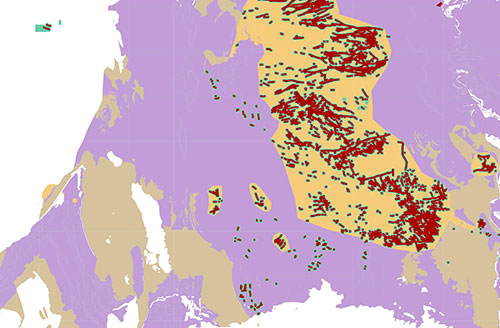
BGS mining hazard (not including coal) coverage. BGS © UKRI – Contains OS data © Crown copyright 2020.
Armed with knowledge about potential hazards, preventative steps can be put in place to alleviate the impact of the hazard to people and property. The cost of such prevention may be very low, and is often many times lower than the repair bill following ground movement.
You may also be interested in

BGS GeoSure
The BGS GeoSure datasets identify areas of potential hazard and, therefore, potential natural ground movement, in Great Britain.
Mineral resources
This dataset contains the geological distribution of all onshore mineral resources.