Scientists set sail to investigate high-resolution sea level, climate and coral reef records
BGS scientists are taking part in an expedition off Hawai'i to investigate sea-level changes recorded by ancient coral reefs.
25/09/2023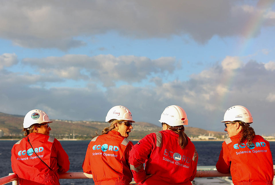

A two-month expedition, running from 31 August 2023 to 31 October 2023 and managed by a team from BGS, has set sail from Hawai’i. The aim of the expedition is to better understand sea level and climate sea change by recovering and researching ancient fossilised coral reefs.
There is a series of twelve fossil coral reefs off the coast of Hawai’i that may reveal the history of sea level change in the region and beyond. The International Ocean Discovery Program (IODP) Expedition 389: Hawai’ian drowned reefs will sample these fossil coral reefs, giving scientists the first opportunity to investigate such high-resolution sea level, climate and reef response records from the past half a million years.
The international team will sample the ancient reefs at water depths up to 1155 m to study how sea level and climate have changed, how coral reefs respond to these changes, and the links between global sea-level changes and global climate change. The high-resolution records will also provide a framework for evaluating the effects of climate change originating from human activity.
A total of 29 scientists from across the world will participate in the expedition, with 10 scientists onboard the MMA Valour, which set sail from Honolulu on 31 August 2023.

Previous mission-specific platform expeditions around Tahiti (IODP 310: Tahiti sea level) and the Great Barrier Reef (IODP 325: Great Barrier Reef environmental changes) currently provide us with a record of past conditions over the past 30 000 years, but the Hawai’i expedition will greatly extend this over the past 500 000 years.
Due to the rapid subsidence of the island, Hawai’i is a perfect location for us to conduct this research, because changes in sea level and global climate are preserved in a greatly expanded and near-continuous fossil coral record covering the last half a million years.
It should also help us to reconstruct sea-level change at a much higher resolution than previously possible, as well as investigating the volcanic evolution of Hawai’i itself.
Dr Hannah Grant, BGS Marine Geoscientist and expedition project manager
Hannah is joined on board by two other BGS staff members, Graham Tulloch (operations manager) and Mary Mowat (data manager). Initial analysis of the recovered coral cores will begin on the ship and continue at the onshore science party, which will take place in February 2024 in Bremen, Germany.
Expedition organisation
The expedition is organised by the ECORD Science Operator (ESO) under instruction from the European Consortium for Ocean Research Drilling (ECORD) as part of IODP. IODP is an international marine research collaboration that explores Earth’s history and dynamics using oceangoing research platforms to recover data recorded in sea-floor sediments and rocks, and to monitor subsea-floor environments.
More information
Relative topics
Related news

Geological research in North Sea helping to safeguard subsea cables
06/07/2026
Subsea power and telecommunications cables are critical to the UK’s energy infrastructure and global connectivity, yet they remain vulnerable to damage from ship anchors, fishing activity and natural hazards.

UK scientists unite for seabed mapping survey of the UK’s south-west coastline
15/04/2026
BGS geologists join research voyage, gathering crucial geological data to support offshore energy and infrastructure projects.

Updated geological assessment of the Southern North Sea set to underpin future offshore infrastructure development
25/03/2026
The first regional assessment for 30 years will support offshore marine and subsurface planning for the UK’s low-carbon energy infrastructure, including the 2030 target of 45 to 50 GW generated through offshore wind.

Extensive freshened water confirmed beneath the ocean floor off the coast of New England for the first time
09/02/2026
BGS is part of the international team that has discovered the first detailed evidence of long-suspected, hidden, freshwater aquifers.

Quaternary UK offshore data digitised for the first time
21/01/2026
The offshore wind industry will be boosted by the digitisation of a dataset showing the Quaternary geology at the seabed and the UK’s shallow subsurface.

Offshore Quaternary 250K
The 1:250 000-scale offshore geological map for quaternary geology (BGS Geology: marine quaternary 250k) is available digitally.

How the geology on our doorstep can help inform offshore infrastructure design
19/11/2025
BGS is part of a new collaboration using onshore field work to contextualise offshore data and update baseline geological models which can inform the sustainable use of marine resources.

Extended seabed geology map of the Bristol Channel published
07/10/2025
BGS has released significantly extended high-resolution maps that will support offshore green-energy initiatives in the area.

New seabed sediment maps reveal what lies beneath the waves
03/09/2025
Marine ecosystem science and offshore infrastructure will be boosted by a new dataset showing sediment composition across the UK continental shelf.

Seabed sediments 250K
This offshore Quaternary geology dataset shows the distribution of interpreted lithostratigraphical units within the shallow subsurface. The dataset represents the Quaternary geology immediately beneath the active seabed sediment layer.

Offshore bedrock 250K
The BGS Offshore Bedrock 250k dataset depicts the distribution of the different types of bedrock on the UK Continental Shelf.

IODP³-NSF Expedition 501: successful offshore operations launches onshore phase
06/08/2025
Scientists have managed to take water and sediment samples from beneath the ocean on the New England Shelf for the first time, with the intention of understanding this offshore aquifer system.