In June 2014, we were asked to carry out a terrestrial LiDAR survey of the Hellfire Caves in Buckinghamshire. These are a network of artifical chalk and flint caverns extending 500 m underground, situated above the village of West Wycombe at the southern edge of the Chiltern Hills near High Wycombe (Figure 1). The Faro Focus X-330 Terrestrial LiDAR Scanner (Figure 2) was used to carry out the survey, along with a Leica Viva GS15 GNSS unit.
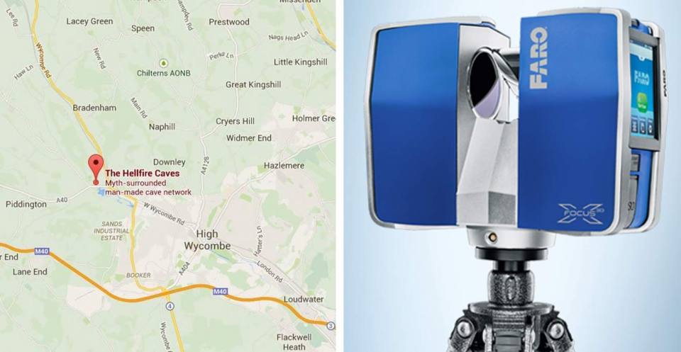

Figure 1 (left): location of the Hellfire Caves.
Figure 2 (right): a Faro Focus X-330 Terrestrial LiDAR Scanner. BGS © UKRI.
This was the first time that BGS had used this system and it required a completely different way of working. The method developed for use with the Focus X-330 relied on the accurate positional control of a fixed GNSS point outside the cave system and the use of spherical prisms, checkerboard targets and planar surfaces as markers by which to ‘tie’ the scans together. At least four of these markers were visible in every two adjoining scans, meaning that at least eight markers were visible in each separate scan; in other words, four markers were visible to both scans two and three and four markers were visible to both scans three and four, so scan three sees both sets of markers. This pattern was repeated throughout all 42 separate scan locations.
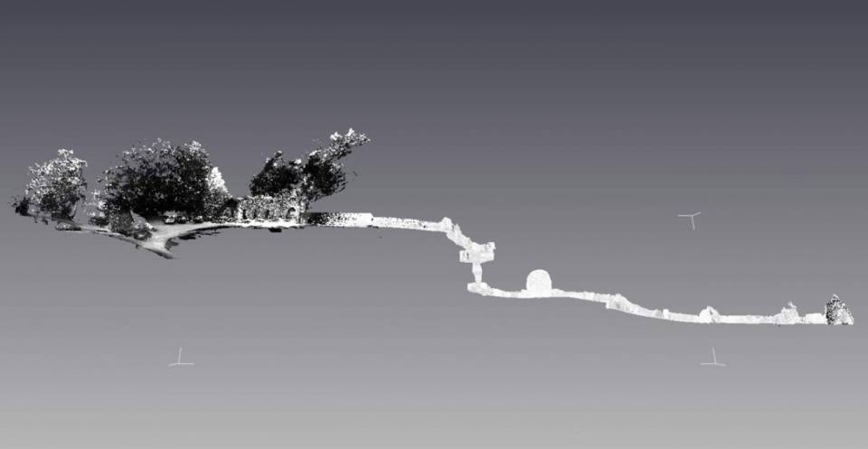
Figure 3: digital surface model (DSM) of the Hellfire Caves. BGS © UKRI.
The terrestrial LiDAR data produced by the oriented laser scan and GNSS survey were processed to develop a digital surface model (DSM) of the entire cave network (Figure 3). The raw data produced by the Scene software consisted of a point cloud comprising 1.8 billion x-y-z points. These data were oriented using the initial GNSS control position and the markers, using a traverse style surveying method and output as an ASCII file, made up of x-y-z intensity and RGB colour values.
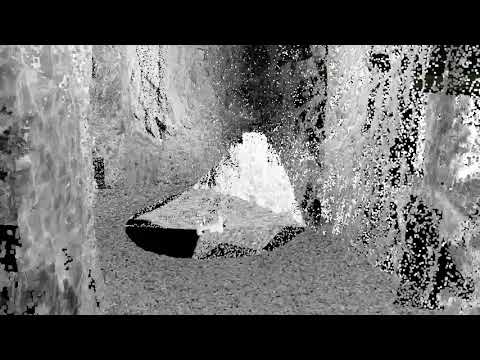

A point-cloud model of the Hellfire Caves created using the GeoVisionary software. BGS © UKRI.
Contact
If you want to discover more then please contact Lee Jones.
Find out more about our research
Ground-based and near-Earth geomatic surveys
BGS has pioneered the use of ground-based (terrestrial) techniques for a variety of geoscientific applications since 1999.
Related news

GSNI project wins multiple awards at RegioStars event
17/10/2025
The AGEO project enjoyed a double success at the RegioStars awards, hosted at the European Commission in Brussels.

AI and Earth observation: BGS visits the European Space Agency
02/07/2025
The newest artificial intelligence for earth science: how ESA and NASA are using AI to understand our planet.
UK’s geomagnetic blind spots tackled with new observatories
28/07/2022
Three new geomagnetic observatories have been installed across the UK to fill in the country’s ‘blind spots’ and tackle the risk posed by space weather.

Using satellite imagery for emergency disaster response
06/07/2021
BGS has a long history of assisting relief efforts by providing satellite maps, data and interpretation to those affected by disasters, helping to identify hazardous areas to avoid.

Spaceborne data: an expanding role in disaster response
23/06/2021
Alessandro Novellino explains the importance of Earth observation to help facilitate successful emergency responses after natural hazard occurrences.
Virtual fieldwork during a global pandemic
03/03/2021
Virtual field reconnaissance can help maintain research momentum during the COVID-19 pandemic.
BGS data supports new tool to track geological changes in abandoned coal mines
20/11/2020
BGS data supports new tool to track geological changes in abandoned coal mines.
Joint project aims to support sustainable development in Kenya
12/10/2020
BGS is part of a joint UK-Kenyan international project that aims to blend data and information with local stakeholder input to explore the sustainable supply of sand and aggregates in Kenya.
Geodesy and Earth observation
Developing and using innovative Earth observation techniques to characterise and monitor Earth processes that affect lives and livelihoods.
Ground-based and near-Earth geomatic surveys
BGS has pioneered the use of ground-based (terrestrial) techniques for a variety of geoscientific applications since 1999.