We have operated a field observatory site at Hollin Hill, North Yorkshire, since 2004. It brings together a combination of our field surveying, geomorphological, geophysical, engineering and hydrogeological expertise. Both aerial and terrestrial LiDAR surveys have been carried out at this site, providing our geologists with a unique opportunity to study the different technologies for monitoring an active landslide site in the UK.
Location
The landslide lies to the north of York (Figure 1), is several hundred metres wide and extends some 200 m down slope (Figure 2). It is located on the south-facing side of a degraded Devensian ice-margin drainage channel; the slope has an angle of approximately 12º. This landslide is National Landslide Database ID 15659/1.
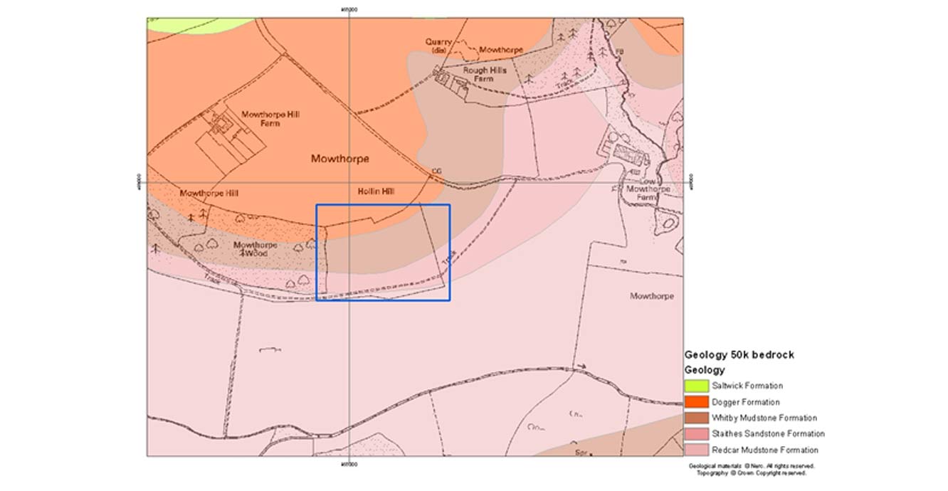

Figure 1: location and geology of the Hollin Hill landslide. Geology . Topography contains Ordnance Survey data © Crown Copyright and database rights 2020.
Geology
The slope at Hollin Hill consists of Early and Middle Jurassic-aged rocks: the Redcar Mudstone Formation (lower Lias Group) is at the base, with an outcrop of the Staithes Sandstone Formation (middle Lias Group) running across the middle section of the slope. The Whitby Mudstone Formation (upper Lias Group) overlies this, with the upper part of the slope composed of the Dogger Formation.
Both the Redcar Mudstone and the Whitby Mudstone formations are highly susceptible to landsliding. Movement across the entire slope is due to these two formations.
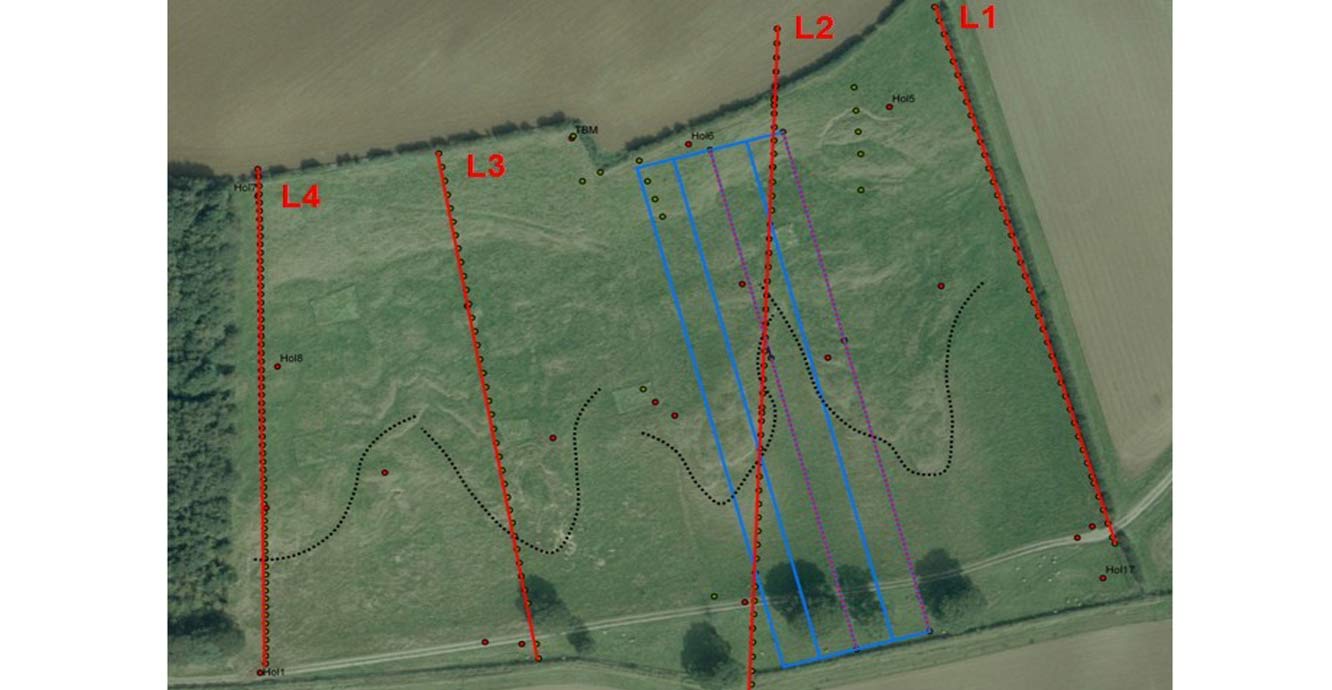
Figure 2: aerial photograph of the Hollin Hill landslide with the geophysical survey plan. © UKP/Getmapping Licence No. UKP2009/01.
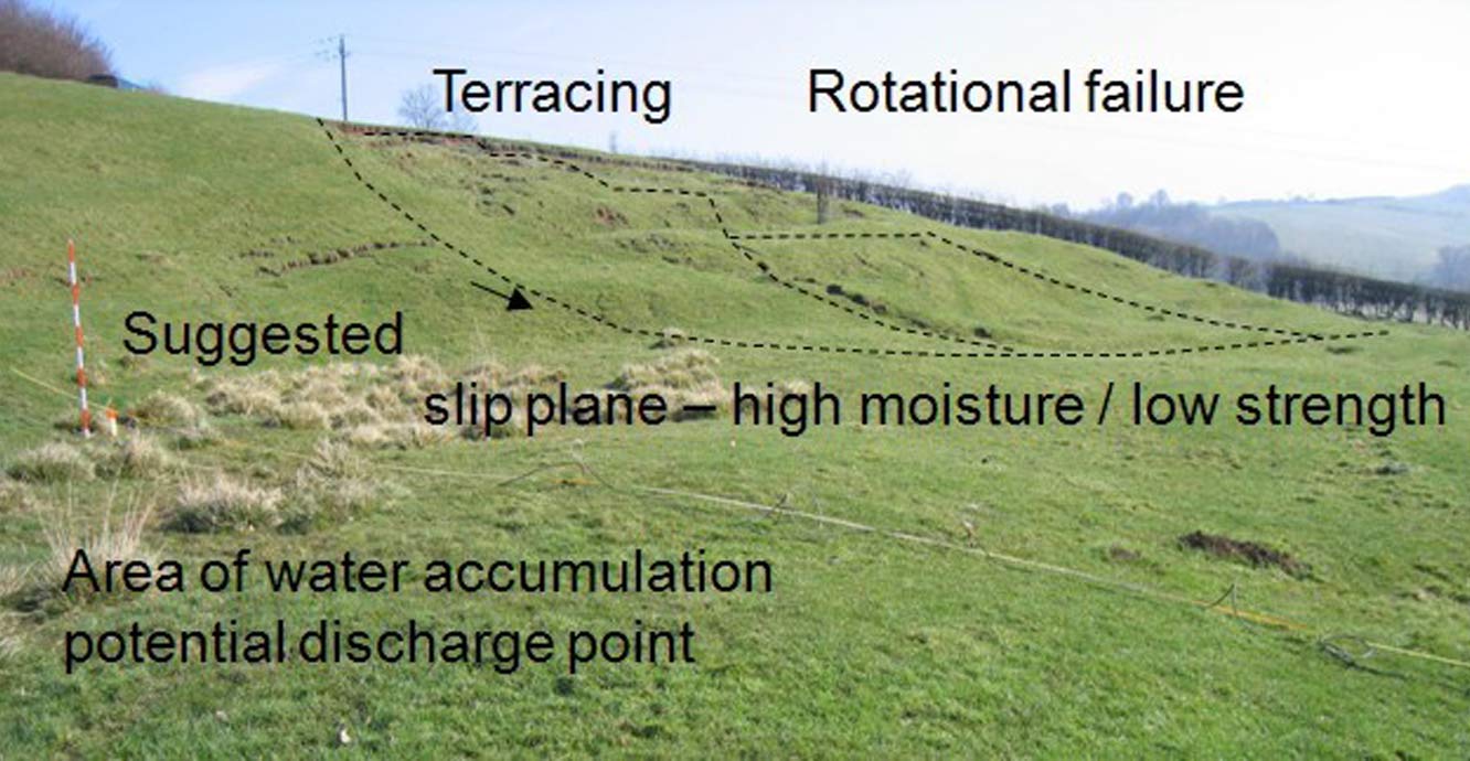
Figure 3: annotated photograph of the Hollin Hill landslide.
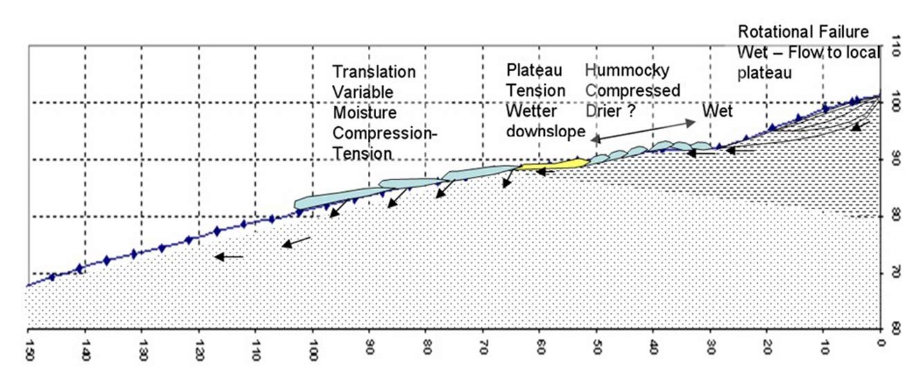
Figure 4: conceptual model of the Hollin Hill landslide.
Hydrogeology
Relatively little is known about the hydrogeology of the site. However, a spring line extends across the base of the slope where the Staithes Sandstone overlies the Redcar Mudstone (Figures 3 and 4).
Geomorphology
The morphology of the slope is complex with numerous isolated shallow failures and slumping. Locally the slope becomes very steep where slipped material has accumulated to form lobes.
Landsliding mechanism
The landslide is largely caused by the movement of the Whitby Mudstone, which is highly prone to landsliding. The landslide is characterised by shallow rotational failures at the top of the slope in the Whitby Mudstone, which move through an area of translational landslide movement and ‘cascade’ over the in situ Staithes Sandstone, feeding into four, larger-scale, slow-moving (tens of centimetres per year) lobes of slumped material at the bottom of the slope.
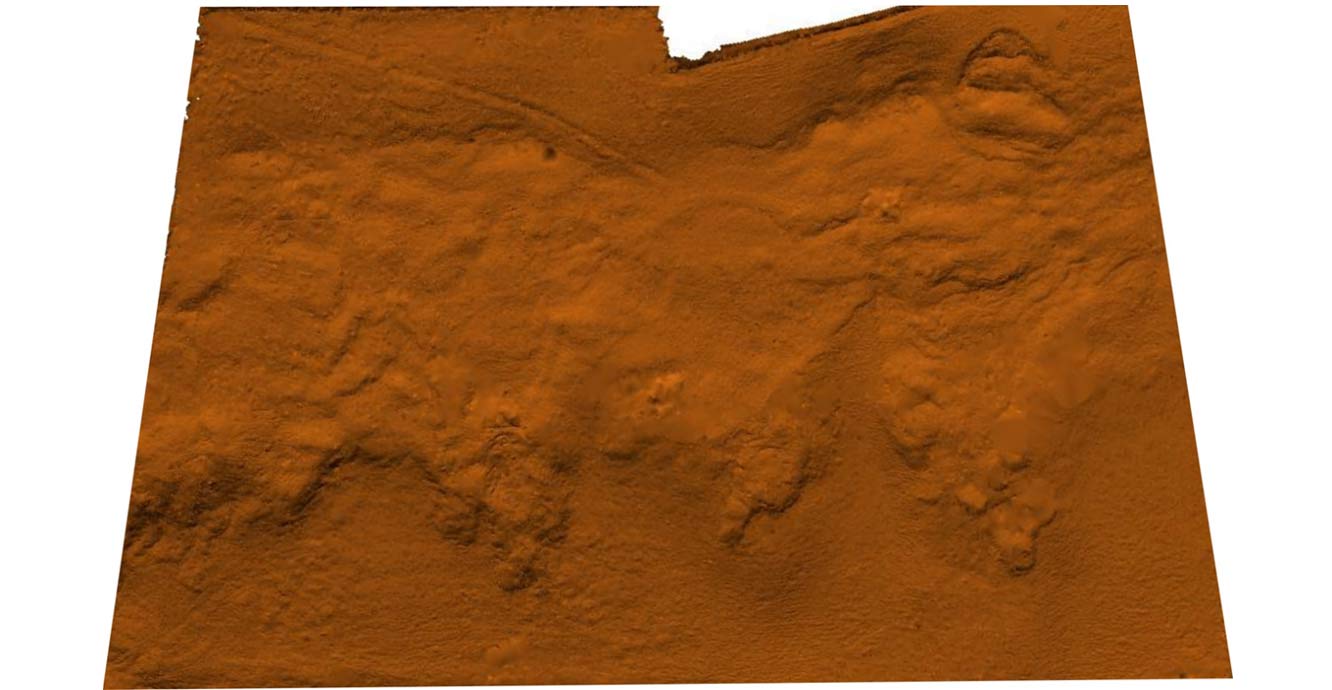
Figure 5: initial terrestrial LiDAR surveysurvey of the Hollin Hill landslide.
Survey methods
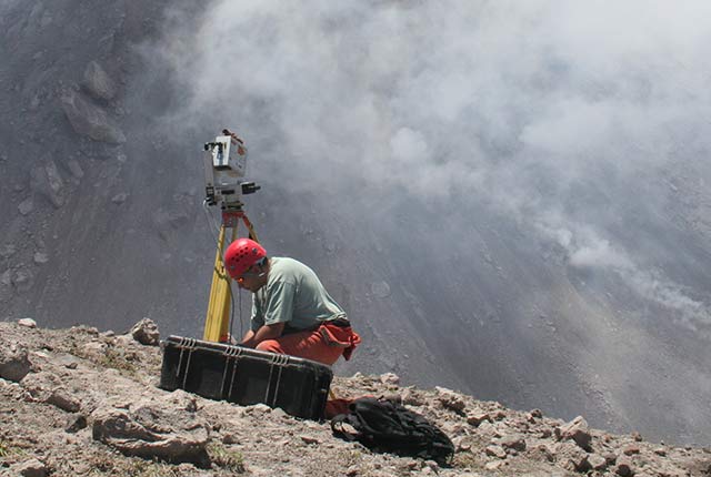
The initial method of survey was long-range laser scanning. The first (‘baseline’) survey recorded the ground surface of the landslide and surrounding area in three dimensions (Figure 5) at a point in time. Subsequent surveys of this active landslide record the movement of the slope.
Surveys are carried out at six-monthly intervals and the data collected in the field by LiDAR and GPS are entered into a computer modelling package. The results are processed to provide data to model the way in which the landslide is moving. Information obtained by the TLS will allow us to monitor the changing shape of the surface.
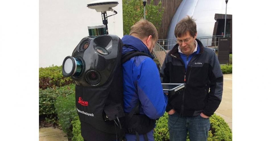
Figure 6: the Pegasus Backpack mobile mapping solution.
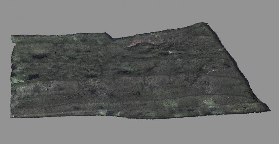
Figure 7: digital terrain model (DTM) of the Hollin Hill landslide.
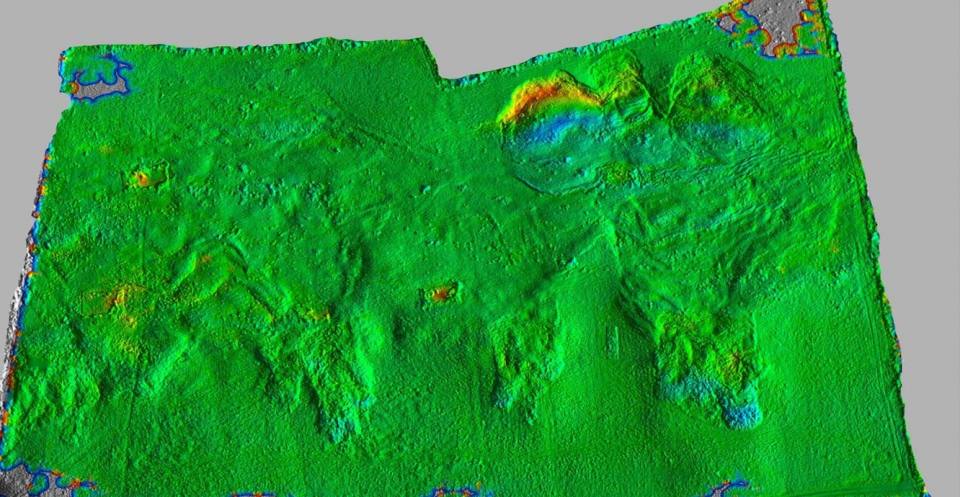
Figure 8: Hollin Hill landslide change model (2008–2018). Red: -2.5 m; blue +2.5 m.
Since 2018 the landslide has been monitored using the Leica Pegasus backpack mobile mapping solution (Figure 6), enabling digital terrain models (DTMs) to be created in a shorter time (Figure 7) and changes to be assessed (Figure 8).
Contact
If you want to discover more then please contact Lee Jones.
You may also be interested in
Ground-based and near-Earth geomatic surveys
BGS has pioneered the use of ground-based (terrestrial) techniques for a variety of geoscientific applications since 1999.