Is your region susceptible? Britain’s geohazard hotspots revealed
From sinkholes to radon: new maps highlight the most geologically at-risk regions
14/08/2025 By BGS Press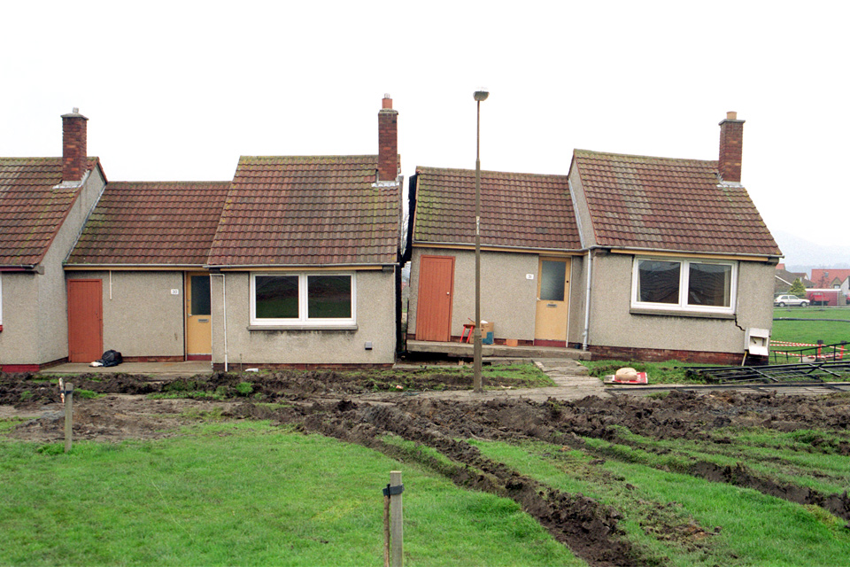

Scientists at the British Geological Survey (BGS) have published UK regional hazard maps revealing the most susceptible local authority regions around the country. The maps provide regional decision makers with an overview of the relevant hazards in their local area and provide an important indication of where more detailed hazard data may be required.
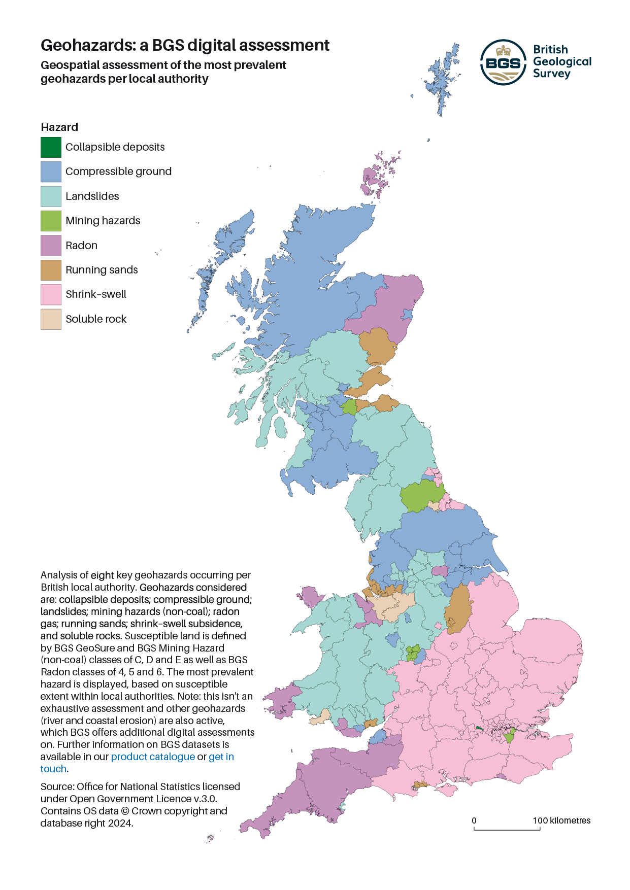
The analysis considers the occurrence of eight key geohazards relating to natural subsidence, the presence of the ground-gas radon, and the possibility of legacy mining in an area (excluding coal).
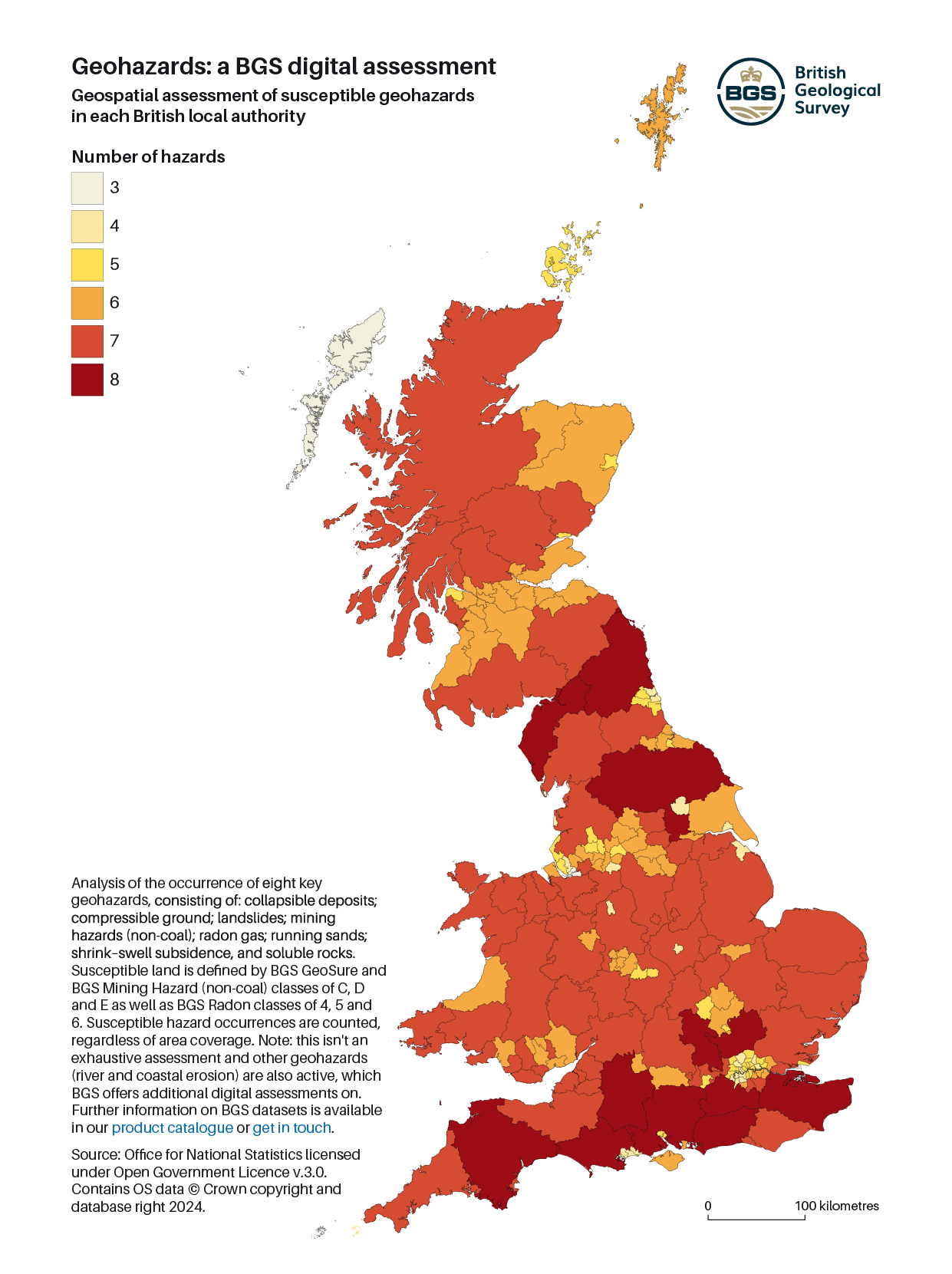
Geospatial assessment of susceptible geohazards in each British local authority. Source: Office for National Statistics licensed under Open Government Licence v.3.0. Contains OS data © Crown copyright and database right 2024. Download this map.
Regions in the south (Devon; Dorset; Hampshire; Kent; Surrey; Wiltshire; West Sussex) and north (Cumbria; North Yorkshire; Northumberland) of England are shown to be the most susceptible, with some regions affected by all eight hazards. The Outer Hebrides and Halton (south of Liverpool) were revealed to be the least susceptible, with exposure to three or fewer hazards.
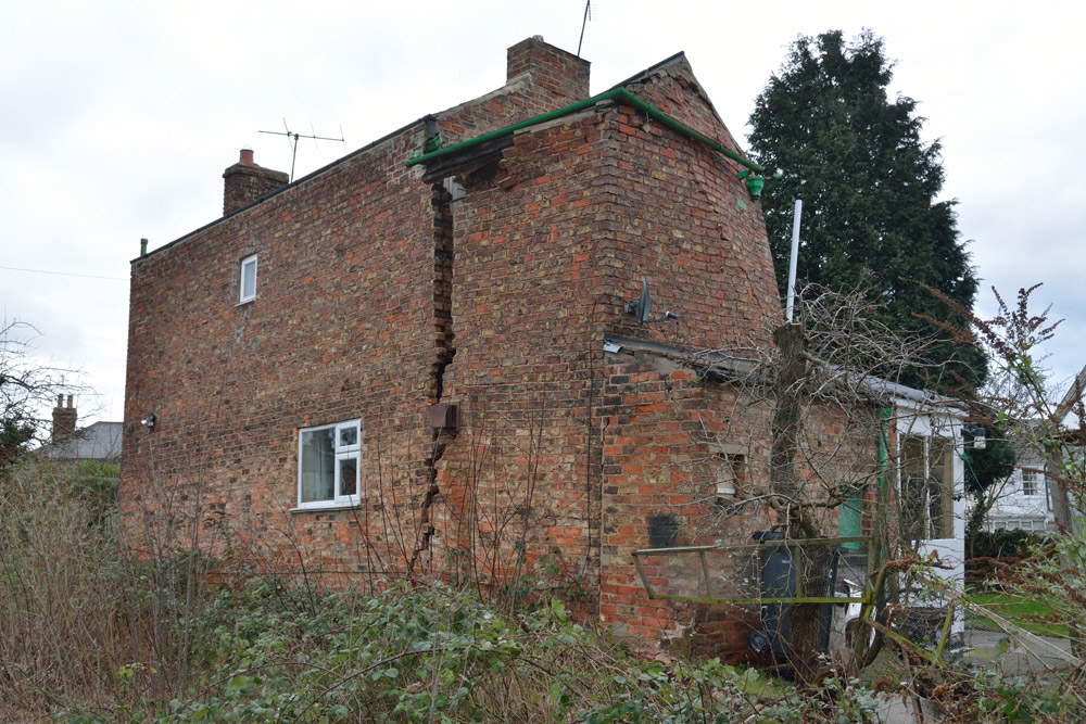
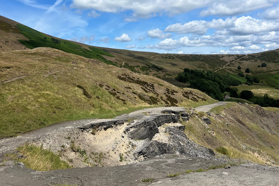
Various geological properties and processes are associated with each hazard but the majority result in some form of ground movement, causing similar societal impacts and damage to infrastructure and homes. For example, collapsible deposits, compressible ground, running sands and shrink-swell subsidence can all result in damage to roads and pathways, breaks in utility pipes and damage to foundations and buildings. Former underground workings and soluble rocks can both cause larger underground cavities that may be prone to collapse, causing more significant and sudden movement and damage. Radon is the exception; it is a natural radioactive gas that can enter buildings from the ground and can increase the risk to human health where there is exposure to high concentrations.
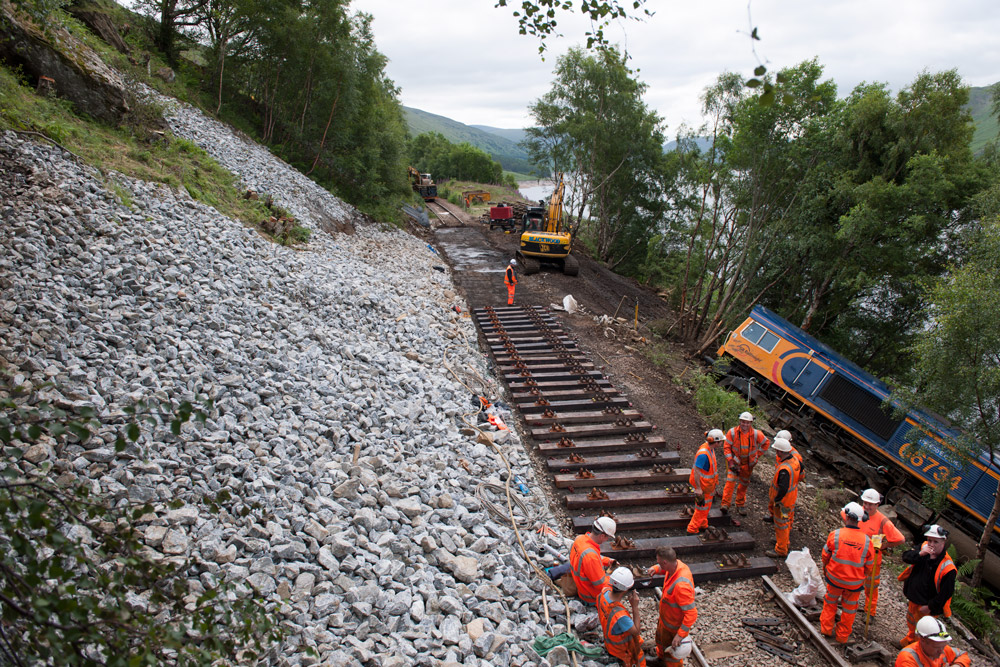
The Stob Coire Sgrodain landslide, approximately 6 km south, south-west of Tulloch station, by the shores of Loch Treig, on the Fort William to Crianlarich railway line. Source: BGS © UKRI
Road subsidence in the Peterborough area due to compression and clay shrink-swell). Source: BGS © UKRI
Partial collapse of a house in Ripon, North Yorkshire, due to sinkhole formation over soluble gypsum in the Permian-aged Edlington Formation, February 2014. BGS © UKRI.
Figures released by the Association of British Insurers show thousands of claims relating to ground movement such as subsidence are being made annually, costing millions of pounds to remediate. Network Rail has revealed landslide damage to the rail network costs tens of millions pounds a year to repair and there are dramatic examples of legacy mine and soluble rock collapses causing sudden and catastrophic damage to residential areas. Radon gas is linked to over 1100 deaths from lung cancer in the UK each year.
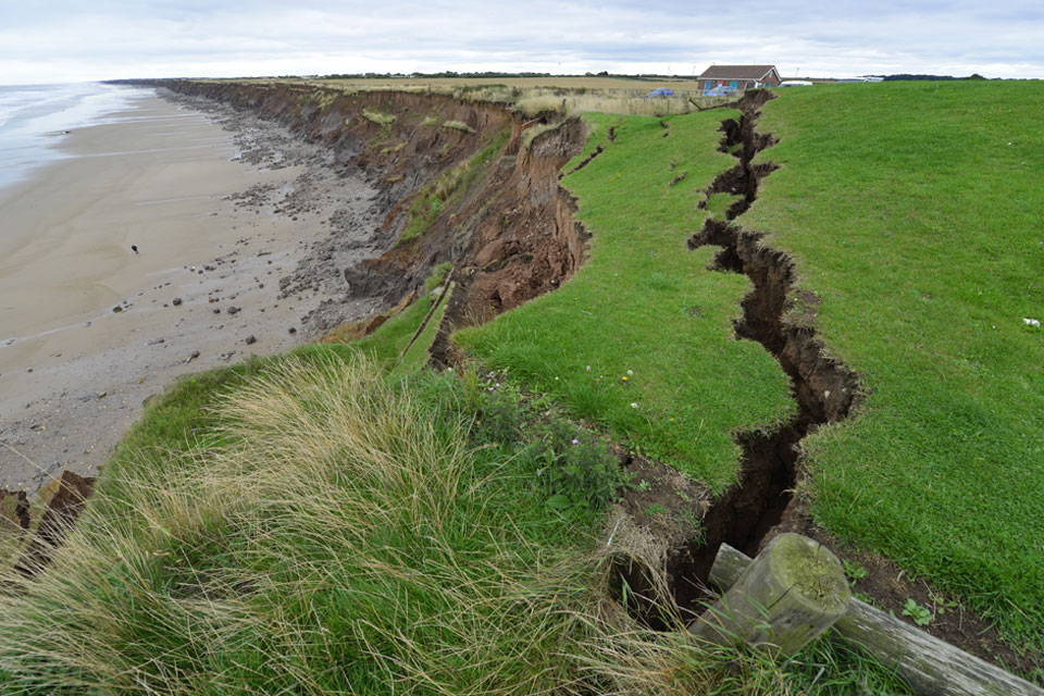
It is important to note that there are other active hazards such as river and coastal erosion affecting some local authority regions, not yet included in this study.
To create these maps, BGS has simplified and summarised its geological information. In this generalised form they give an indication as to which geohazards are most prevalent per region. For a more detailed view of specific areas that are most prone to particular geohazards risks please visit the BGS data product webpages for mining hazards (non including coal), ground instability and radon gas to find out how to access higher-resolution data.
Geospatial assessment of the most prevalent geohazards per local authority. Source: Office for National Statistics licensed under Open Government Licence v.3.0. Contains OS data © Crown copyright and
database right 2024. Download this map.
BGS has compiled its most comprehensive and authoritative datasets in this way to provide the maximum support for a diverse range of stakeholders, ranging from regulators to policymakers and planners.

Presenting the data in this generalised manner provides a quick and convenient indication as to which geohazards are most prevalent by region, informing mitigation strategies and the acquisition of higher resolution data. We would encourage anyone interested in our hazard data to contact us or visit our dataset webpages for more information.
Katy Lee – BGS Product Portfolio Manager
The underlying BGS geohazard datasets from which these statistics are derived are each presented as five susceptibility classes per hazard. The summary maps shown here present statistics relating the upper three classifications which represent areas most likely to be impacted by the respective hazards. For the BGS GeoSure and mining hazard (not including coal) ground instability hazards these upper three classes represent areas where susceptibility to ground instability is possible, probable or known. The BGS Radon Potential upper three classes cover 95 per cent of homes estimated to be at or above the threshold guideline for radon levels (200 becquerels per cubic metre).
For full details of the classification breakdown, please refer to the respective dataset product user guides:
Download the maps
- Geohazard susceptibility in each British local authority
- Most prevalent geohazards per local authority
Further information on the assessed hazards:
If you have any queries about the BGS data available to support hazard susceptibility assessments please get in touch (digitaldata@bgs.ac.uk) or visit our dataset webpages for more information.
Collapsible deposits are soil materials that undergo a significant reduction in volume (collapse) when saturated with water and then loaded.
https://www.bgs.ac.uk/datasets/bgs-geosure-collapsible-deposits/
Soft materials like peat or alluvium that compact under a load.
https://www.bgs.ac.uk/datasets/bgs-geosure-compressible-ground/
Downslope movement of materials due to the effect of gravity and influenced by factors including geology, drainage, and slope.
Subsurface voids resulting from past underground mining activity pose a possible hazard. Former underground workings, particularly where shallow, may collapse and cause surface settlement.
https://www.bgs.ac.uk/datasets/mining-hazard-not-including-coal-coverage/
Radon is a naturally occurring radioactive gas, that can enters buildings from the ground. Exposure to high concentrations increases the risk of lung cancer.
https://www.bgs.ac.uk/datasets/radon-data-indicative-atlas-of-radon/
Loosely-packed sandy layers in the subsurface that can be fluidised by water flowing through them, leading to damage to roads and pathways, breaks in utility pipes and connections, and structural damage to foundations and buildings.
https://www.bgs.ac.uk/datasets/bgs-geosure-running-sand/
Clay-rich soils shrink and swell in response to changes in moisture content, leading to ground movement and potentially causing damage to buildings.
https://www.bgs.ac.uk/datasets/geoclimateukcp18-premium/
Rocks such as limestone and salt can pose a hazard because they dissolve when exposed to water, creating underground cavities and potentially causing subsidence, sinkholes, and structural damage to buildings and infrastructure.
https://www.bgs.ac.uk/datasets/bgs-geosure-soluble-rocks/
Relative topics
Download BGS Geospatial assessment of susceptible geohazards
Related news

BGS awarded funding to support Malaysia’s climate resilience plan
17/12/2025
The project, funded by the Foreign, Commonwealth & Development Office, will focus on minimising economic and social impacts from rainfall-induced landslides.

UK braced for what could be the largest solar storm in over two decades
12/11/2025
Intense geomagnetic activity could disrupt technology such as communication systems, global positioning systems and satellite orbits.
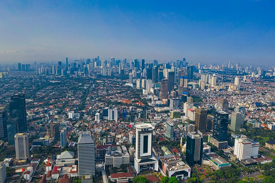
New research highlights significant earthquake potential in Indonesia’s capital city
04/11/2025
Research reveals that a fault cutting through the subsurface of Jakarta could generate a damaging earthquake of high magnitude.

GSNI project wins multiple awards at RegioStars event
17/10/2025
The AGEO project enjoyed a double success at the RegioStars awards, hosted at the European Commission in Brussels.
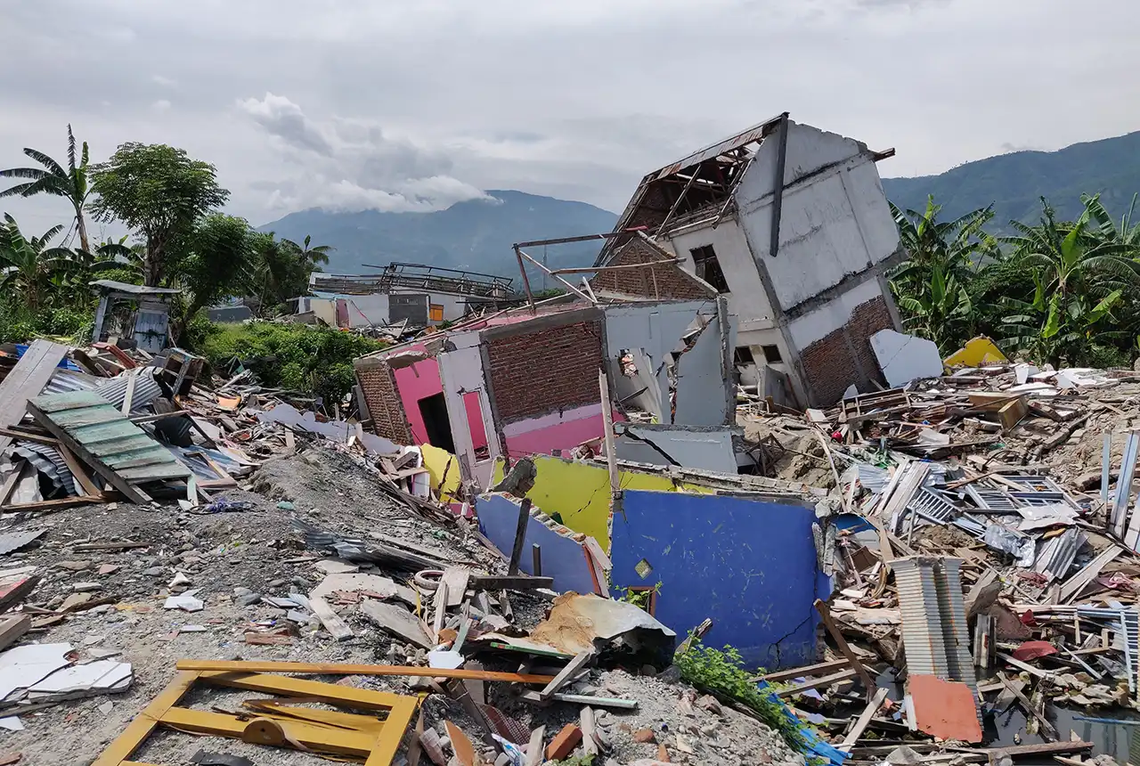
New report sets pathway to reduce the impacts of geohazards in one of the world’s most hazard-prone nations
30/09/2025
A new White Paper, co-developed by Indonesian and UK hazard experts, presents a strategic roadmap to significantly reduce the impacts of geological hazards in Indonesia.
Artificial intelligence helps scientists identify 3000 moving slopes potentially at risk of landslide
25/09/2025
A new approach that combines AI and satellite data has been used by scientists to detect actively moving landslides at a national scale.

UK scientists in awe-rora as national coverage of magnetic field complete for the first time
23/09/2025
New sensors being installed across the UK are helping us understand the effects that extreme magnetic storms have on technology and national infrastructure.
BGS-led paper scoops prestigious award
16/09/2025
New research providing earlier warnings of landslides has been awarded the British Geotechnical Association medal.
BGS scientists work with United Nations to update hazard profiles
21/08/2025
From tsunamis to sinkholes, the profiles provide a standardised, internationally agreed definition of hazards to support disaster risk management worldwide.
Is your region susceptible? Britain’s geohazard hotspots revealed
14/08/2025
From sinkholes to radon: new maps highlight the most geologically at-risk regions
New tool helps identify coal mine gas risk for housing developments in Scotland
05/08/2025
Scientists have co-developed a new tool for North Lanarkshire Council to help screen coal mine gas emissions prior to the development of new houses and buildings.
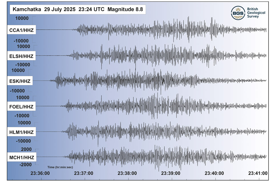
Kamchatka earthquake highlights the advances in tsunami early warning systems
31/07/2025
The response to the 8.8 magnitude earthquake in Russia has emphasised how far scientific understanding of tsunamis has come over the last two decades, and the improved mitigation measures that are now in place.