Trans-Pacific Transit 2023: deep-diving ocean partnership sets sail
BGS has joined a multidisciplinary research expedition to ‘explore the unexplored’ and fill in some of the biggest gaps in our knowledge of the oceans' darkest depths.
04/10/2023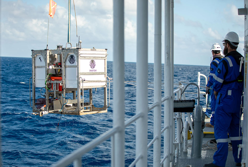

Sail across the surface of an ocean and beneath you lie hundreds of millions of cubic miles of mystery — and what lies at the bottom is shadowier still. Underwater landscapes the size and complexity of continents, unknown ecosystems and processes that defy study from the surface means there are many gaps in our knowledge that science is hoping to fill. Due to the challenges of research at even moderate depths, almost every expedition venturing below 3000 m throws up a surprise.
The Trans-Pacific Transit Expedition
The Open Ocean Research Program kicked off in early June 2023 on its first exploratory voyage entitled the ‘Trans-Pacific Transit Expedition’. Study will be based around a series of transits in the south-eastern Pacific Ocean that will continue through November and December 2023. The multidisciplinary team is composed of scientists from:
- BGS (leading geology)
- University of Western Australia (biology)
- Oceanly Science (physical oceanography)
- Inkfish (ocean research)
Inkfish is also financing the project.
The researchers aim to engage local nations, for whom evolving oceanic processes have measurable impact day-to-day, and use the assets of all partners to make our view of the deep ocean sharper than ever before.

The game changer with what we hope to achieve here is scale. No other programme can support multiple, global, repeatable series of complementary research expeditions. Of course, we will find new features and new species — but that is almost a bonus to the work we hope to undertake.
Heather Stewart, BGS Marine Geologist and primary investigator for the programme.
A rich field for research
This first expedition has three principal aims:
- conduct a detailed survey of the little-known fauna encountered to study their abundance, biodiversity and genetics
- fill in the many gaps in the geological maps of the world they inhabit to understand the structures, processes and habitats of the deep sea
- analyse the dynamic oceanic systems over a large latitudinal and longitudinal area
The project will focus on the Pacific abyssal plains. The six legs of the expedition will use technologies such as free-fall landers, armed with a scientific payload to make in situ observations at full-ocean depth, and submarine survey equipment such as multibeam echosounders capable of mapping even extreme points of the sea floor from a surface vessel at superior accuracy.
Deep-sea exploration is always going to be tricky given the sheer water depths we are working in. We hope to reveal sea-floor features such as preserved spreading fabrics and knolls and seamounts that have recorded a history of volcanism, ridges and faults. We will cross multiple fracture zones that record offsets in the mid-ocean ridge where crust is created. The sea-floor video will give us insights into the composition of the seabed and the biological communities that live there.
Heather Stewart, BGS Marine Geologist
Several of the features surveyed over the course of the six-month Trans-Pacific Transit Expedition, which ends in Tonga in January 2024, will be ‘new’ — features that existing, low-resolution satellite altimetry data have thus far failed to resolve.
Over 50 per cent of the planet lies at a depth of nearly 4000 m and the Pacific Ocean hosts the greatest area of abyssal plains: 47 555 030 km2. Locations around the Pacific Rim, such as Japan, Hawai’i, California, Chile and Aotearoa New Zealand, have collected significant baseline data in their waters. However, there is little to connect these datasets across these intermediate expanses of water.
Sampling efforts on the abyssal plains have been severely constrained by limited time and resources. As a result, large spatial and ecological patterns in species diversity, abundance, genetic links and habitat characteristics remain poorly understood across the wider Pacific basin. The scale of data acquisition undertaken during this expedition is unprecedented.
Prof Alan Jamieson, chief scientist of the expedition based at the Minderoo-UWA Deep Sea Research Centre.
Hades of the deep
The hadal zone (named for Hades, the Greek god of the underworld) represents the most enigmatic of undersea terrains. At depths ranging from 6000 to 11 000 m, this zone includes the planet’s deepest and most remote ocean trenches. Found in seismic regions where tectonic plates meet and plunging deeper than Mount Everest is high, the trenches have long been out of sight and reach to all but the most specialised expeditions.
Despite only a quarter of a per cent of the world’s sea floor being in the hadal zone, it accounts for just under half (45 per cent) of its entire depth column. Most of these ocean-abyss environments are found in the Pacific, around the so-called Ring of Fire where the sea floor is being dragged beneath continental plates in subduction trenches that can reach enormous depths. Later expeditions in the Open Ocean Research Programme hope to visit a number of these in 2024.
Heather, who is leading the expedition’s geological exploration of the seabed and its evolution over time, is no stranger to the challenges and potential of extreme depths: previously she was chief geologist for the Five Deeps Expedition. The vessel from this record-breaking challenge has been re-named to RV Dagon and the submersible re-named to Bakunawa, with both forming an integral part of this new research programme. The research craft present an opportunity that is fiercely rare: Bakunawa is one of only two operational craft in the world capable of reaching Challenger Deep, the most extreme point of the planet’s surface lying just short of 11 km beneath the waves.
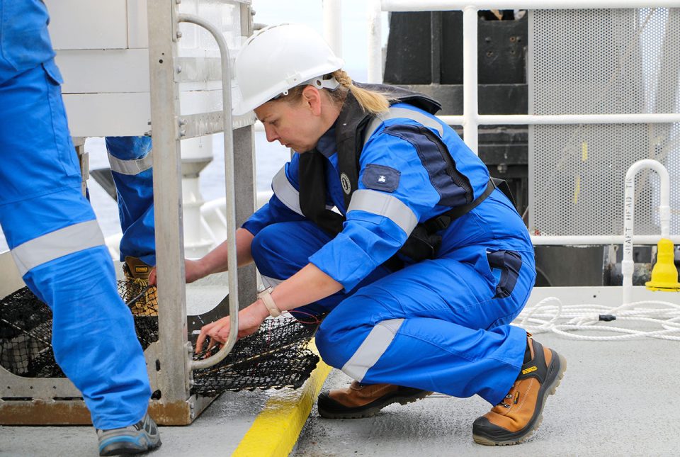
Marine geologist Heather Stewart working with scientific landers onboard RV Dagon in the Pacific Ocean. © Inkfish.
Accidental discoveries on the ocean floor
The history of sea-floor exploration has thrown up its share of accidental discovery. Much insight into the oceanic landscape of the Pacific came courtesy of professor and navy commander Harry Hammond Hess during the Second World War. Results from his echo sounder running constantly yielded a landscape profile that formed the basis of his 1962 paper, ‘History of ocean basins‘. His analysis of the plains, guyots, ridges and trenches birthed the concept of sea floor spreading, work that was further refined into the theory of plate tectonics by Canadian and British scientists. Their analysis of military magnetometer readings found symmetrical stripes of alternating polarity in sea-floor rocks either side of oceanic ridges, giving a timestamp for the Earth’s many magnetic inversions and the evolution of the sea floor.
More recently, the most accurate measurement for the Challenger Deep (10 983 m) was determined not by intention, but from calculations made from the sonic signature of an implosion of a scientific instrument.
These all show just how hit-and-miss discoveries have been regarding the terrain that covers some 71 per cent of the planet’s surface and how purposeful targeted research with state-of-the-art equipment could be.
A new kind of expedition
With the multidisciplinary, repeatable nature of the Open Ocean Research Programme, scientists on board hope to use the unique platform to enhance the quality of data collection to a level impossible with traditional research expeditions.
For me, the opportunity to undertake multiple expeditions in one large geomorphological feature such as a subduction trench is unprecedented in our field. Working across disciplines with engineers, biologists and oceanographers is always something I enjoy as the extra dimension you get from working outside your own field frequently throws up new questions to explore and a new twist on how we view the data.
Government-funded research tends to support standalone projects rather than those undertaken as part of an ambitious, coherent network of global expeditions. Inkfish have provided us with a unique opportunity for open ocean exploration and discovery. The flexibility to remain in one geographic area for more than one cruise allows us to acquire a comprehensive dataset with which we can test multiple, cross-discipline hypotheses.
All the research we will undertake will be published open access, so any interested party can explore our findings, whether for planning and decision-making purposes as part of the blue economy and conservation or to guide future offshore expeditions implemented by other groups around the world.
Heather Stewart.
Inkfish, meanwhile, is pleased to support marine researchers from around the world, bringing together diverse perspectives to collectively understand the deep sea. The team hopes to share discoveries as the expedition progresses.
About the author
Relative topics
Related news

Geological research in North Sea helping to safeguard subsea cables
06/07/2026
Subsea power and telecommunications cables are critical to the UK’s energy infrastructure and global connectivity, yet they remain vulnerable to damage from ship anchors, fishing activity and natural hazards.

UK scientists unite for seabed mapping survey of the UK’s south-west coastline
15/04/2026
BGS geologists join research voyage, gathering crucial geological data to support offshore energy and infrastructure projects.

Updated geological assessment of the Southern North Sea set to underpin future offshore infrastructure development
25/03/2026
The first regional assessment for 30 years will support offshore marine and subsurface planning for the UK’s low-carbon energy infrastructure, including the 2030 target of 45 to 50 GW generated through offshore wind.

Extensive freshened water confirmed beneath the ocean floor off the coast of New England for the first time
09/02/2026
BGS is part of the international team that has discovered the first detailed evidence of long-suspected, hidden, freshwater aquifers.

Quaternary UK offshore data digitised for the first time
21/01/2026
The offshore wind industry will be boosted by the digitisation of a dataset showing the Quaternary geology at the seabed and the UK’s shallow subsurface.

Offshore Quaternary 250K
The 1:250 000-scale offshore geological map for quaternary geology (BGS Geology: marine quaternary 250k) is available digitally.

How the geology on our doorstep can help inform offshore infrastructure design
19/11/2025
BGS is part of a new collaboration using onshore field work to contextualise offshore data and update baseline geological models which can inform the sustainable use of marine resources.

Extended seabed geology map of the Bristol Channel published
07/10/2025
BGS has released significantly extended high-resolution maps that will support offshore green-energy initiatives in the area.

New seabed sediment maps reveal what lies beneath the waves
03/09/2025
Marine ecosystem science and offshore infrastructure will be boosted by a new dataset showing sediment composition across the UK continental shelf.

Seabed sediments 250K
This offshore Quaternary geology dataset shows the distribution of interpreted lithostratigraphical units within the shallow subsurface. The dataset represents the Quaternary geology immediately beneath the active seabed sediment layer.

Offshore bedrock 250K
The BGS Offshore Bedrock 250k dataset depicts the distribution of the different types of bedrock on the UK Continental Shelf.

IODP³-NSF Expedition 501: successful offshore operations launches onshore phase
06/08/2025
Scientists have managed to take water and sediment samples from beneath the ocean on the New England Shelf for the first time, with the intention of understanding this offshore aquifer system.