Shallow geohazards
BGS Research

Geohazards, such as volcanoes, earthquakes and landslides, are the natural geological processes that present a direct risk to people or an indirect risk by impacting development. They can be subdivided between earth hazards , such as earthquakes, volcanoes and tsunamis, and shallow geohazards.
Shallow geohazards occur in the near-surface, typically including landslides, sinkholes and discontinuities that result from cambering or fault reactivation, as well as a range of hazards that occur as a consequence of karst and Quaternary processes. The term ‘shallow geohazard’ has also been extended by engineering geologists to embrace properties of geological materials that are a potential risk to infrastructure and include:
- clay shrink-swell
- collapsible soils
- compressible soils
- soluble rocks
- ground gases
- soil piping
- soil geochemistry
- running sand
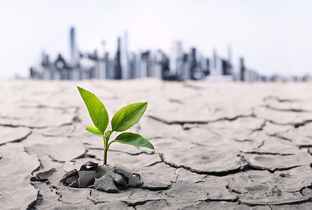
The properties associated with each of these geohazards are sensitive to changes in moisture content and therefore to the consequences of climate change and hydrohazards, including the various types of flooding: pluvial, fluvial and groundwater.
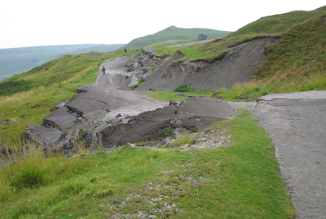

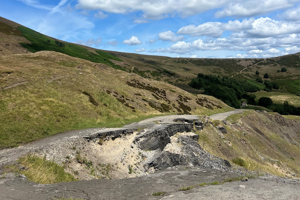
Landslide affecting the abandoned A625 road at Mam Tor, Derbyshire. BGS © UKRI.
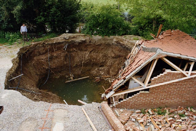
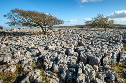
Sinkhole in soluble bedrock, Ripon, Yorkshire. BGS © UKRI.
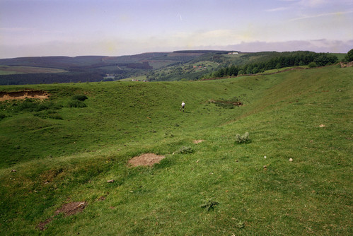
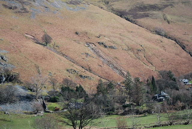
Deep camber gull at Sneck Yate Bank, North York Moors. BGS © UKRI.
Collaborative shallow-geohazard research is important to society for planning and development and for infrastructure management. In the international context, this research contributes to resilience through the United Nations’ Sustainable Development Goals.
The focus of BGS shallow geohazards research is on developing and communicating better understanding of distribution, characterisation, susceptibility and triggering and potential impacts of shallow geohazards.
The BGS is home to the National Landslide Database, the National Karst Database and a National Sinkhole Database. Data is collected using methods that range from Earth observation to literature searches, social media and crowd science. We draw from our researchers’ skills to respond to geohazard events, e.g. landslides induced by the Nepal earthquake of 2015 and sinkholes (for example, Solotvyno, Ukraine), and we can assess data quality and representation in terms of size frequency distributions.
Conceptual classifications of shallow geohazards underpin geohazard communication, such landslide, sinkhole and shrink–swell potential, which is based on the Atterberg limits of the soil and its position on the Casagrande plasticity chart.
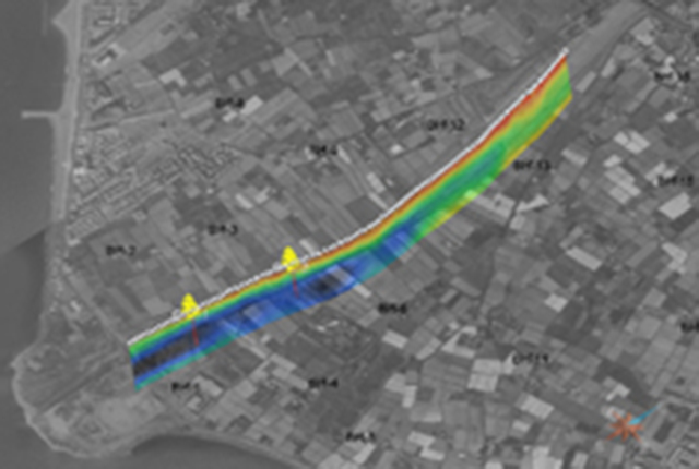
Modelling commonly requires more specific, field-based information, fo example dimensions, soil types and details of the triggering process. A number of techniques are used to collect this information, including Earth observation, ground based geomatics, geological and geomorphological mapping and ground investigation techniques such as probing, drilling and shallow geophysics. Examples of this activity include responsive visit case studies and specific research projects, as at Aldbrough and Barton on Sea.
Algorithms, based on process understanding, are developed to identify areas where the ground conditions are more susceptible to geohazards for our BGS GeoSure products. By adopting a domains approach, we are recognising that regions of common geology and geomorphology give rise to similar styles of geohazard. Perturbations (triggers) that initiate geohazards may be meteorological, tectonic (such as earthquakes) or anthropogenic.
Our shallow geohazard trigger threshold value research takes a number of approaches to identify hazard tipping points. Input data includes the monitoring data from geohazard observatories. By combining the concepts of susceptibility with MetOffice weather forecasting, we contribute to the Natural Hazards Partnership daily hazard assessment. This is being advanced by domain-scale, real-time modelling.
By integrating susceptibility with hazard characterisation, we can better understand the potential impact of geohazards. Our research on this topic relies on both the development of impact libraries and modelling, which enable risk assessment and the provision of information for early warning systems to protect vulnerable communities and modelling for multi-hazard research.
Find out more about our research
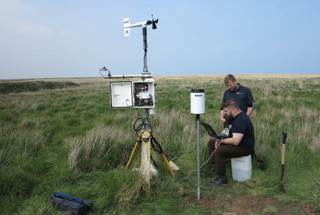
Hazard monitoring
Hazard monitoring provides valuable information for process understanding and for the science required for developing early warning systems to protect people and infrastructure.
Sinkholes and karst research
Our research extends beyond the distribution and processes associated with sinkhole formation to the broader subject of karst.
Swelling and shrinking soils
Shrink–swell, or expansive, soils are one of the most costly and widespread geological hazards globally, with costs estimated to run into several billion pounds annually.
Soil piping
Soil piping is a naturally occurring hydraulic process that leads to the development of macropores (large, air-filled voids) in the subsurface that are associated with landslides and collapse subsidence.
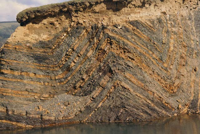
Cambering, gulls and valley bulging
Cambering, gulls and valley bulging are responses to stress relief that results from rapid erosion of the landscape in conjunction with gravitational forces.
Related news
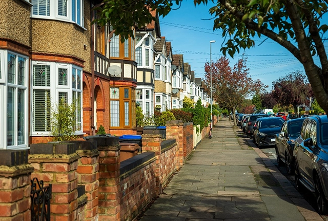
Latest research emphasises climate-related subsidence risk to millions of British homes
11/06/2026
New data from BGS highlights the projected future impact of warmer, drier summers and underlines the need for mitigation measures in susceptible regions.
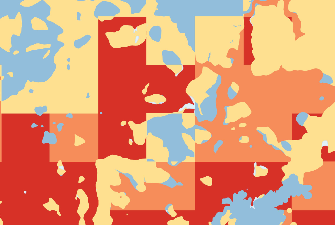
GeoClimate Shrink–Swell
GeoClimate clay shrink-swell provides information on the projected future change in susceptibility of clay shrink–swell across Great Britain due to climate change.

BGS GeoClimate – dataset launch webinar
Event on 02/06/2026
The virtual launch of our new BGS GeoClimate dataset – helping mitigate the economic risk from shrink-swell subsidence. Event recording now available

Hole-y c*@p! How bat excrement is sculpting Borneo’s hidden caves
23/12/2025
BGS researchers have delved into Borneo’s underworld to learn more about how guano deposited by bats and cave-dwelling birds is shaping the subsurface.

BGS awarded funding to support Malaysia’s climate resilience plan
17/12/2025
The project, funded by the Foreign, Commonwealth & Development Office, will focus on minimising economic and social impacts from rainfall-induced landslides.

UK braced for what could be the largest solar storm in over two decades
12/11/2025
Intense geomagnetic activity could disrupt technology such as communication systems, global positioning systems and satellite orbits.
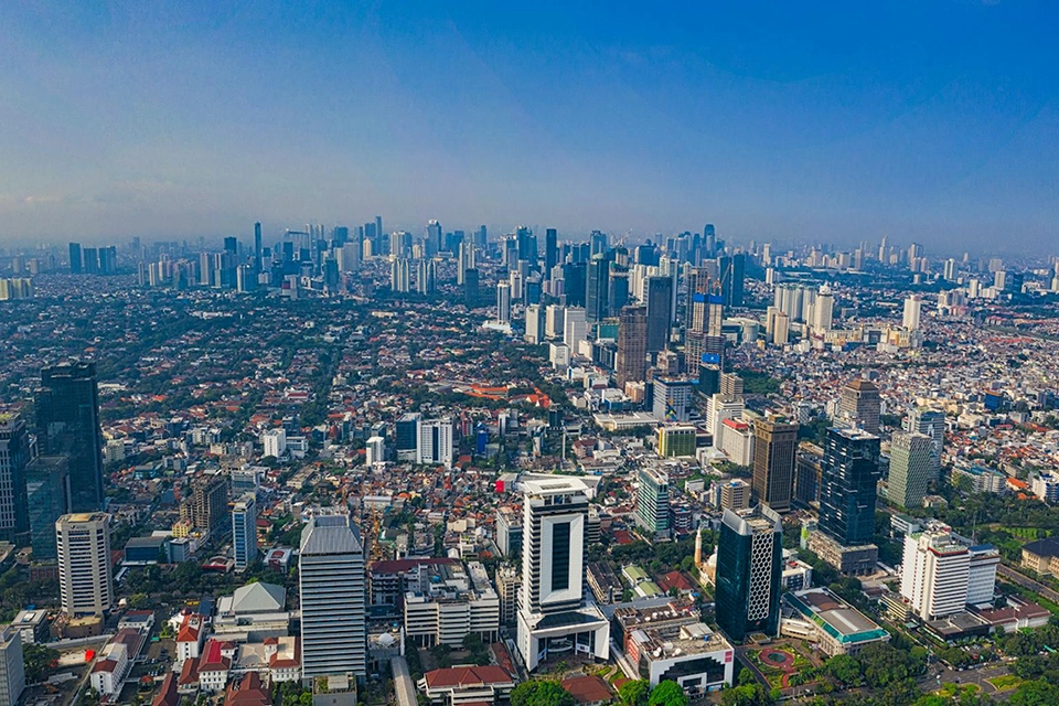
New research highlights significant earthquake potential in Indonesia’s capital city
04/11/2025
Research reveals that a fault cutting through the subsurface of Jakarta could generate a damaging earthquake of high magnitude.

World Cities Day: the geological story of our cities
31/10/2025
Understanding the rocks that underlie our towns and cities, the risks they can present and how they influence urban planning and redevelopment.
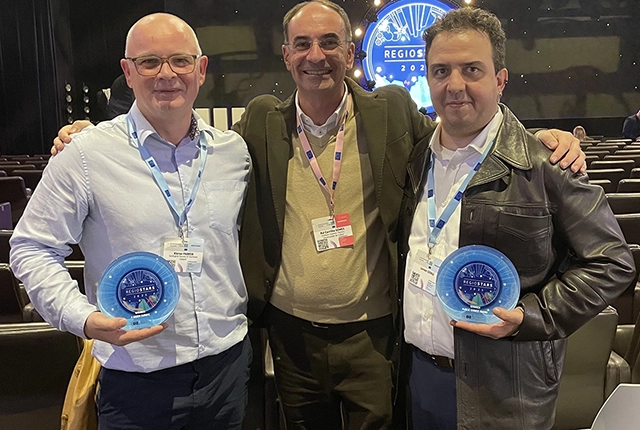
GSNI project wins multiple awards at RegioStars event
17/10/2025
The AGEO project enjoyed a double success at the RegioStars awards, hosted at the European Commission in Brussels.
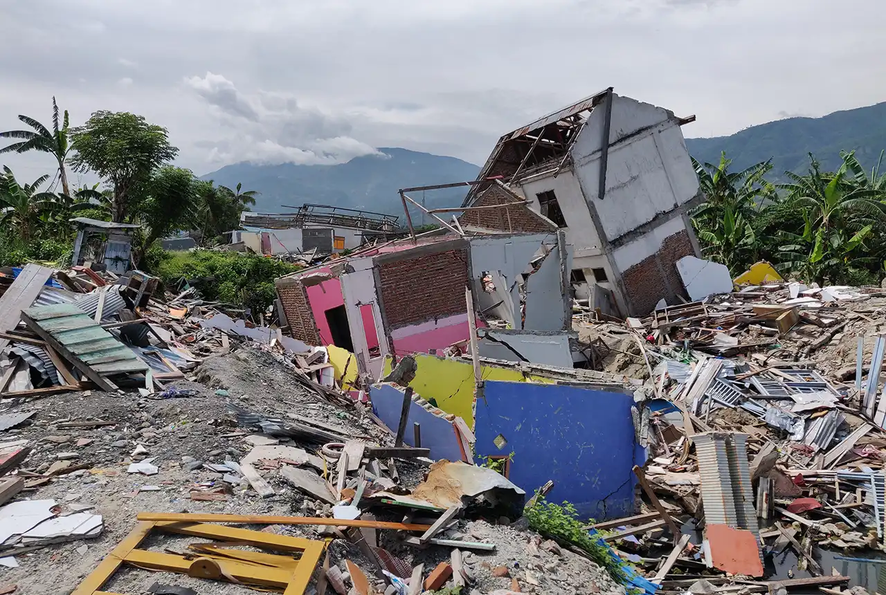
New report sets pathway to reduce the impacts of geohazards in one of the world’s most hazard-prone nations
30/09/2025
A new White Paper, co-developed by Indonesian and UK hazard experts, presents a strategic roadmap to significantly reduce the impacts of geological hazards in Indonesia.
Artificial intelligence helps scientists identify 3000 moving slopes potentially at risk of landslide
25/09/2025
A new approach that combines AI and satellite data has been used by scientists to detect actively moving landslides at a national scale.

UK scientists in awe-rora as national coverage of magnetic field complete for the first time
23/09/2025
New sensors being installed across the UK are helping us understand the effects that extreme magnetic storms have on technology and national infrastructure.
You may also be interested in
Shallow geophysics
Creating and using leading-edge technologies such as geophysical tomography to visualise the shallow subsurface.
Hazard and resilience modelling
Developing new and innovative data products that deliver geoscientific information to a range of users in an accessible form.