Cambering, gulls and valley bulging are responses to stress relief or ‘unloading’ that results from rapid incision or erosion of the landscape in conjunction with gravitational forces. Hutchinson (1991) used the term ‘superficial valley disturbances’ to describe the processes of cambering, gulls and valley bulging associated with periglacial conditions.
Cambering
Cambering involves large-scale stretching, tilting or rotation of more competent blocks over less competent strata such as clays, mudstones or shales. Cambered strata occur on valley crests and commonly the cambered blocks are tilted to the valley axis. The movement of the competent strata may result, at least in part, from weathering and changes in pore pressures in the underlying, less competent strata.
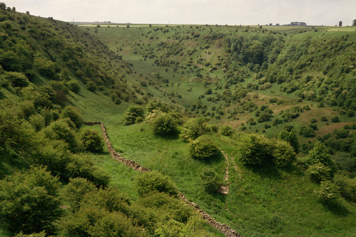

Hambleton Hills, North Yorkshire. To the right of the stone wall is a block of gritstone that has camber-slipped down the valley side. BGS © UKRI.
Gulls
Gulls are deep discontinuities in competent strata that extend back from the valley crest, commonly parallel to the axis of the valley and associated with relaxation of the valley side. Gull widths can range from millimetres to tens of metres. They do not always extend up to the ground surface and may or may not be sediment filled. In some scenarios the dating of cements can provide information with respect to their minimum age (Self and Farrant, 2013).
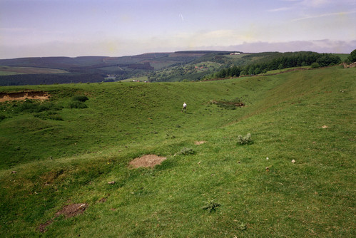
Deep camber gull at Sneck Yate Bank, North York Moors. BGS © UKRI.
Valley bulging
Valley bulging comprises the development of non-tectonic anticlinal folds or discontinuities in the base of valleys. The processes leading to valley bulging can be complex, incorporating rebound due to erosion and periglacial freezing of the ground accompanied by the development of excess pore pressures and compressional forces imposed by inward relaxation of valley sides, e.g. the example at Rowlee Bridge.
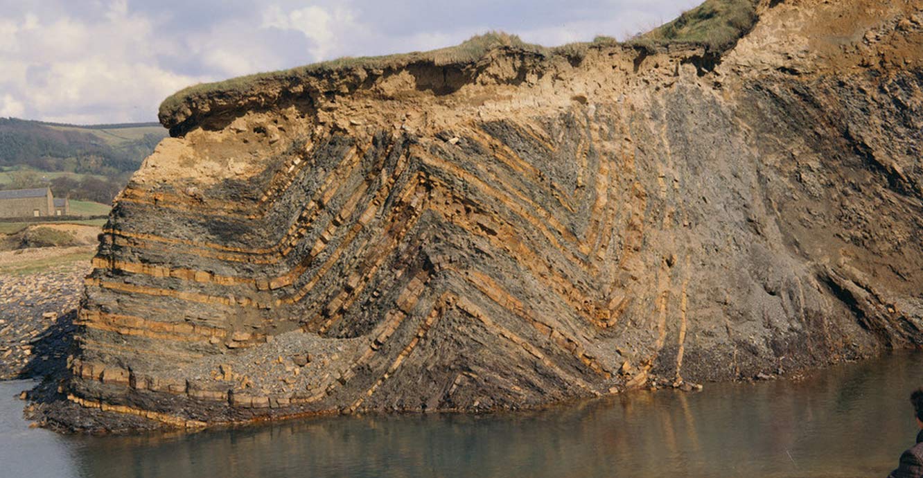
Valley bulging near Rowlee Bridge. BGS © UKRI.
Why are we interested in cambering and valley bulging?
These features are of interest to our researchers because they help us to better understand the processes associated with permafrost, Quaternary conditions and rates of landscape evolution. Improved understanding also informs planning for ground engineering projects.
The size and scale of these features can impact significantly on engineering. For example, evaluation of clay disturbance as a consequence of valley bulging was critical to the construction of the Empingham dam at Rutland Water and the upper dams of the Derwent Valley. We have also been investigating the use of geophysical techniques such as electrical resistivity topography and ground-probing radar to determine the location of and characterise buried gull features.
Other processes causing shallow geohazards
Glacial depositional environments may comprise very variable sequences of lithology. There is a range of other glacial and periglacial processes that have the potential to affect the engineering of the near-surface, including:
- relict cryogenic mounds, for example disturbance by relict pingos, which can be a cause of unforeseen ground conditions
- relict ice wedges
- landslides
- other hill-slope processes, such as:
- frost creep: downslope soil displacement that occurs during freeze–thaw cycles
- soilfluction: downhill movement of water-saturated soil
- gelifluction: a similar process to solifluction that occurs in permafrost conditions
- nivation: processes that occur under snow cover
- thermokarst processes: process that occur during thawing of permafrost or large-scale ice sheets
Hutchinson, JN. 1991. Theme lecture: periglacial and slope processes. Geological Society of London Engineering Geology Special Publications, Vol. 7, 283–331. DOI: https://doi.org/10.1144/GSL.ENG.1991.007.01.27
Self, C, and Farrant, A R. 2013. Gulls, gull-caves and cambering in the southern Cotswold Hills, England. 16th International Congress of Speleology, Brno, Czech Republic, 21–28 July 2013. Prague, Czech Republic, Czech Speleological Society.
You may also be interested in
Shallow geohazards
Measuring, recording and analysing near-surface geological hazards including landslides, sinkholes and discontinuities.