Soil piping is a naturally occurring, hydraulic process that leads to the development of macropores (large, air-filled voids) in the subsurface that are associated with landslides and collapse subsidence. It is most commonly associated with ‘soil’, a term that has contextual meanings. Here we consider soil in the engineering definition:
- naturally occurring
- loosely or weakly cemented, or relatively unconsolidated, or uncemented, mineral particles
- organic or inorganic in character
- lying over the bedrock
- formed by weathering (disintegration) of rocks
In these materials, in the right conditions, individual particles can be eroded by the subsurface flow of water, particularly when this is focused along preferential flow paths.
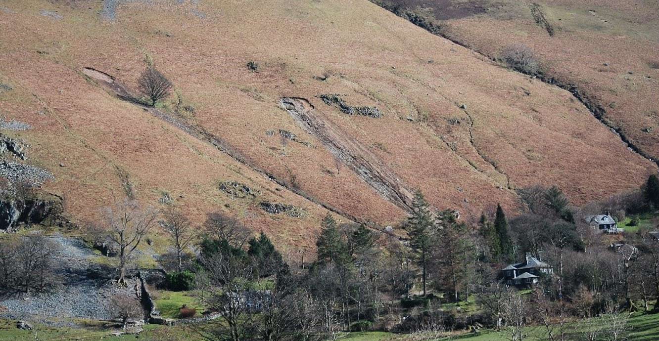

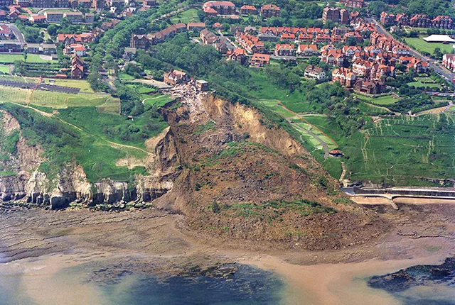
Soil piping-induced landslides. Patterdale in the Lake District, Cumbria. BGS © UKRI.
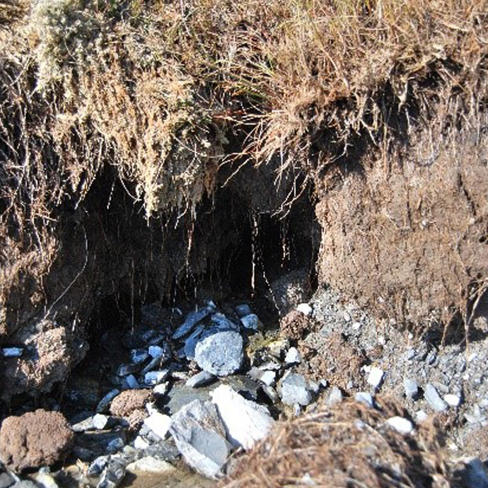
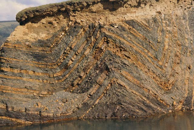
Exposed soil pipe in Patterdale. BGS © UKRI.
How do soil pipes form?
Soil piping can occur if the soil contains uncemented particles that are smaller than the general pore space in the soil. Over time, as more soil particles are removed, the macropores become connected and the system evolves, enabling increasingly large particles to be mobilised. Research has shown that piping occurs when soils have large particle diameter to small particle diameter ratios of 2.5:1 and 7:1 for loose and dense soils, respectively (Statham, 1977).
Another factor that influences whether or not piping will occur is the geomorphological context. Pipe flow is relatively common in the British uplands, where it is associated with steep valley-side slopes; it has also been encountered in flood plains marginal to stream channels (Jones, 2010). Some pipes are fed by desiccation cracks in the soil and if the extent of desiccation is influenced by aspect, the density of piping may vary locally as a consequence.
Anthropogenic factors can modify the likelihood of pipe flow, e.g. as consequence of ground compaction or ploughing.
Why we are interested in soil piping?
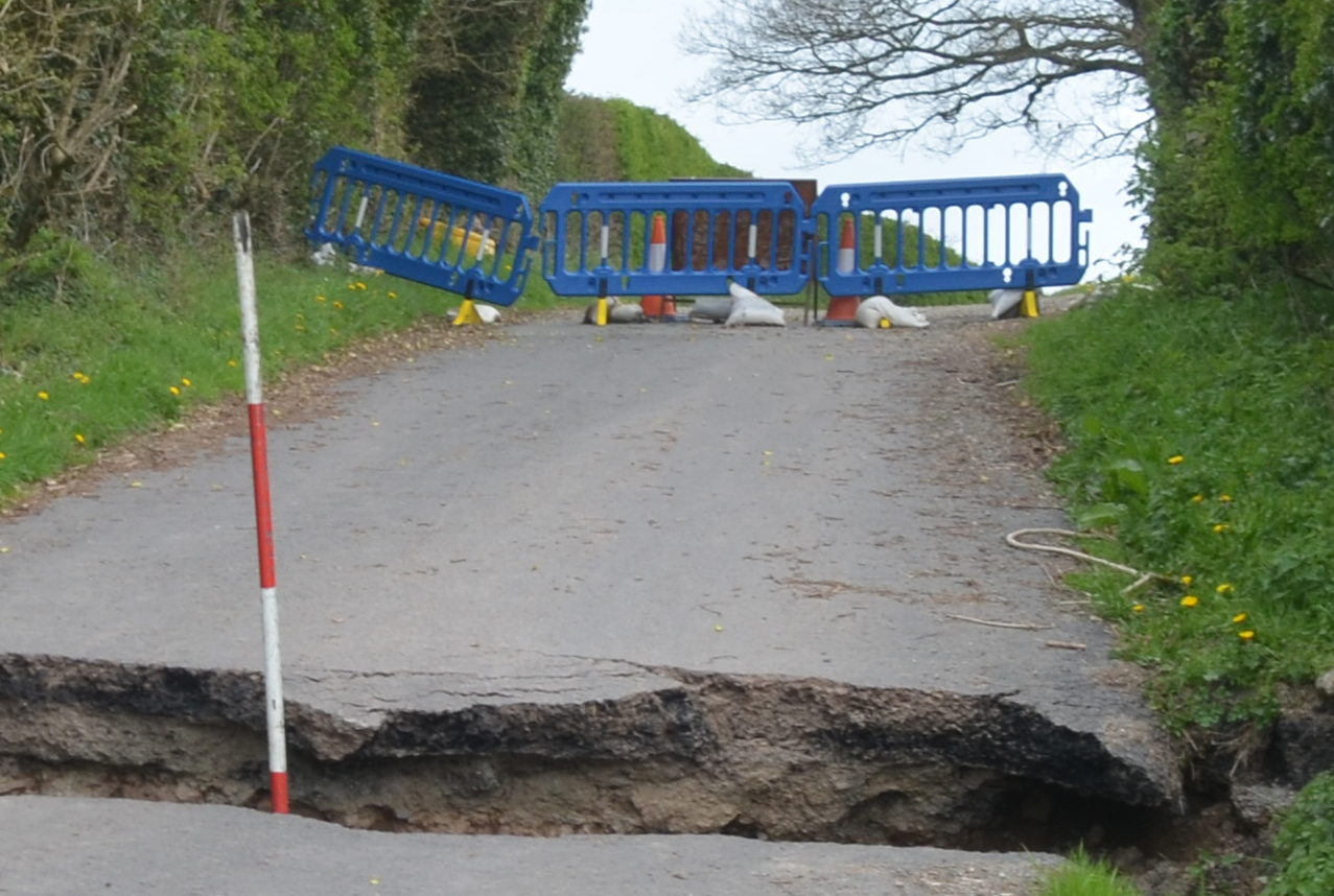
Soil piping is of interest to both hydrogeology and shallow geohazards research. For example, during storms, soil pipes can make a significant and often underestimated quick- or base-flow contribution to stream hydrographs (water level and/or flows). The pipe networks may be recharged by vertical infiltration and rising groundwater levels (Jones, 2010). They are relevant to subsidence, because erosion or ground vibration can lead to dropout or collapse subsidence above the soil pipe network, or part of it, resulting in a hollow or crater at the ground surface. Collapses of this type are commonly reported as sinkholes during periods of prolonged or unusually intense rainfall, e.g. during the spate of ‘sinkholes’ reported in the UK in 2014.
In similar conditions, the rapid build-up of pore-water pressure in the ground can lead to soil instability and landslides, with examples being reported in the English Lake District as a consequence of Storm Desmond in 2015. The observation that some pipe networks are recharged via desiccation cracks indicates the potential for prolonged drought conditions to impact the soil-pipe hydrology and the subsequent potential for sinkholes or landslides during wetter periods.
Jones, J A A. 2010. Soil piping and catchment response. Hydrological Processes, Vol. 24(12), 1548–1566.
Statham, I. 1977. Earth Surface Sediment Transport (Contemporary Problems in Geography). (Oxford: Clarendon.)
You may also be interested in:
Shallow geohazards
Measuring, recording and analysing near-surface geological hazards including landslides, sinkholes and discontinuities.
National Landslide Database
The BGS National Landslide Database (NLD) is the most extensive source of information on landslides in Great Britain.
Landslides
Building resilience both in the UK and internationally to landslides and carrying out many aspects of landslide research.
Cambering, gulls and valley bulging
Cambering, gulls and valley bulging are responses to stress relief that results from rapid erosion of the landscape in conjunction with gravitational forces.