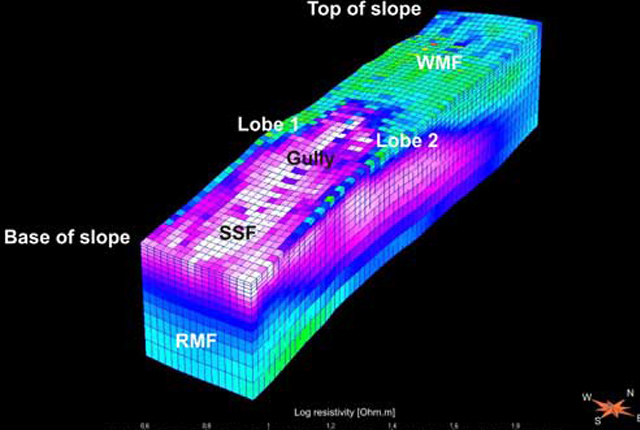
We have long-term monitoring observatories where data have been collected, in some instances, since 2001. We use a range of techniques to measure the changes at these sites including LiDAR, photogrammetry, geophysics and geotechnics.
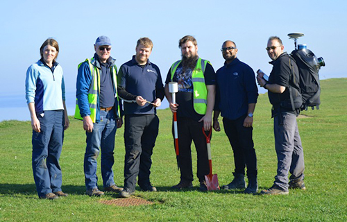

The team at the Aldbrough Coastal Landslide Observatory. BGS © UKRI.
From our monitoring and observation data we can inform our understanding of the landslide processes that will ultimately allow us to assess susceptiblity and risk, as well as providing a baseline against which to determine change and calculate loss.
Contact
If you want to discover more then please contact Vanessa Banks.
View our observatories
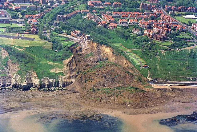
Aldbrough Coastal Landslide Observatory
Monitoring and modelling landslide activity at BGS’s coastal landslide observatory at Aldbrough, on the East Riding of Yorkshire coast.
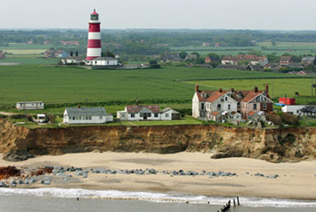
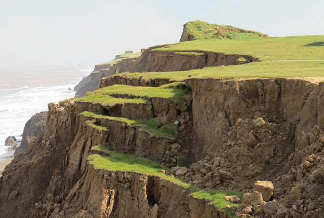
Happisburgh Landslide Observatory
Rapid erosion of the cliffs at Happisburgh means that we can observe processes that may normally take thousands of years at other sites.
Hollin Hill Landslide Observatory
Accurately monitoring and eventually predicting landslide movement through scientific research.
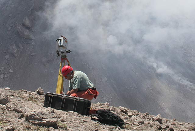
Ground-based and near-Earth geomatic surveys
BGS has pioneered the use of ground-based (terrestrial) techniques for a variety of geoscientific applications since 1999.
You may also be interested in
Landslides
Building resilience both in the UK and internationally to landslides and carrying out many aspects of landslide research.

Landslide case studies
The landslides team at the BGS has studied numerous landslides. This work informs our geological maps, memoirs and sheet explanations and provides data for our National Landslide Database, which underpins much of our research.
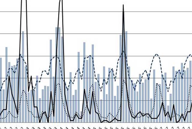
Landslides and rainfall
We combine rainfall statistics and landslide data to produce graphs demonstrating the relationship between landslides and rainfall.
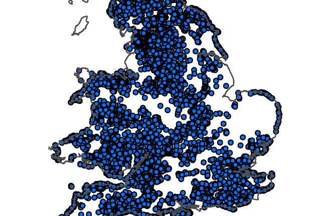
National Landslide Database
The BGS National Landslide Database (NLD) is the most extensive source of information on landslides in Great Britain.