Evolving policies in the face of climate change: BGS data can help
Climate change is increasingly recognised as a major challenge for organisations, with the need for adaptation driving a wave of policy updates and reforms across multiple sectors. BGS data holdings are relevant to many of these changes and the following examples outline how these data packages can be applied.
25/08/2023

Financial stress tests
The Bank of England stress tests have been designed to ensure that banks, insurers and lenders are resilient enough to cope with severe economic conditions. In 2021 the 2021 Climate Biennial Exploratory Scenario (CBES) was carried out to test resilience against physical risks associated with different climate change scenarios.
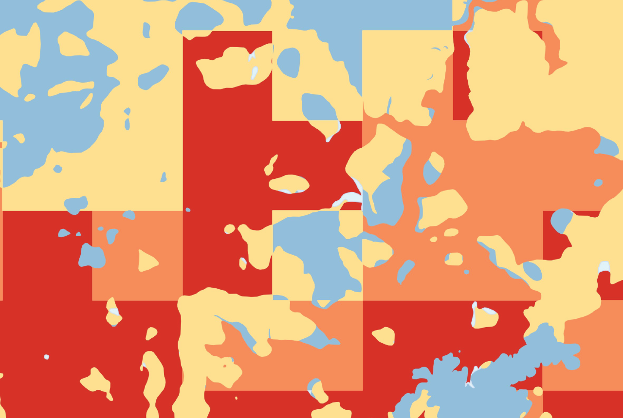
BGS GeoClimate is our flagship climate change geohazard dataset which assesses the susceptibility of lithologies to shrink-swell subsidence considering different climate change scenarios.This allows organisations to assess their portfolios for potential future ground instability risks and develop mitigation plans accordingly.
In 2021, BGS GeoClimate utilised UKCP18 climate projection data to offer susceptibility projections for RCP8.5. In order to better support future stress testing and policy changes BGS is developing an additional BGS GeoClimate update which deploys EURO-CORDEX climate simulations to deliver shrink-swell subsidence susceptibility projections. This will include data for RCPs 2.6, 4.5 and 8.5. (Keep an eye out for our upcoming product launch and blog post aimed at demystifying climate projections.)
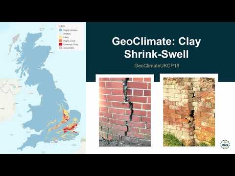

BGS GeoClimate video
Conveyancing regulations
Earlier this year the Law Society for England and Wales announced new guidance relating to climate change, which placed the onus on solicitors to ‘advise on physical climate risks and how they impact real estate ownership and use’. BGS GeoClimate can play a key role in advising conveyancers and property search companies on potential future subsidence threats.
BGS GeoCoast is a coastal geohazard data package containing future coastal inundation scenarios and an assessment of the erodibility of the GB coastline. With sea levels predicted to rise into the future BGS GeoCoast is a powerful tool to satisfy policy requirements and identify properties which are likely to be impacted by these geohazards in the future. BGS GeoCoast has been specifically designed to be integrated with shoreline management plan areas to support local authorities in implementing their region-specific policies.
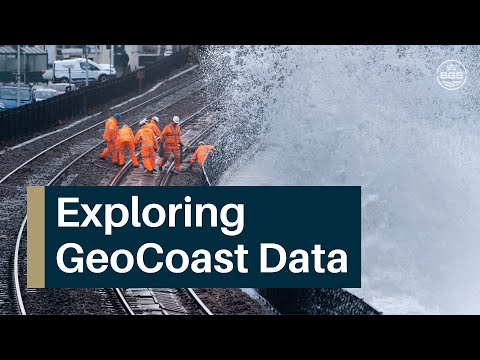
BGS GeoCoast video
National adaptation planning
The Department for Levelling Up, Housing and Communities ran a consultation period from December 2022 to March 2023 regarding proposed changes to the National Planning Policy Framework. BGS responded to this consultation, a component of which focused on tackling climate change. The consultation made little mention of geohazards but stated that ‘Any changes needed for adaptation in the National Planning Policy Framework will include considering any changes required to reflect the third National Adaptation Programme, governments policy response to the latest assessment of UK climate risk.’ Defra has since published the National Adaptation Programme (NAP3), which identifies 61 climate risks and opportunities, including geohazards such as:
- groundwater flooding and scarcity
- coastal erosion
- subsidence
- aquifer contamination from saltwater intrusions
- threats to soils and agricultural productivity
- river erosion.
BGS has compiled a breakdown of BGS digital datasets available to support sector specific climate change challenges and covers a host of geohazards, focusing on those identified by NAP3.
These include groundwater vulnerability datasets for England, Wales and Scotland and BGS GeoScour , a national river erosion susceptibility data package which identifies river beds and banks prone to erosion that is a valuable tool for any forward-looking assessment of threats to riverside assets and infrastructure.
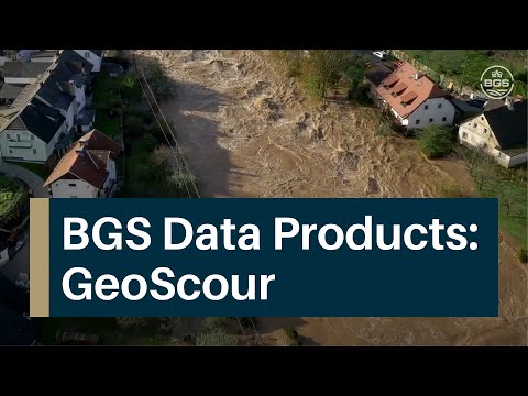
BGS GeoScour video
More information
Although this is by no means an exhaustive list of either the evolving policies across all UK sectors or the BGS geoscience and datasets available to support their implementation, we hope that this has provided a useful insight into how BGS data holdings can be applied. If you would like to find out more or have a specific query please see our BGS geohazards and climate change position statement, which provides a review of current BGS geohazard-related activities that consider our changing climate within a UK context. You can also get in touch with the digital data team (digitaldata@bgs.ac.uk).
About the author

Rob Shaw
Geospatial data analyst
Relative topics
Related news

Updated national 3D model will determine the depth to the solid bedrock beneath our feet
13/07/2026
The BGS Superficial Deposit Thickness Model now includes an elevation model of geological rockhead for the first time, providing important data for civil engineers, geoscientists and environmental scientists.

From archive to discovery: historical mineral reports support gold exploration in Scotland
25/06/2026
Digitised geological records show potential to unlock untapped mineral resources in Ardlochan, Argyllshire.

Latest research emphasises climate-related subsidence risk to millions of British homes
11/06/2026
New data from BGS highlights the projected future impact of warmer, drier summers and underlines the need for mitigation measures in susceptible regions.

Ukraine and the UK strengthen their commitment to geological cooperation
10/06/2026
A new Memorandum of Understanding reaffirms the UK’s support of Ukraine’s ambitions to develop its critical mineral resources, paving the way for collaboration through capacity-building programmes.
GeoClimate Shrink–Swell
GeoClimate clay shrink-swell provides information on the projected future change in susceptibility of clay shrink–swell across Great Britain due to climate change.

New geological maps of Berwick-upon-Tweed to help future-proof natural water supply
20/05/2026
Scientists have mapped the geology under the town to better understand the groundwater system to inform decisions around abstraction.

BGS GeoClimate – dataset launch webinar
Event on 02/06/2026
The virtual launch of our new BGS GeoClimate dataset – helping mitigate the economic risk from shrink-swell subsidence. Event recording now available

PhD adventures in Copenhagen, Denmark: revealing past recovery processes of tropical forest systems through ancient environmental DNA
12/03/2026
PhD student Chris Bengt visited the University of Copenhagen to carry out very delicate extraction of aeDNA from lake-sediment cores, in the hopes of unlocking the secrets of past volcanic eruptions.

Map of BGS BritPits showing the distribution of worked mineral commodities across the country
18/02/2026
BGS’s data scientists have generated a summary map of the most commonly extracted mineral commodities by local authority area, demonstrating the diverse nature of British mineral resources.

Funding secured to help mitigate ground risk in UK construction sector
05/02/2026
The BGS Common Ground project has been awarded new funding to help unlock the value of ground investigation data.

BGS awarded funding to support Malaysia’s climate resilience plan
17/12/2025
The project, funded by the Foreign, Commonwealth & Development Office, will focus on minimising economic and social impacts from rainfall-induced landslides.

New geological maps of the Yorkshire Wolds to better inform groundwater management and policy decisions
17/12/2025
The new mapping provides crucial data on localised geological issues that may assist in protecting water supplies.