
Hydrogeological maps of Scotland. BGS © UKRI.
Hydrogeological maps of Scotland
- 1:100 000
- Scotland
- Premium
BGS has produced a suite of hydrogeological maps of Scotland. The suite comprises two layers: groundwater vulnerability and aquifer productivity (bedrock and superficial).
Key information
- Scale:
- 1:100 000
- Coverage:
- Scotland
- Availability:
- Premium
- Price:
£0.45 per km2. Subject to number of users, licence fee and data preparation fee.
- Format:
- GIS polygon data (ESRI, MapInfo, others available by request)
- Uses:
- Local-level use
- Themes:
- Environmental change, Hydrogeology
The BGS has produced a suite of hydrogeological maps of Scotland. The suite comprises two layers: groundwater vulnerability and aquifer productivity (bedrock and superficial).
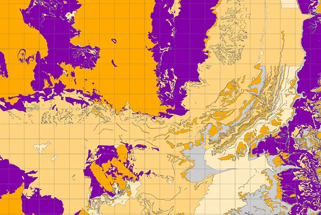
Groundwater vulnerability layer
Groundwater vulnerability is the tendency and likelihood for general contaminants to move vertically through the unsaturated zone and reach the water table after introduction at the ground surface. The groundwater vulnerability map shows the relative vulnerability to contamination of groundwater at the uppermost water table.
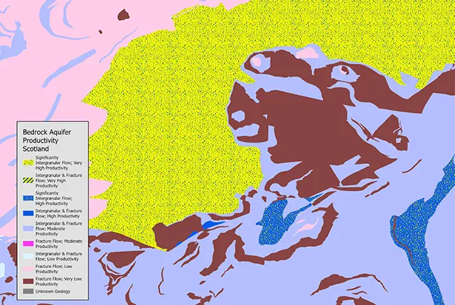
Aquifer productivity layer
The aquifer productivity maps describe the potential of bedrock and superficial deposit aquifers across Scotland to sustain various levels of borehole water supply, plus the dominant groundwater flow type in each aquifer. They have been used to help characterise groundwater bodies as required by the Water Framework Directive and are useful in policy development to prioritise water supply and site investigations, to inform planning decisions and to improve awareness of groundwater in general.
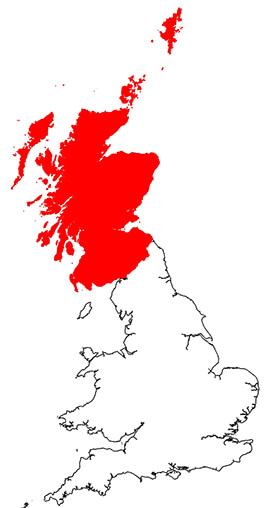
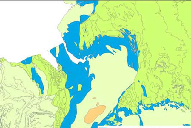
Hydrogeology of Scotland dataset coverage. BGS © UKRI – Contains OS data © Crown copyright 2020.
You may also be interested in
Aquifer designation data
The aquifer designation dataset reflects the importance of aquifers in England and Wales as a resource and their role in supporting surface water flows and wetland ecosystems.
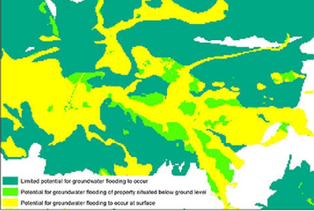
Groundwater flooding
In response to the need for more information on groundwater flooding, BGS has produced the first national dataset on the susceptibility across Britain.
Groundwater vulnerability data
Our groundwater vulnerability maps provide an assessment of the vulnerability of groundwater in overlying superficial rocks and those that comprise the underlying bedrock.
Hydrogeology 625K digital hydrogeological map of the UK
The hydrogeological map indicates aquifer potential in generalised term.
Infiltration SuDS map
The BGS Infiltration SuDS map dataset is suitable for those involved in the design of sustainable drainage systems and approving SuDS planning applications.

Permeability
Permeability data is often used in studies of groundwater. Our permeability information is based on BGS Geology 50K data.