Can geophysics help feed people in a changing climate?
Conservation agriculture and electrical resistivity tomography could help combat the factors affecting food security in southern Africa.
09/11/2021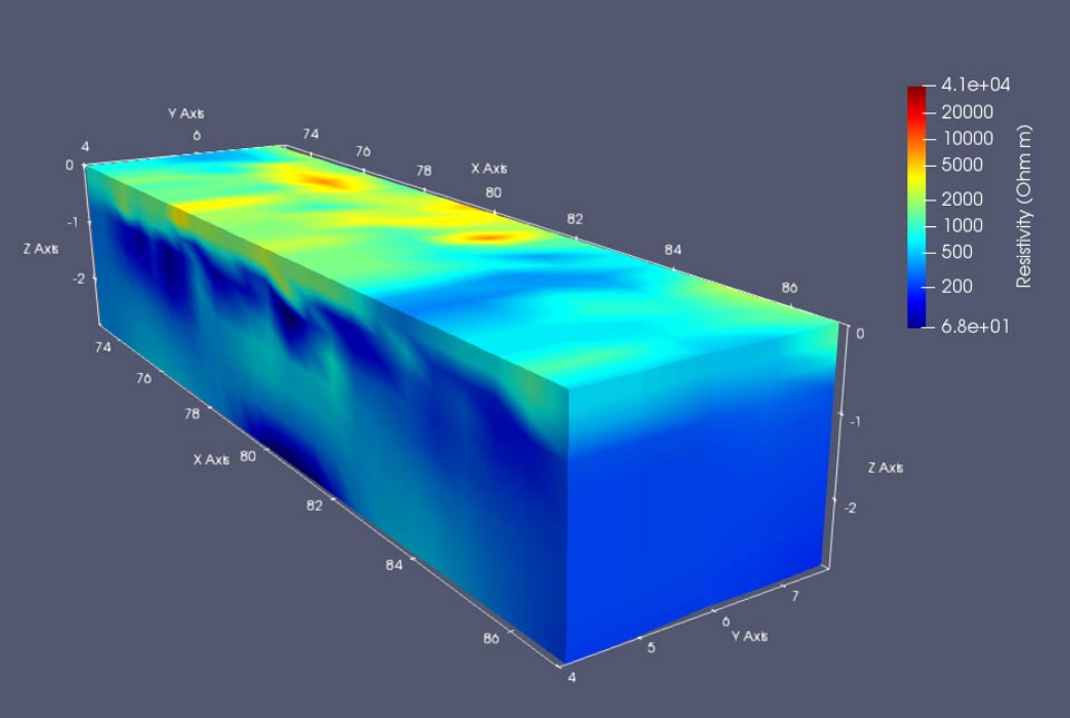

As climate change affects the globe, the regional impact in southern Africa is that of a drying climate with more frequent droughts (Dai, 2012). Combined with an increasing population, this poses challenges to future food supply (van Ittersum et al., 2016).
Conservation agriculture (CA) is a promising tool to help combat the factors affecting food security in the region. This is an agricultural technique consisting of minimal soil disturbance (no tillage), mulching the soil with crop residues (the remains of the crop after harvest), and crop rotation and/or intercropping to diversify the system (FAO, 2016). CA has been shown to increase both yields and the resilience of crops to drought when compared to conventional agricultural methods and has been found to increase water infiltration into soils, reducing runoff and erosion (McGarry et al., 2000; Palm et al., 2014; Pittelkow et al., 2014; Steward et al., 2018; Thierfelder and Wall, 2009; Verhulst et al., 2010).
Whilst we are aware that CA can improve yields and drought tolerance and that it can influence water infiltration, little is known about hydrodynamics below the ground surface, i.e. the way the water moves through and is stored within the soil profile and how it travels to the groundwater table. The CEPHaS project, described in detail in a blog by project lead Prof Murray Lark, aims to provide some answers to fill this knowledge gap.
Questions the project hopes to answer include:
- how does CA affect the quantity of water stored in the soil profile?
- how is water uptake by crops influenced by CA?
- how does CA alter recharge rates for groundwater?
My own research is on near-surface geophysics, specifically developing and applying electrical resistivity tomography (ERT), a ground imaging technique. ERT entails the use of an instrument to pass an electrical current through the ground via cabling and metal electrodes, and the measurement of voltages produced by the resultant electrical field in the vicinity of that current. By collecting many measurements in one dataset and processing the data with specialised software, it is possible to model (or image) the electrical resistivity of the subsurface in either two or three dimensions and at a high spatial resolution.
3D electrical resistivity image created using ERT data from the Zimbabwean CEPHaS observatory. The top of the cuboid is the ground surface: warmer colours show higher resistivities and cooler colours show lower resistivities. The modelled volume reaches approximately 2.5 m depth and the data for this image has been collected solely using electrodes at the ground surface. BGS © UKRI.
The resultant electrical resistivity models may be influenced by factors such as soil composition, porosity and water content. Through the repetition of ERT measurements over time, it is possible to see the changes in resistivity of the ground; assuming the soil composition has remained constant, any difference in resistivity is likely caused by variations in the water content of the soil, therefore it is possible to image soil moisture content over time (hydrodynamics). This ability to study the hydrodynamics of soils makes ERT ideally suited to helping to answer the research questions of the CEPHaS project.
At BGS we have developed a low-cost, low-power, ERT monitoring instrument called PRIME. Due to its low cost we have been able to purchase several instruments, enabling each to be permanently installed at an individual site. The low power requirements mean that we can install them in remote locations with just a solar panel and some batteries to provide the required energy. Consequently, we have been able to collect data with a higher temporal resolution than has been previously possible. We are collecting measurements twice daily in our three CEPHaS observatories in Zambia, Malawi and Zimbabwe.
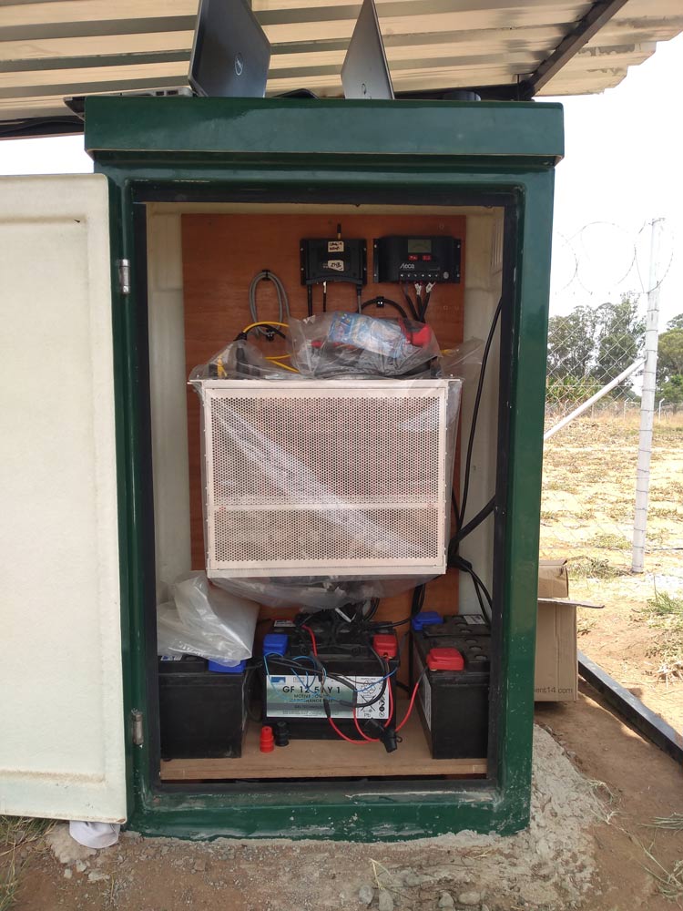
An example PRIME instrument installation at the Zimbabwe CEPHaS observatory; the PRIME instrument is the metal rack in the centre of the cabinet. The batteries at the base provide all the power needed to run PRIME and are connected to a solar panel via the solar regulator at the top of the cabinet. Next to the solar regulator is a GSM router that allows the remote sending of data and receiving of instructions to and from anywhere in the world. BGS © UKRI.
In the CEPHaS project, we are using a combination of techniques to try to address our research objectives, through both the novel technique of ERT monitoring and more traditional methods:
- collecting weather data and monitoring the crops themselves to calculate evapotranspiration
- installing point sensors in the upper metre to monitor soil water content and soil suction (the capillary suction caused by the porosity of the soil).
- drilling boreholes to tens of metres and instrumenting them with piezometers to monitor the level of the groundwater table in order to study groundwater recharge
These traditional point-sensor methods provide high accuracy and a high frequency of measurements over time (temporal resolution), but their low spatial resolution means that they struggle to capture heterogeneities common in the subsurface and are not always able to show the cause of any rise or fall in groundwater levels.
We are using these more traditional methods together with ERT monitoring as the strengths and limitations of each complement one another. While the collection of twice-daily measurements is pushing the boundaries for ERT monitoring, it is far less frequent than data collection by point sensors. Meanwhile, the high spatial resolution collected by ERT monitoring allows us not only to better understand heterogeneities between point sensors, but also to bridge the gap between the soil sensors in the upper metre and those sensors found in the boreholes at depth.
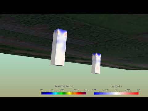

Fly through of the modelled ERT data at the Malawian CEPHaS observatory. BGS © UKRI.
The aerial photograph in the video shows the agricultural test plots, while the coloured cuboids beneath the ground surface show the modelled electrical resistivity. Each of the resistivity cuboids are 1 m square in plan view, and 3.1 m deep. In the initial, static phase, warmer colours equate to higher resistivities, while cooler colours signify lower resistivities. After this, the modelled ERT shows changes in resistivity over time, with blue colours depicting decreasing resistivity and red showing resistivity increases. The decreases in the resistivity are caused by the wetting fronts created by several rainfall events penetrating to depth.
In addition to the research objectives of CEPHaS, the project possesses a very strong capacity-building element. The training and experience that has been provided throughout the project means that colleagues at the University of Zambia, Lilongwe University of Agriculture and Natural Resources and the University of Zimbabwe are amongst the most advanced users of PRIME technology outside of BGS. Not only this, but the equipment installed in the three CEPHaS observatories is to remain after the end of the project, allowing project partners to continue with important research and bid for new projects.
The CEPHaS project aims to answer important questions surrounding the hydrodynamics of CA by using complementary methods, both traditional and novel. With our findings, we want to assist policymakers and potential CA farmers with making informed decisions about the uptake of this promising agricultural method. We hope that the dissemination of our findings, and the increased research capacity the project has built, will leave a legacy long beyond the project end.
Dai, A., 2012. Increasing drought under global warming in observations and models. Nature Climate Change, 3: 52.
FAO, 2016. Save and Grow in practice: maize rice wheat. Food and Agriculture Organization of the United Nations, Rome.
McGarry, D., Bridge, B.J. and Radford, B.J., 2000. Contrasting soil physical properties after zero and traditional tillage of an alluvial soil in the semi-arid subtropics. Soil and Tillage Research, 53(2): 105-115.
Palm, C., Blanco-Canqui, H., DeClerck, F., Gatere, L. and Grace, P., 2014. Conservation agriculture and ecosystem services: An overview. Agriculture, Ecosystems & Environment, 187: 87-105.
Pittelkow, C.M., Liang, X., Linquist, B.A., van Groenigen, K.J., Lee, J., Lundy, M.E., van Gestel, N., Six, J., Venterea, R.T. and van Kessel, C., 2014. Productivity limits and potentials of the principles of conservation agriculture. Nature, 517: 365.
Steward, P.R., Dougill, A.J., Thierfelder, C., Pittelkow, C.M., Stringer, L.C., Kudzala, M. and Shackelford, G.E., 2018. The adaptive capacity of maize-based conservation agriculture systems to climate stress in tropical and subtropical environments: A meta-regression of yields. Agriculture, Ecosystems & Environment, 251: 194-202.
Thierfelder, C. and Wall, P.C., 2009. Effects of conservation agriculture techniques on infiltration and soil water content in Zambia and Zimbabwe. Soil and Tillage Research, 105(2): 217-227.
van Ittersum, M.K., van Bussel, L.G.J., Wolf, J., Grassini, P., van Wart, J., Guilpart, N., Claessens, L., de Groot, H., Wiebe, K., Mason-D’Croz, D., Yang, H., Boogaard, H., van Oort, P.A.J., van Loon, M.P., Saito, K., Adimo, O., Adjei-Nsiah, S., Agali, A., Bala, A., Chikowo, R., Kaizzi, K., Kouressy, M., Makoi, J.H.J.R., Ouattara, K., Tesfaye, K. and Cassman, K.G., 2016. Can sub-Saharan Africa feed itself? Proceedings of the National Academy of Sciences.
Verhulst, N., Govaerts, B., Verachtert, E., Catellanos-Navarette, A., Mezzalama, M., Wall, P.C., Chocobar, A., Deckers, J. and Sayre, K.D., 2010. Conservation Agriculture, Improving Soil Quality for Sustainable Production Systems? In: R. Lal and B. Stewart (Editors), Food Security and Soil Quality. CRC Press, Boca Raton.
Russell Swift
Engineering and environmental geophysicist
Relative topics
Latest blogs

Building Europe’s geological future
20/07/2026
BGS scientists are contributing to a continent-wide initiative that is strengthening collaboration across borders to tackle shared subsurface challenges and unlock new opportunities.

Collecting beach pebbles: fun hobby but is it legal?
14/07/2026
The UK coastline will be inundated with keen holidaymakers this summer, many of whom will take a memento of their trip home in the shape of a pebble or two — but is it legal?

Strengthening capacity through partnership: a critical minerals perspective
28/04/2026
BGS has been working in partnership with the Geological Survey Department of Zambia (GSD) to build national capacity, improve data accessibility and support long-term, sustainable development.

PhD adventures in Copenhagen, Denmark: revealing past recovery processes of tropical forest systems through ancient environmental DNA
12/03/2026
PhD student Chris Bengt visited the University of Copenhagen to carry out very delicate extraction of aeDNA from lake-sediment cores, in the hopes of unlocking the secrets of past volcanic eruptions.

MARC Conference 2025: highlighting the importance of conferences to PhD students
16/02/2026
BGS and University of Nottingham PhD student Paulina Baranowska shares her experience presenting her research on nuclear forensics at her first international conference.

Hole-y c*@p! How bat excrement is sculpting Borneo’s hidden caves
23/12/2025
BGS researchers have delved into Borneo’s underworld to learn more about how guano deposited by bats and cave-dwelling birds is shaping the subsurface.

How the geology on our doorstep can help inform offshore infrastructure design
19/11/2025
BGS is part of a new collaboration using onshore field work to contextualise offshore data and update baseline geological models which can inform the sustainable use of marine resources.

Fieldwork on Volcán de Fuego
13/10/2025
Understanding how one of the world’s most active volcanoes builds up material, and how they collapse to feed hot flows
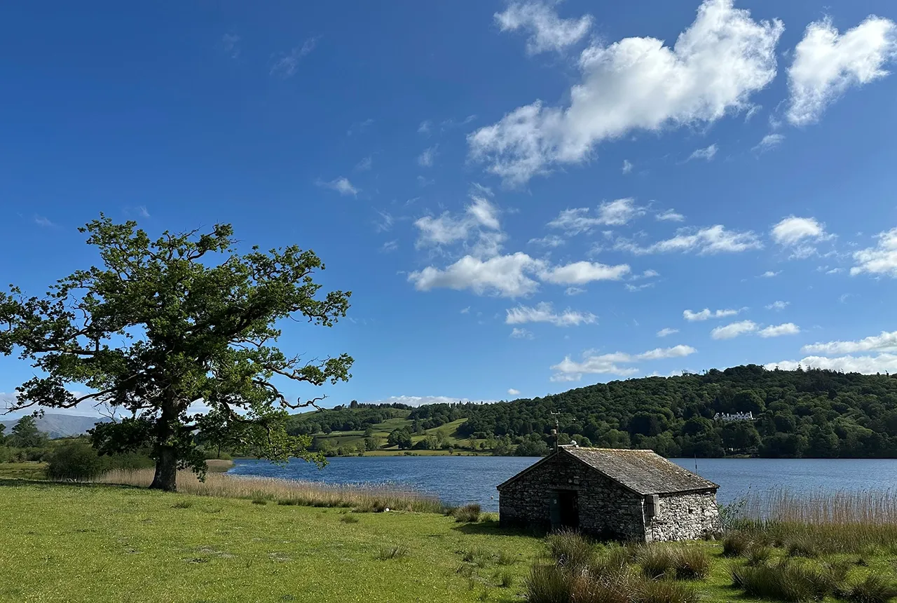
Esthwaite Water: applying novel approaches to understand lake-water nutrient pollution
19/09/2025
Andi Smith (BGS) and Savannah Worne (Loughborough University) embarked on fieldwork in the Lake District, applying a novel stable isotope method for tracing phosphorus sources.

Opening up the geosciences: making work experience more accessible
19/09/2025
BGS has been working with partners to make the geosciences more accessible to young people, including those from under-represented backgrounds.
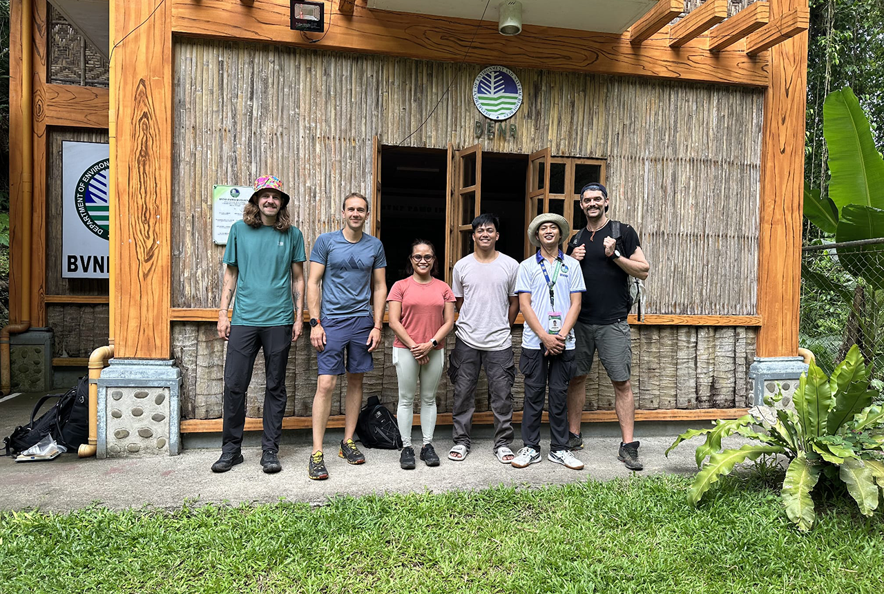
PhD adventures in the Philippines: coring around Lake Bulusan
05/09/2025
Chris Bengt recounts his two-week field trip to Bulusan Volcano Natural Park in the Philippines to collect lake sediment cores, fresh soil and water samples.
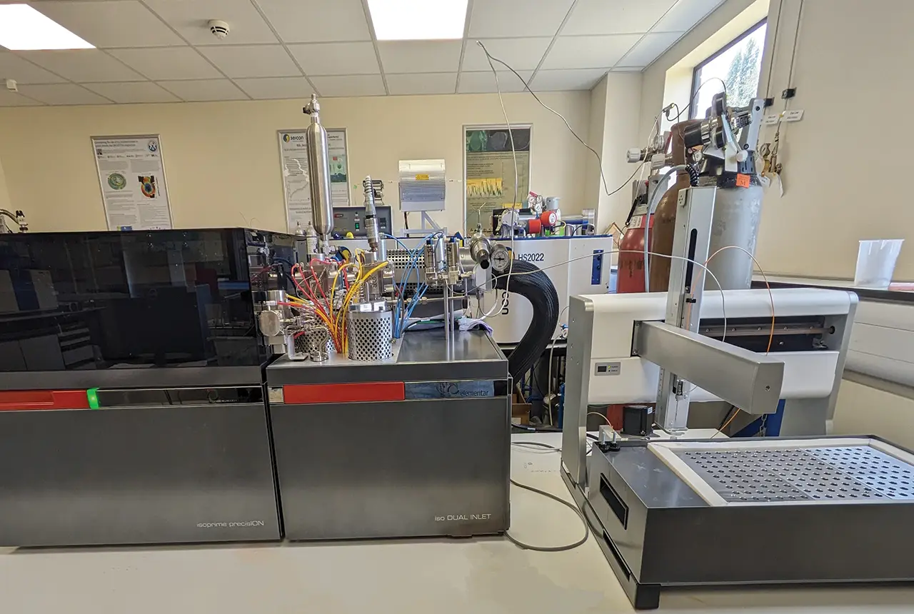
Gemini: a new stable isotope tool
21/08/2025
BGS’s Stable Isotope Facility has new mass spectrometer equipment for analysing carbon and oxygen isotopes from carbonates and water.