PRIME is a low-cost system specifically designed to remotely monitor ‘at risk’ geotechnical assets (e.g. embankments; cuttings; dams). PRIME combines emerging geophysical ground-imaging technology with innovative data telemetry, web portal access and intelligent monitoring. It develops the basis of a new generation of ‘smart’ earthwork technology capable of imaging the internal physical condition of infrastructure earthworks using diagnostic methods routinely used in medical physics.
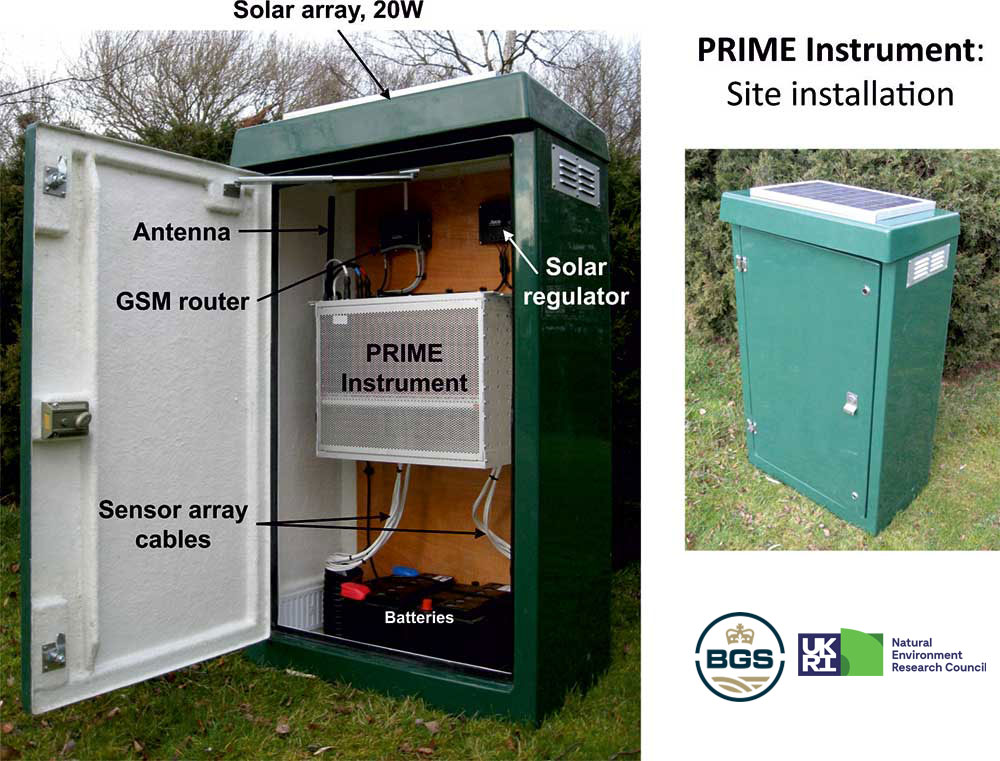

PRIME system.
The PRIME system uses electrical resistivity tomography (ERT) technology, a non-invasive geophysical technique that enables the imaging of the subsurface. It uses renewable solar energy to power the 10W requirement of the system, enabling it to run without mains electricity.
Using PRIME, it is possible to monitor the internal condition of infrastructure assets in near real time, with high temporal and spatial resolution. It monitors the moisture content of the asset and can track ground movement, whilst its interface with point sensors allows it to respond to changes in conditions by increasing the temporal resolution of its monitoring schedule.

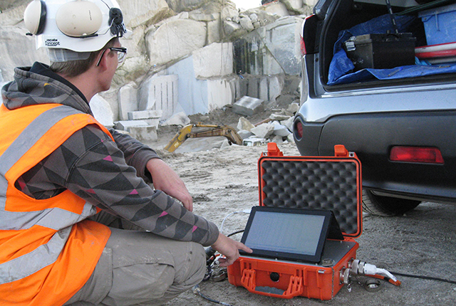
Close up of PRIME hardware.
PRIME assists with decision support by giving near real time updates of the condition of an asset, providing an early warning of failure. This allows stakeholders to predict, rather than just respond to, incidents involving critical infrastructure. In recognition of these benefits, PRIME won the 2016 Ground Engineering Product and Equipment Innovation Award.
In addition to geotechnical applications, PRIME can also be used for monitoring geohazards (e.g. landslides) and groundwater processes (e.g. contaminant transport). These applications are backed up by a wealth of experience in the geophysical tomography team.
Project partners
- Arup
- Atkins
- The Canal and River Trust
- Environment Agency
- Highways England
- HS2
- Kier
- National Grid
- Network Rail
- RSSB
- Scottish Canals
- SOCOTEC Monitoring UK Ltd (formerly ITM Monitoring)
- Transport Scotland
Contact
If you want to discover more please contact Jonathan Chambers.
You may also be interested in
Applications
Applications range from mineral exploration and waste management, to monitoring active processes within the subsurface, such as the movement of pollutants, or the flow of groundwater in unstable slopes affecting infrastructure.
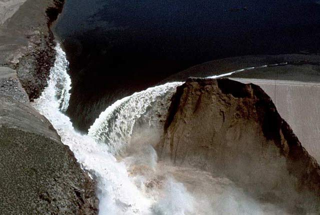
BGS PRIME: an early warning system for slope failure
Dam and slope failures can lead to the wide-scale destruction of property and, in some cases, catastrophic loss of life.
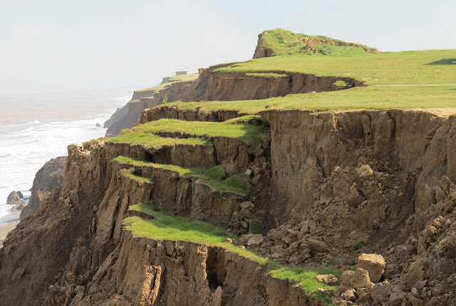
Landslide observatories
BGS have long-term monitoring observatories where data have been collected, in some instances, since 2001.