Key information
Scale:
1:10 000 – 1:50 000Coverage:
RegionalAvailability:
FreeFormat:
Free to view via online map viewerUses:
Regional-level useGet data
Free access
The maps are free to view online via the BGS Offshore GeoIndex. For information on licensing the downloadable GIS data (ESRI format), please contact digitaldata@bgs.ac.uk.
Offshore GeoIndexSupporting documents
User guides are available via the links in the map series in the table further down the page below.
BGS has initiated a new programme of mapping the seabed geology of the UK’s continental shelf, the first effort to consistently characterise the geology of the seabed in over 20 years. These new, fine-scale maps provide detailed and accurate characterisation of the seabed geology, integrating substrate geology, structural geology and seabed geomorphology.
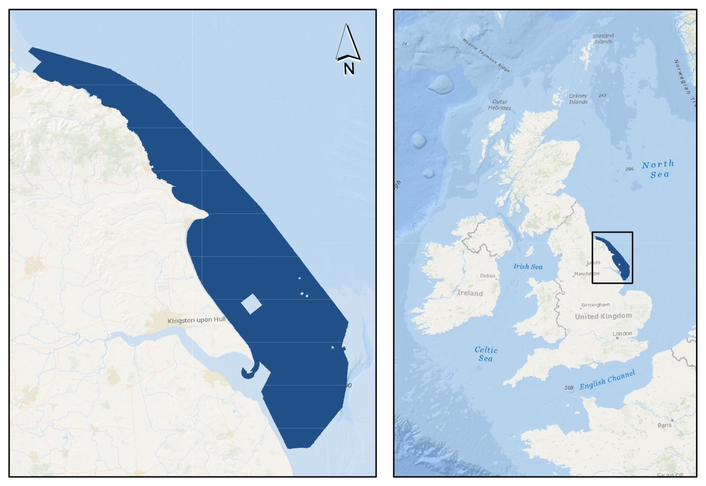

Dark blue area shows the coverage of the BGS Seabed Geology 10K: offshore Yorkshire map. Background image from World Ocean Base dataset compiled by Esri, Garmin, GEBCO, NOAA NGDC, and other contributors. Basemap created using ArcGIS. Copyright © Esri. All rights reserved. www.esri.com
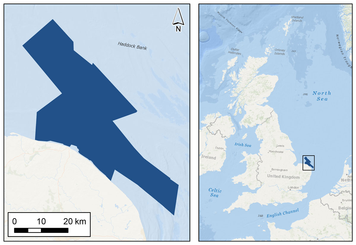
Dark blue area shows the coverage of the BGS Seabed Geology 10K: East Anglia. Background image from World Ocean Base dataset compiled by Esri, Garmin, GEBCO, NOAA NGDC, and other contributors. Basemap created using ArcGIS. Copyright © Esri. All rights reserved. www.esri.com
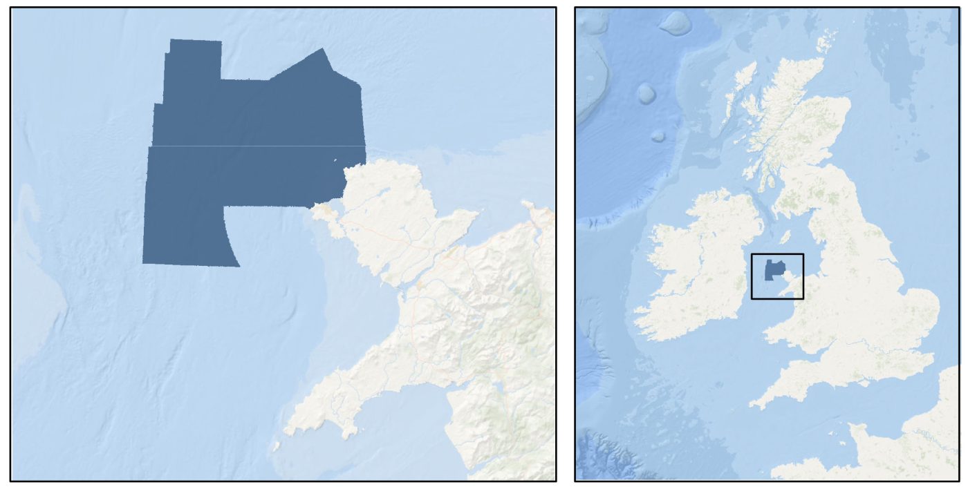
Dark blue area shows the coverage of the BGS Seabed Geology 10K: Anglesey map. Background image from World Ocean Base dataset compiled by Esri, Garmin, GEBCO, NOAA NGDC, and other contributors. Basemap created using ArcGIS. Copyright © Esri. All rights reserved. www.esri.com
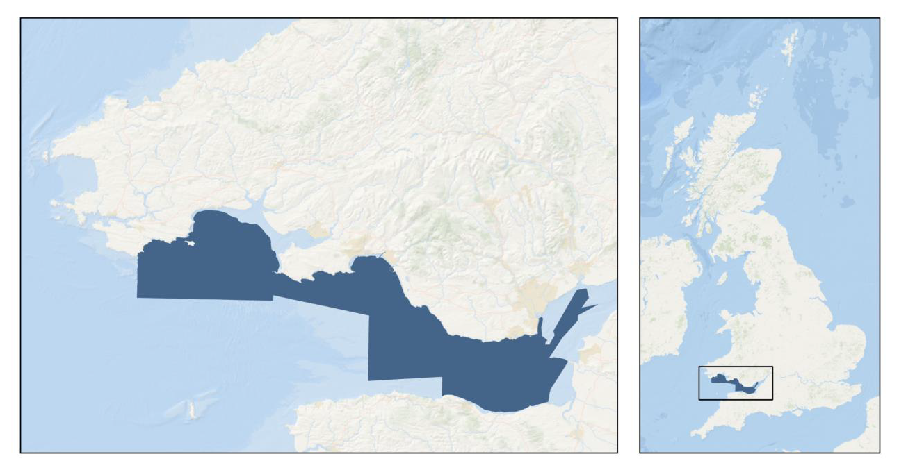
Dark blue area shows the coverage of the BGS Seabed Geology 10K: Bristol Channel map. Background image from World Ocean Base dataset compiled by Esri, Garmin, GEBCO, NOAA NGDC, and other contributors. Basemap created using ArcGIS. Copyright © Esri. All rights reserved. www.esri.com
The digital maps are intended as resources to support a diverse range of offshore activities and applications, including scientific research, offshore development, conservation initiatives and marine spatial planning and management.
The new mapping is based primarily on high-resolution bathymetry data produced by the UK Civil Hydrography Programme (CHP). Analysis and interpretation are further informed by secondary data and information resources, including:
- acoustic backscatter
- physical samples (for example grabs, cores and boreholes)
- seismic data
- academic and publicly accessible industry data and literature
- previous BGS mapping (onshore and offshore)
The CHP is administered by the Maritime and Coastguard Agency (MCA), with technical oversight, data validation and onward charting undertaken by the UK Hydrographic Office (UKHO).
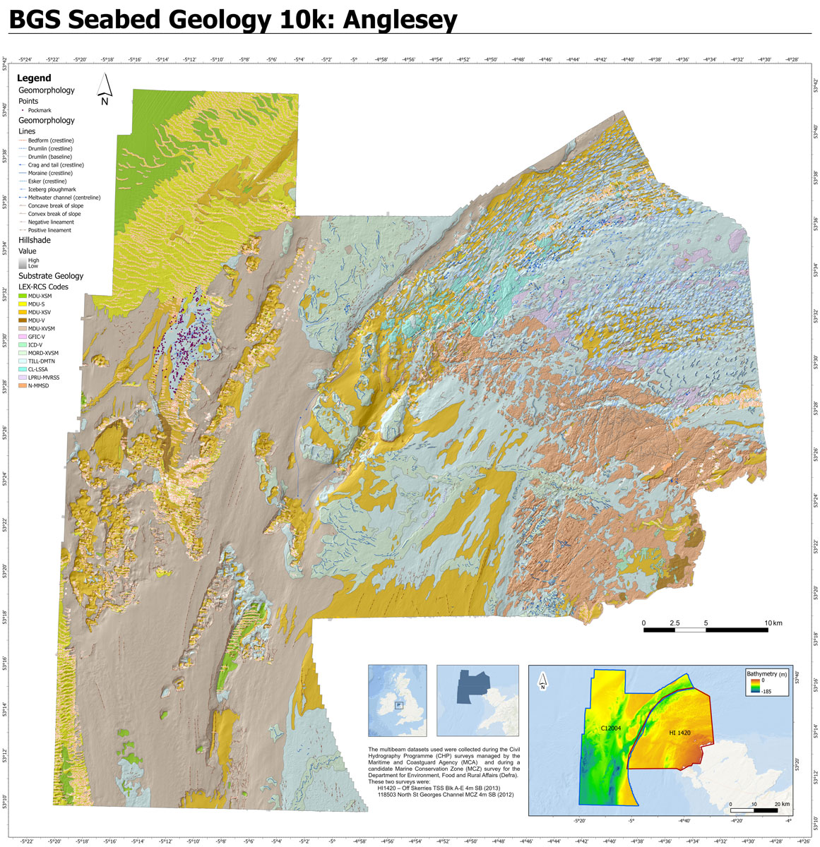
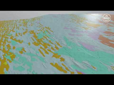
BGS Seabed Geology 10K: Anglesey map, showing geomorphology layers (lines and points), structural geology, substrate geology and hillshade. Contains OS data © Crown Copyright and database right 2020. The underlying hillshade image is derived from bathymetric data acquired by the MCA © Crown Copyright 2022, released under OGL.
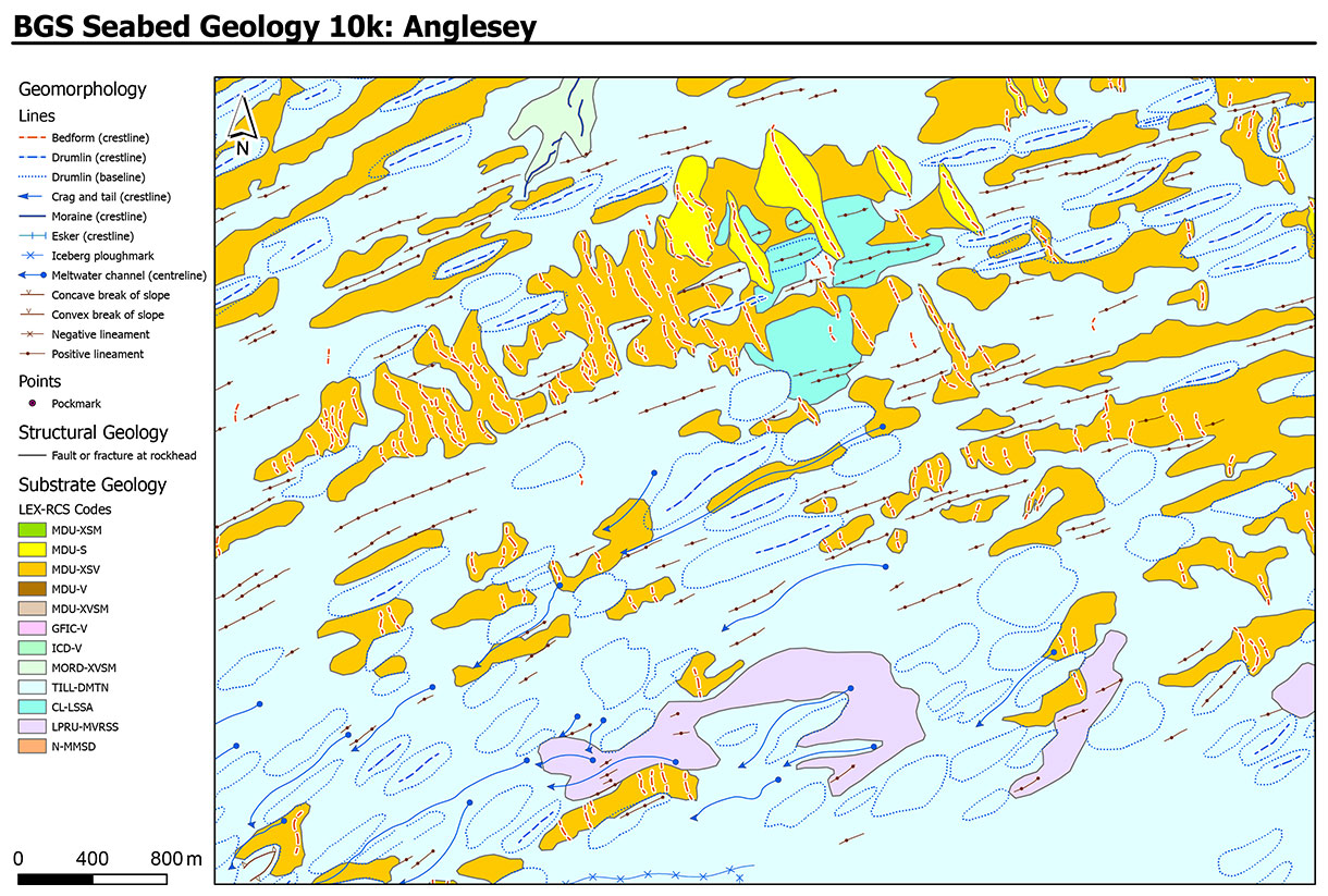
Section of the BGS Seabed Geology 10K: Anglesey map, showing geomorphology layers (lines and points), structural geology and substrate geology. Contains OS data © Crown Copyright and database right 2020.
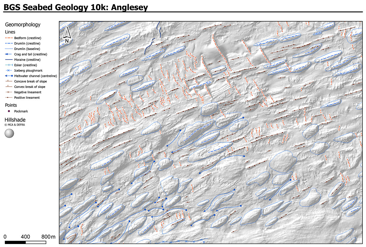
Section of the BGS Seabed Geology 10k: Anglesey map, showing geomorphology layers (lines and points) and hillshade. Contains OS data © Crown Copyright and database right 2020. The underlying hillshade image is derived from bathymetric data acquired by the MCA © Crown Copyright 2022, released under OGL.
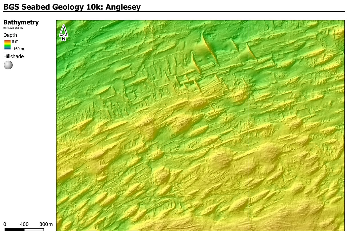
Section of the BGS Seabed Geology 10k: Anglesey map, showing bathymetry data (depth and hillshade). Contains OS data © Crown Copyright and database right 2020. The underlying hillshade image is derived from bathymetric data acquired by the MCA © Crown Copyright 2022, released under OGL.
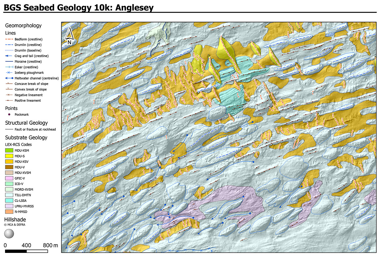
Section of the BGS Seabed Geology 10k: Anglesey map, showing geomorphology layers (lines and points), structural geology, substrate geology and hillshade. Contains OS data © Crown Copyright and database right 2020. The underlying hillshade image is derived from bathymetric data acquired by the MCA © Crown Copyright 2022, released under OGL.
Product summary
The new fine-scale BGS Seabed Geology mapping comprise three complimentary components (or layers):
- substrate geology: distribution of bedrock and superficial geological units interpreted to be dominant within the top 1 m below seabed
- structural geology: principal structural features such as faults and folds observed at rockhead
- seabed geomorphology: physical morphology and interpreted geomorphic character of the seabed
Further detail on the mapping process and dataset characteristics are described within individual dataset user guides.

Available fine-scale maps
The BGS Seabed Geology maps can be viewed under the BGS fine-scale maps drop-down menu within the Offshore Geoindex. For information on licensing the downloadable GIS data (ESRI format), please contact digitaldata@bgs.ac.uk.
| Map | User guide | Further information |
|---|---|---|
| Anglesey | Available in NORA | Press release |
| Bristol Channel | Available in NORA | Press release Geology blog (from v1 mapping in 2022) |
| Dorset* | N/A | Research page |
| East Anglia | Available in NORA | Press release |
| Offshore Yorkshire | Available in NORA | Press release |
* Bedrock and structural geology only. The Dorset map was produced under the auspices of the Marine Environmental Mapping Programme (MAREMAP), in collaboration between BGS and the University of Southampton.
Relative topics
Related news

PhD adventures in Copenhagen, Denmark: revealing past recovery processes of tropical forest systems through ancient environmental DNA
12/03/2026
PhD student Chris Bengt visited the University of Copenhagen to carry out very delicate extraction of aeDNA from lake-sediment cores, in the hopes of unlocking the secrets of past volcanic eruptions.

Call for new members and Chair to join the NERC facilities steering committees
25/02/2026
New members are needed to join the committees over the next four years.

Your views wanted – developing a ‘Geothermal energy subsurface data portfolio’
24/02/2026
BGS is aiming to support the growth of the sector by providing the best-available, location-specific geothermal and ground source heat information as an accessible product or service.

Map of BGS BritPits showing the distribution of worked mineral commodities across the country
18/02/2026
BGS’s data scientists have generated a summary map of the most commonly extracted mineral commodities by local authority area, demonstrating the diverse nature of British mineral resources.

MARC Conference 2025: highlighting the importance of conferences to PhD students
16/02/2026
BGS and University of Nottingham PhD student Paulina Baranowska shares her experience presenting her research on nuclear forensics at her first international conference.

Funding awarded to map the stocks and flows of technology metals in everyday electronic devices
12/02/2026
A new BGS project has been awarded Circular Electricals funding from Material Focus to investigate the use of technology metals in everyday electrical items.

New UK/Chile partnership prioritises sustainable practices around critical raw materials
09/02/2026
BGS and Chile’s Servicio Nacional de Geología y Minería have signed a bilateral scientific partnership to support research into critical raw materials and sustainable practices.

Extensive freshened water confirmed beneath the ocean floor off the coast of New England for the first time
09/02/2026
BGS is part of the international team that has discovered the first detailed evidence of long-suspected, hidden, freshwater aquifers.

Funding secured to help mitigate ground risk in UK construction sector
05/02/2026
The BGS Common Ground project has been awarded new funding to help unlock the value of ground investigation data.


After-school kids’ clubs
Event from 25/02/2026 to 25/03/2026
An after school club for junior geology enthusiasts

Can sandstones under the North Sea unlock the UK’s carbon storage potential?
02/02/2026
For the UK to reach its ambitious target of storing 170 million tonnes of carbon dioxide per year by 2050, it will need to look beyond the current well-studied geographical areas.
You may also be interested in:

Sea floor: marine geoscience
Providing independent and expert geological advice, research and data acquisition to anyone working in the marine environment.