New community launched to support effective management of the subsurface
The initiative aims to increase knowledge exchange on subsurface issues between interested parties involved in subsurface policy and planning.
03/10/2024 By BGS Press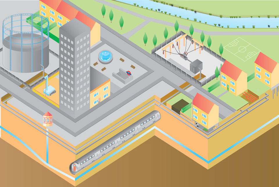

BGS and The Geological Society of London have accepted an invitation from the Government Office for Science (GO-Science) to launch a new network after its report, ‘The future of the subsurface foresight’, called for improved cross-sectoral work to address future issues.
The network, ‘Future of the Subsurface Community of Interest’, is set to be a community of decision makers from Government departments, local authorities, regulators and others in the public sector involved in subsurface policy and planning. It will serve as a forum for exchanging knowledge on subsurface issues to improve coordination and regulation and allow more effective management of the subsurface and the services it provides.
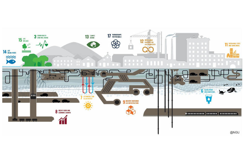
Use of the subsurface has been vital to people for thousands of years. The availability of subsurface resources, such as water, fertile soil and building materials, has long influenced where we choose to live. The UK’s diverse geology also plays a significant role in shaping its landscape and influences various aspects of land use, planning and society.

The subsurface is a natural space for the infrastructure that underpins society. We have developed methods to use and exploit the subsurface in a multitude of different ways, such as for natural resources and space for infrastructure, which deliver a range of societal benefits.
The Foresight study not only highlights the future need for the subsurface to deliver net zero technologies and climate adaptation measures; it also emphasises the challenge of implementing cross-sectoral solutions and the issue of incomplete and inconsistent regulation, which limit future options.
We will work alongside The Geological Society to ensure that we fulfil the need highlighted in the report, to facilitate a shared understand across decision makers of the value of the subsurface for the long-term public good.
Stephanie Bricker, head of urban geoscience and spatial planning, BGS
Informed and effective public policy relies on access to timely, digestible and relevant scientific evidence. By working with the British Geological Survey to facilitate this Community of Interest, we aspire to support those working across the breadth of subsurface policy and planning to engage with the best available geoscience and promote informed decision making.
Dr Megan O’Donnell, head of policy and communications at The Geological Society
Find out more about Go-Science’s report, the Future of the Subsurface Foresight.
Contact
For enquiries about the Community of Interest please contact FutureSubsurface@bgs.ac.uk
For media enquiries, please contact the BGS Press Office (bgspress@bgs.ac.uk) or call 07790 607 010.
The British Geological Survey is a world-leading geological survey and global geoscience organisation, focused on public-good science for government and research to understand earth and environmental processes. We are the UK’s premier provider of objective, impartial and authoritative geoscientific data, information and knowledge to help society to use its natural resources responsibly, manage environmental change and build resilience capabilities. From resource management and environmental protection to natural hazard mitigation and climate change adaptation, our work underpins many of the key challenges and opportunities facing the UK today.
The Geological Society of London is the UK’s national society for geoscience, providing support to around 12 000 members in the UK and overseas.
We aim to be an inclusive and thriving earth science community advancing knowledge, addressing global challenges and inspiring future generations.
Relative topics
Related news

UK’s world-class research organisations launch new collective
10/07/2026
The launch of the National Research Organisations Group brings together more than 100 science leaders to provide an authorativive voice on science, research policy and long-term investment.

Funding secured to help mitigate ground risk in UK construction sector
05/02/2026
The BGS Common Ground project has been awarded new funding to help unlock the value of ground investigation data.
Making research matter: BGS joins leading research organisations in new national initiative
10/12/2025
A new alliance of 35 organisations has been formed that is dedicated to advancing science for the benefit of people, communities, the economy and national priorities.

World Cities Day: the geological story of our cities
31/10/2025
Understanding the rocks that underlie our towns and cities, the risks they can present and how they influence urban planning and redevelopment.
New research published on brownfield land
27/08/2025
National Brownfield Forum research on the interactions of policies affecting the planning and development of brownfield land has been published.
Pioneering tool expanding to analyse agricultural pollution and support water-quality interventions
06/02/2025
An online tool that shows which roads are most likely to cause river pollution is being expanded to incorporate methods to assess pollution from agricultural areas.
Dynamics of land-to-lake transfers in the Lake Victoria Basin
09/12/2024
In June 2024, a UK/Kenya research team shared research findings from a collaborative, four-year field and experimental programme within Kenya.
UK 2024 Criticality Assessment published
28/11/2024
The latest UK Criticality Assessment, produced by the UK Critical Minerals Intelligence Centre, shows that growing diversification brings an increasing vulnerability in terms of disruption to supply.
What lies beneath Liverpool?
11/10/2024
The geological secrets lying under the surface of Liverpool and Warrington have been unveiled for the first time in BGS’s 3D interactive tool.
New community launched to support effective management of the subsurface
03/10/2024
The initiative aims to increase knowledge exchange on subsurface issues between interested parties involved in subsurface policy and planning.
Delivering a sustainable urban future for Europe through geoscience
08/05/2024
Research, led by BGS and EuroGeoSurveys’ Urban Geology Expert Group, explores how urban geoscience is reflected in European urban and environmental policy.

Building stones spotlight: the Sir Walter Scott Memorial 25 years after its conservation
29/04/2024
BGS geologist, Luis Albornoz-Parra, discusses the iconic Edinburgh monument, the building stones used in its construction and the result (so far) of its conservation efforts.