New report on the National Land Data Programme published
The report, based on pilot projects across the UK, explains how spatial data and modelling can support better decisions on land use.
06/06/2023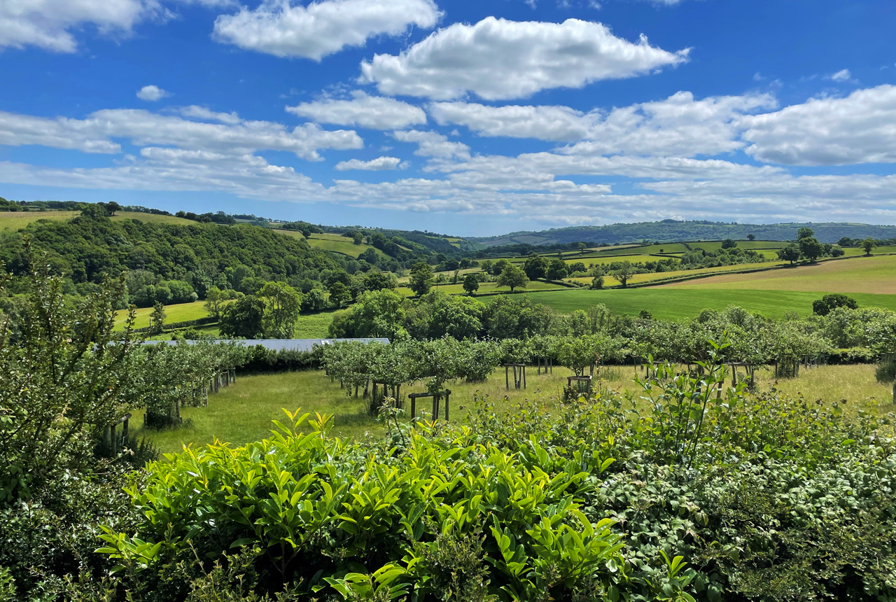

The newly published Geospatial Commission report ‘Finding Common Ground’ sets out the findings and recommendations from its National Land Data Programme (NLDP). The report explains that complex decisions around land use can and should be supported by spatial data and modelling to enable better and more informed decision making, given that land in the UK is a finite resource.
BGS was commissioned to work with the Food, Farming and Countryside Commission (FFCC) and Westcountry Rivers Trust as part of FFCC’s development of a land-use framework. The NLDP included a series of national-scale projects and regional ‘deep dive’ pilots in Devon, Cambridgeshire and Peterborough, Northern Ireland, and Newcastle. Further information about these and can be found in the pilot and project overview.
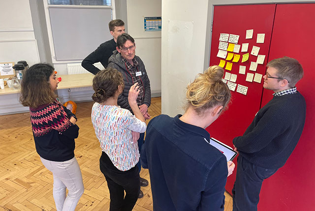
BGS hosted a ‘design sprint’ in Exeter with our partners and local land managers and advisors: Exmoor National Park, Clinton Devon Estates and Clyst Valley Regional Park. BGS © UKRI.
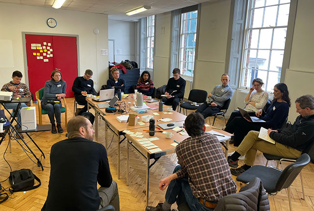
BGS hosted a ‘design sprint’ in Exeter with our partners and local land managers and advisors: Exmoor National Park, Clinton Devon Estates and Clyst Valley Regional Park. BGS © UKRI.
BGS facilitated the collaborative design of a prototype spatial decision-support tool. The tool will help to articulate the potential benefits of rural land management and land-use change on carbon sequestration, carbon storage and wider environmental benefits.
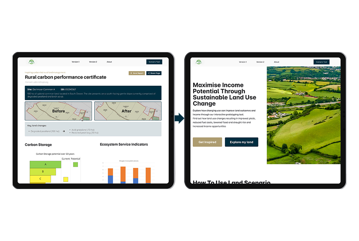
A prototype tool was built, enabling users to test how changing land use would impact carbon sequestration or storage potential, and to identify and potentially quantify existing applicable financial incentives that could support the proposed land use change. BGS © UKRI.
The prototype tool was designed so that users would be able to perform multiple functions. It allows users to select a land parcel for which they can access a summary of the land cover and soil data. They are able to identify potential new or improved habitat types for each land parcel and assess how changing the use of land would affect carbon sequestration or storage. They are also able to see the financial benefits of these land-use change options, the functionality of which could be enhanced over time as more financial information is gleaned. The prototype produces a ‘rural carbon-performance certificate’ report, showing the potential effect of changing land use on carbon and other ecosystem service indicators.

Shared digital evidence for decision making is a crucial part of finding ‘common ground’ for multi-functional and sustainable land-use decision making. It’s been an absolute pleasure working with a passionate, committed team on this nationally relevant work.
Dr Darren Beriro, BGS Principal Geoscientist.
Having a clear, shared evidence base to inform Government policy is critical to making decisions about complex land–use demands. If we hope to achieve the many targets the Government has set out that require land, this shared evidence base will be absolutely crucial. The recommendations to champion markets for these data tools and to encourage academia, civil society and businesses to work together to bring greater clarity and information to these datasets are also welcome and we look forward to seeing how the Government takes these proposals forward.
Georgie Barber, FFCC Countryside and Land Use Lead.
The Geospatial Commission report paves the way for integrating data, science and innovation to address the challenges of holistic, evidence-based decision making for future land use in the UK. BGS remain committed to similar objectives. For more information on this and other aspects of our five-year plan, see the new BGS Strategy for 2023 to 2028, ‘Understanding our Earth’.
The design sprint report will be published shortly.
About the author

Dr Darren Beriro
Principal geoscientist