Our data and knowledge of the UK’s geology, use of industry standard technical tools, and collaborative ways of working enable us to efficiently deliver valuable geological insights across a range of sectors.
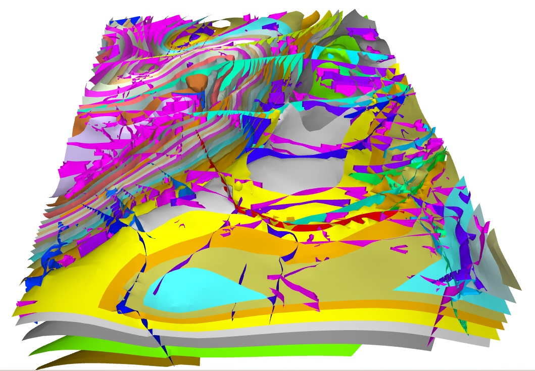

Automated 3D geological model of Edinburgh. BGS © UKRI.
Our integrated approach
BGS is uniquely placed to offer a truly cross-disciplinary approach to geological data delivery. We develop new geological understanding to answer a wide array of geological questions through collaborative science and relevant modern survey and modelling approaches. This can include use of remote sensing, survey mapping, modelling and laboratory investigation.
Our outputs span national and regional-scale geological maps, to site-scale maps, 3D models, and technical reports tailored to our clients’ specific questions and requirements.
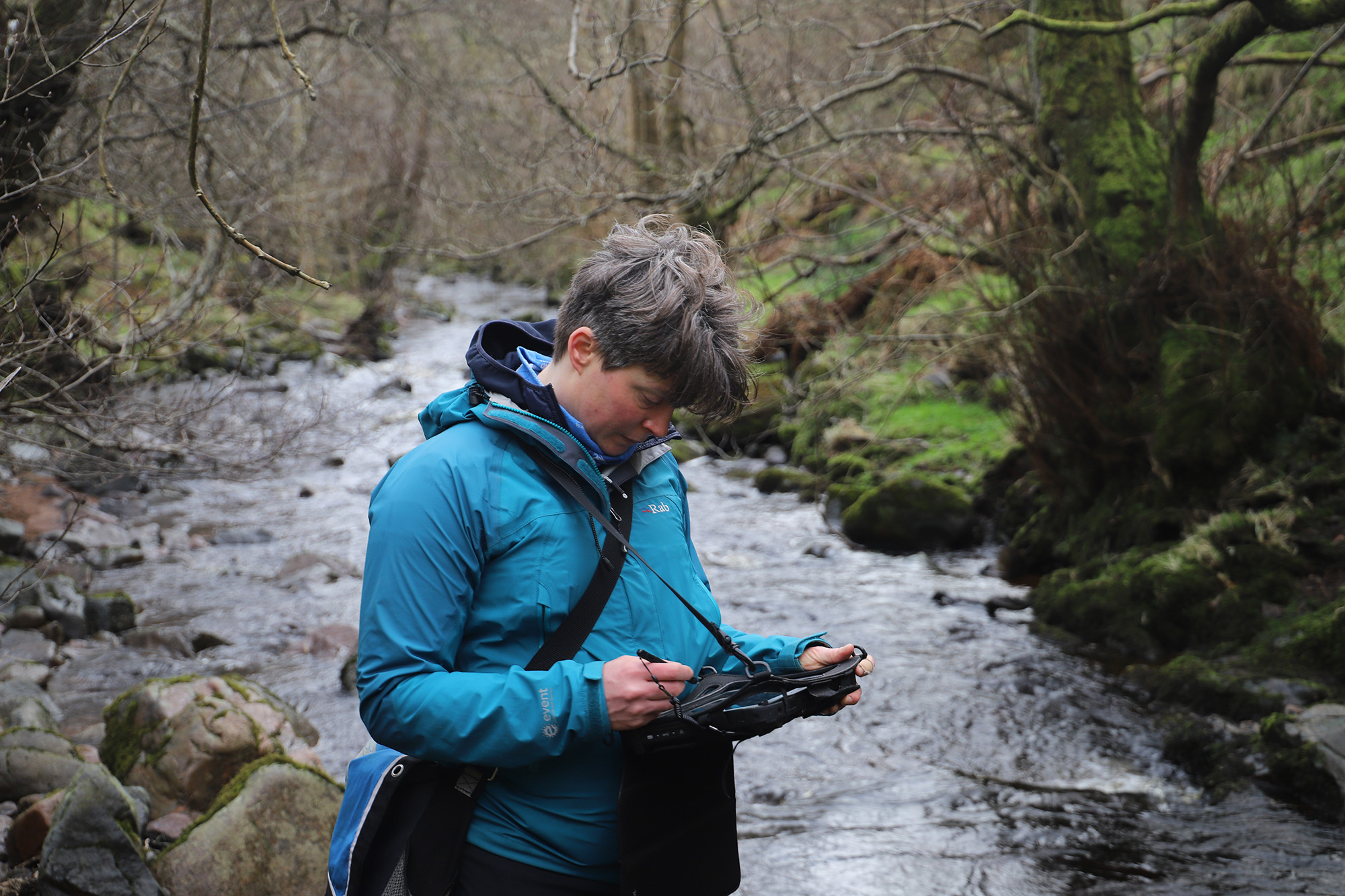
Field data collection is a vital part of our integrated approach to geological knowledge delivery. BGS © UKRI.
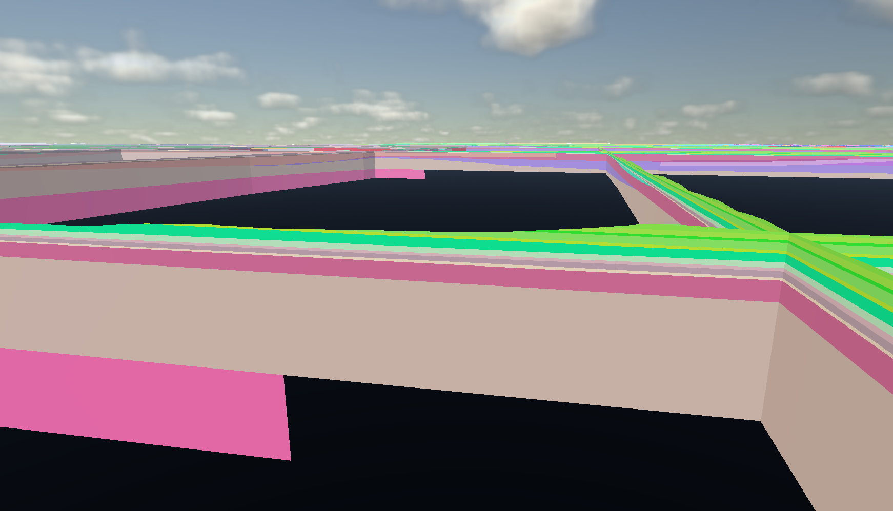
Cross-sections through a Chalk bedrock region of England viewed within in-house 3D field reconnaissance and data visualisation software GeoVisionary. BGS © UKRI.
A modern geologist’s toolkit
We use a wide array of approaches in our modern toolkit, including:
- both our longstanding and recent data archives and corporate datasets
- modern data acquisition
- remote sensing and earth observation
- laboratory analysis
- geological surveying
We use industry standard and in-house tools to support the analysis and interpretation of a wide array of geological data. This includes deployment of GIS platforms such as ArcGIS Pro and QGIS, a wide range of modelling software (such as AspenSKUA, Petrel and Leapfrog) and in-house tools such as GeoVisionary and Groundhog. These enable us to test new geological understanding and produce geological model outputs to aid further data analysis, visualisation and communication with our stakeholders.
Our newly developed digital mapping workflow, based around the Mergin Maps plugin within QGIS, ensures we have new, efficient and streamlined production of geological map data.
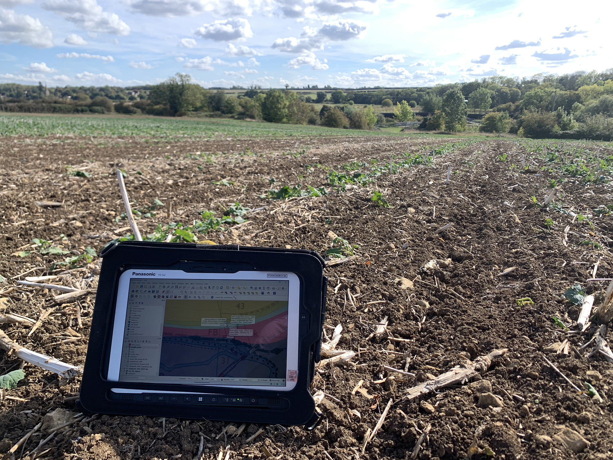
Our QGIS-based digital mapping platform in use on fieldwork in Oxfordshire farmland. BGS © UKRI.
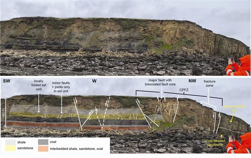
Geological interpretation of the Crag Point Fault.
Estimations of the uncertainty associated with our geological interpretations are provided, which are essential tools to inform decision making, project planning, budget allocation and de-risking infrastructure design and cost effectiveness ground investigation. This example presents an example of BGS work to characterise subsurface complexity (in terms of both rock type and structure) that is of relevance to informing stakeholder decisions. BGS © UKRI.
Some of our key strategic outputs
The BGS National Geoscience programme is an authoritative figure in UK geoscience. We are responsible for the creation and update of the nation’s baseline geological maps, national stratigraphical framework and rock classification scheme, and are committed to ensuring that this information is fit for 21st century multi-stakeholder use.
We deliver data and science to these datasets:
- BGS Geology
- BGS Lexicon of Named Rock Units
- BGS Rock Classification Scheme
- BGS Lithoframe
- Buried valleys
- UK3D
Our work also underpins many other datasets and derived licensed products created by BGS, such as:
- BGS Civils
- BGS GeoClimate
- BGS GeoScour Open and Premium
- BGS GeoSure
- Infiltration SuDS
Contact
If you would like more information, please contact Tim Kearsey.