How BGS is helping the farming sector of Great Britain
New legislation concerning soil management and technology in modern farming has led to an increase in enquiries about BGS’s Soil Parent Material Model.
17/01/2024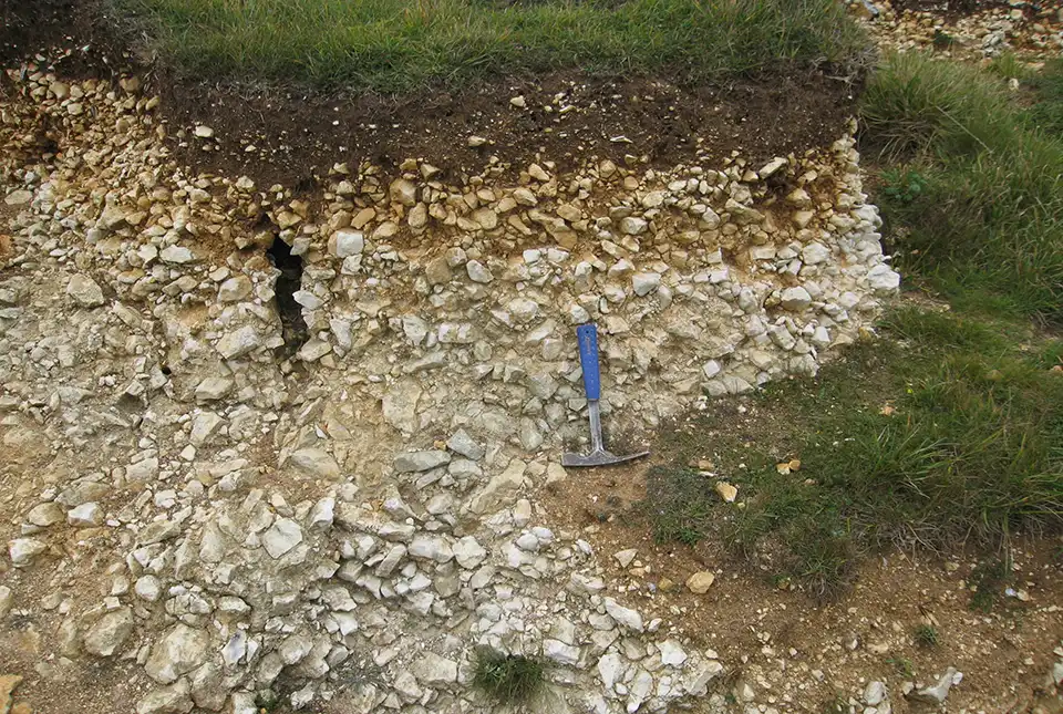

Rural soils make up 85 per cent of the land area of the UK, with agricultural land use occupying the vast majority of that space. In England, around 70 per cent of the total land area is used for agriculture. Soils enable food production and livestock grazing, in addition to other essential ecosystem services such as carbon or water storage.
Soil parent materials are one of five soil-forming factors and are derived from the weathering of underlying rocks and deposits. Understanding a soil’s parent material is useful when assessing different types of environmental and soil measurements as it strongly influences a soil’s texture, drainage characteristics, baseline chemistry and depth and profile structure.
What is the BGS Soil Parent Material Model?
The BGS Soil Parent Material Model provides information to better understand soil and subsoil characteristics across Great Britain. It includes information on:
The dataset is intended for a wide range of users, including:
- farmers
- agronomists
- environmental groups
- land agents
- energy companies
The model provides information to help farmers and agronomists to identify soils and landscapes susceptible to erosion and develop more resilient soil-management plans for their farms. Increasingly, the dataset is being combined with on-farm soil sample data, as well as being used to cross-check data captured from drone surveys and onboard sensors.
Soil texture
The texture of a soil is a critical factor for crop production and other types of land use. It is one of the most easily recognisable soil properties for farmers when assessing their soils for crop viability. Texture is determined by the size and mixture of clay, sand and silt particles, which influence a wide range of other soil properties like its water-holding capacity, drainage characteristics and overall structure.
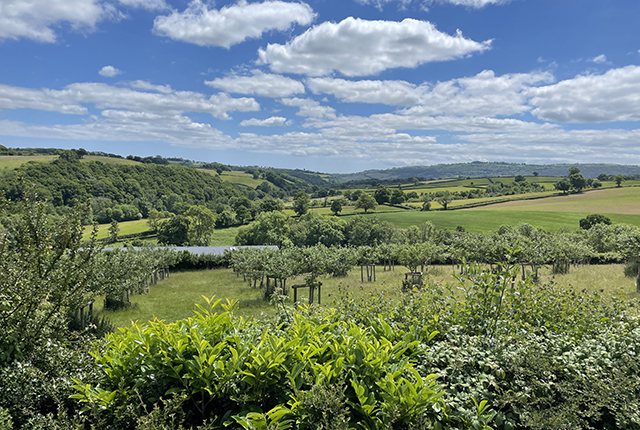
Glaciofluvial deposits give rise to light soils that are good for arable farming, as seen here near Linlithgow, West Lothian, Scotland. BGS © UKRI.
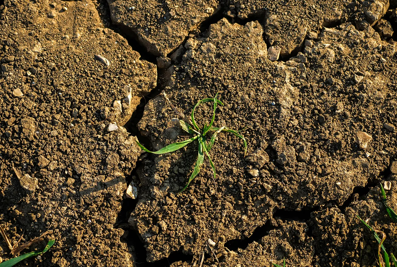
For example, soils with a heavy clay content better retain water and nutrients; however, their compact structure makes them harder to work with. Sandy soils allow for better drainage due to the larger particles, but this can make them more susceptible to drying out in warmer conditions and allow nutrients to leach away much more easily during heavy rainfall. Loamy soils, which contain a more equal distribution of sand, silt and clay, are often considered to be the most ideal soil type for agriculture.
The BGS Soil Parent Material Model dataset indicates soil texture using the descriptions ‘light’, ‘medium’ and ‘heavy’, based on the percentage sand, silt and clay content.
Soil depth
The depth of a soil influences the type of vegetation that can grow in it, as well as how much water and nutrients may be available. Deep-rooted crops will require deeper soils to thrive and there may be problems with water management where shallow soils are unable to provide sufficient plant-available water capacity.

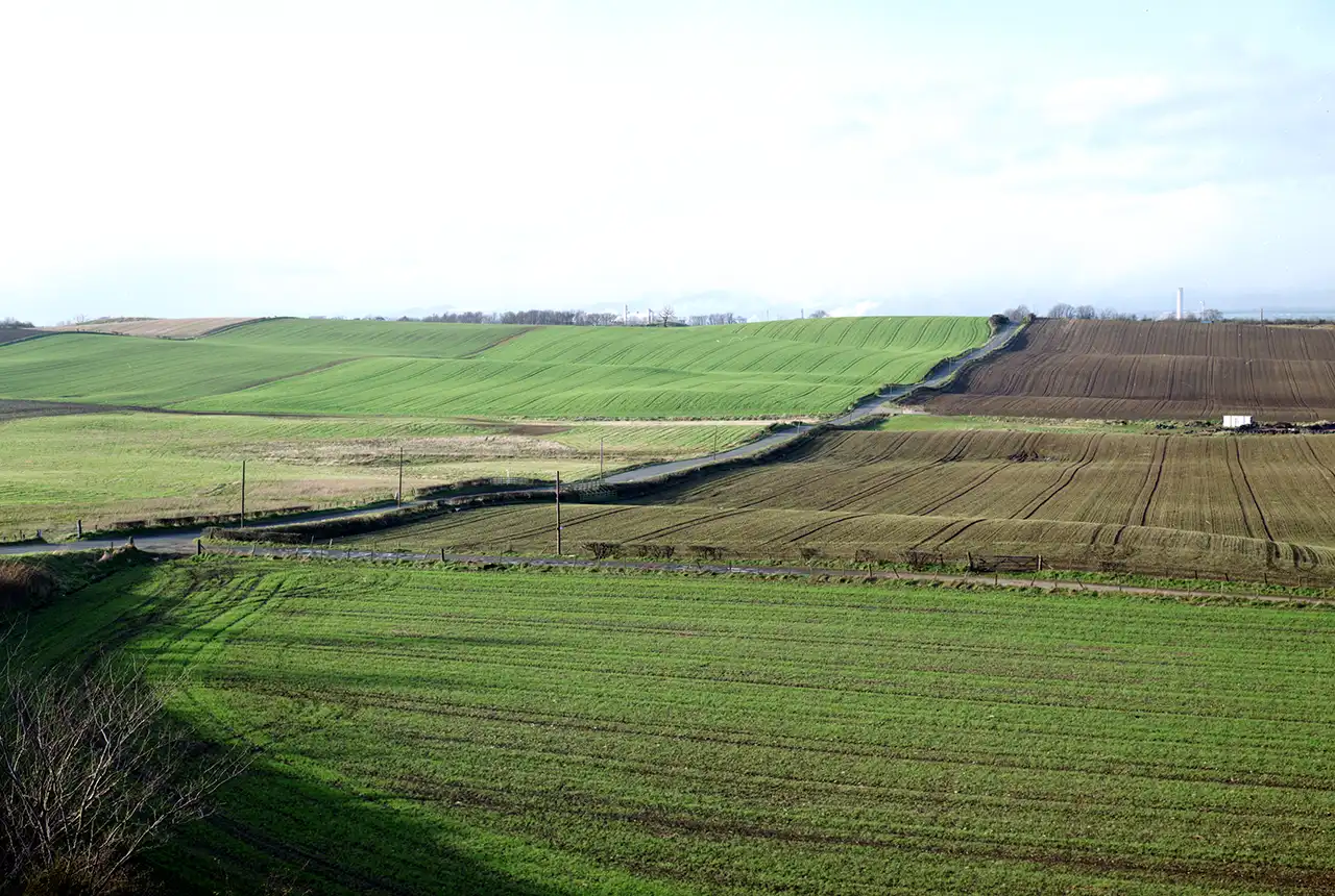
The texture, depth and chemistry of a soil all affect the crops that grow in it. Vale of Belvoir, Leicestershire. BGS © UKRI.
Interest in putting more organic carbon back into soils is increasing, which is also driving more interest in the thickness of soil profiles across Great Britain. These profiles are available in the BGS Soil Parent Material Model. The dataset has also been used to look at agroforestry, where soil depth plays an important role in crop development.
Soil chemistry
A soil’s chemistry is heavily derived from the minerals found in the underlying soil parent material. Applications of nutrients and conditioners to farming land can change this over time, but the natural processes of soil development will always return a soil to the baseline geochemistry of its parent.
The pH of a soil is critical to nutrient availability, influencing the type of vegetation that can grow in it. Our dataset provides information on the carbonate content of parent materials, which has been used to assess buffering of pH, as well as the plant availability of critical minerals like magnesium and selenium.
Soil erosion
One of the threats to soils is the risk of erosion by wind and rain, which has been blamed on intensive agriculture and land-management processes. Over two million hectares of land in England and Wales are at risk of erosion. Climate change may exacerbate soil erosion. Changing weather patterns can bring periods of more intense rainfall, creating rills and gullies in a wide range of soil types, whilst periods of desiccation during heatwaves, combined with more intense wind systems, pose a risk of wind erosion to our lighter soils. The loss of valuable soils into drainage systems is costly and often requires some form of remedial clean-up.
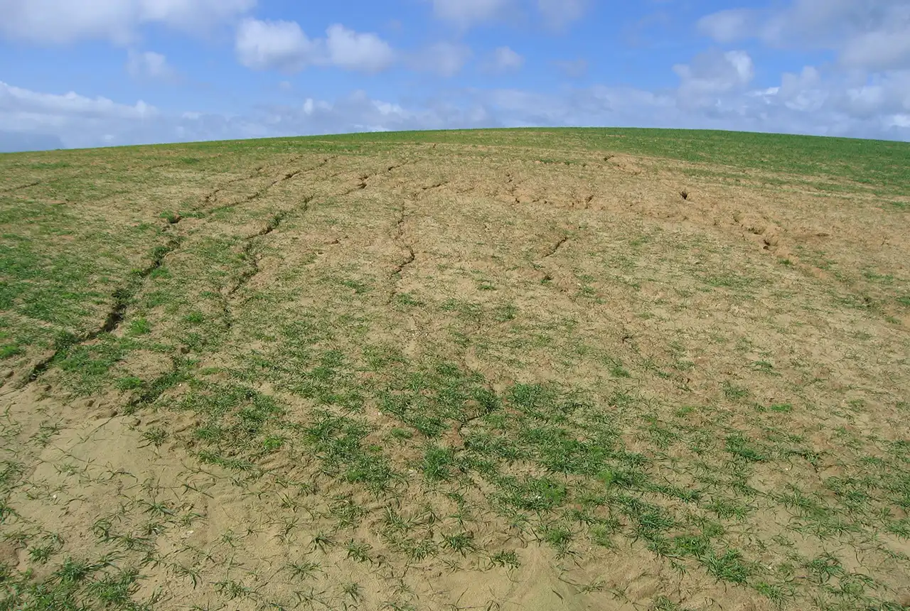
Soil erosion and gullying following rainfall, Mersley Farm, Arreton, Isle of Wight. BGS © UKRI.
Why are more people accessing BGS’s Soil Parent Material Model?
Increasing interest in the BGS Soil Parent Material Model can be attributed to a growing awareness of the importance of soils and the need to better understand soils to help develop sustainable agriculture. The UK Government’s ‘Twenty-Five Year Plan to Improve the Environment‘ outlines the aim for all of England’s soils to be managed sustainably by 2030.
UK research into soils has grown significantly in the last few years and, more recently, has been driven by better modelling techniques and data availability, and a rise in people wanting to use data for soil and landscape metrics. Farmers are also being asked to collect more information about their soils. This valuable new data can be used in conjunction with mapping to improve sampling strategy and optimise the extrapolation of the data across the wider farm holdings. The wider agronomy sector is using a range of novel spatial analysis techniques, including artificial intelligence, to compare different aspects of land use for soil benchmarking; integration with the parent material mapping enables local-to-regional extrapolation of their research.
How to access the model
The BGS Soil Parent Material Model dataset is available for download. A more detailed, 1:50 000-scale dataset is available under licence — please contact BGS Enquiries (enquiries@bgs.ac.uk). The dataset webpages have more information, links, sample data, downloads and a user guide.
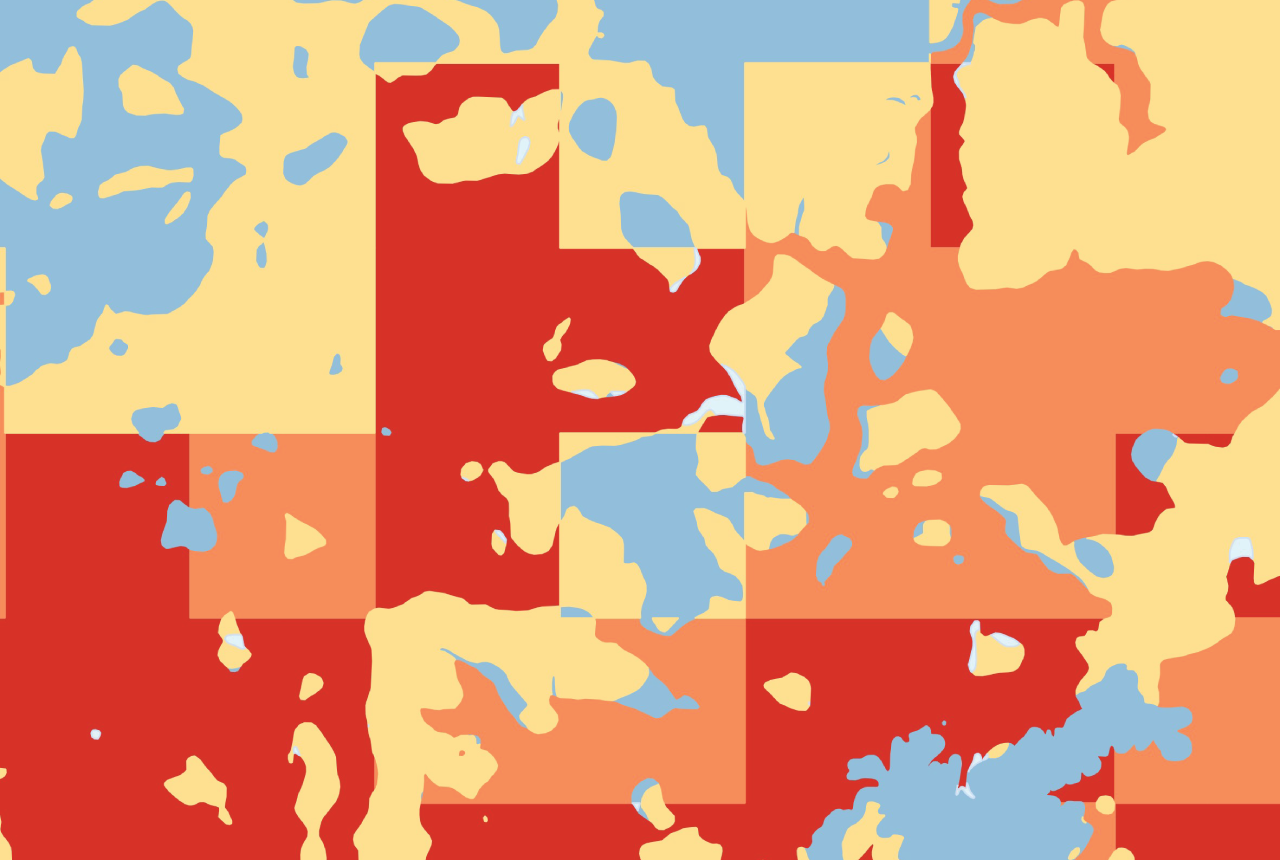
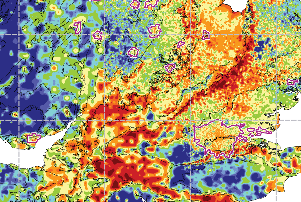
The model is also available to view as a map through the UK Soil Observatory (UKSO), which provides soil data comprising 200 layers of information from nine research bodies across the UK.
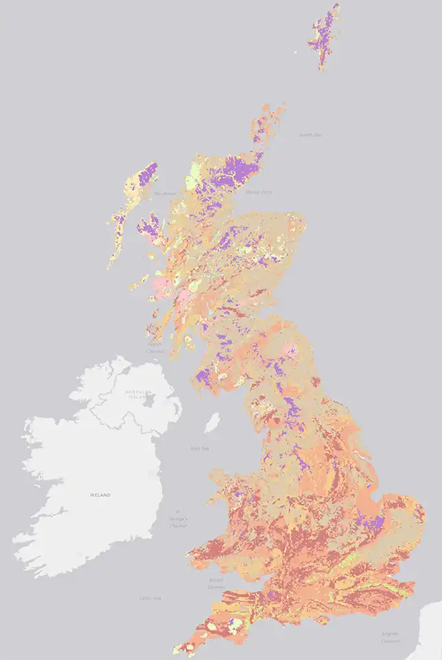
UK Soil Observatory subsoil grain size map layer for BGS Soil Parent Material Model. BGS © UKRI.
The future of the BGS Soil Parent Material Model
We are currently in the process of securing funding for UKSO the next five years and preparing for the latest release of the BGS Soil Parent Material Map within the next 12 months.
BGS has an active soil research team and a world-leading group of environmental statisticians contributing to our soil research activities.
For further information about the BGS Soil Parent Material Model please contact the digital data team (digitaldata@bgs.ac.uk).
About the authors

Russell Lawley
Geologist, BGS Product Development
Lauren Harris is a business assistant in BGS Informatics, but is also in her fourth year of part-time study at the Open University studying for a BSc in environmental science (2020 to present).
Relative topics
Related news
GeoClimate Shrink–Swell
GeoClimate clay shrink-swell provides information on the projected future change in susceptibility of clay shrink–swell across Great Britain due to climate change.

Suite of ten new soil reference materials released
02/01/2026
BGS has a longstanding track record of producing high-quality reference materials and has released ten new soil reference materials.
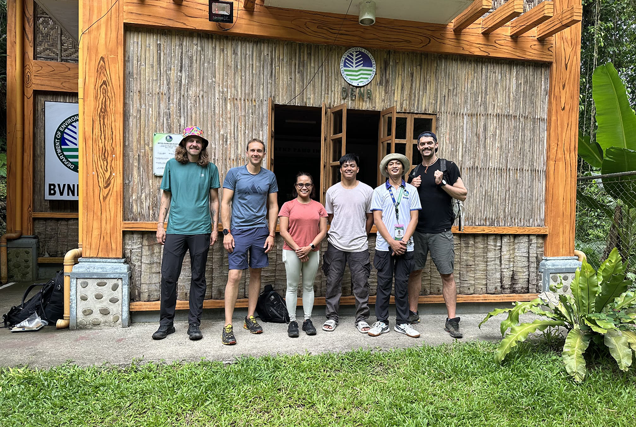
PhD adventures in the Philippines: coring around Lake Bulusan
05/09/2025
Chris Bengt recounts his two-week field trip to Bulusan Volcano Natural Park in the Philippines to collect lake sediment cores, fresh soil and water samples.
BGS Predictive Seabed Sediments (UK)
The BGS Predictive Seabed_Sediments (UK) data provide digital maps of seabed sediment (SBS) composition across the UK Continental Shelf (UKCS).
New journal article reveals snapshot of forever chemicals in shallow English soils
31/07/2025
Data on the presence of per- and polyfluoroalkyl substance concentrations in English soils has been released.
What is the impact of drought on temperate soils?
22/05/2025
A new BGS review pulls together key information on the impact of drought on temperate soils and the further research needed to fully understand it.
UKGravelBarriers
Increasing our understanding and modeling capabilities of gravel beach and barrier dynamics.
Forty years and counting: new topsoil data provides most extensive snapshot of environmental pollution effects
01/10/2024
Scientists have uncovered clear signs of the impact environmental pollution is having across the country’s soil.
Monitoring coastal change from space
BGS is helping to develop applications that detect and track coastal erosion and accretion from space to inform coastal management plans.
UK: topsoil geochemistry
The UK Compiled Topsoil Dataset (UKTS), is the most extensive topsoil geochemistry dataset for the UK.