BGS to support novel scientific ocean drilling expedition to explore Arctic Ocean palaeoceanography and climate
BGS is pleased to be part of a joint IODP expedition focused on the Arctic Ocean, a key location in global climate change.
18/02/2021 By BGS Press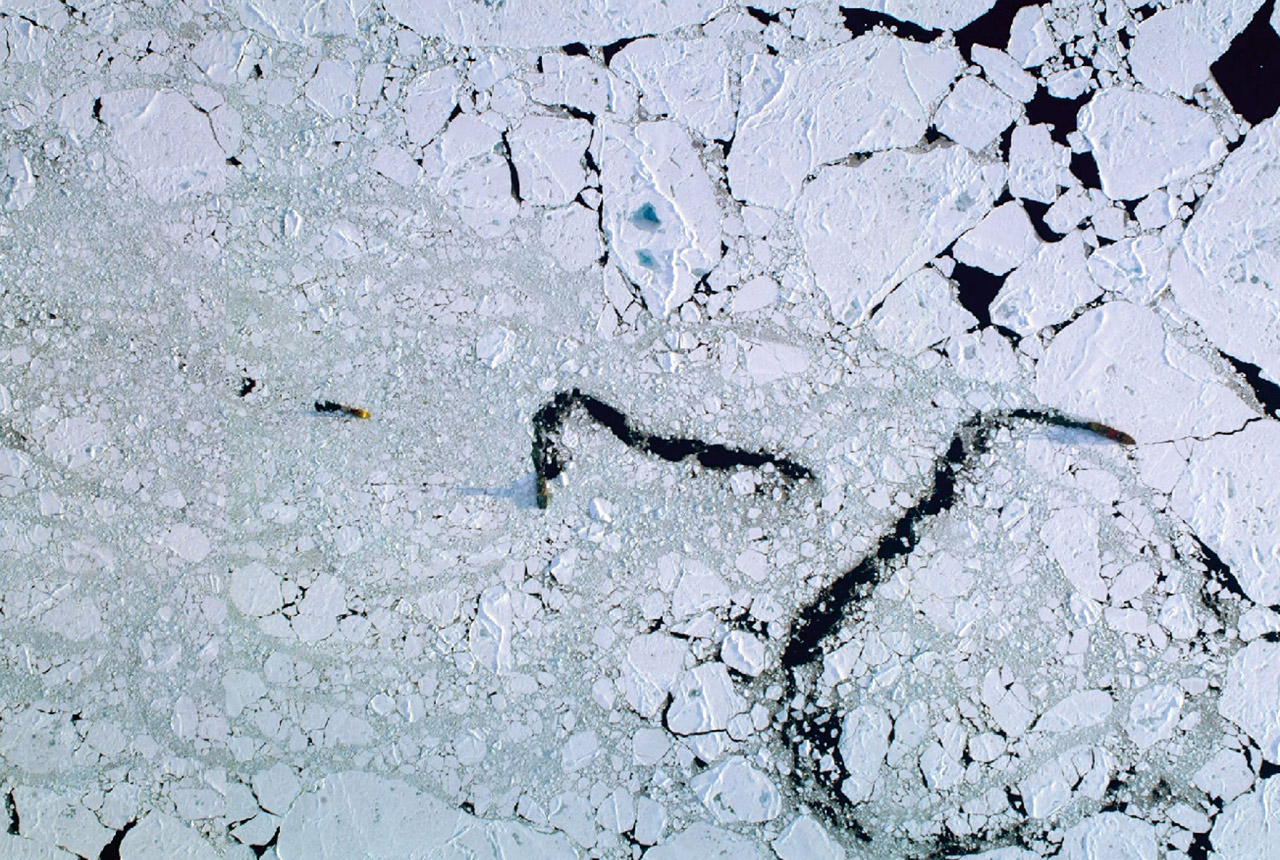

BGS is pleased to be part of a joint expedition of the International Ocean Discovery Program (IODP), focused on the Arctic Ocean – a key location in global climate change.
Despite its global importance, the Arctic Ocean is the last major region on Earth where the long-term climate history remains poorly known.
IODP Expedition 377 Arctic Ocean Paleoceanography – or ArcOP – will represent a step-change in reconstructing the detailed history of climate change in the central Arctic Ocean over the last 50 million years.
A joint expedition, it will involve expertise from the European Consortium for Ocean Research Drilling (ECORD), the Swedish Polar Research Secretariat (SPRS) and Arctic Marine Solutions (AMS) and is planned to take place in August and September 2022.
![]()
Science behind the ArcOrp Expedition
The Arctic Ocean is a very sensitive and important region for global climate change, and is unique in comparison to the other oceans on Earth. Due to complex feedback processes (collectively known as “Arctic amplification”), the Arctic is both a contributor to climate change and a region that is most affected by global warming.
Major advances in understanding were achieved in 2004 when the successful completion of IODP Expedition 302: Arctic Coring Expedition – ACEX, also implemented by ECORD, marked the start of a new era in Arctic climate exploration.
The ArcOP expedition will explore a critical time interval, spanning the period when prominent changes in global climate took place during the transition from the early Cenozoic Greenhouse world to the late Cenozoic Icehouse world.
An international team of scientists will collect about 900 m of sediment cores at two sites along the Lomonosov Ridge.

We anticipate that the sedimentary record that the Arc-OP expedition is targeting will provide critical puzzle pieces enabling the scientific community to better understand the drivers, feedbacks, consequences, and varying rates of Cenozoic climate change at both regional and global scales.
Prof Kristen St John, ArcOP Co-chief Scientist.
A unique and challenging expedition, a fleet composed of a scientific drillship supported by two icebreakers will be used to make drilling possible in this permanently ice-covered region.
Such a multi-vessel approach was employed by ECORD for the first time during the ACEX Expedition in 2004.
The expedition will last for about seven weeks offshore and will be followed by intensive investigation and sampling of the cores onshore to unlock their climate secrets.
BGS will help to lead the implementation of the expedition through its role as the co-ordinator of the ECORD Science Operator (ESO), in close collaboration with SPRS and AMS.
BGS staff are excited to be part of this ambitious IODP expedition that will see us manage, co-ordinate and support an international team of scientists through our role as the coordinator of the ECORD Science Operator.
Our role is very much to support the team’s efforts to uncover and understand the history of climate change in the central Arctic Ocean over the last 50 million years.
We will provide expedition management and coring oversight, and work with our partners to provide facilities and services for the curation, databasing, archiving and analysis of collected cores and samples, and downhole logging services.
David McInroy, BGS Geoscientist.
Further details of the expedition can be found on the ECORD website.
More information
- ArcOrp expedition
- IODP research programme
- ECORD Science Operator (ESO)
- Swedish Polar Research Secretariat (SPRS)
- Arctic Marine Solutions (AMS)
Related news

New NERC-funded project empowers young people to engage with environmental science
23/07/2026
BGS is part of a new, collaborative project, funded through NERC’s ‘Opening up the environment’ programme, helping the environmental research community become more accessible.

Delving deep into mountains for future water security
16/07/2026
A BGS-led project is using new water-tracing investigation methods, geophysics and modelling to understand how water moves from mountains to the lowlands, helping to improve water security for billions of people.

Updated national 3D model will determine the depth to the solid bedrock beneath our feet
13/07/2026
The BGS Superficial Deposit Thickness Model now includes an elevation model of geological rockhead for the first time, providing important data for civil engineers, geoscientists and environmental scientists.

UK’s world-class research organisations launch new collective
10/07/2026
The launch of the National Research Organisations Group brings together more than 100 science leaders to provide an authorativive voice on science, research policy and long-term investment.

Cheshire Geoenergy Observatory releases key geological datasets for UK thermal energy storage scheme design
09/07/2026
A new report and data packs from BGS will provide a unique resource for scientists working on the geology and hydrogeology of the Sherwood Sandstone Formation, an important aquifer and reservoir rock.

New geological mapping underway to help manage flooding along the River Tweed
08/07/2026
Scientists are surveying the Tweed catchment for the first time in over 100 years to enhance understanding of localised groundwater and improve flood forecasting.

Geological research in North Sea helping to safeguard subsea cables
06/07/2026
Subsea power and telecommunications cables are critical to the UK’s energy infrastructure and global connectivity, yet they remain vulnerable to damage from ship anchors, fishing activity and natural hazards.

UK Critical Minerals Intelligence Centre makes recommendations for the next UK criticality assessment
01/07/2026
CMIC has outlined the enhancements made to the next assessment update to ensure it is better tailored to the structure of the UK economy.

From archive to discovery: historical mineral reports support gold exploration in Scotland
25/06/2026
Digitised geological records show potential to unlock untapped mineral resources in Ardlochan, Argyllshire.

UK and Philippines scientists investigate natural hydrogen generation processes at atomic scale
22/06/2026
BGS researchers were granted access to use the Diamond Light Source facility in order to study hydrogen in light brighter than the sun.

Shortage of end-of-life materials presents challenge to UK critical minerals security
17/06/2026
A new report by the UK Critical Minerals Intelligence Centre reveals insufficient end-of-life material stocks present a supply risk over the coming decade, but offer significant long-term potential to meet critical mineral demand through recycling.

UK geothermal catalogue receives update
16/06/2026
BGS releases the second digital version of the UK geothermal catalogue of subsurface temperature and rock thermal conductivity measurements and heat flow calculations.