BGS announces collaboration with Ordnance Survey
Ordnance Survey and BGS have teamed up to add a range of geological data products to the OS Data Hub, making it easier for users to access and use geospatial data.
29/05/2024 By BGS Press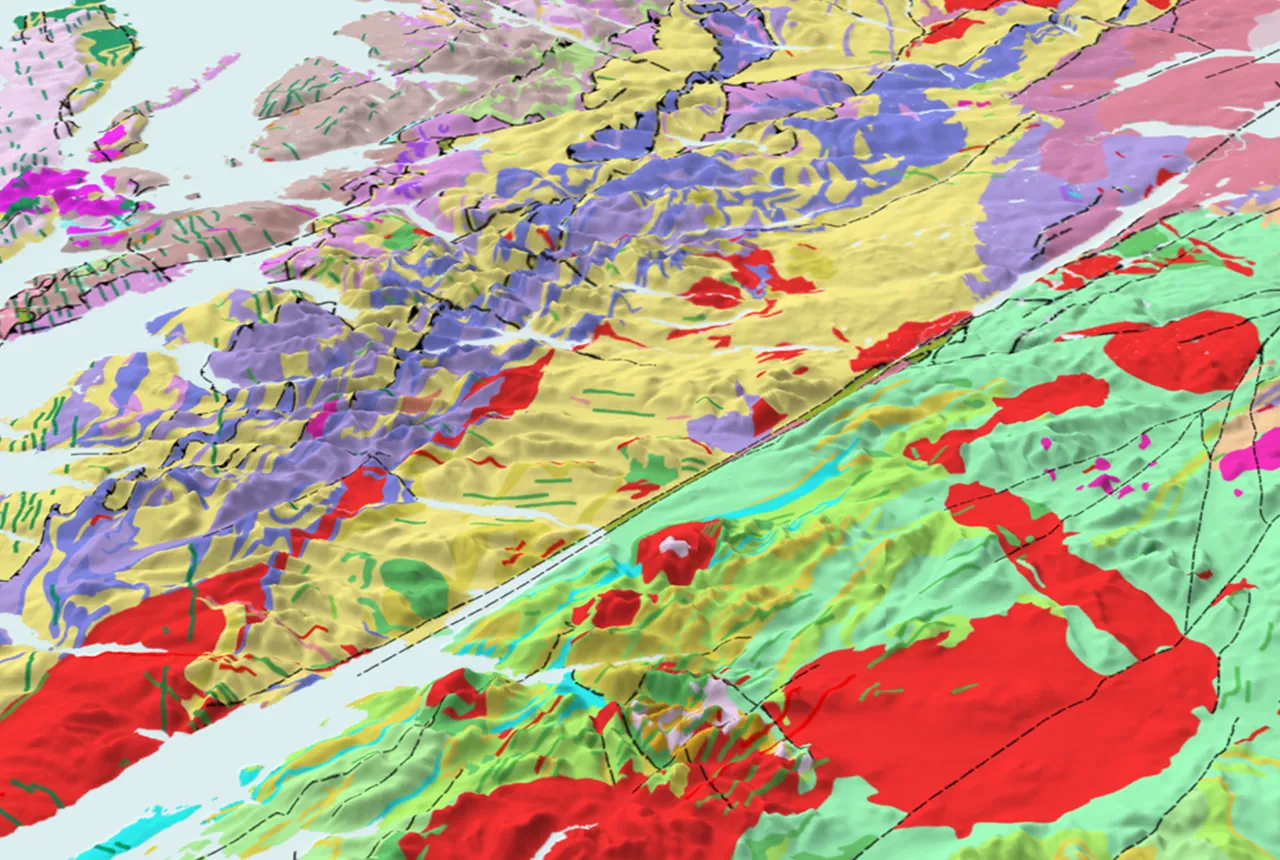

Nine of BGS’s primary datasets will now be included as open data in the Ordnance Survey (OS) Data Hub. This development will enable customers to access and combine OS and BGS data on a single platform, making it easier than ever to create value from geospatial data.
The inclusion of datasets will introduce OS Data Hub users to a selection of the detailed data that is available from BGS. The datasets will provide access to large-scale overview maps of ground hazards where there could be, for example, landslides. The maps can inform further assessment and highlight potential hazards that either need to be regraded or investigated in more detail.

I am delighted that we have extended the OS Data Hub to include data from the British Geological Survey. Ordnance Survey is constantly looking to provide a greater and richer variety of data to customers whether above or below ground, so adding the BGS datasets — which is a first for us — will extend our offering to our customers significantly. As we explore this new territory for the OS Data Hub, we really hope to encourage other third parties to collaborate with us and for new and existing customers to explore the new data available to support their own challenges.
John Kimmance, OS Managing Director of National Mapping Services.
We are excited to continue to build our relationship with Ordnance Survey as a Geo6 partner and make nine primary BGS datasets available to users via the OS Data Hub. The OS Data Hub presents a superb opportunity for new, differing user communities to access BGS geological data and we are eager to see what impact this will bring.
Garry Baker, director of BGS Informatics.
This new collaboration has been funded by the Government Office of Technology Transfer’s Knowledge Asset Grant Fund, which supports public sector organisations to explore or further develop new and innovative uses for their knowledge assets. This followed engagement with OS and BGS’s customers, which showed potential benefits to both public and private sectors from greater access to geological data.
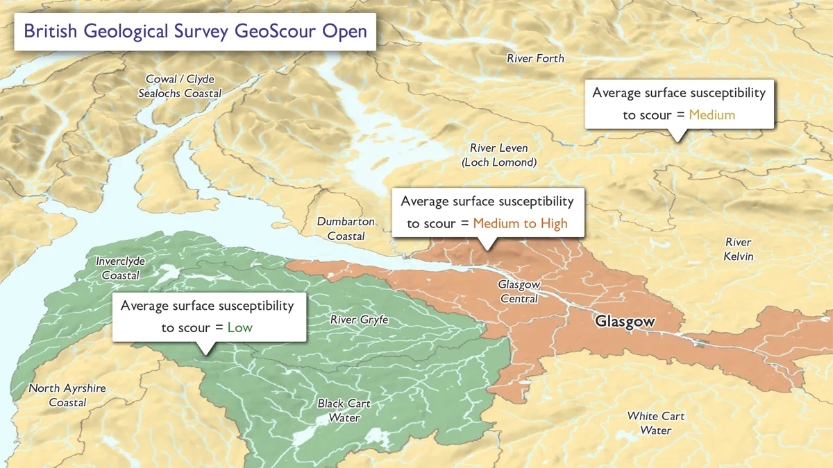
Data from BGS GeoScour Open showing a generalised overview of the natural characteristics and properties of river areas for the assessment of river sediment. Overlaid with data from OS Open Rivers, OS Open Zoomstack and OS Terrain 50. BGS © UKRI.
The nine datasets
BGS Geology 625k
Bedrock geology showing rock type and lithology for the UK, which could be used by academic institutions to understand geological presence at regional and national levels. The data could also be used to work out the percentage geology type in counties or regions of the UK or, by pairing with a digital terrain model, to understand how the geology influences the shape of our landscape.
BGS Mining Hazard (not including coal) 1 km hex grid
A national-scale summary of the presence of mining and an indication of the level of hazard associated with old workings, generalised into a hexagon cell, this provides an overview of the likelihood that mining has occurred in a locality. This will be valuable to local authorities to identify potential threats and whether additional investigation is required in planning developments in these areas. Polygon data is available from BGS as a licensable data product providing more detail.
BGS GeoSure 5km hex grid
Used to inform potential regional ground instability issues and which types of instability might be present, for example:
- collapsible deposits
- compressible ground
- landslides
- running sands
- shrink–swell
- soluble rocks
This could also be used by local authorities to understand the types of hazards that may be present in areas when considering planning applications and any need for extra investigation that could use the BGS GeoSure data suite for each hazard type.
BGS GeoClimate UKCP18 Open
Shrink–swell national datasets show potential change in subsidence due to changes in climate. They have been developed by combining long-term UK Climate Projection (UKCP) scenarios for rainfall and temperature changes with the geotechnical properties of the ground, to identify areas projected to experience the largest increases in susceptibility to subsidence over the next century. The data could be used by lenders, insurers and large UK companies that require a screening tool to assess their potential future exposure to subsidence and the need for large UK private companies to adhere to climate change reporting requirements. Further investigation can be undertaken with the BGS GeoClimate UKCP18 premium data.
BGS GeoCoast Open
This dataset contains a detailed suite of statistical data based on the underlying datasets (BGS GeoCoast Premium). These include, for example, the percentage of a county at threat from inundation and the percentage of a county’s coastline having high susceptibility to erosion. In addition, there is a tool to compare or share best practise at a regional scale and streamline the consideration of multiple underlying datasets through a simple, high-level scheme, presented as domains. The data is of particular use for coastline planning when assessing risk to assets and infrastructure.
BGS GeoScour Open
This provides a generalised overview of the natural characteristics and properties of river areas for the assessment of river sediment. This could help local authority planning by identifying the potential risks associated with flooding. The same can be said of asset owners and the potential for mitigation measures if assets such as bridges could be affected. Further investigation can be undertaken with the BGS GeoScour Premium data.
BGS Hydrogeology 625k (digital hydrogeological map of the UK)
Indicating aquifer potential in generalised terms using classifications defining flow based upon the geology, the data will be of use to hydrogeologists and groundwater management specialists who require a national understanding of groundwater flow to aid water management strategies.
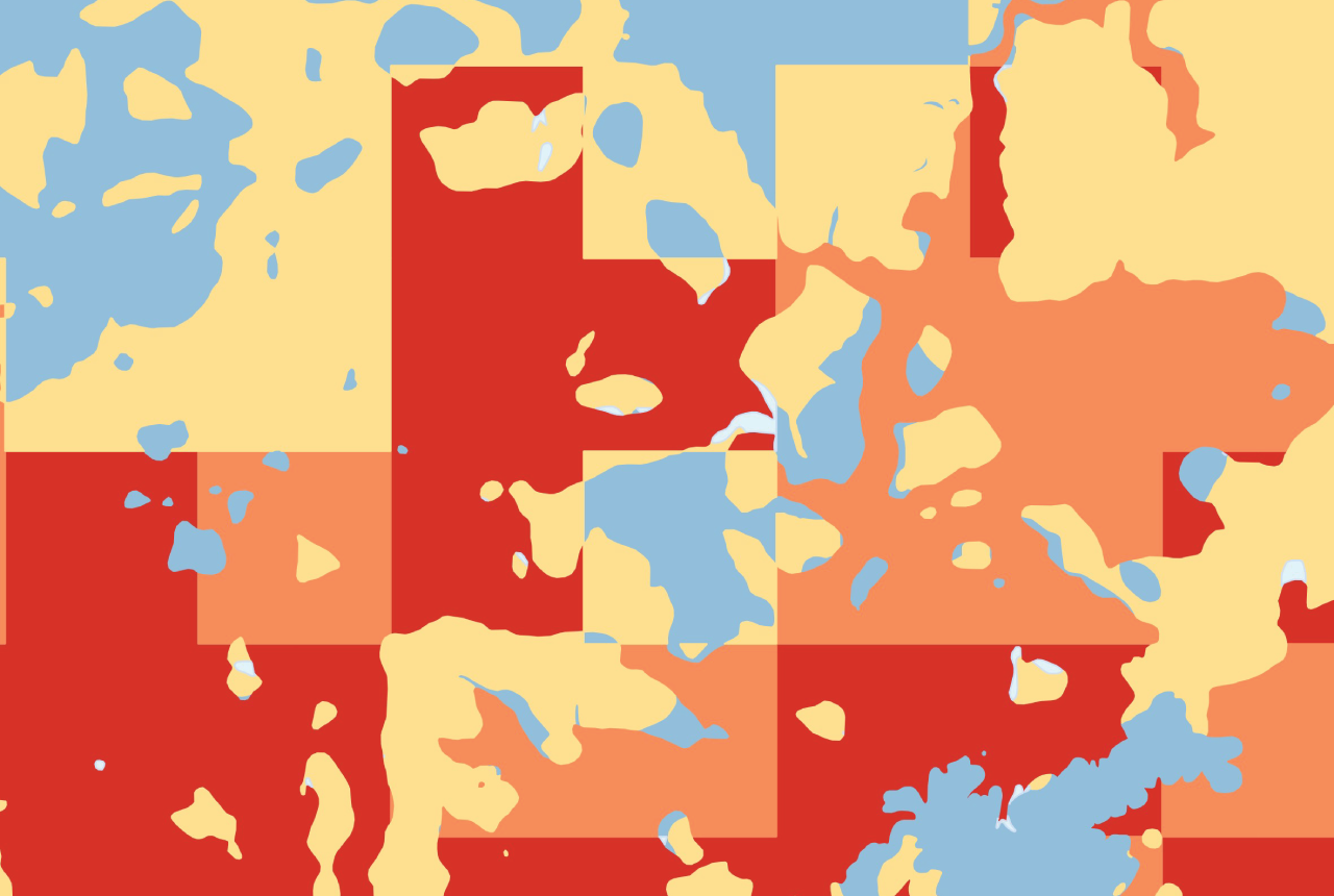
BGS/UKHSA radon data: Indicative Atlas of Radon
A simplified version of the radon potential dataset with each 1 km grid square being classed according to the highest radon potential found within it. The UK Health Security Agency recommends radon levels should be reduced in homes where the annual average is at or above 200 becquerels per cubic metre (200 Bq/m3). Local authorities can use this data as a screening tool for identifying areas that require further investigation with the detailed radon potential dataset.
BGS Soil Parent Material Model
Parent materials (underlying geology) provide the basic foundations and building blocks of a soil, influencing texture, structure, drainage and chemistry. This model details the distribution of physiochemical properties of the weathered and unweathered parent materials of the UK to help identify soils and landscapes sensitive to erosion or deficient in nutrients and is useful for farmers and crop scientists.
Other BGS data products
These open datasets can also be accessed via our website as part of our wider suite of data products. The data is accessible in a variety of formats and via different platforms including the BGS GeoIndex map viewer and web map services. Some of the datasets also have a premium version which can be licensed. For more information about our data products please contact the digital data team (digitaldata@bgs.ac.uk).
Relative topics
Related news

Updated national 3D model will determine the depth to the solid bedrock beneath our feet
13/07/2026
The BGS Superficial Deposit Thickness Model now includes an elevation model of geological rockhead for the first time, providing important data for civil engineers, geoscientists and environmental scientists.

New geological mapping underway to help manage flooding along the River Tweed
08/07/2026
Scientists are surveying the Tweed catchment for the first time in over 100 years to enhance understanding of localised groundwater and improve flood forecasting.

From archive to discovery: historical mineral reports support gold exploration in Scotland
25/06/2026
Digitised geological records show potential to unlock untapped mineral resources in Ardlochan, Argyllshire.

Ukraine and the UK strengthen their commitment to geological cooperation
10/06/2026
A new Memorandum of Understanding reaffirms the UK’s support of Ukraine’s ambitions to develop its critical mineral resources, paving the way for collaboration through capacity-building programmes.
GeoClimate Shrink–Swell
GeoClimate clay shrink-swell provides information on the projected future change in susceptibility of clay shrink–swell across Great Britain due to climate change.

New geological maps of Berwick-upon-Tweed to help future-proof natural water supply
20/05/2026
Scientists have mapped the geology under the town to better understand the groundwater system to inform decisions around abstraction.

BGS GeoClimate – dataset launch webinar
Event on 02/06/2026
The virtual launch of our new BGS GeoClimate dataset – helping mitigate the economic risk from shrink-swell subsidence. Event recording now available

Updated geological assessment of the Southern North Sea set to underpin future offshore infrastructure development
25/03/2026
The first regional assessment for 30 years will support offshore marine and subsurface planning for the UK’s low-carbon energy infrastructure, including the 2030 target of 45 to 50 GW generated through offshore wind.

Map of BGS BritPits showing the distribution of worked mineral commodities across the country
18/02/2026
BGS’s data scientists have generated a summary map of the most commonly extracted mineral commodities by local authority area, demonstrating the diverse nature of British mineral resources.

Funding secured to help mitigate ground risk in UK construction sector
05/02/2026
The BGS Common Ground project has been awarded new funding to help unlock the value of ground investigation data.

Can sandstones under the North Sea unlock the UK’s carbon storage potential?
02/02/2026
For the UK to reach its ambitious target of storing 170 million tonnes of carbon dioxide per year by 2050, it will need to look beyond the current well-studied geographical areas.

Quaternary UK offshore data digitised for the first time
21/01/2026
The offshore wind industry will be boosted by the digitisation of a dataset showing the Quaternary geology at the seabed and the UK’s shallow subsurface.