New report sets pathway to reduce the impacts of geohazards in one of the world’s most hazard-prone nations
A new White Paper, co-developed by Indonesian and UK hazard experts, presents a strategic roadmap to significantly reduce the impacts of geological hazards in Indonesia.
30/09/2025 By BGS Press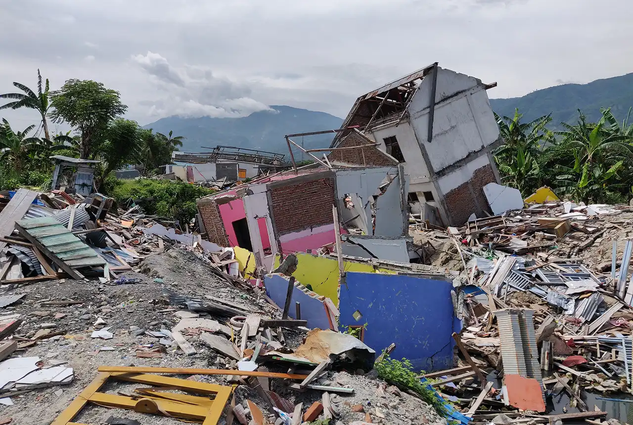

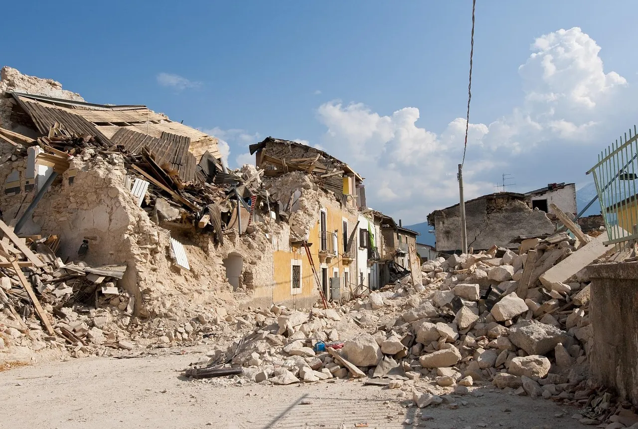
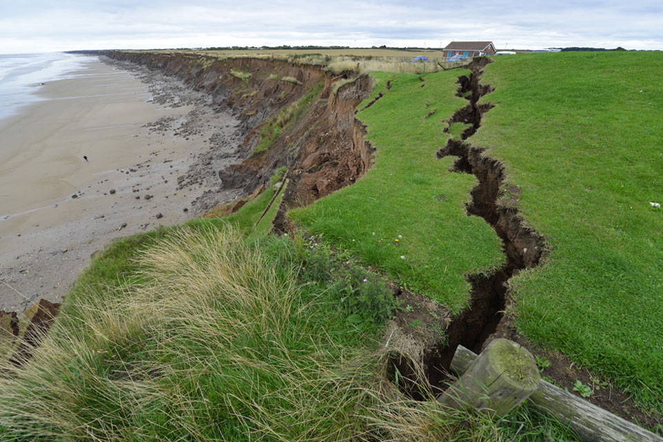
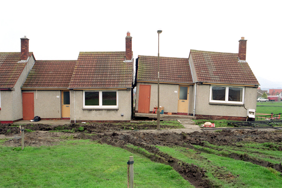
Indonesia is one of the world’s most hazard-prone nations and experiences over 2000 disasters annually. Natural hazard disasters in Indonesia are responsible for the loss of hundreds to thousands of lives each year and costs the national economy US$1 to US$3 billion[1], [2]. Population growth, increased urbanisation, embedded poverty and rising inequality mean these risks are rising.
Effective disaster risk reduction across the spectrum of geohazards, from landslides to tsunamis, depends on decisions grounded in the best available earth science. Yet significant knowledge gaps remain, particularly in understanding previous hazardous events, how they shape future risk, and how lessons from the past can best inform effective hazard-management strategies.
A new White Paper, co-developed by the British Geological Survey (BGS) and UK and Indonesian multi-disciplinary hazard experts, presents a strategic roadmap to advance geohazard science assessment and significantly reduce the impacts of geological hazards in the country by 2035.
The report, titled ‘UK–Indonesia Partnerships for Advancing Geohazard Science for Disaster Risk Assessment in Indonesia’, is intended to benefit policymakers, funders, researchers and institutions that are committed to collaboratively reducing disaster risk in Indonesia.
The paper sets out five recommendations to support evidence-based resilient development in one of the world’s most hazard-prone nations:
- establish a formal UK–Indonesia geohazard disaster resilience partnership as a basis to coordinate joint research, policy dialogue and technical collaboration
- invest in long-term, interdisciplinary research on dynamic multi-hazard risks
- adopt a national geohazard data and information policy to ensure consistency, transparency and integration with ongoing initiatives such as Indonesia’s ‘one map’ policy
- strengthen workforce value and knowledge exchange via fellowships, joint PhD or Masters programmes, mobility schemes and community engagement platforms
- embed disaster risk reduction in national development planning by requiring multi-hazard risk assessments for infrastructure and urban planning projects

The white paper provides a unique opportunity to combine global scientific excellence and rich local expertise to address the urgent need to manage geological hazards. This partnership is not only instrumental in shaping research and policy but also in strengthening institutions. Our five recommendations are designed to be actionable, sustainable and rooted in the strength of UK–Indonesia research partnerships.
Dr Ekbal Hussain, remote sensing geoscientist at the British Geological Survey and coordinating author of the White Paper.
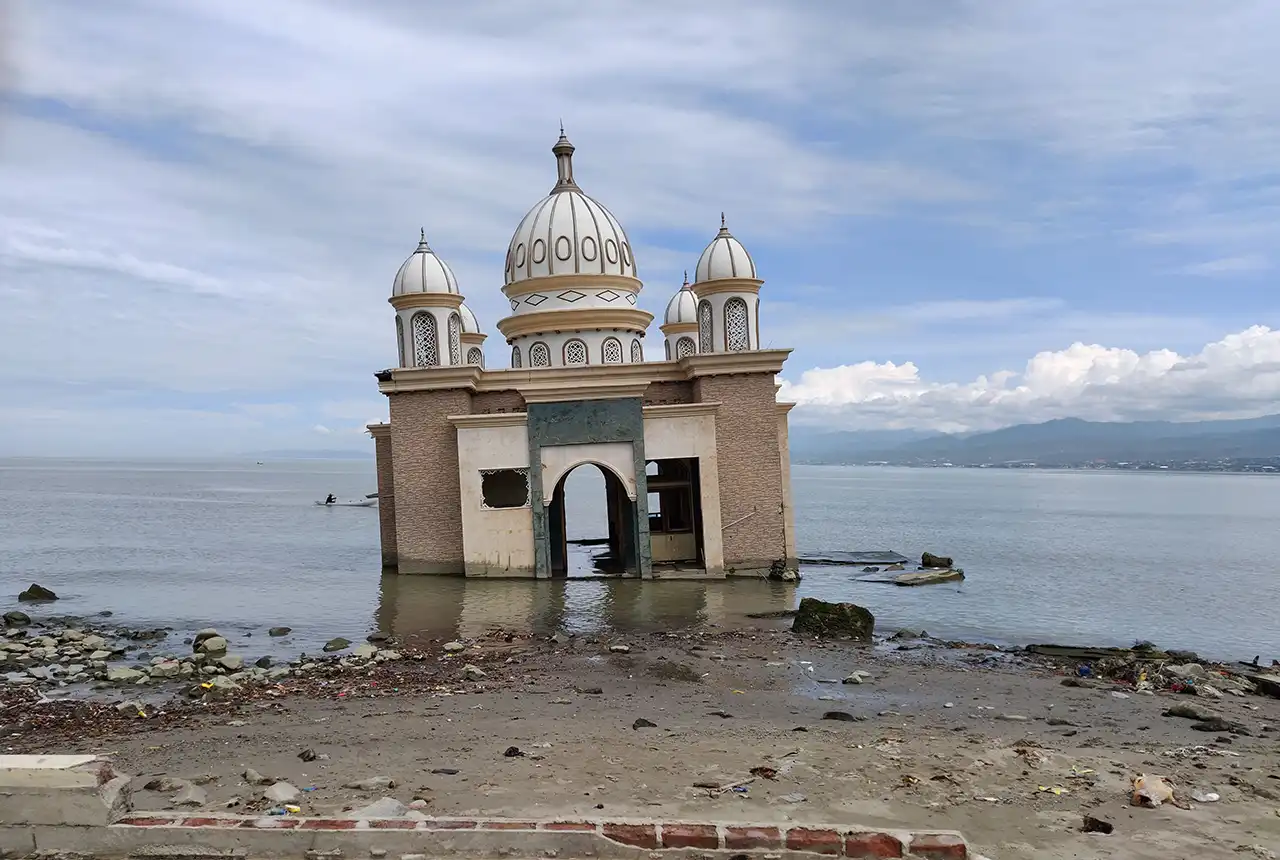
Subsidence and tsunami damage in Palu, Indonesia. BGS © UKRI.
Indonesia is one of the most hazard-prone countries in the world and faces persistent risks from earthquakes, tsunamis, volcanic eruptions, and other geohazards. Therefore, advancing scientific knowledge and developing innovative approaches to disaster risk assessment and reduction are of the utmost importance. BRIN strongly supports this initiative and looks forward to deepening collaboration with UK partners to enhance scientific capacity, foster innovation, advance science-driven policy, and contribute to global knowledge and practices in disaster risk reduction.
Professor Ocky Karna Radjasa, Chairman, Research Organization of Earth Sciences and Maritime, National Research and Innovation Agency (BRIN).
For BMKG, the White Paper holds both strategic and operational value. It reinforces our mandate in real-time monitoring, forecasting, and multi-hazard early warning services, while also enhancing coordination with national and local disaster management agencies.
Dr Nelly Florida Riama, Deputy Head of Geophysics, The Agency for Meteorology, Climatology, and Geophysics of the Republic of Indonesia (BMKG).
PVMBG is committed to advancing geohazard science as a foundation for disaster risk reduction. Partnerships such as this UK–Indonesia collaboration are crucial to strengthen knowledge, build resilience, and enhance science-driven decision-making at both national and international levels.
Dr Priatin Hadi Wijaya, S T, M T Head, Center for Volcanology and Geological Hazard Mitigation (PVMBG).
[1] Indonesia – Vision 2045 towards water security
[2] Publikasi – Indonesia Increases Adaptive Disaster Management Funding
Relative topics
Related news
Perth and Kinross tops the UK’s earthquake activity charts for 2025
29/12/2025
Seismologists at BGS have published data on the number of seismic events over the past 12 months with over 300 earthquakes recorded.

BGS awarded funding to support Malaysia’s climate resilience plan
17/12/2025
The project, funded by the Foreign, Commonwealth & Development Office, will focus on minimising economic and social impacts from rainfall-induced landslides.
New research shows artificial intelligence earthquake tools forecast aftershock risk in seconds
25/11/2025
Researchers from BGS and the universities of Edinburgh and Padua created the forecasting tools, which were trained on real earthquakes around the world.

UK braced for what could be the largest solar storm in over two decades
12/11/2025
Intense geomagnetic activity could disrupt technology such as communication systems, global positioning systems and satellite orbits.
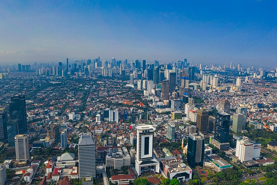
New research highlights significant earthquake potential in Indonesia’s capital city
04/11/2025
Research reveals that a fault cutting through the subsurface of Jakarta could generate a damaging earthquake of high magnitude.
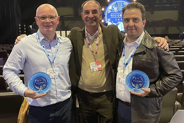
GSNI project wins multiple awards at RegioStars event
17/10/2025
The AGEO project enjoyed a double success at the RegioStars awards, hosted at the European Commission in Brussels.
New report sets pathway to reduce the impacts of geohazards in one of the world’s most hazard-prone nations
30/09/2025
A new White Paper, co-developed by Indonesian and UK hazard experts, presents a strategic roadmap to significantly reduce the impacts of geological hazards in Indonesia.
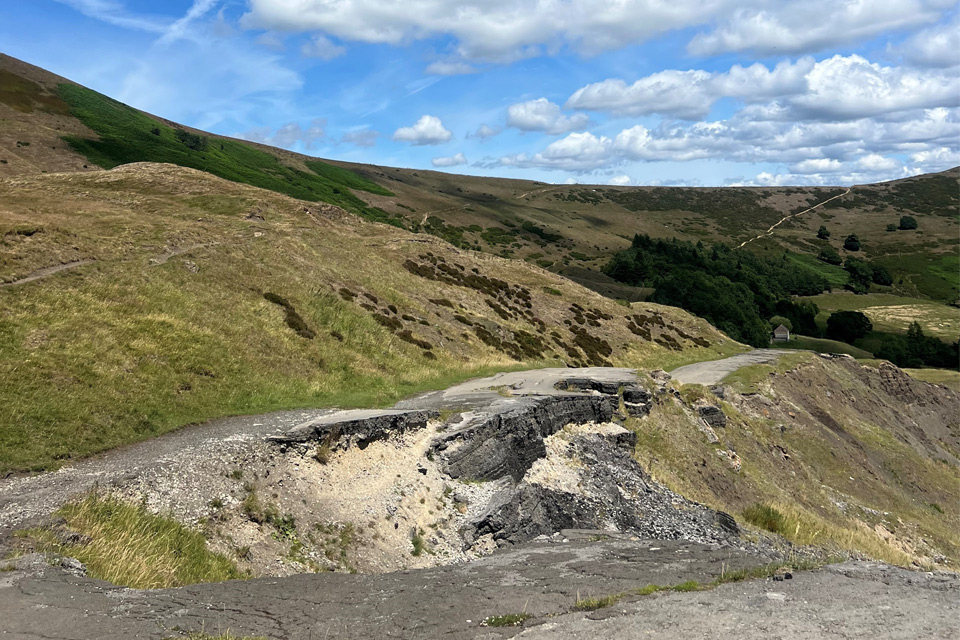
Artificial intelligence helps scientists identify 3000 moving slopes potentially at risk of landslide
25/09/2025
A new approach that combines AI and satellite data has been used by scientists to detect actively moving landslides at a national scale.

UK scientists in awe-rora as national coverage of magnetic field complete for the first time
23/09/2025
New sensors being installed across the UK are helping us understand the effects that extreme magnetic storms have on technology and national infrastructure.
BGS-led paper scoops prestigious award
16/09/2025
New research providing earlier warnings of landslides has been awarded the British Geotechnical Association medal.
BGS scientists work with United Nations to update hazard profiles
21/08/2025
From tsunamis to sinkholes, the profiles provide a standardised, internationally agreed definition of hazards to support disaster risk management worldwide.
Is your region susceptible? Britain’s geohazard hotspots revealed
14/08/2025
From sinkholes to radon: new maps highlight the most geologically at-risk regions