Relative topics
48 results for "marine geoscience"
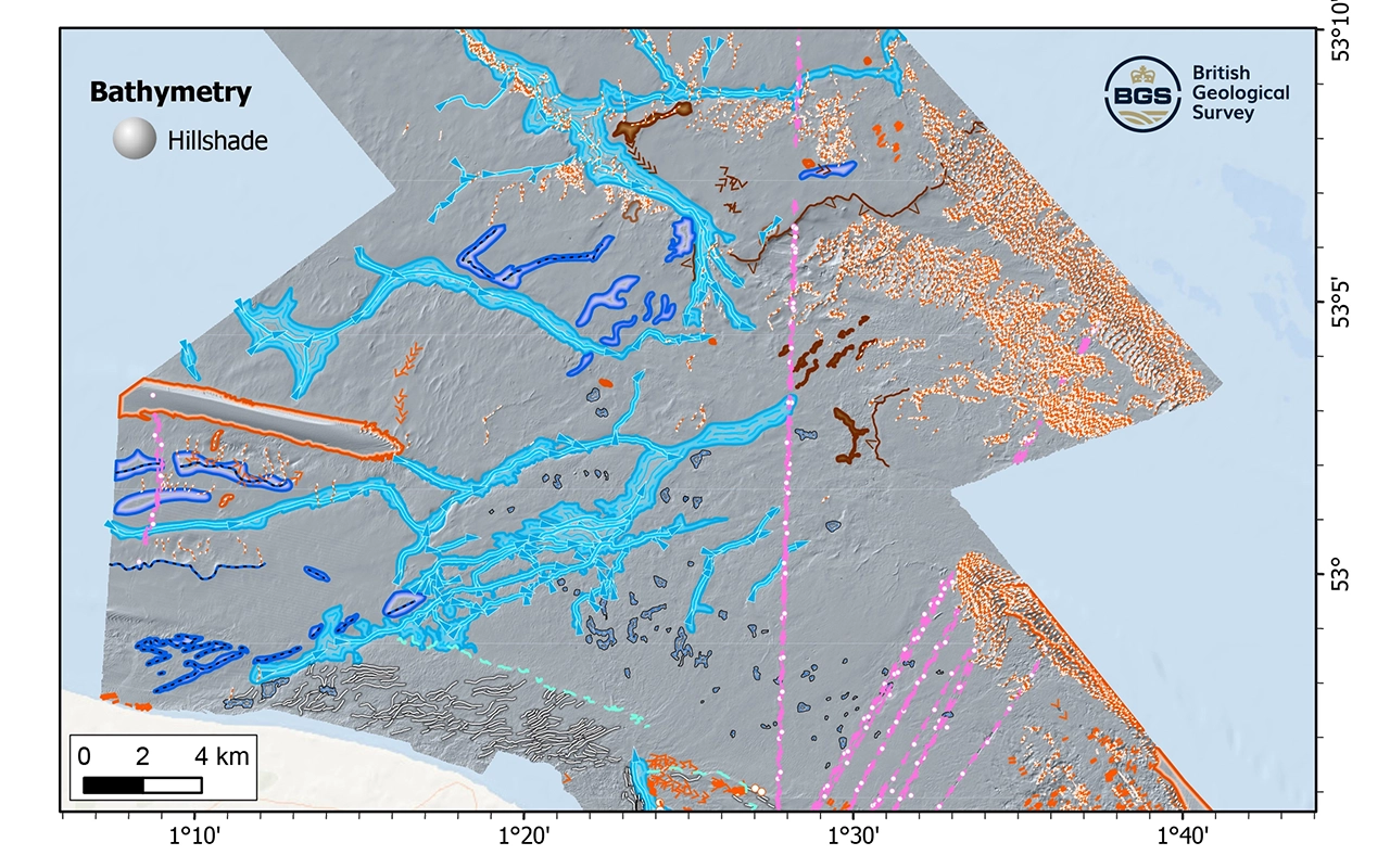
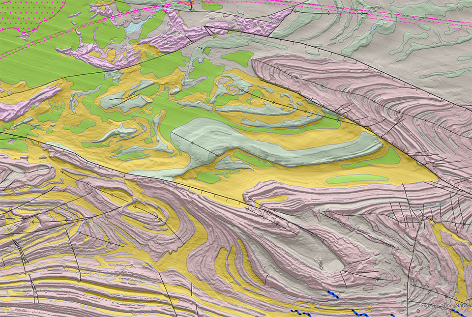
New research reveals the secrets of the seabed off the East Anglian coast
New geological map will help in the hunt for new renewable energy opportunities whilst protecting delicate marine ecosystems.
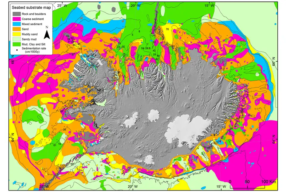
BGS awarded research grant to support potential offshore wind development in Iceland
BGS has been awarded the NERC-Arctic grant for a collaboration project with Iceland GeoSurvey.
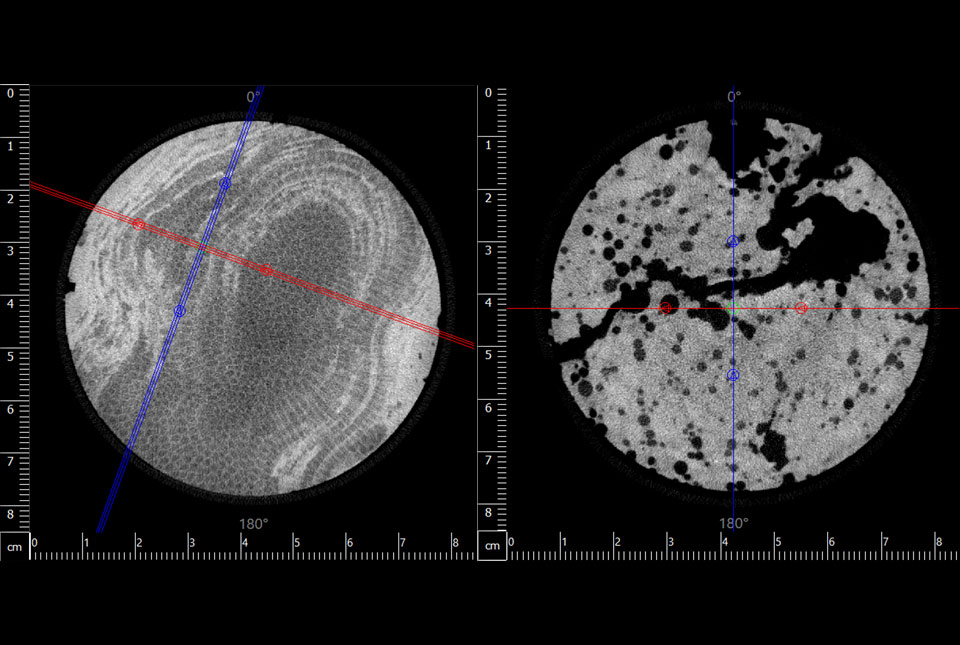
Largest CT core scan completed at the BGS Core Scanning Facility
BGS has completed its largest CT core scan project to date, with around 400 m of core imaged for the IODP Drowned Reefs project.
Scientists produce first record of environmental data off coast of Hawai’i
An international team of researchers, including BGS geoscientists, have succeeded in acquiring a continuous record of environmental data using fossilised coral from Hawai’i.
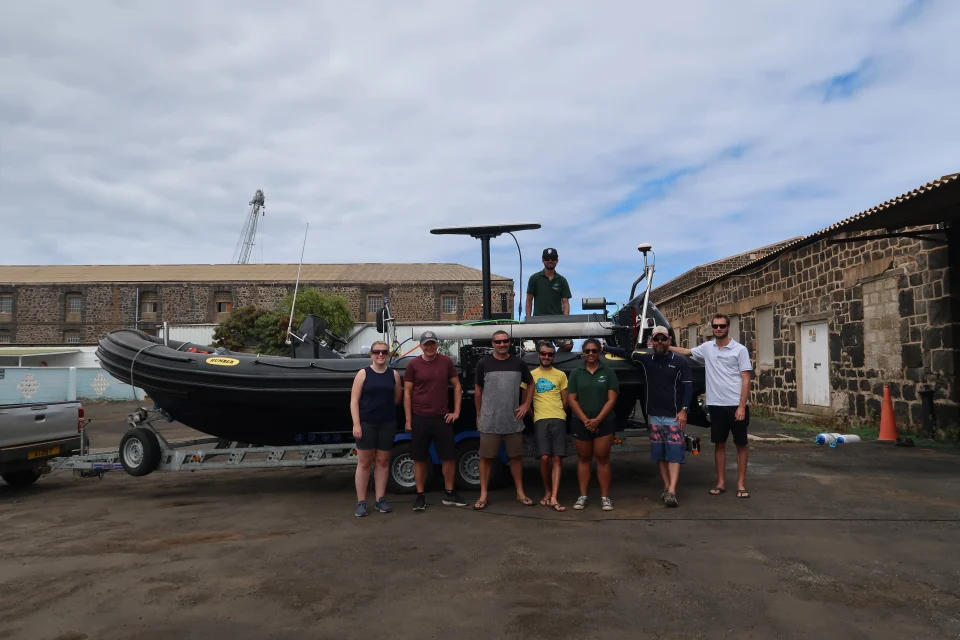
In photos: marine surveying a remote volcanic island
A photo blog by members of the BGS Marine Survey team, who recently completed marine surveys around Ascension Island in the South Atlantic Ocean.
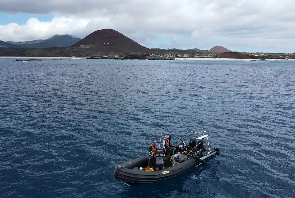
BGS completes first mapping expedition to Ascension Island
BGS marine geoscientists travelled to Ascension Island to support its government with an ongoing, conservation-driven mapping programme.
Industry-leading data sharing partnership announced
A data sharing partnership has been agreed between BGS and Ossian, allowing BGS to advance its knowledge of the rock and soil conditions under the seabed.
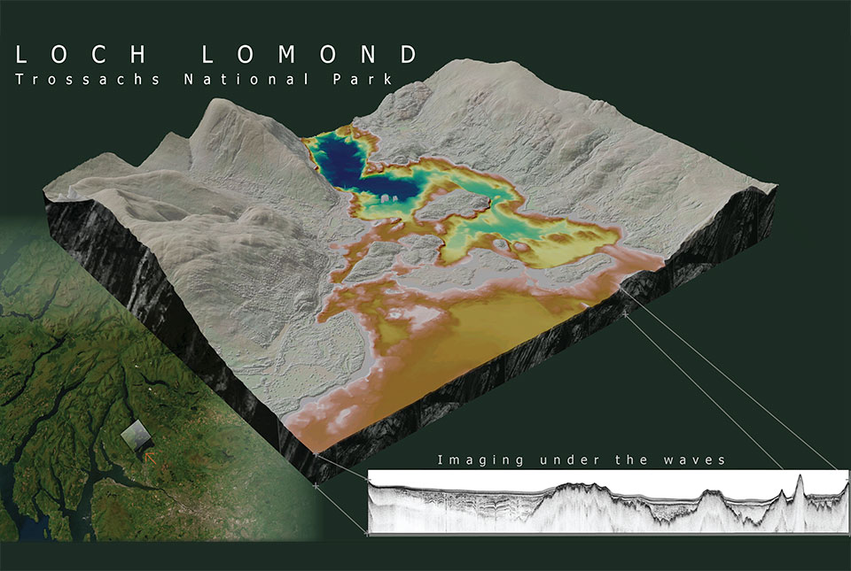
What lies beneath Loch Lomond?
BGS geoscientists have visualised what lies beneath the waves of Loch Lomond, revealing an image of the loch bed and various sedimentary features of the subsurface.