Project findings provide essential insight into the last British–Irish ice sheet
Understanding more about the north-west European continental shelf and improving forecasting for the Antarctic and Greenland ice sheets.
29/09/2022 By BGS Press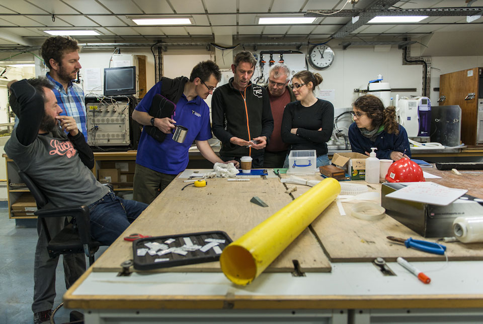

A paper marking the culmination of a highly successful project into a former ice sheet is helping researchers to understand more about the north-west European continental shelf. It’s also helping improve forecasting for the Antarctic and Greenland ice sheets.
The five-year, £3.7 million BRITICE-CHRONO consortium, funded by NERC, took on the most ambitious geochronological project yet, encompassing on- and offshore mapping around the UK and Ireland to better describe and understand the growth and decay of the last British–Irish ice sheet.
BRITICE research included 1500 days of field investigation yielding 18 000 km of marine geophysical data, 377 cores of sea-floor sediment and geomorphological and stratigraphical information at over one hundred sites on land. This enabled the generation of 690 new geochronometric ages, which were collected to understand the timings, coverage and retreat of the British–Irish ice sheet and to provide a geochronological framework between 31 000 and 15 000 years ago.
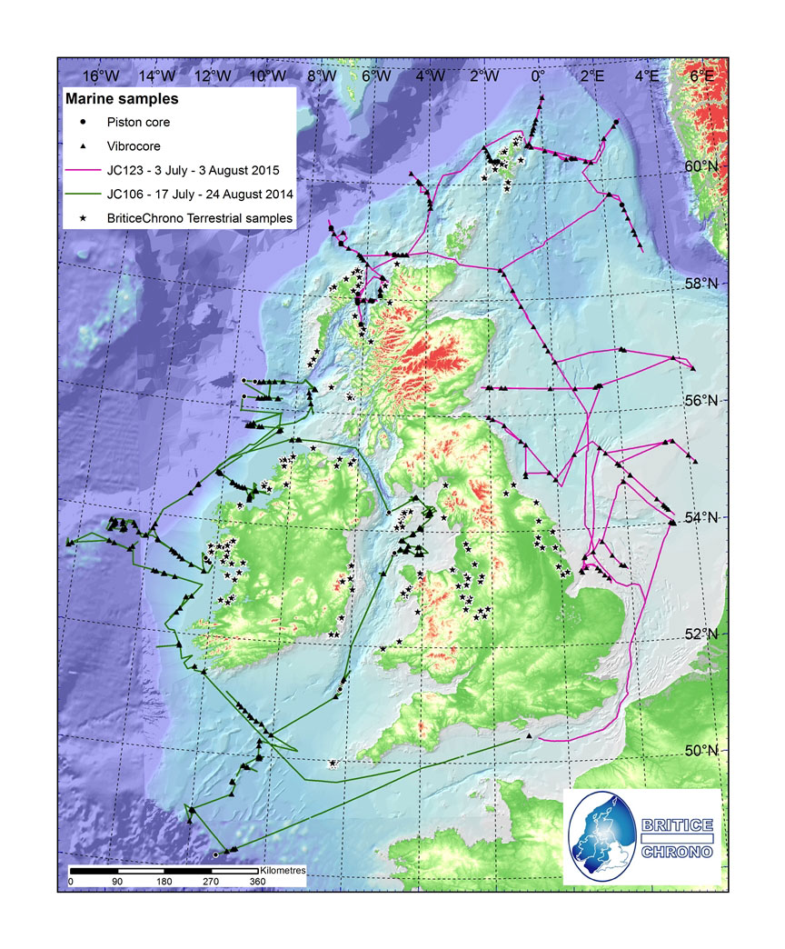
Voyages around a former ice sheet. © BRITICE-CHRONO
The findings bear a strong similarity to the dynamics and evolving configuration in the Antarctic today, enabling scientists to refine and improve current ice sheet modelling approaches. It will also aid researchers investigating regional palaeoenvironments as well as those working on offshore development (e.g. offshore renewables) and marine management.

BGS is proud to have played a role in this important project. The paper compiles and distils many of the detailed findings from the onshore work and offshore transects of the project and will serve as a useful resource to inform and expand on current knowledge on the evolution of the British–Irish ice sheet.
Dayton Dove, BGS Marine Geoscientist.
BGS scientists participated in and contributed to the project by providing expertise, data and information to support planning, implementation and interpretation of survey and project results. The offshore coring was also carried out by BGS engineering teams.
Two reconstructions of the ice sheet were developed: an empirical version and one that combines modelling and the new empirical evidence. Palaeoglaciological maps of ice extent, thickness, velocity and flow geometry at thousand-year time intervals were also produced.
The paper, Growth and retreat of the last British–Irish Ice Sheet, 31 000 to 15 000 years ago: the BRITICE-CHRONO reconstruction, was published in BOREAS.
Relative topics
Related news

New NERC-funded project empowers young people to engage with environmental science
23/07/2026
BGS is part of a new, collaborative project, funded through NERC’s ‘Opening up the environment’ programme, helping the environmental research community become more accessible.

Delving deep into mountains for future water security
16/07/2026
A BGS-led project is using new water-tracing investigation methods, geophysics and modelling to understand how water moves from mountains to the lowlands, helping to improve water security for billions of people.

Updated national 3D model will determine the depth to the solid bedrock beneath our feet
13/07/2026
The BGS Superficial Deposit Thickness Model now includes an elevation model of geological rockhead for the first time, providing important data for civil engineers, geoscientists and environmental scientists.

UK’s world-class research organisations launch new collective
10/07/2026
The launch of the National Research Organisations Group brings together more than 100 science leaders to provide an authorativive voice on science, research policy and long-term investment.

Cheshire Geoenergy Observatory releases key geological datasets for UK thermal energy storage scheme design
09/07/2026
A new report and data packs from BGS will provide a unique resource for scientists working on the geology and hydrogeology of the Sherwood Sandstone Formation, an important aquifer and reservoir rock.

New geological mapping underway to help manage flooding along the River Tweed
08/07/2026
Scientists are surveying the Tweed catchment for the first time in over 100 years to enhance understanding of localised groundwater and improve flood forecasting.

Geological research in North Sea helping to safeguard subsea cables
06/07/2026
Subsea power and telecommunications cables are critical to the UK’s energy infrastructure and global connectivity, yet they remain vulnerable to damage from ship anchors, fishing activity and natural hazards.

UK Critical Minerals Intelligence Centre makes recommendations for the next UK criticality assessment
01/07/2026
CMIC has outlined the enhancements made to the next assessment update to ensure it is better tailored to the structure of the UK economy.

From archive to discovery: historical mineral reports support gold exploration in Scotland
25/06/2026
Digitised geological records show potential to unlock untapped mineral resources in Ardlochan, Argyllshire.

UK and Philippines scientists investigate natural hydrogen generation processes at atomic scale
22/06/2026
BGS researchers were granted access to use the Diamond Light Source facility in order to study hydrogen in light brighter than the sun.

Shortage of end-of-life materials presents challenge to UK critical minerals security
17/06/2026
A new report by the UK Critical Minerals Intelligence Centre reveals insufficient end-of-life material stocks present a supply risk over the coming decade, but offer significant long-term potential to meet critical mineral demand through recycling.

UK geothermal catalogue receives update
16/06/2026
BGS releases the second digital version of the UK geothermal catalogue of subsurface temperature and rock thermal conductivity measurements and heat flow calculations.