MYRIAD-EU: shifting the paradigm in disaster risk management
How changing our approach to disaster risk reduction practices can create a more resilient future.
17/01/2023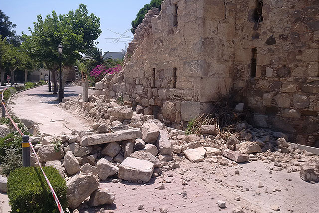

Multi-hazard risk and disaster risk management
Effects from disasters due to natural hazards have increased over time. Without effective disaster risk management (DRM), this trend will continue as exposure to natural hazards and the intensity and frequency of climate-related hazards become ever greater over this century.

The Hunga Tonga Hunga Ha’apai eruption, on 15 January 2022, as captured by Japan’s Himawari-8 weather satellite. The eruption triggered a tsunami that had major impacts across Tonga. It also caused damage in multiple nations across the Pacific. © Japan Meteorological Agency, CC BY 4.0.
Disaster risk is a product of hazard, exposure and vulnerability. The ability to anticipate interactions and feedbacks between different components of DRM, along with their change over time, is a challenge for those involved.
- Multi-hazards can interact with each other, as one can trigger or amplify the likelihood of another
- Hazards can occur at the same time (compound events) or consecutively (cascade events)
- Mitigation of one hazard can change risk by increasing vulnerability to another: for example, raising a house on stilts to protect it from floods in a region prone to earthquakes can make it more vulnerable to ground shakin
The effects of hazards and their interactions can also affect multiple sectors and geographical scales, either directly or through ‘knock-on’ effects: for example, damage to transport infrastructure that disrupts supply chains can result in business interruption. Ideally, risk assessments should be made using an approach that considers multi-hazards and risks across multiple different sectors, scales and timeframes. However, such approaches are not yet mainstream. A lot of risk research and policy continue to focus on single hazards and sectors, despite a proliferation of multi-hazard and risk research in the last couple of decades.
A paradigm shift in DRM is needed. This is something that the MYRIAD-EU project wants to catalyse.
The MYRIAD-EU project
MYRIAD-EU, of which BGS is a partner, is a pan-European project made up of 18 different institutions, six of which represent different economic sectors. The project will co-develop the first integrated framework for multi-hazard, multi-sector and systemic risk management, alongside a suite of tools and services that will enable its adoption by risk managers and other decision makers.
To do this, the MYRIAD-EU partners are studying the links between different hazards and economic sectors in five pilot study regions of different geographical scales (Figure 1:
- the North Sea
- the Canary Islands
- Scandinavia
- the Danube region
- the Veneto region of Italy
Within each pilot region, work is focusing on understanding the relationships and dependencies between the different hazards the region is exposed to and at least three of the following economic sectors:
- infrastructure and transport
- food and agriculture
- ecosystems and forestry
- energy
- finance
- tourism
This knowledge is being used to develop forward-looking DRM pathways that address the particular challenges that have been identified for each of the regions. The diverse nature of the different pilots means that outputs will have applications across Europe.
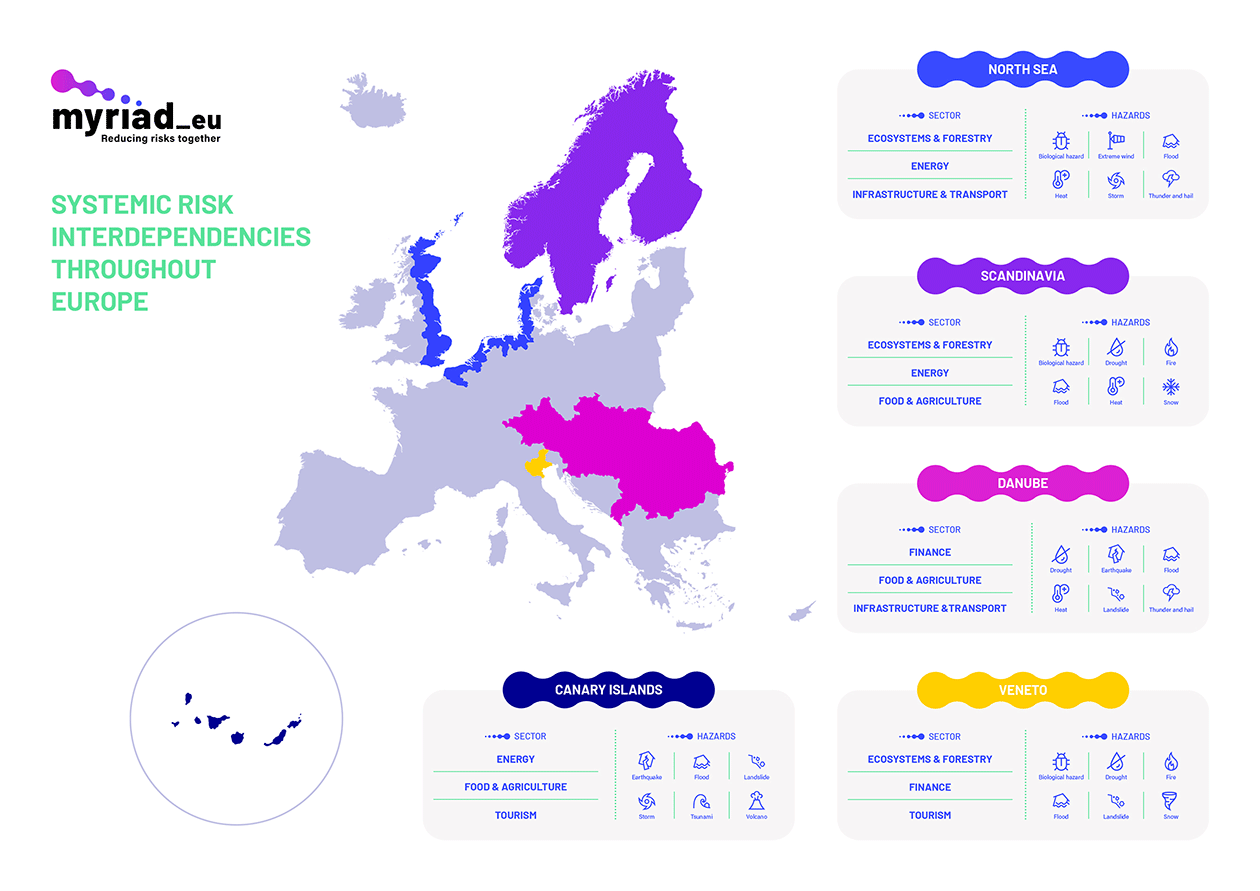
Figure 1 The MYRIAD-EU pilot study regions and the hazards and economic sectors that will be studied within them. © MYRIAD-EU Project 2021.
The overall aim is to develop new products, services and solutions that better enable decision makers, policymakers and other risk practitioners to manage and reduce risk more effectively when the project ends in 2025. To ensure that the project outputs are useful and usable for real-world applications, MYRIAD-EU will work closely with stakeholders from different sectors and at different levels of engagement throughout the project’s lifetime.
Keeping up-to-date with MYRIAD-EU
To keep up-to-date with the project visit the MYRIAD-EU website, where you can register for alerts, or follow the project Twitter account.
Project outputs will be made available (open access) as they are completed on the Zenodo platform and can be accessed via the platform or through links on the MYRIAD-EU library.
Project outputs
Recent outputs developed by BGS, in collaboration with project partners, include:
- a handbook of multi-hazard, multi-risk definitions and concepts: this resource provides reference terminology and extended definitions related to concepts relevant to the project
- the DisasterRiskGateway: a crowdsourced wiki for discovering and sharing approaches to assessing and managing multi-(hazard risks), as well as terminology definitions. We welcome new contributions from across the disaster risk community.
Further reading
Ward, P J, et al. 2022. Invited perspectives: a research agenda towards disaster risk management pathways in multi-hazard risk assessment. Natural Hazards and Earth System Sciences, Vol. 22(4), 1487–1497. DOI: https://doi.org/10.5194/nhess-22-1487-2022
Funding
About the author

Dr Lara Smale
Volcanologist; international data analyst
Relative topics
Related news

Latest research emphasises climate-related subsidence risk to millions of British homes
11/06/2026
New data from BGS highlights the projected future impact of warmer, drier summers and underlines the need for mitigation measures in susceptible regions.
GeoClimate Shrink–Swell
GeoClimate clay shrink-swell provides information on the projected future change in susceptibility of clay shrink–swell across Great Britain due to climate change.

BGS GeoClimate – dataset launch webinar
Event on 02/06/2026
The virtual launch of our new BGS GeoClimate dataset – helping mitigate the economic risk from shrink-swell subsidence. Event recording now available
Perth and Kinross tops the UK’s earthquake activity charts for 2025
29/12/2025
Seismologists at BGS have published data on the number of seismic events over the past 12 months with over 300 earthquakes recorded.

BGS awarded funding to support Malaysia’s climate resilience plan
17/12/2025
The project, funded by the Foreign, Commonwealth & Development Office, will focus on minimising economic and social impacts from rainfall-induced landslides.
New research shows artificial intelligence earthquake tools forecast aftershock risk in seconds
25/11/2025
Researchers from BGS and the universities of Edinburgh and Padua created the forecasting tools, which were trained on real earthquakes around the world.

UK braced for what could be the largest solar storm in over two decades
12/11/2025
Intense geomagnetic activity could disrupt technology such as communication systems, global positioning systems and satellite orbits.

New research highlights significant earthquake potential in Indonesia’s capital city
04/11/2025
Research reveals that a fault cutting through the subsurface of Jakarta could generate a damaging earthquake of high magnitude.

World Cities Day: the geological story of our cities
31/10/2025
Understanding the rocks that underlie our towns and cities, the risks they can present and how they influence urban planning and redevelopment.
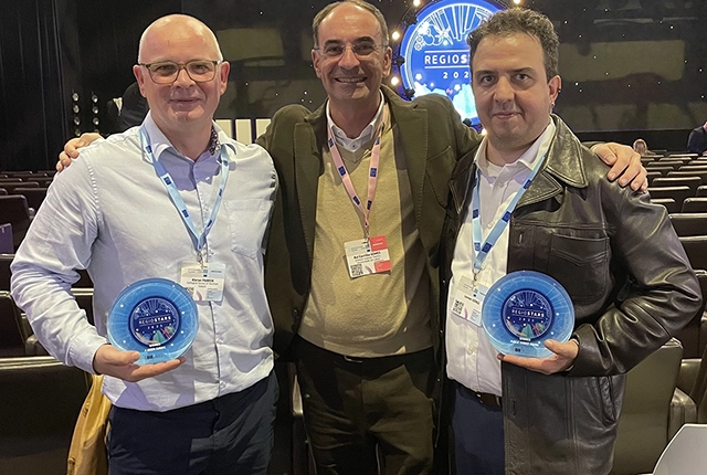
GSNI project wins multiple awards at RegioStars event
17/10/2025
The AGEO project enjoyed a double success at the RegioStars awards, hosted at the European Commission in Brussels.
New report sets pathway to reduce the impacts of geohazards in one of the world’s most hazard-prone nations
30/09/2025
A new White Paper, co-developed by Indonesian and UK hazard experts, presents a strategic roadmap to significantly reduce the impacts of geological hazards in Indonesia.
Artificial intelligence helps scientists identify 3000 moving slopes potentially at risk of landslide
25/09/2025
A new approach that combines AI and satellite data has been used by scientists to detect actively moving landslides at a national scale.