Mining hazard data (not including coal) from BGS
Great Britain has over 250 000 documented mining sites and the underground voids resulting from past mining activity pose a possible hazard. Knowledge of the distribution of former mining areas will help us to plan for future development and ongoing maintenance.
17/05/2022 By BGS Press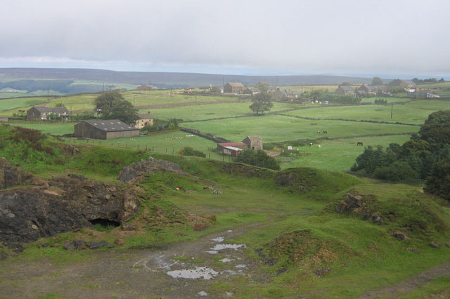

Mine workings range from small-scale, local workings, such as graphite mining in the Lake District or jet mined in Whitby, to large-scale, national resources such as salt extraction in Cheshire. While modern mine workings meet stringent safety standards, many old, disused or abandoned sites are gradually decaying, leaving a long-forgotten legacy that poses potential problems to infrastructure and property. It is therefore essential we have knowledge of the distribution of former mining areas, helping us to plan for future development and ongoing maintenance.
What is a mining hazard?
The voids resulting from past underground mining activity pose a possible hazard. Former underground workings, particularly where shallow, may collapse and cause surface settlement.
Mining hazards in Great Britain can take on various different forms, including surface impacts like ground instability, gradual subsidence, cover collapse and groundwater contamination. As our climate changes, new climate conditions may exacerbate ground conditions further, leading to more incidents of this nature.
Armed with knowledge about potential hazards, preventative steps can be put in place to alleviate the impact of the hazard on people and property. The cost of such prevention may be very low and is often many times lower than the repair bill following ground movement.
Mining hazard examples
- An old mining substructure at Burrow Lead Mine in Derbyshire decayed, leading to a tunnel collapse and propagation to the surface. In turn, this caused roadside subsidence in 2011, which disrupted infrastructure
- Ferniehill in Edinburgh has seen issues where movement in old limestone workings has caused property damage
- Former chalk workings opened up, causing potential risk to life, at Gillingham in Kent (2014) and St Albans, Hertfordshire (2018)
- Ten million gallons of contaminated water flowed out of old mine workings at Wheal Jane tin mine, Cornwall, in 1992. The workings became flooded and the groundwater contaminated with heavy metal pollution; when an underground structure failed, a sudden outrush occurred
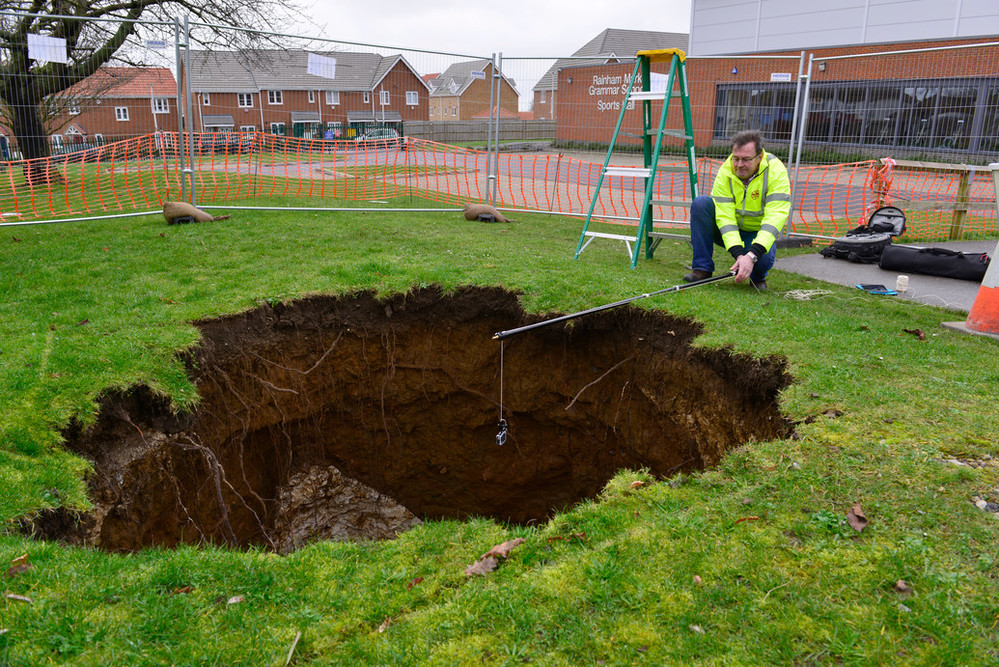
Denehole at Rainham Mark Grammar School, Gillingham, Kent (2014). Deneholes are medieval chalk extraction pits; characteristically they comprise a narrow shaft with a number of chambers radiating from the base. The depth of the features reflects the depth to the underlying chalk bedrock. The shaft width was commonly in the order of 2–3 m, widening out into galleries at depth. BGS © UKRI.
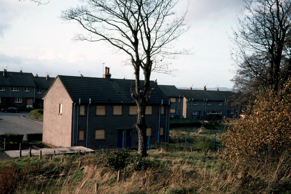
Condemned houses over collapsing mine workings in Johnstone, Renfrewshire. BGS © UKRI.
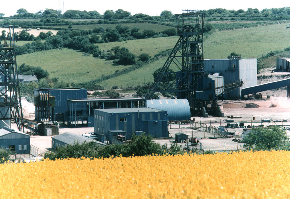
Derelict Wheal Jane mine, Cornwall. BGS © UKRI.
New research incorporated into our mining hazard data product
Currently. approximately two per cent of the land area of Great Britain is identified as having high susceptibility to mining hazard. The BGS Mining Hazard (not including coal) data product identifies areas affected by non-coal mining, providing a general assessment of hazard potential, thereby indicating areas at risk of possible subsidence associated with voids resulting from mine workings.
The newly released version of the BGS Mining Hazard data product also introduces a series of derived ‘zones of influence’ (ZOI) for evaporites (e.g. salt; gypsum; anhydrite), oil shales and building stone (e.g. limestone; sandstone; slate).
(Mining of coal is specifically excluded from this dataset. Enquiries on past coal mining should be directed to the Coal Authority.)
What is a zone of influence?
Zones of influence are areas indicating the potential surface extent that may be affected by underground workings. Calculations evaluate a number of criteria, including:
- seam thickness
- depth and dip of seam
- competence of roof and floor
- age of working
By integrating ZOIs into the product, a clearer picture of the surface area of legacy mining on property, people and pursuits can be established.
- Learn more about our mining hazard (not including coal) data
Case study: Long Meg Mine, Cumbria
- Worked for gypsum and anhydrite; approximately five million tonnes were extracted
- Mining was from horizontal adits and drifts driven from the side of the Eden Valley
- The mining method was pillar-and-stall, once underground
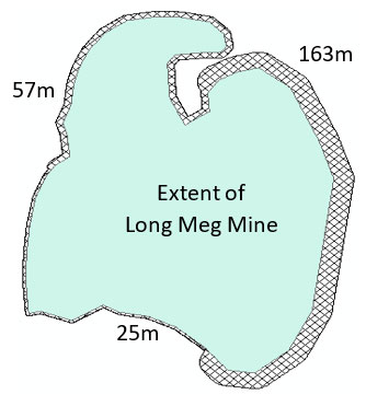
Extent of mining hazard at Long Meg mine. Blue area represents the extent of the mine; hatched area is additional potential hazard that could affect the surface. BGS © UKRI.
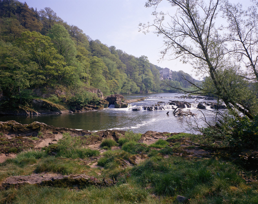
Long Meg mine (buildings in the background) alongside the River Eden, Cumbria. BGS © UKRI.
Try our open data option for free
BGS offers a generalised 1 km ‘hexgrid’ version of the data in ESRI shapefile format under the Open Government Licence to enable users to get a feel for our mining hazard (not including coal) data.
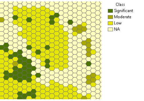
Mining hazard hexgrid example. BGS © UKRI.
Further information
For further information please contact digitaldata@bgs.ac.uk.
Relative topics
Related news

New NERC-funded project empowers young people to engage with environmental science
23/07/2026
BGS is part of a new, collaborative project, funded through NERC’s ‘Opening up the environment’ programme, helping the environmental research community become more accessible.

Delving deep into mountains for future water security
16/07/2026
A BGS-led project is using new water-tracing investigation methods, geophysics and modelling to understand how water moves from mountains to the lowlands, helping to improve water security for billions of people.

Updated national 3D model will determine the depth to the solid bedrock beneath our feet
13/07/2026
The BGS Superficial Deposit Thickness Model now includes an elevation model of geological rockhead for the first time, providing important data for civil engineers, geoscientists and environmental scientists.

UK’s world-class research organisations launch new collective
10/07/2026
The launch of the National Research Organisations Group brings together more than 100 science leaders to provide an authorativive voice on science, research policy and long-term investment.

Cheshire Geoenergy Observatory releases key geological datasets for UK thermal energy storage scheme design
09/07/2026
A new report and data packs from BGS will provide a unique resource for scientists working on the geology and hydrogeology of the Sherwood Sandstone Formation, an important aquifer and reservoir rock.

New geological mapping underway to help manage flooding along the River Tweed
08/07/2026
Scientists are surveying the Tweed catchment for the first time in over 100 years to enhance understanding of localised groundwater and improve flood forecasting.

Geological research in North Sea helping to safeguard subsea cables
06/07/2026
Subsea power and telecommunications cables are critical to the UK’s energy infrastructure and global connectivity, yet they remain vulnerable to damage from ship anchors, fishing activity and natural hazards.

UK Critical Minerals Intelligence Centre makes recommendations for the next UK criticality assessment
01/07/2026
CMIC has outlined the enhancements made to the next assessment update to ensure it is better tailored to the structure of the UK economy.

From archive to discovery: historical mineral reports support gold exploration in Scotland
25/06/2026
Digitised geological records show potential to unlock untapped mineral resources in Ardlochan, Argyllshire.

UK and Philippines scientists investigate natural hydrogen generation processes at atomic scale
22/06/2026
BGS researchers were granted access to use the Diamond Light Source facility in order to study hydrogen in light brighter than the sun.

Shortage of end-of-life materials presents challenge to UK critical minerals security
17/06/2026
A new report by the UK Critical Minerals Intelligence Centre reveals insufficient end-of-life material stocks present a supply risk over the coming decade, but offer significant long-term potential to meet critical mineral demand through recycling.

UK geothermal catalogue receives update
16/06/2026
BGS releases the second digital version of the UK geothermal catalogue of subsurface temperature and rock thermal conductivity measurements and heat flow calculations.