Maps show the real threat of climate-related subsidence to British homes and properties
New maps launched by BGS reveal how climate change is likely to drive an increase in subsidence-related issues for British homes and properties over the next 50 years.
19/05/2021 By BGS Press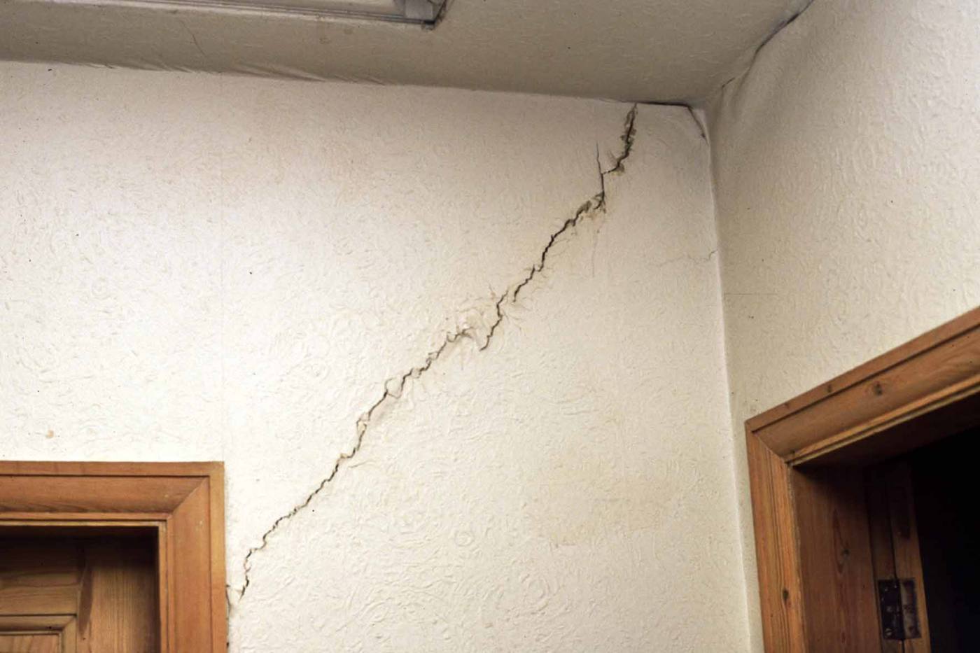

New maps launched by the British Geological Survey (BGS) reveal how climate change is likely to drive an increase in subsidence-related issues for British homes and properties over the next 50 years.
Experts at the BGS, the UK’s geoscientific advisor which helps to advance our knowledge about changes in the environment, warns that the number of properties in Great Britain facing subsidence issues and damage to property from shrink-swell is on the rise, with figures of just 3 per cent in 1990 likely to reach 10 per cent by 2070.
Shrinking and swelling of the ground, often reported as subsidence, is already one of the most damaging geohazards in Britain today, costing the economy an estimated £3 billion over the past decade.
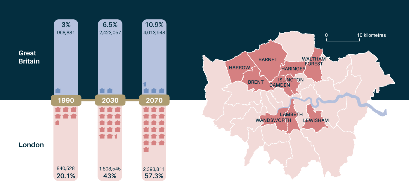
Projected number of properties highly likely or extremely likely to be affected by clay shrink-swell due to climate change (left) and London boroughs at greatest risk to be affected by 2070. BGS © UKRI.
BGS has combined geotechnical information about potential ground movement, with data about long-term rainfall and temperature scenarios, to identify the areas of Britain most likely to become susceptible to shrink-swell subsidence in the future.
Based on one of four new BGS datasets, the information traces the impact of climate change from 1990 and reveals important projections for the next decade, as well as future projections up to 2070.
They represent the worst-case scenario if Britain were to take no action to reduce carbon emissions, using scaled values which highlight the areas with the highest susceptibility to shrink-swell subsidence activity driven by a changing climate.
Shrink-swell refers to changes in soil volume due to moisture changes in the ground. When clay-rich soils absorb lots of water, swelling pressures can cause the ground to rise and structures to lift, known as heave. In warmer, drier weather, soils can become very hard when dry. As a result, the ground shrinks and cracks, leading to subsidence.
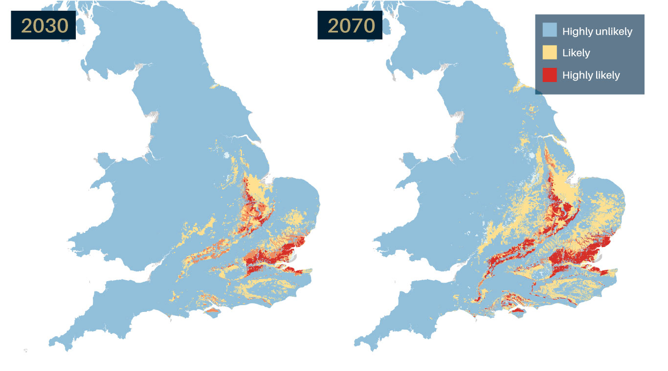
GeoClimate UKCP18 projections, identifying areas expected to experience the largest increases in susceptibility to subsidence by 2030 and 2070. Source: BGS © UKRI – Contains Ordnance Survey data © Crown copyright and database right 2022
BGS says that highlighting potential hazards early will help local authorities, developers and property owners to increase resilience to climate changes, plan effectively and reduce their exposure to potentially high remediation costs.
According to projections, more than three per cent of properties are likely to be affected across Great Britain by 2030, and almost three times that number (10.9 per cent), by 2070.

‘By combining our extensive geology survey data and geological expertise to UK Climate Projection scenarios (UKCP18), we can highlight those areas most vulnerable to shrink–swell subsidence due to future climate change. This is important information that can help communities and property owners to build resilience to future climate change.’
Patrick Gray, BGS Head of Digital Products.
Most susceptible are properties in the highly-populated London areas, particularly in northern and central London boroughs, and Kent in the South East. Projections suggest that the number of properties in London likely to be affected by climate will rise from 20 per cent in 1990, to 43 per cent by 2030, and almost 3 times 1990 values (57 per cent) by 2070.
‘Of particular interest are areas with clay-rich soils that shrink and swell with changes in moisture. For example in the South East, many of the clay formations are too young to have been changed into stronger mud rocks, leaving them vulnerable to absorb and lose moisture.
‘Added to that, Britain is seeing increasingly variable climates. In summer 2018 for example, we experienced some of the warmest and driest summer months in years, whereas 2019 was one of the wettest on record.
‘Dry weather and high temperatures are a major factor in the emergence of shrink-swell subsidence and looking to the future, these increases in annual temperatures and variability in rainfall are very likely to continue.
‘This is going to be a major factor in the emergence of future shrink-swell activity, which needs careful monitoring, mitigation and potentially costly remediation activity.’
Lee Jones, BGS Engineering Geologist.
Shrink-swell subsidence can lead to financial loss for anyone involved in the ownership or management of property, major infrastructure works and utilities, including developers, householders and local government.
These costs can lead to increased insurance premiums, depressed house prices and in some cases, engineering works to stabilise land or property and replacement of utility pipeworks and unstable transport infrastructure.
However, experts at the BGS say it is important to understand there are steps that property owners can take to limit the future impact of shrink-swell subsidence on properties.
‘Whilst we should be careful to note that these are projections, property owners can help to limit the potential effects of future subsidence-related issues.
‘Whilst it may not be possible for everyone, it’s advisable for those living in an area showing an increased susceptibility under future climate conditions to seek specialist advice before starting any major building work. This can be done by a suitably qualified expert such as a structural surveyor, geotechnical engineer or chartered engineering geologist.
‘Other steps property owners can take is to be aware of the effects of laying impermeable drives, paths or hardstanding and of planting or removing trees close to properties, which can all have an impact on soil moisture profiles.’
Lee Jones, BGS Engineering Geologist.
BGS has made further advice publicly available online, together with GeoClimate UKCP18 open data. A second open dataset is also available based on a medium emissions scenario (UKCP09).
Premium information is available through two further licensed datasets, which include projections for average, wetter and drier climate conditions based on medium and higher emissions scenarios across variable time periods.
> Register for our free GeoClimate webinar on Thursday 20 May at 1pm
Relative topics
Media enquiries
Hannah Pole, British Geological Survey Press Office
hapo@bgs.ac.uk | 07565 297 132
Available for interview (phone or Zoom)
Lee Jones, BGS Geological Engineer
Patrick Gray, BGS Head of Digital Products
Maps and graphics are available on request.
BGS GeoClimate
The BGS GeoClimate: shrink–swell national datasets show potential change in subsidence due to changes in climate. They have been developed by combining long-term UK Climate Projection (UKCP) scenarios for rainfall and temperature changes with the geotechnical properties of the ground, to identify areas projected to experience the largest increases in susceptibility to subsidence over the next century.
GeoClimate UKCP18 is a publicly available dataset. Open data is provided for two time periods, 2030s and 2070s, with one projection provided for each time period based on the average outcome for the UKCP18 higher emissions scenario and the most susceptible GeoSure value (worst case) within the grid cell.
GeoClimate UKCP18 is one of four datasets provided by the BGS. Other datasets include:
GeoClimate UKCP09 Open, provided for three time periods:,2030s, 2050s and 2080s, with one projection provided for each time period based on the average outcome for the UKCP09 medium emissions scenario and the most susceptible GeoSure value (worst case) within the grid cell.
GeoClimate UKCP09 Premium, a quasi-1:50 000-scale product, provided as area polygons for five time-period envelopes of 2020, 2030, 2040, 2050 and 2080. It is based on the medium emissions scenario and provides projections for average, wetter and drier climate conditions, describing five categories of projected susceptibility, from highly unlikely to extremely likely.
GeoClimate UKCP18 Open, provided for two time periods, 2030s and 2070s, with one projection provided for each time period based on the average outcome for the UKCP18 higher emissions scenario and the most susceptible GeoSure value (worst case) within the grid cell.
GeoClimate UKCP18 Premium, a quasi-1:50 000-scale product, provided as area polygons for two projected 11-year windows of 2030 and 2070. It is based on the UKCP18 higher emissions scenario and provides projections for average, wetter and drier climate conditions, describing five categories of projected susceptibility, from highly unlikely to extremely likely.
Areas showing moderate to low susceptibility are less likely to be affected. For these areas, it is recommended to visit the BGS GeoSure national datasets, which provide both open and licensed geological information about potential ground movement or subsidence to help planning decisions.
Shrink-swell subsidence
According to the Association of British Insurers (ABI 2018), the effects of subsidence in a property can usually be seen as cracks in walls that:
-
- are more than 3 mm thick
- run diagonally across the wall
- are wider from top to bottom
- are visible from inside and outside
- occur near doors and windows
- cause rippling in wallpaper
Advice for homeowners
More information about shrink–swell can be found on our shallow geohazards pages.
If you are in an area that shows an increased susceptibility under future climate conditions, you can seek specialist advice from a suitably qualified expert such as a structural surveyor, geotechnical engineer or chartered engineering geologist.
If active clay shrinkage or swelling is not affecting your property but the area has shrink–swell clay potential, this should be taken into account before starting new buildings, extensions or modifications, or any other changes in land use.
- Take specialist advice before starting major building work.
- Consider the effect of laying impermeable drives, paths or hardstanding on the rainfall reaching the soil below and changing its moisture content.
- Seek expert advice before planting trees near to a house. The safe planting distance will depend on the tree species, the type of foundation and soil composition.
- Ensure foundations of new constructions or extensions are designed for the shrinkable clay soil conditions that are present and forecast under future climate conditions.
- Do not plant potentially large trees next to a house.
- Do not remove mature trees that pre-date the construction of the house before taking advice. Tree management by crown reduction or thinning may be better than removal because it will maintain a stable soil moisture profile.
British Geological Survey
The British Geological Survey (BGS) is a world-leading applied geoscience research centre that is part of UK Research and Innovation (UKRI) and affiliated to the Natural Environment Research Council (NERC). BGS core science provides objective and authoritative geoscientific data, information and knowledge to inform UK Government on the opportunities and challenges of the subsurface. It undertakes national and public good research to understand earth and environmental processes in the UK and globally. BGS works with more than 150 private sector organisations, has close links to 40 universities and sponsors about 100 PhD students each year. See www.bgs.ac.uk.
Related news
Zambia’s first critical minerals guide supports the country’s potential in global clean energy transition
18/07/2025
A new guide to Zambia’s critical minerals highlights the country’s current and potential critical mineral resources, including cobalt and lithium.

Funding awarded to UK/Canadian critical mineral research projects
08/07/2025
BGS is part of a groundbreaking science partnership aiming to improve critical minerals mining and supply chains.
Release of over 500 Scottish abandoned-mine plans
24/06/2025
The historical plans cover non-coal mines that were abandoned pre-1980 and are available through BGS’s plans viewer.
New collaboration aims to improve availability of real-time hazard impact data
19/06/2025
BGS has signed a memorandum of understanding with FloodTags to collaborate on the use of large language models to improve real-time monitoring of geological hazards and their impacts.
Modern pesticides found in UK rivers could pose risk to aquatic life
17/06/2025
New research shows that modern pesticides used in agriculture and veterinary medicines have been found for the first time in English rivers.
Goldilocks zones: ‘geological super regions’ set to drive annual £40 billion investment in jobs and economic growth
10/06/2025
Eight UK regions identified as ‘just right’ in terms of geological conditions to drive the country’s net zero energy ambitions.
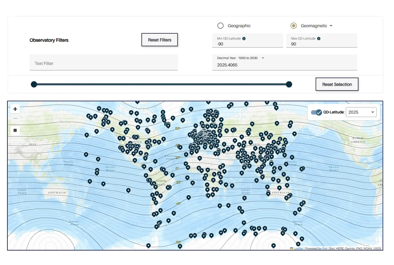
Upgraded web portal improves access to geomagnetism data
02/06/2025
BGS’s geomagnetism portal, which holds data for over 570 observatories across the world, has received a significant update.
BGS digital geology maps: we want your feedback
29/05/2025
BGS is asking for user feedback on its digital geological map datasets to improve data content and delivery.
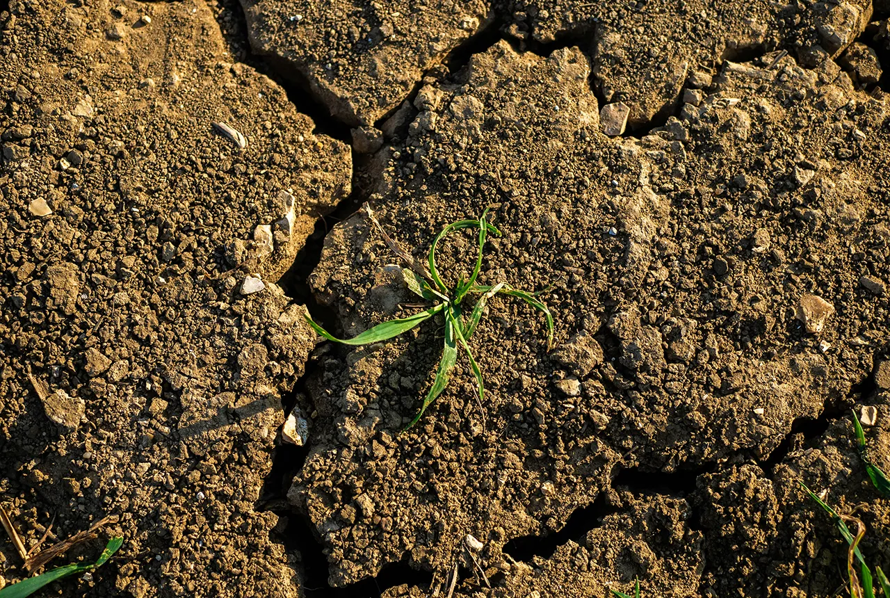
What is the impact of drought on temperate soils?
22/05/2025
A new BGS review pulls together key information on the impact of drought on temperate soils and the further research needed to fully understand it.
UK Minerals Yearbook 2024 released
21/05/2025
The annual publication provides essential information about the production, consumption and trade of UK minerals up to 2024.
BGS scientists join international expedition off the coast of New England
20/05/2025
Latest IODP research project investigates freshened water under the ocean floor.
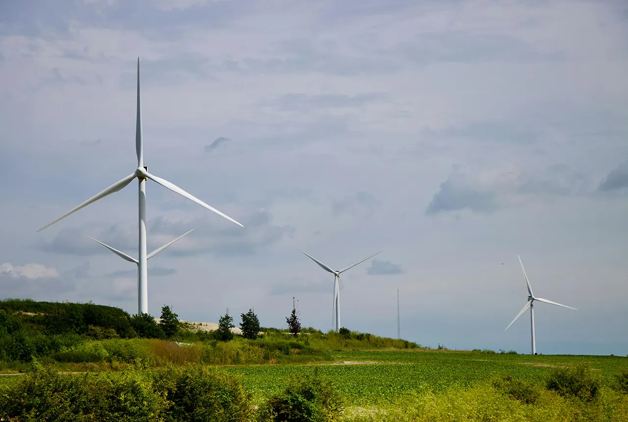
New interactive map viewer reveals growing capacity and rare earth element content of UK wind farms
16/05/2025
BGS’s new tool highlights the development of wind energy installations over time, along with their magnet and rare earth content.